- Meigs County, Tennessee
-
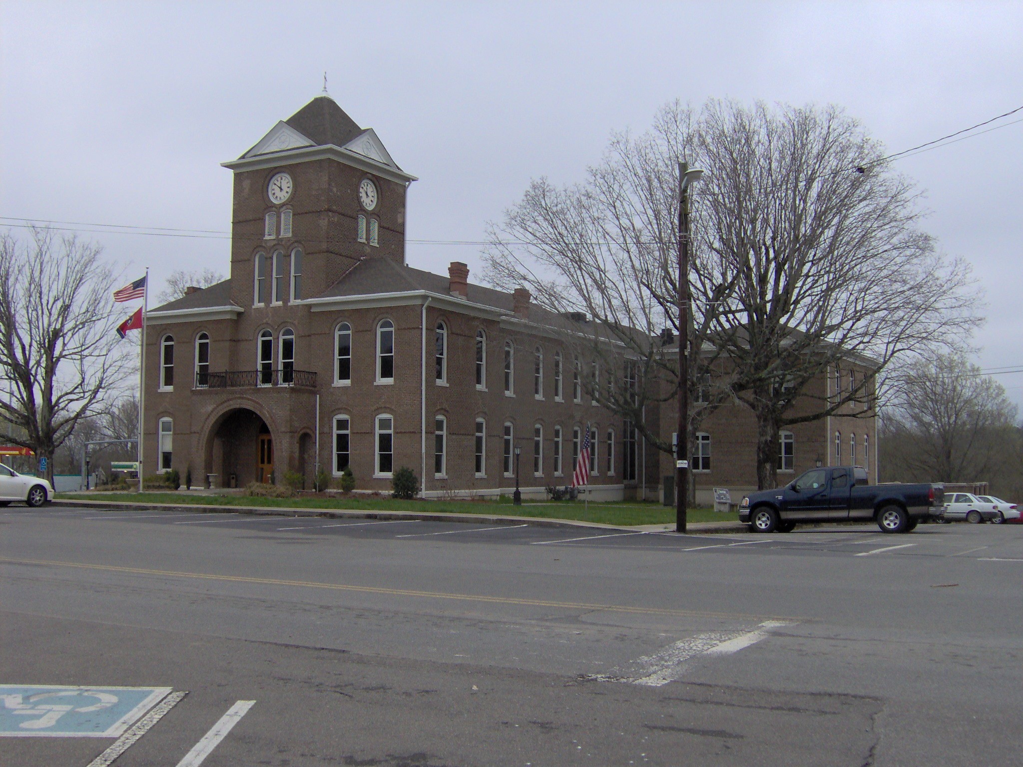
Meigs County, Tennessee 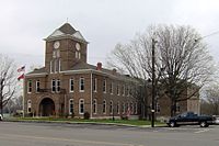 Meigs County Courthouse in Decatur
Location in the state of Tennessee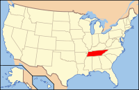
Tennessee's location in the U.S.Founded 1836 Seat Decatur Largest city Decatur Area
- Total
- Land
- Water
217 sq mi (561 km²)
195 sq mi (505 km²)
22 sq mi (57 km²), 10.11%Population
- (2010)
- Density
11,753
57/sq mi (22/km²)Time zone Eastern: UTC-5/-4 Meigs County is a county located in the U.S. state of Tennessee. As of 2010, the population was 11,753. Its county seat is Decatur.[1]
Contents
History
Before 1819, the area that is now Meigs County was Cherokee territory. White settlers established ferries to cross the Tennessee River from Rhea County as early as 1807. Col. Return J. Meigs, who was to become the county's namesake, operated an Indian agency across the river in Rhea County until 1817, when the agency moved east to the area that is now Meigs County. In 1819 the Hiwassee Treaty opened the land to white settlement, initially as a part of Rhea County.[2]
In 1985, the Meigs County Family and Community Education (“FCE”) Club began a large quilt to commemorate the early history of Meigs County, for a state project, the Tennessee “Homecoming 1986." The quilt includes images of fourteen sites representing the early history of Meigs County. The central quilt design, including a map of the area to locate the various sites represented, was created by the late Flossie Bennett, a longtime leader of the FCE. A committee of representatives from Ten Mile, Peakland, Concord, Goodfield, and Decatur, decided which sites would be included in the quilt. The sites chosen were the Elisha Sharp House (also known as the Sharp-Wasson-Worth House, c. 1825), the Stewart House (1830), the R.H. Johnson Stable, the Mount Zion church and Cemetery (1830), Zeigler's Mill (1850,previously Gettys Mill), the Washington Ferry (1808), the Pisah Church (1818), the old gymnasium (c. 1822), the old Meigs County Courthouse (1904), the old Volunteer Electric Cooperative BUilding (1935), the Ashley House (1885), and the Sam Eaves Store (c. 1861). Nell Jeannette Fields Worth also insisted that images of Hereford cattle be included throughout the quilt, since Meigs County is noted for its beef cattle. The quilt was awarded the “Best Original Design” at the McMinn County Living Heritage Museum's Quilt Show. The quilt initially was displayed at the Meigs-Decatur Public Library, and as of 2010, now hangs in the Meigs County Historical Museum, in Decatur, Tennessee.[3]
A new building on Smith Avenue in Decatur, Tennessee, was built to house the collection of the Meigs County historical Museum. The new site was opened in July 2002.[4] The Meigs County Historical Museum houses many court and family records. On permanent display is a mural depicting Main Street Decatur in the 1930s. The mural was funded by grants from the Tennessee Arts Commission and the VEC Customershares program and painted by Bill McDonald, a local artist.[5]
Geography
According to the U.S. Census Bureau, the county has a total area of 217 square miles (560 km2), of which 195 square miles (510 km2) is land and 22 square miles (57 km2) (10.11%) is water.
The main geographic feature of Meigs County is the Tennessee River, which provides the county's western boundary. Watts Bar Dam is located along the river between Meigs and adjacent Rhea County, and forms Watts Bar Lake, which spans the river upstream to Fort Loudoun Dam just west of Knoxville. Watts Bar Dam's tailwaters are part of Chickamauga Lake, which stretches downstream to Chickamauga Dam in Chattanooga. The mouth of the Hiwassee River is located in southwestern Meigs County, near the point where Meigs, Rhea, and Hamilton counties meet.
Transportation
State Route 58 - The principal north/south highway, runs the entire length of the county dividing the county down the middle. The only link via the Hiwassee River Bridge to the southernmost part of the county.
State Route 30 - The principal east/west highway. This highway divides the county into north and south and intersects Highway 58 in Decatur. The Tennessee Department of Transportation is in the process of upgrading Highway 30 from a 2-lane highway to a 4-lane divided highway. allowing for more major east/west traffic and faster connection to Interstate 75. (The section from Decatur eastward was finished in 2008.)
State Route 68 - A north/south main highway for the county, that actually runs east/west though the northern county. This highway crosses the Tennessee River at Watts Bar Dam.
State Route 60 - A principal east/west highway forming the southern border of the county.
State Route 304 - An important local road, mainly for local residents that live off of the highway, and its northern portions allows access to Watts Bar Lake's many marinas, resorts, and campgrounds. Also connects the unincorporated community of Ten Mile with the county seat of Decatur.
State Route 305 - An important local road, connecting Interstate 75 with State Route 68 and State Route 58. This also connects the north-central part of the county with the neighboring city of Athens in McMinn County.
Adjacent counties
- Roane County, Tennessee (North)
- McMinn County, Tennessee (East)
- Bradley County, Tennessee (Southeast)
- Hamilton County, Tennessee (South)
- Rhea County, Tennessee (West)
Demographics
 Age pyramid Meigs County[6]
As of the census[7] of 2000, there were 11,086 people, 4,304 households, and 3,262 families residing in the county. The population density was 57 people per square mile (22/km²). There were 5,188 housing units at an average density of 27 per square mile (10/km²). The racial makeup of the county was 97.65% White, 1.24% Black or African American, 0.21% Native American, 0.18% Asian, 0.11% from other races, and 0.60% from two or more races. 0.57% of the population were Hispanic or Latino of any race.
There were 4,304 households out of which 32.80% had children under the age of 18 living with them, 61.70% were married couples living together, 9.90% had a female householder with no husband present, and 24.20% were non-families. 20.80% of all households were made up of individuals and 7.80% had someone living alone who was 65 years of age or older. The average household size was 2.55 and the average family size was 2.94.
In the county the population was spread out with 25.10% under the age of 18, 8.10% from 18 to 24, 28.90% from 25 to 44, 26.30% from 45 to 64, and 11.50% who were 65 years of age or older. The median age was 37 years. For every 100 females there were 100.00 males. For every 100 females age 18 and over, there were 97.30 males.
The median income for a household in the county was $29,354, and the median income for a family was $34,114. Males had a median income of $29,521 versus $20,419 for females. The per capita income for the county was $14,551. About 15.80% of families and 18.30% of the population were below the poverty line, including 23.50% of those under age 18 and 14.60% of those age 65 or over.
Cities and towns
Decatur, the county seat, is the only incorporated municipality in Meigs County. Unincorporated communities include Ten Mile and Georgetown.
See also
References
- ^ "Find a County". National Association of Counties. http://www.naco.org/Counties/Pages/FindACounty.aspx. Retrieved 2011-06-07.
- ^ National Register of Historic Places Nomination Form: Historic Resources of Meigs County, 1983
- ^ Johnny Hutsell-Royster, “Meigs history told one stitch at a time,” The Daily Post-Athenian, Athens, Tennessee (Wednesday, February 28, 2001), 12-13; “Meigs County historical quilt on display at library” The Daily Post-Athenian, Athens, Tennessee (date unknown, “1986 revisited”).
- ^ Paulette Jones, “Meigs Historical Society Praises Nell Worth,” The Daily Post Athenian, Athens, Tennessee, (July 23, 2010); Johnny, Hutshell-Royster, “$100,000 gift gives museum a boost,” The Daily Post-Athenian (Thursday, February 15, 2001); and Ron Clayton, “$100,000 gift boosts Meigs museum fund,” Chattanooga Times Free Press, Chattanooga, Tennessee (Friday, February 16, 2001), B2; and Johnny Hutsell-Royster, “Meigs Museum continues to grow and educate,” The Daily Post-Athenian, Athens, Tennessee (Friday, March 26, 2004), C4
- ^ http://www.meigscountyhistoricalmuseum.com/id5.html
- ^ Based on 2000 census data
- ^ "American FactFinder". United States Census Bureau. http://factfinder.census.gov. Retrieved 2008-01-31.
External links

Roane County Rhea County 
McMinn County  Meigs County, Tennessee

Hamilton County Bradley County Municipalities and communities of Meigs County, Tennessee Town 
Unincorporated
communitiesFootnotes ‡This populated place also has portions in an adjacent county or counties
Categories:- Tennessee counties
- Meigs County, Tennessee
- 1836 establishments in the United States
- Populated places established in 1836


Wikimedia Foundation. 2010.