- Maryland Route 290
-
Maryland Route 290

Route information Maintained by MDSHA Length: 17.20 mi[1][2] (27.68 km) Major junctions South end:  MD 300 in Dudley Corners
 US 301 near Dudley Corners
 MD 544 in Crumpton
 MD 291 near Chesterville
 MD 444 in Chesterville
 MD 313 in Galena
 MD 213 in Galena US 301 near Sassafras
North end:  MD 299 in Sassafras
Location Counties: Queen Anne's, Kent Highway system Maryland highway system
Interstate • US • State • Minor • Former • Turnpikes←  MD 289
MD 291 →Maryland Route 290 (MD 290) is a state highway in the U.S. state of Maryland. The state highway runs 17.20 miles (27.68 km) from MD 300 at Dudley Corners north to MD 299 in Sassafras. MD 290 roughly parallels U.S. Route 301 (US 301), which it intersects twice, as it connects the communities of Crumpton in northern Queen Anne's County and Chesterville and Galena in eastern Kent County. MD 290 in Queen Anne's County was constructed as MD 301 in the early to mid 1920s. In Kent County, a portion south of Galena was built in the late 1910s; MD 290 was extended south to Crumpton in the late 1920s. MD 290 assumed the course of MD 301 in 1940 to avoid a number conflict with US 301. MD 290 was extended east from Galena to Sassafras in the late 1940s.
Contents
Route description
MD 290 begins at an intersection with MD 300 (Sudlersville Road) in the hamlet of Dudley Corners. Benton Corners Road heads south from the intersection as a county highway. MD 290 heads north as Dudley Corner Road, a two-lane road that heads north through farmland. After crossing Red Lion Branch, the state highway passes through an interchange with US 301 (Blue Star Memorial Highway). MD 290 passes through the hamlet of Pondtown before reaching an intersection with MD 544 (McGinnes Road). The state highway passes through the town of Crumpton before crossing the Chester River into Kent County.[1][3]
MD 290 heads north as Crumpton Road until the state highway turns east for a short concurrency with MD 291 (River Road). MD 290 turns north and intersects MD 444 (Locust Grove Road) and Chesterville Bridge Road within Chesterville, where the name of the highway changes to Chesterville Road. The state highway crosses the Chestertown Branch of the Northern Line of the Maryland and Delaware Railroad at the hamlet of Lambson. MD 290 intersects Irelands Corner Road, the old alignment of MD 313, before joining MD 313 (Massey Galena Road) in a concurrency into the town of Galena, where the highway becomes Main Street. North–south Main Street intersects east–west Cross Street in the center of town next to the town hall. MD 213 heads west toward Chestertown and north toward Cecilton, MD 313 has its northern terminus, and MD 290 turns east toward Sassafras. MD 290 becomes Galena Sassafras Road and crosses Mill Creek, Swantown Creek, and Jacobs Creek before meeting US 301 for the second time at a diamond interchange. A short distance east of US 301, MD 290 reaches its northern terminus at MD 299 near the village of Sassafras. MD 299 heads south as Massey Road and northeast as a continuation of Galena Sassafras Road.[2][3]
History
The highway between Dudley Corners and Crumpton was marked as one of the original state roads destined for improvement by the Maryland State Roads Commission in 1909.[4] However, work on the highway was postponed indefinitely since it was not considered an essential part of the state road system.[5] The short segment between MD 544 and Crumpton was paved as a state-aid road by 1921.[6] The Crumpton–Dudley Corners highway was finally constructed in 1924 and 1925.[7][8] This highway was designated MD 301.[9]
The first section of MD 290 in Kent County was paved as a state-aid road between Galena and the railroad crossing at Lambson between 1915 and 1919.[5][10][6] The highway was extended south from Lambson to the Chester River in 1929 and 1930.[11][12] MD 290 was extended south over MD 301's course to Dudley Corners in 1940 to remove a number conflict with US 301, which was extended north from Virginia to Baltimore the same year.[13]
The portion of MD 290 between Galena and Sassafras was constructed between 1946 and 1948.[14][15] MD 290 was extended north through Galena and east along the new road to its present northern terminus at MD 299 in 1949.[16] A modern bridge was constructed at Crumpton in 1951.[17] When the Blue Star Memorial Highway was completed in Queen Anne's and Kent counties in 1956, interchanges were constructed at both junctions with MD 290.[18][19][20][21] MD 290 was widened between Dudley Corners and Crumpton and between Galena and Sassafras in 1956. At the same time, MD 290 was realigned south of Galena in conjunction with the relocation of MD 313 to bypass Irelands Corner.[22]
Junction list
County Location Mile
[1][2]Destinations Notes Queen Anne's Dudley Corners 0.00 Benton Corners Road south Southern terminus MD 300 (Sudlersville Road) – Sudlersville, Church Hill1.21 US 301 (Blue Star Memorial Highway) – Bay Bridge, WilmingtonInterchange Crumpton 3.69 MD 544 (McGinnes Road) – Chestertown, Millington4.80 Bridge over Chester River Kent Chesterville 5.91 MD 291 west (River Road) – ChestertownSouth end of concurrency with MD 291 6.58 MD 291 east (River Road) – MillingtonNorth end of concurrency with MD 291 7.56 MD 444 north (Locust Grove Road) / Chesterville Bridge Road eastGalena 12.04 MD 313 south (Massey Galena Road) – MasseySouth end of concurrency with MD 313 12.76 MD 213 (Cross Street/Main Street) – Chestertown, CeciltonNorth end of concurrency with MD 313; MD 290 turns east at this intersection Sassafras 16.84 US 301 (Blue Star Memorial Highway) – Bay Bridge, WilmingtonDiamond interchange 17.20 MD 299 (Massey Road/Galena Sassafras Road) – Massey, WarwickNorthern terminus 1.000 mi = 1.609 km; 1.000 km = 0.621 mi References
- ^ a b c "Highway Location Reference: Queen Anne's County" (PDF). Maryland State Highway Administration. 2009. http://www.marylandroads.com/Location/2009_QUEENANNES.pdf. Retrieved 2010-10-06.
- ^ a b c "Highway Location Reference: Kent County" (PDF). Maryland State Highway Administration. 2009. http://www.marylandroads.com/Location/2009_KENT.pdf. Retrieved 2010-10-06.
- ^ a b Google, Inc. Google Maps – Maryland Route 290 (Map). Cartography by Google, Inc. http://maps.google.com/maps?f=d&source=s_d&saddr=MD-290+N%2FDudley+Corner+Rd&daddr=MD-290+N%2FDudley+Corner+Rd+to:MD-290+N%2FMD-313+N%2FGalena+Rd+to:MD-290+N%2FGalena+Sassafras+Rd&geocode=FcDnVQIdlvl5-w%3BFU_EVgId9oZ5-w%3BFSw9WAIdUDV6-w%3BFbquWAId4jx7-w&hl=en&mra=ls&sll=39.241361,-75.914948&sspn=0.007628,0.01929&ie=UTF8&t=h&z=11. Retrieved 2010-10-06.
- ^ Maryland Geological Survey. Map of Maryland (Map) (1910 ed.).
- ^ a b Report of the State Roads Commission of Maryland. 1912-1915. Baltimore: Maryland State Roads Commission. May 1915. p. 128. http://www.archive.org/details/annualreportsofs1912mary. Retrieved 2010-10-06.
- ^ a b Maryland Geological Survey. Map of Maryland: Showing State Road System and State Aid Roads (Map) (1921 ed.).
- ^ Report of the State Roads Commission of Maryland. 1924-1926. Baltimore: Maryland State Roads Commission. January 1927. pp. 33, 95. http://www.archive.org/details/annualreportsofs1924mary. Retrieved 2010-10-06.
- ^ Maryland Geological Survey. Map of Maryland: Showing State Road System and State Aid Roads (Map) (1927 ed.).
- ^ Maryland State Roads Commission. General Highway Map: State of Maryland (Map) (1939 ed.).
- ^ Report of the State Roads Commission of Maryland. 1916-1919. Baltimore: Maryland State Roads Commission. January 1920. p. 46. http://www.archive.org/details/annualreportsofs1916mary.
- ^ Report of the State Roads Commission of Maryland. 1927-1930. Baltimore: Maryland State Roads Commission. 1930-10-01. p. 218. http://www.archive.org/details/reportofstateroa1927mary. Retrieved 2010-10-06.
- ^ Maryland Geological Survey. Map of Maryland Showing State Road System: State Aid Roads and Improved County Road Connections (Map) (1930 ed.).
- ^ Maryland State Roads Commission. Map of Maryland Showing Highways and Points of Interest (Map) (1940 ed.).
- ^ Report of the State Roads Commission of Maryland. 1945-1946. Baltimore: Maryland State Roads Commission. 1947-02-01. p. 90. http://www.archive.org/details/reportofstateroa1945mary. Retrieved 2010-10-06.
- ^ Report of the State Roads Commission of Maryland. 1947-1948. Baltimore: Maryland State Roads Commission. 1949-02-15. p. 106. http://www.archive.org/details/reportofstateroa1947mary. Retrieved 2010-10-06.
- ^ Maryland State Roads Commission. Maryland: Official Highway Map (Map) (1949 ed.).
- ^ Report of the State Roads Commission of Maryland. 1951-1952. Baltimore: Maryland State Roads Commission. 1952-12-15. p. 125. http://www.archive.org/details/reportofstateroa1951mary. Retrieved 2010-10-06.
- ^ Report of the State Roads Commission of Maryland. 1953-1954. Baltimore: Maryland State Roads Commission. 1954-11-12. p. 150. http://www.archive.org/details/reportofstateroa1953mary. Retrieved 2010-10-06.
- ^ Maryland State Roads Commission. Maryland: Official Highway Map (Map) (1956 ed.).
- ^ "NBI Structure Number: 100000140005011". National Bridge Inventory. http://nationalbridges.com/nbi_record.php?StateCode=24&struct=100000140005011. Retrieved 2010-10-06.
- ^ "NBI Structure Number: 100000170011011". National Bridge Inventory. http://nationalbridges.com/nbi_record.php?StateCode=24&struct=100000170011011. Retrieved 2010-10-06.
- ^ Report of the State Roads Commission of Maryland. 1955-1956. Baltimore: Maryland State Roads Commission. 1956-11-02. p. 140. http://www.archive.org/details/reportofstateroa1955mary. Retrieved 2010-10-06.
External links
Roads in Kent County, Maryland State highways 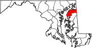
U.S. Highways Roads in Queen Anne's County, Maryland State highways 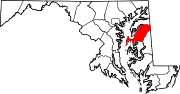
U.S. Highways Categories:- State highways in Maryland
- Roads in Kent County, Maryland
- Roads in Queen Anne's County, Maryland


Wikimedia Foundation. 2010.