- Dohem
-
Dohem

 DohemLocation within Nord-Pas-de-Calais region
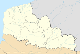 Dohem
DohemAdministration Country France Region Nord-Pas-de-Calais Department Pas-de-Calais Arrondissement Saint-Omer Canton Lumbres Intercommunality Pays de Lumbres Mayor Guy Hilmoine Statistics Elevation 60–151 m (200–495 ft)
(avg. 136 m/446 ft)Land area1 9.16 km2 (3.54 sq mi) Population2 712 (1999) - Density 78 /km2 (200 /sq mi) INSEE/Postal code 62271/ 62380 1 French Land Register data, which excludes lakes, ponds, glaciers > 1 km² (0.386 sq mi or 247 acres) and river estuaries. 2 Population without double counting: residents of multiple communes (e.g., students and military personnel) only counted once. Coordinates: 50°38′20″N 2°11′12″E / 50.6388888889°N 2.18666666667°E
Dohem is a commune in the Pas-de-Calais department in the Nord-Pas-de-Calais region of France.
Contents
Geography
A farming village situated 9 miles (14 km) southwest of Saint-Omer, at the D190 and D193 crossroads.
Population
Historical population of Dohem 1962 1968 1975 1982 1990 1999 557 575 613 687 705 712 From the year 1962 on: population without double counting—residents of multiple communes (e.g. students and military personnel) are counted only once. Places of interest
- The church of St.Omer, dating from the fifteenth century.
See also
References
External links
- Dohem on the Quid website (French)
Categories:- Communes of Pas-de-Calais
- Pas-de-Calais geography stubs


Wikimedia Foundation. 2010.