- Offekerque
-
Offekerque

 OffekerqueLocation within Nord-Pas-de-Calais region
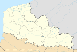 Offekerque
Administration Country France Region Nord-Pas-de-Calais Department Pas-de-Calais Arrondissement Saint-Omer Canton Audruicq Intercommunality Communauté de communes de la Région d'Audruicq Mayor Georges Paris Statistics Elevation 1–5 m (3.3–16 ft)
(avg. 2 m/6.6 ft)Land area1 13.37 km2 (5.16 sq mi) Population2 1,026 (2006) - Density 77 /km2 (200 /sq mi) INSEE/Postal code 62634/ 62370 1 French Land Register data, which excludes lakes, ponds, glaciers > 1 km² (0.386 sq mi or 247 acres) and river estuaries. 2 Population without double counting: residents of multiple communes (e.g., students and military personnel) only counted once. Coordinates: 50°56′31″N 2°01′10″E / 50.9419444444°N 2.01944444444°E
Offekerque is a commune in the Pas-de-Calais department in the Nord-Pas-de-Calais region of France.
Contents
Geography
Offekerque is a farming village, originally of marshland, now drained by the river Oye and ditches around the commune, some 6 miles (9 km) east of Calais, on the D230, half a mile from the A16 autoroute.
Population
Population history 1962 1968 1975 1982 1990 1999 2006 634 635 628 698 759 939 1026 Census count starting from 1962: Population without duplicates Places of interest
- The church of St.Marie-Madeleine, dating from the twentieth century.
- A brick-built windmill.
See also
References
External links
- Offekerque on the Insee website (French)
- Offekerque on the Quid website (French)
Categories:- Communes of Pas-de-Calais
- Pas-de-Calais geography stubs


Wikimedia Foundation. 2010.