- Neola, Iowa
-
Neola, Iowa — City — Location of Neola, Iowa
Coordinates: 41°27′3″N 95°37′3″W / 41.45083°N 95.6175°WCoordinates: 41°27′3″N 95°37′3″W / 41.45083°N 95.6175°W Country  United States
State  Iowa
IowaCounty Pottawattamie Area - Total 0.4 sq mi (1.0 km2) - Land 0.4 sq mi (1.0 km2) - Water 0.0 sq mi (0.0 km2) Elevation 1,099 ft (335 m) Population (2000) - Total 845 - Density 2,087.9/sq mi (806.1/km2) Time zone Central (CST) (UTC-6) - Summer (DST) CDT (UTC-5) ZIP code 51559 Area code(s) 712 FIPS code 19-55560 GNIS feature ID 0459458 Neola is a city in Pottawattamie County, Iowa, United States. The population was 845 at the 2000 census.
Contents
Geography
Neola is located at 41°27′3″N 95°37′3″W / 41.45083°N 95.6175°W (41.450942, -95.617532)[1].
According to the United States Census Bureau, the city has a total area of 0.4 square miles (1.0 km2), all of it land.
Demographics
As of the census[2] of 2000, there were 845 people, 339 households, and 247 families residing in the city. The population density was 2,087.9 people per square mile (815.6/km²). There were 357 housing units at an average density of 882.1 per square mile (344.6/km²). The racial makeup of the city was 98.58% White, 0.59% Native American, 0.71% Asian, 0.12% from other races. Hispanic or Latino of any race were 0.24% of the population.
There were 339 households out of which 37.2% had children under the age of 18 living with them, 59.3% were married couples living together, 9.1% had a female householder with no husband present, and 27.1% were non-families. 24.2% of all households were made up of individuals and 12.7% had someone living alone who was 65 years of age or older. The average household size was 2.49 and the average family size was 2.96.
In the city the population was spread out with 27.6% under the age of 18, 6.9% from 18 to 24, 29.7% from 25 to 44, 21.3% from 45 to 64, and 14.6% who were 65 years of age or older. The median age was 35 years. For every 100 females there were 90.7 males. For every 100 females age 18 and over, there were 93.1 males.
The median income for a household in the city was $47,500, and the median income for a family was $49,632. Males had a median income of $30,288 versus $23,182 for females. The per capita income for the city was $17,737. About 4.3% of families and 7.3% of the population were below the poverty line, including 11.2% of those under age 18 and 5.7% of those age 65 or over.
Notable natives and residents
- Red Downs, professional baseball player
- R. A. Lafferty, science fiction writer
- Red Morgan, professional baseball player
- [ LeRoy Eims ], author, Navigator Staff
References
- ^ "US Gazetteer files: 2010, 2000, and 1990". United States Census Bureau. 2011-02-12. http://www.census.gov/geo/www/gazetteer/gazette.html. Retrieved 2011-04-23.
- ^ "American FactFinder". United States Census Bureau. http://factfinder.census.gov. Retrieved 2008-01-31.
External links
Metropolitan area of Omaha-Council Bluffs Primary Cities NebraskaIowa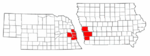
Cities over 10,000
(per 2000 Census)NebraskaCities of 5,000 to 10,000
(per 2000 Census)NebraskaIowaCities of 1,000 to 5,000
(per 2000 Census)NebraskaIowaCensus-designated places NebraskaCities and villages
of fewer than 1,000
(per 2000 Census)NebraskaAlvo · Avoca · Bennington · Boys Town · Cedar Bluffs · Cedar Creek · Ceresco · Colon · Elmwood · Fort Calhoun · Greenwood · Herman · Ithaca · Kennard · Leshara · Malmo · Manley · Mead · Memphis · Morse Bluff · Murdock · Murray · Nehawka · Prague · South Bend · Union · Valparaiso · Washington · Waterloo · WestonIowaCounties NebraskaIowaMunicipalities and communities of Pottawattamie County, Iowa Cities Avoca | Carson | Carter Lake | Council Bluffs | Crescent | Hancock | Macedonia | McClelland | Minden | Neola | Oakland | Shelby‡ | Treynor | Underwood | Walnut

Unincorporated
communityHoney Creek
Footnotes ‡This populated place also has portions in an adjacent county or counties
Categories:- Cities in Iowa
- Populated places in Pottawattamie County, Iowa


Wikimedia Foundation. 2010.