- Northrepps
-
Coordinates: 52°54′07″N 1°20′17″E / 52.902°N 1.338°E
Northrepps 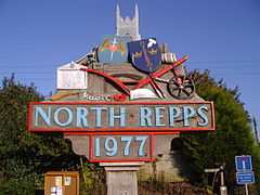
The village sign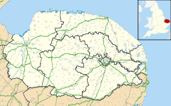
 Northrepps
Northrepps shown within NorfolkArea 10.65 km2 (4.11 sq mi) Population 839 (parish, 2001 census) - Density 79 /km2 (200 /sq mi) OS grid reference TG245395 - London 136 miles Parish Northrepps District North Norfolk Shire county Norfolk Region East Country England Sovereign state United Kingdom Post town CROMER Postcode district NR27 Dialling code 01263 Police Norfolk Fire Norfolk Ambulance East of England EU Parliament East of England UK Parliament North Norfolk List of places: UK • England • Norfolk Northrepps is a village and a civil parish in the English county of Norfolk.[1] The village is 3.4 miles (5.5 km) southeast of Cromer, 22.2 miles (35.7 km) north of Norwich and 137 miles (220 km) north of London. The village lies west of the A149 [2] which runs between Kings Lynn and Great Yarmouth. The nearest railway station is at Cromer for the Bittern Line which runs between Sheringham, Cromer and Norwich. The nearest airport is Norwich International Airport. The Village and parish of Northrepps had in the 2001 census, a population of 839. For the purposes of local government, the village falls within the district of North Norfolk.
Contents
Description
The parish of Northrepps was reduced in size in 1906, losing land to the parish of Overstrand which lies to the north. The parish boundary to the north-west is with Cromer, to the north-east with Sidestrand. To the west are the boundaries with Felbrigg and Roughton whilst to the south is the parish of Southrepps. At its nearest point the parish is just 500 meters from the coast on the north-eastern boundary, which partly follows the course of the disused Norfolk and Suffolk Joint Railway between Cromer and North Walsham which closed in 1953. Also in the north of the parish is Cottage Wood which is largely given over to the Forest Park Caravan Site. In the south east of the parish there is more woodland known as Fox Hills, bounded around its south-west edge by the Paston Way footpath. The Bittern Line railway cuts through the western section of the parish. The landscape of the parish is largely arable farmland made up of low hills and valleys; the soil is light, the subsoil gravel. The parish contains the village of Northrepps, as well as the Frogshall which is within Fox Hills and Crossdale Street which straddles the A149 in the west of the parish. The A140 begins at a junction with the A149 within the parish. The name Northrepps[3] is derived from the Old English word repel, meaning strips of land in a fen that can be tilled.
Further information: FrogshallFurther information: Norfolk and Suffolk Joint RailwayHistory
Evidence suggested that the occupants of Northrepps have always been agriculturally based. This is confirmed by entries in the Domesday Book which has the village’s name listed as Norhrepes and Norrepes.[4] The main tenant was William de Warenne. The survey shows that the value of the parish was reasonably low. The survey also state that there was 1 free man of Ketel's, at 30 acres (120,000 m2) of land. Always 2 villagers, 5 smallholders, pannage for 5 swine, always 1 plough, 2 acres (8,100 m2) of meadow 2 mills and 1 church, at 18 acres (73,000 m2). Value always 10s. The listing of the mills confirm the central role of farming in the community. In the Domesday Book the size of woodland was normally given as the number of swine a wood[5] could support in this case pannage for 5 swine.
19th Century
By 1881 records show that the parish was owned by three landlords. John Henry Gurney was the principal owner, Lord Suffield was lord of the manor, and Samuel Hoare, Lord Templewood was the third. The manor of Northrepps therefore seems to have been governed by the Suffield family from 18th century Gunton Hall in the parish of Hanworth which is 5 kilometres (3.1 mi) south of Northrepps village. Gurney, who was the principal land owner, was at that time resident at Northrepps Hall, not actually a hall or manor house but a converted farmhouse with a largely 19th century exterior. The Hall is now a listed building.
The Foundry
The village once had a foundry and is best recalled for developing the Gallus plough in 1830. This design of plough was widely used well into the 1920s. There is an example of a Gallus plough that was manufactured at the foundry on display in the parish church.
Smuggling
The village once had a gang of smugglers whose leader allegedly was a member of the large Summers family; hence his nickname Old Summers. Local folklore tells of the time that his gang tied up the chief 'prevention' officer to a post while they disposed of their contraband. A local woman called Sally Bean who lived in a cottage on Shucks Hill was an ally of the smuggling ring. Her cottage had a 20-mile (32 km) view of the countryside on the south side of the village which enabled her to give warnings to the smugglers of the 'prevention' men.
Village amenities
The Primary school
Northrepps primary school is a feeder for Cromer High School and currently has approximately 35 students and is local authority maintained. The school is twinned with a small school in the Aveyrons region of France in the small village of St. Laurent d’Olt. The school building was built in 1879 and is a traditional flint and brick Victorian school. There is a first floor extension to the school accommodation which houses the staff room and resources room. There is also a mobile classroom which is used by the Gnomes Pre-School Playgroup. In 2004, new offices, reception and entrance were added to the school buildings. The school has a playground which has a small grass playing area with climbing equipment, built with funds raised by the children and parents. This area is surrounded by security fencing which was installed in 2004. The school also has the use of a large playing field which is across the road. Also within the village there is an ongoing adult education programme including a computer club at the school.
The Village hall
The village hall was built in 1996 and plays host to a variety of clubs and organisations.
The Foundry Arms
The village pub is located on Church Street and is called the Foundry Arms. The pub is so named after a once famous foundry that was in the village. Inside there are a bar, dining room and a games room. The pub has a good range of beers and good food is served; there is also a real log fire on cold nights. In the summer months the pub serves afternoon teas, Fridays through to Sundays.
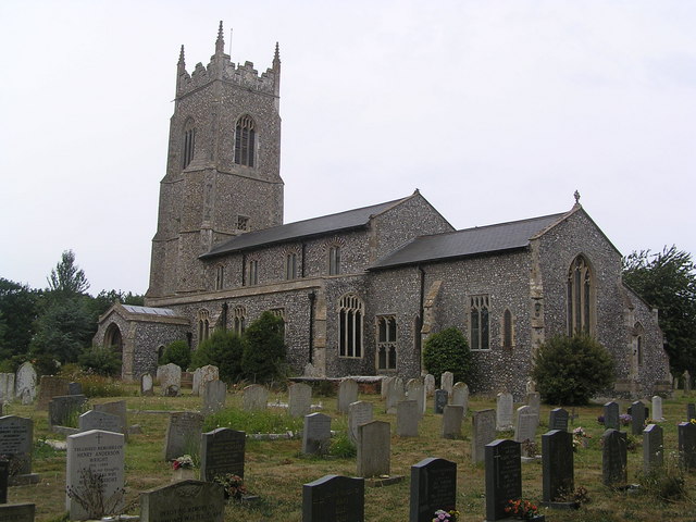
The parish church of Saint Mary
The parish church of Saint Mary the Virgin is located on the south side of the village. The building is mainly 15th century[6] but the chancel has two lancet windows that date from the 13th century.[6] The rood screen was given to the church in 1460[6] by John Playford and his wife Custance, their names being carved on its rail. The rood screen had at sometime been removed from the church and was found by the then rector of the church, John Cresswell, in a local barn.[7] He had it restored into the church in 1912.[6] The chancel has 14th century[8] arcades of four bays supported on octagonal piers and double-chamfered arches. The tower is to the west and is compact and has a western doorway below. Above the doorway is a frieze[8] of the royal arms with the lion and the unicorn. They are labelled for George III, but are actually the early Stuart arms of a century and a half earlier of Charles I. In the south aisle, the east window depicting the archangels St Gabriel, St Michael and St Raphael, a host of angels above them which dates from the early 20th century. The chancel also has some surviving Norman windows and some zig-zag[8] in the stone. On top of the church, the weather vane depicts the Gallus plough produced at the old foundry, which was donated by local man, John Golden who had connections with the foundry.
Gallery
-

Northrepps Parish Church
-
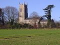
Northrepps Parish Church
-

The Foundry Arms
-

A Gallus plough, on display in the parish church
-

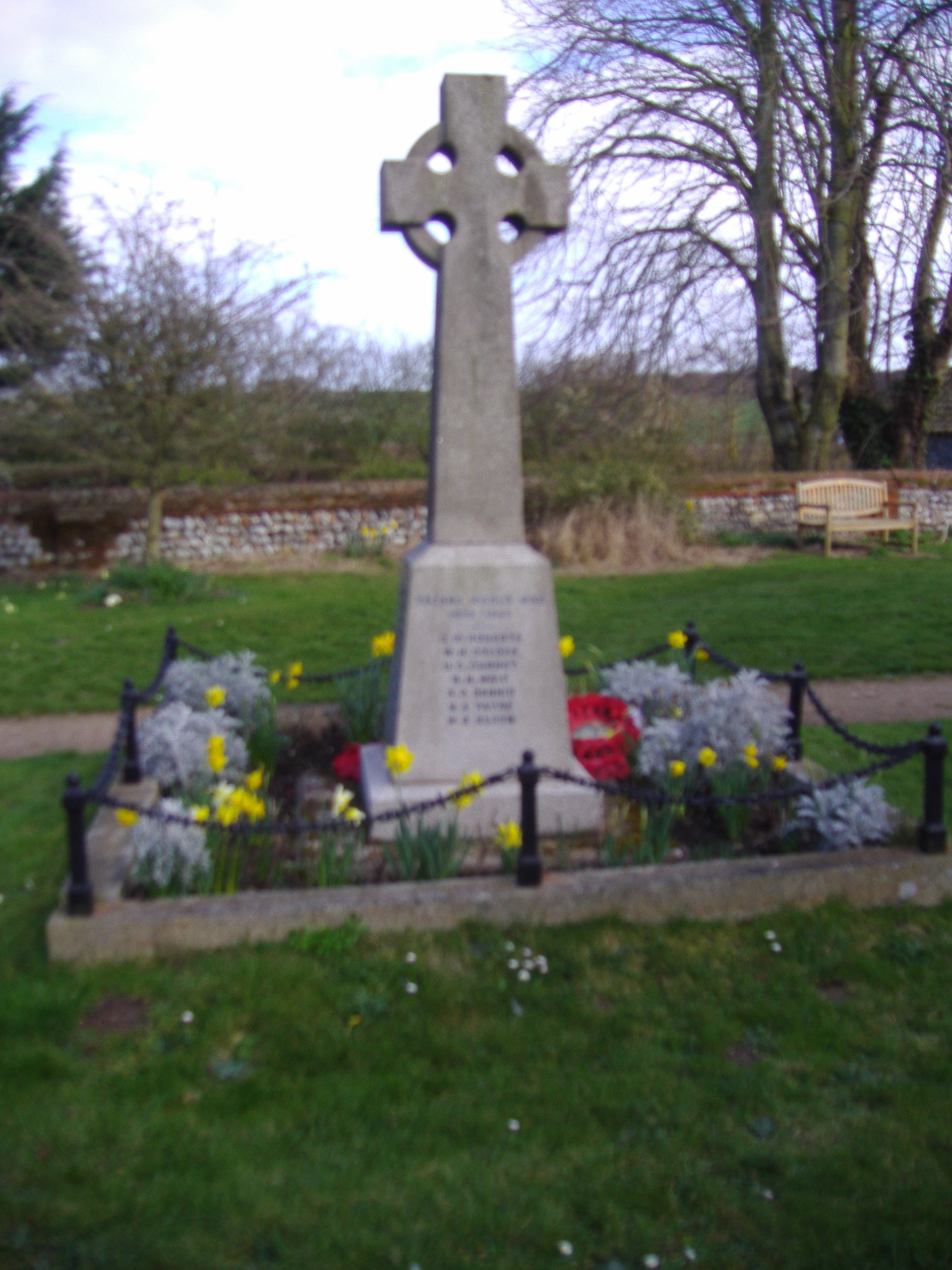
Northrepps War Memorial
References
- ^ Ordnance Survey, Explorer Sheet 252, Norfolk Coast East, ISBN 9780319467268
- ^ County A to Z Atlas, Street & Road maps Norfolk, page 228 ISBN 978 1 84348 614 5
- ^ A Popular Guide to Norfolk Place-names: by James Rye: Published by Larks press, Dereham, Norfolk, 2000 ; ISBN 0 948400 15 3
- ^ Domesday Book, Norfolk, Part I and Part II,33, Morris, J. (General Editor), 1984. Published: Phillimore & Co. ISBN 0850334799
- ^ The Normans in Norfolk by Sue Margeson, Fabienne Seillier and Andrew Rogerson, Pub:1994, Page 100, farming. ISBN 0 903101 62 9
- ^ a b c d The King’s England series, NORFOLK, by Arthur Mee,Pub:Hodder and Stoughton,1972, page 179 Northrepps, ISBN 0 340 15061 0
- ^ The Popular Guide to Norfolk Churches,1:North-East Norfolk, By D.P. Mortlock & C.V. Roberts, 1981, Pub:Acorn Editions, Page 69 Northrepps Saint Mary’s, ISBN 0 906554 04 7
- ^ a b c Norfolk 1: Norwich and North-East, By Nikolaus Pevsner and Bill Wilson, Northrepps entry, page 200. ISBN 0-300-09607-0
See also
- Northrepps Aerodrome
- River Mun
- Frogshall a hamlet within the parish.
- Verily Anderson Author of the Northrepps Grandchildren.
Categories:- Villages in Norfolk
- Civil parishes in Norfolk
-


Wikimedia Foundation. 2010.