- Marshall, New York
-
Marshall, New York — Town — Location within the state of New York
 Marshall, New York
Coordinates: 42°57′50″N 75°23′36″W / 42.96389°N 75.39333°WCoordinates: 42°57′50″N 75°23′36″W / 42.96389°N 75.39333°W Country United States State New York County Oneida Government - Type Town Council - Town Supervisor Nelson A. Blau (R) - Town Council Members' ListArea - Total 32.8 sq mi (85.0 km2) - Land 32.8 sq mi (85.0 km2) - Water 0.0 sq mi (0.0 km2) Elevation 1,158 ft (353 m) Population (2000) - Total 2,127 - Density 64.8/sq mi (25.0/km2) Time zone Eastern (EST) (UTC-5) - Summer (DST) EDT (UTC-4) FIPS code 36-45755 GNIS feature ID 0979201 Marshall is a town in Oneida County, New York, United States. The population was 2,127 at the 2000 census.
The Town of Marshall is in the southeast part of the county. Marshall is southwest of Utica, New York.
Contents
History
Settlers first arrived before 1776. The town was formed in 1829 from the Town of Kirkland.
Geography
According to the United States Census Bureau, the town has a total area of 32.8 square miles (85 km2), all of it land.
Part of the south town line is the border of Madison County, New York.
Demographics
As of the census[1] of 2000, there were 2,127 people, 786 households, and 579 families residing in the town. The population density was 64.8 people per square mile (25.0/km²). There were 829 housing units at an average density of 25.3 per square mile (9.8/km²). The racial makeup of the town was 98.54% White, 0.52% African American, 0.14% Asian, 0.05% from other races, and 0.75% from two or more races. Hispanic or Latino of any race were 0.80% of the population.
There were 786 households out of which 36.1% had children under the age of 18 living with them, 60.1% were married couples living together, 8.9% had a female householder with no husband present, and 26.3% were non-families. 21.9% of all households were made up of individuals and 7.8% had someone living alone who was 65 years of age or older. The average household size was 2.71 and the average family size was 3.16.
In the town the population was spread out with 28.0% under the age of 18, 7.9% from 18 to 24, 29.0% from 25 to 44, 24.2% from 45 to 64, and 11.0% who were 65 years of age or older. The median age was 37 years. For every 100 females there were 99.3 males. For every 100 females age 18 and over, there were 98.2 males.
The median income for a household in the town was $42,125, and the median income for a family was $47,214. Males had a median income of $31,150 versus $24,196 for females. The per capita income for the town was $19,133. About 6.8% of families and 10.1% of the population were below the poverty line, including 13.8% of those under age 18 and 7.0% of those age 65 or over.
Communities and locations in Marshall
- Brothertown – A location in the southwest part of the town, northwest of Waterville. Locally known for accommodating Native Americans before and during local settlement. Waterville Central School's football and outdoor soccer facility was named Brothertown Stadium and Waterville's mascot is an Indian.
- Daytonville – A hamlet northwest of the Marshall hamlet.
- Deansboro – A hamlet on NY 12B in the northwest part of the town. Location of the town government.
- Forge Hollow – A hamlet northwest of Waterville, located on NY 315.
- Hanover – A hamlet west of the Marshall hamlet and north of Waterville.
- Hubbard Corners – A location northwest of Marshall, located on NY 12.
- Lewis Corners – A location west of the Marshall hamlet.
- Marshall – The hamlet of Marshall is near the east town line.
- McConnell Corners – A location near the north town line.
- Oriskany Falls – The Village of Oriskany Falls is at the southwest corner of the town.
- Peck Corners – A location north of Daytonville.
- Small Corners – A hamlet south of Deansboro.
- Tassel Hill – Highest point in Oneida County. Located in the eastern part of the town, east of Route 12 on the borders of the towns of Bridgewater, Paris, and Sangerfield.
- Waterville – The north part of the Village of Waterville is on the south town line.
References
- ^ "American FactFinder". United States Census Bureau. http://factfinder.census.gov. Retrieved 2008-01-31.
External links
Municipalities and communities of Oneida County, New York County seat: Utica Cities 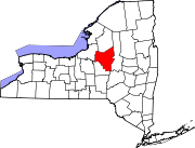
Towns Annsville | Augusta | Ava | Boonville | Bridgewater | Camden | Deerfield | Florence | Floyd | Forestport | Kirkland | Lee | Marcy | Marshall | New Hartford | Paris | Remsen | Sangerfield | Steuben | Trenton | Vernon | Verona | Vienna | Western | Westmoreland | Whitestown
Villages Barneveld | Boonville | Bridgewater | Camden | Clayville | Clinton | Holland Patent | New Hartford | New York Mills | Oneida Castle | Oriskany | Oriskany Falls | Prospect | Remsen | Sylvan Beach | Vernon | Waterville | Whitesboro | Yorkville
CDP Other
hamletsAdrian | Cassville | Deansboro | Durhamville | Jewell | Point Rock | Sauquoit | Taberg | Verona Mills | Washington Mills
Categories:- Towns in New York
- Utica–Rome metropolitan area
- Populated places in Oneida County, New York


Wikimedia Foundation. 2010.