- Marcy, New York
-
Marcy, New York — Town — Location within the state of New York
 Marcy, New York
Coordinates: 43°10′N 75°17′W / 43.167°N 75.283°W Country United States State New York County Oneida Government – Type Town Council – Town Supervisor Brian N. Scala (R) – Town Council Members' ListArea – Total 33.4 sq mi (86.5 km2) – Land 33.0 sq mi (85.4 km2) – Water 0.4 sq mi (1.2 km2) Elevation 827 ft (252 m) Population (2000) – Total 9,469 – Density 287.2/sq mi (110.9/km2) Time zone Eastern (EST) (UTC-5) – Summer (DST) EDT (UTC-4) ZIP code 13403 Area code(s) 315 FIPS code 36-45535 GNIS feature ID 0979197 Marcy is a town in Oneida County, New York, United States. The population was 9,469 at the 2000 census. The town was named after Governor William L. Marcy.
The Town of Marcy lies between the cites of Rome and Utica. The Erie Canal is in the southern part of the town.
Contents
History
The first settlers arrived around 1773. During the American Revolution, the settlers, having been warned by a friendly Oneida Indian about an enemy raid, abandoned their farms until after the war. The town was resettled in 1793.
The Town of Marcy was formed in 1832 from part of the Town of Deerfield, located to the east.
In 1920, the population of Marcy was 1,919
The Neck Canal of 1730 was listed on the National Register of Historic Places in 1995.[1]
Geography
According to the United States Census Bureau, the town has a total area of 33.4 square miles (87 km2), of which, 33.0 square miles (85 km2) of it is land and 0.4 square miles (1.0 km2) of it (1.35%) is water.
The Mohawk River defines the south town line.
The New York State Thruway (Interstate 90) passes through the southeast corner of the town.
The Erie Canal (also known as the Barge Canal) passes through the south end of the town, running along River Road, with Lock 20 Canal Park just east of the Route 291 bridge lying on the canal.
Demographics
As of the census[2] of 2000, there were 9,469 people, 2,003 households, and 1,526 families residing in the town. The population density was 287.2 people per square mile (110.9/km²). There were 2,073 housing units at an average density of 62.9 per square mile (24.3/km²). The racial makeup of the town was 68.42% White, 22.20% African American, 0.27% Native American, 0.60% Asian, 0.04% Pacific Islander, 6.55% from other races, and 1.91% from two or more races. Hispanic or Latino of any race were 14.02% of the population.
There were 2,003 households out of which 33.0% had children under the age of 18 living with them, 65.5% were married couples living together, 6.9% had a female householder with no husband present, and 23.8% were non-families. 19.6% of all households were made up of individuals and 8.0% had someone living alone who was 65 years of age or older. The average household size was 2.60 and the average family size was 2.99.
In the town the population was spread out with 13.2% under the age of 18, 13.4% from 18 to 24, 44.7% from 25 to 44, 20.3% from 45 to 64, and 8.5% who were 65 years of age or older. The median age was 36 years. For every 100 females there were 242.8 males. For every 100 females age 18 and over, there were 276.2 males.
The median income for a household in the town was $47,180, and the median income for a family was $54,231. Males had a median income of $30,943 versus $25,044 for females. The per capita income for the town was $16,182. About 3.7% of families and 5.4% of the population were below the poverty line, including 9.2% of those under age 18 and 2.3% of those age 65 or over.
Communities and locations in Marcy, NY
- Careys Corners – A hamlet in the south part of the town by the Erie Canal. This no longer exists. It is now the offramp for NY 291 from the Utica-Rome Expressway.
- Marcy – The hamlet of Marcy is in the south part of the town.
- Marcy Correctional Facility – A state prison located near Marcy.
- Maynard – A hamlet in the southeast part of the town.
- Mid-State Correctional Facility – A prison near Marcy.
- Stittville – A hamlet in the northwest corner of the town.
Notable residents
- Lynette "Squeaky" Fromme, former member of the Manson Family, lives in Marcy.[3]
References
- ^ "National Register Information System". National Register of Historic Places. National Park Service. 2009-03-13. http://nrhp.focus.nps.gov/natreg/docs/All_Data.html.
- ^ "American FactFinder". United States Census Bureau. http://factfinder.census.gov. Retrieved 2008-01-31.
- ^ Fusco, Jennifer; Rocco LaDuca (2009-09-14). "Would-be Ford assassin 'Squeaky' Fromme moving to Marcy". Observer Dispatch. http://www.uticaod.com/news/x211355264/Would-be-Ford-assassin-moving-to-Marcy. Retrieved 2009-09-28.
External links
Coordinates: 43°10′N 75°17′W / 43.167°N 75.283°W
Municipalities and communities of Oneida County, New York Cities 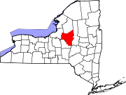
Towns Annsville | Augusta | Ava | Boonville | Bridgewater | Camden | Deerfield | Florence | Floyd | Forestport | Kirkland | Lee | Marcy | Marshall | New Hartford | Paris | Remsen | Sangerfield | Steuben | Trenton | Vernon | Verona | Vienna | Western | Westmoreland | Whitestown
Villages Barneveld | Boonville | Bridgewater | Camden | Clayville | Clinton | Holland Patent | New Hartford | New York Mills | Oneida Castle | Oriskany | Oriskany Falls | Prospect | Remsen | Sylvan Beach | Vernon | Waterville | Whitesboro | Yorkville
CDP Other
hamletsAdrian | Cassville | Deansboro | Durhamville | Jewell | Point Rock | Sauquoit | Taberg | Verona Mills | Washington Mills
Categories:- Towns in New York
- Utica–Rome metropolitan area
- Populated places in Oneida County, New York


Wikimedia Foundation. 2010.