- New Denver, British Columbia
-
Village of New Denver — Village — Location of New Denver in British Columbia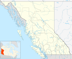
 Village of New Denver
Coordinates: 49°59′29″N 117°22′19″W / 49.99139°N 117.37194°W Country  Canada
Province  British Columbia
Region Slocan Valley, West Kootenay Regional district Central Kootenay Founded 1892 Incorporated 1929 Government – Governing body New Denver Village Council – Mayor Gary Wright Area – Total 1.07 km2 (0.4 sq mi) Elevation 560 m (1,837 ft) Population (2006) – Total 512 Time zone PST (UTC-8) Highways 6
31AWaterways Slocan Lake Website Town of New Denver New Denver is a village in southeastern British Columbia, Canada, along the shore of Slocan Lake. New Denver was founded as a mining town in 1892, and briefly known as Eldorado City before being renamed after Denver, Colorado. It was incorporated as a village in 1929 and currently has approximately 600 residents.
During World War II, New Denver became a Japanese Canadian internment camp. Not long after the attack on Pearl Harbor in December 1941, men between the ages of 18 and 45 were sent to labour camps in the Interior of British Columbia or farther into Eastern Canada. Approximately 1,500 women, children, and elderly men were sent to the "Orchard", a small section of New Denver set up to house them. New Denver's Nikkei Internment Memorial Centre is dedicated to the history of the 23,000 Japanese Canadians that were interned by the Canadian government.
In the 1950s, children of Freedomites, a Doukhobor extremist group, were removed from their parents and sent to residential school in New Denver. The Freedomites refused to send their children to school because of their religious beliefs.[1]
The town is also notable for its lack of mobile phones. In a 2008 referendum citizens voted against the introduction of cellular telephone service.[2] Despite this, on July 20, 2010, Telus Canada began installation of a cell phone facility in the heart of the village with many citizens peacefully protesting the installation.
Climate
Climate data for New Denver Month Jan Feb Mar Apr May Jun Jul Aug Sep Oct Nov Dec Year Record high °C (°F) 10.6
(51.1)14
(57)18.5
(65.3)27.2
(81.0)33.5
(92.3)35.5
(95.9)36.5
(97.7)37.2
(99.0)35.5
(95.9)22.5
(72.5)18.3
(64.9)11.5
(52.7)37.2
(99.0)Average high °C (°F) −0.3
(31.5)2.7
(36.9)7.6
(45.7)13.6
(56.5)18.8
(65.8)22.1
(71.8)25.7
(78.3)25.4
(77.7)19.4
(66.9)11.5
(52.7)4.2
(39.6)0
(32)12.6 Average low °C (°F) −5.3
(22.5)−3.8
(25.2)−1.4
(29.5)1.6
(34.9)5.7
(42.3)9.3
(48.7)11.5
(52.7)11.6
(52.9)7.5
(45.5)3.2
(37.8)−0.7
(30.7)−4.4
(24.1)2.9 Record low °C (°F) −23.5
(−10.3)−21
(−6)−15.6
(3.9)−7.2
(19.0)−2
(28)2.2
(36.0)1.1
(34.0)1.7
(35.1)−1.5
(29.3)−11
(12)−23.5
(−10.3)−28.9
(−20.0)−28.9
(−20.0)Precipitation mm (inches) 103
(4.06)68.7
(2.705)60.1
(2.366)57
(2.24)61.6
(2.425)75.7
(2.98)63.3
(2.492)62.7
(2.469)52.7
(2.075)66.8
(2.63)98.9
(3.894)109.5
(4.311)879.9
(34.642)Source: Environment Canada[3] References
- ^ "Russia Handed Propaganda Gift By Persecuted Sect In Canada". Miami News. 21 January 1958. http://news.google.com/newspapers?id=47wyAAAAIBAJ&sjid=JewFAAAAIBAJ&pg=2314,2561471. Retrieved 19 November 2010.
- ^ Metcalfe, Bill. "Why a Little BC Town Wants to Banish Cell Phones", "The Tyee", 2008-03-13.
- ^ Environment Canada—Canadian Climate Normals 1971–2000, accessed 26 March 2010
External links
Subdivisions of British ColumbiaSubdivisions Regions · Regional districts · Forest Regions and Forest Districts · School districts · Land DistrictsSettlements Urban centres Villages Alert Bay · Anmore · Ashcroft · Belcarra · Burns Lake · Cache Creek · Canal Flats · Chase · Clinton · Fraser Lake · Fruitvale · Gold River · Granisle · Harrison Hot Springs · Hazelton · Kaslo · Keremeos · Lions Bay · Lumby · Lytton · Masset · McBride · Midway · Montrose · Nakusp · New Denver · Pemberton · Port Alice · Port Clements · Pouce Coupe · Queen Charlotte · Radium Hot Springs · Salmo · Sayward · Silverton · Slocan · Tahsis · Telkwa · Valemount · Warfield · ZeballosCoordinates: 49°59′30″N 117°22′17″W / 49.99167°N 117.37139°W
Categories:- Villages in British Columbia
- Populated places in the Slocan
- Mining communities in British Columbia
- Japanese Canadian internment

Wikimedia Foundation. 2010.