- National Register of Historic Places listings in Douglas County, Colorado
-
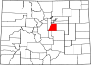
 Location of Douglas County in Colorado
This is a list of the National Register of Historic Places listings in Douglas County, Colorado. It is intended to be a complete list of the properties and districts on the National Register of Historic Places in Douglas County, Colorado, United States. The locations of National Register properties and districts for which the latitude and longitude coordinates are included below, may be seen in a Google map.[1]
There are 26 properties and districts listed on the National Register in the county.
-
- This National Park Service list is complete through NPS recent listings posted November 10, 2011.[2]
Listings county-wide
[3] Landmark name Image Date listed Location City or town Summary 1 American Federation of Human Rights Headquarters March 19, 1998 9070 S. Douglas Boulevard
39°13′44″N 104°53′15″W / 39.228889°N 104.8875°WLarkspur 2 Bear Canon Agricultural District October 29, 1975 South of Denver on both sides of State Highway 105 from State Highway 67 south to Jarre Creek
39°23′46″N 104°57′41″W / 39.396111°N 104.961389°WSedalia 3 Castle Rock Depot 
October 11, 1974 420 Elbert St.
39°22′27″N 104°51′43″W / 39.374167°N 104.861944°WCastle Rock 4 Castle Rock Elementary School 
September 20, 1984 3rd and Cantril Sts.
39°22′22″N 104°51′19″W / 39.372778°N 104.855278°WCastle Rock 5 Cherokee Ranch October 21, 1994 North of County Road 85 and south of Daniels Park Rd.
39°27′20″N 104°55′36″W / 39.455556°N 104.926667°WSedalia 6 Cherry Creek Bridge 
October 15, 2002 State Highway 83 at milepost 46.30
39°19′52″N 104°44′02″W / 39.331111°N 104.733889°WFranktown 7 Church of St. Philip-in-the-Field and Bear Canon Cemetery April 11, 1973 5 miles south of Sedalia on State Highway 105
39°22′05″N 104°57′33″W / 39.368056°N 104.959167°WSedalia 8 Daniels Park June 30, 1995 Along Douglas County Road 67 northeast of Sedalia
39°28′50″N 104°55′37″W / 39.480556°N 104.926944°WSedalia 9 Devils Head Lookout 
June 13, 2003 South Platte District in the Pike National Forest
39°15′37″N 105°06′03″W / 39.260278°N 105.100833°WSedalia 10 First National Bank of Douglas County 
April 14, 1995 300 Wilcox St.
39°22′21″N 104°51′33″W / 39.3725°N 104.859167°WCastle Rock 11 Franktown Cave February 1, 2006 Address Restricted Franktown 12 Glen Grove School November 5, 1974 North of Palmer Lake off Perry Park Rd.
39°15′38″N 104°57′02″W / 39.260556°N 104.950556°WPalmer Lake 13 Benjamin Hammar House 
February 3, 1993 203 Cantril St.
39°22′18″N 104°51′22″W / 39.371667°N 104.856111°WCastle Rock 14 Indian Park School February 8, 1978 10 miles (16 km) west of Sedalia on State Highway 67
39°22′49″N 105°04′52″W / 39.380278°N 105.081111°WSedalia 15 Keystone Hotel 
June 20, 1997 219 and 223 4th St.
39°22′25″N 104°51′36″W / 39.373611°N 104.86°WCastle Rock 16 John Kinner House October 11, 1974 6694 Perry Park Rd.
39°16′18″N 104°57′25″W / 39.271667°N 104.956944°WSedalia 17 Lamb Spring March 13, 1997 Address Restricted Littleton 18 Louviers Village 
July 2, 1999 Louviers Boulevard, Hillcrest Dr., Triangle Dr., Main St., Valley View St., and 1st, 2nd, 3rd and 4th Sts.
39°28′36″N 105°00′22″W / 39.476667°N 105.006111°WLouviers 19 Louviers Village Club 
September 22, 1995 Junction of Louviers Boulevard and 1st St.
39°28′34″N 105°00′23″W / 39.476111°N 105.006389°WLouviers 20 Pike's Peak Grange No. 163 
October 1, 1990 3093 State Highway 83
39°24′32″N 104°45′42″W / 39.408889°N 104.761667°WFranktown 21 Ben Quick Ranch and Fort October 1, 1974 6695 W. Plum Creek Rd.
39°15′52″N 104°57′10″W / 39.264444°N 104.952778°WPalmer Lake 22 Roxborough State Park Archaeological District 
January 27, 1983 Address Restricted Waterton 23 Ruth Memorial Methodist Episcopal Church May 1, 1989 19670 E. Mainstreet
39°31′05″N 104°45′34″W / 39.518056°N 104.759444°WParker 24 Santa Fe Railway Water Tank April 18, 2003 U.S. Route 85 west of its junction with State Highway 67
39°26′22″N 104°57′50″W / 39.439444°N 104.963889°WSedalia 25 Reginald Sinclaire House September 20, 1991 6154 Perry Park Rd.
39°16′20″N 104°56′39″W / 39.272222°N 104.944167°WLarkspur Home of Reginald Sinclaire, in Colorado Aviation Hall of Fame 26 Spring Valley School December 18, 1978 East of Larkspur at Spring Valley and Lorraine Rds.
39°09′08″N 104°46′10″W / 39.152222°N 104.769444°WLarkspur See also
- List of National Historic Landmarks in Colorado
- National Register of Historic Places listings in Colorado
References
- ^ The latitude and longitude information provided in this table was derived originally from the National Register Information System, which has been found to be fairly accurate for about 99% of listings. For about 1% of NRIS original coordinates, experience has shown that one or both coordinates are typos or otherwise extremely far off; some corrections may have been made. A more subtle problem causes many locations to be off by up to 150 yards, depending on location in the country: most NRIS coordinates were derived from tracing out latitude and longitudes off of USGS topographical quadrant maps created under the North American Datum of 1927, which differs from the current, highly accurate WGS84 GPS system used by Google maps. Chicago is about right, but NRIS longitudes in Washington are higher by about 4.5 seconds, and are lower by about 2.0 seconds in Maine. Latitudes differ by about 1.0 second in Florida. Some locations in this table may have been corrected to current GPS standards.
- ^ "National Register of Historic Places: Weekly List Actions". National Park Service, United States Department of the Interior. Retrieved on November 10, 2011.
- ^ Numbers represent an ordering by significant words. Various colorings, defined here, differentiate National Historic Landmark sites and National Register of Historic Places Districts from other NRHP buildings, structures, sites or objects.
U.S. National Register of Historic Places Topics Lists by states Alabama • Alaska • Arizona • Arkansas • California • Colorado • Connecticut • Delaware • Florida • Georgia • Hawaii • Idaho • Illinois • Indiana • Iowa • Kansas • Kentucky • Louisiana • Maine • Maryland • Massachusetts • Michigan • Minnesota • Mississippi • Missouri • Montana • Nebraska • Nevada • New Hampshire • New Jersey • New Mexico • New York • North Carolina • North Dakota • Ohio • Oklahoma • Oregon • Pennsylvania • Rhode Island • South Carolina • South Dakota • Tennessee • Texas • Utah • Vermont • Virginia • Washington • West Virginia • Wisconsin • WyomingLists by territories Lists by associated states Other Municipalities and communities of Douglas County, Colorado Cities Aurora‡ | Castle Pines North | Littleton‡ | Lone Tree
Towns CDPs Acres Green | Castle Pines | Franktown | Grand View Estates | Highlands Ranch | Louviers | Meridian | Perry Park | Roxborough Park | Sedalia | Stonegate | The Pinery | Westcreek
Unincorporated
communitiesFootnotes ‡This populated place also has portions in an adjacent county or counties
Categories:- National Register of Historic Places in Colorado by county
- Douglas County, Colorado
- Buildings and structures in Douglas County, Colorado
-


Wikimedia Foundation. 2010.