- Choseley
-
Coordinates: 52°56′07″N 0°35′42″E / 52.93533°N 0.59504°E
Choseley 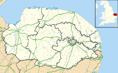
 Choseley
Choseley shown within NorfolkArea 2.75 km2 (1.06 sq mi) Population 18 - Density 7 /km2 (18 /sq mi) OS grid reference TF745407 Parish Choseley District King's Lynn and West Norfolk Shire county Norfolk Region East Country England Sovereign state United Kingdom Post town KING'S LYNN Postcode district PE31 Police Norfolk Fire Norfolk Ambulance East of England EU Parliament East of England List of places: UK • England • Norfolk Choseley is a tiny hamlet and civil parish in the English county of Norfolk. It is situated between the villages of Titchwell and Docking and about 4 kilometres (2.5 mi) from each. The town of Fakenham is 20 km (12 mi) to the south-east, the town of King's Lynn is 25 km (16 mi) to the south-west, and the city of Norwich is 60 km (37 mi) to the south-east.[1]
The civil parish has an area of 2.75 km2 (1.06 sq mi) and in the 2001 census had a population of 18 in 10 households. For the purposes of local government, the parish falls within the district of King's Lynn and West Norfolk.[2]
Notes
- ^ Ordnance Survey (2002). OS Explorer Map 250 - Norfolk Coast West. ISBN 0-319-21886-4.
- ^ Office for National Statistics & Norfolk County Council (2001). Census population and household counts for unparished urban areas and all parishes. Retrieved December 2, 2005.
External links
- Map sources for Choseley.
- Information from Genuki Norfolk on Choseley.
Categories:- Hamlets in Norfolk
- King's Lynn and West Norfolk
- Civil parishes in Norfolk
- Norfolk geography stubs

Wikimedia Foundation. 2010.