- National Register of Historic Places listings in Washington County, Vermont
-
 Location of Washington County in Vermont
This is a list of the National Register of Historic Places listings in Washington County, Vermont.
This is intended to be a complete list of the properties and districts on the National Register of Historic Places in Washington County, Vermont, United States. Latitude and longitude coordinates are provided for many National Register properties and districts; these locations may be seen together in a Google map.[1]
There are 62 properties and districts listed on the National Register in the county, including 2 National Historic Landmarks.
-
- This National Park Service list is complete through NPS recent listings posted November 10, 2011.[2]
Contents: Counties in Vermont Addison - Bennington - Caledonia - Chittenden - Essex - Franklin - Grand Isle - Lamoille - Orange - Orleans - Rutland - Washington - Windham - Windsor Current listings
[3] Landmark name [4] Image Date listed Location City or town Summary 1 Allenwood Farm December 22, 1983 U.S. Route 2
44°16′42″N 72°26′02″W / 44.278333°N 72.433889°WPlainfield 2 Athenwood and Thomas W. Wood Studio 
June 13, 1974 41 and 39 Northfield St.
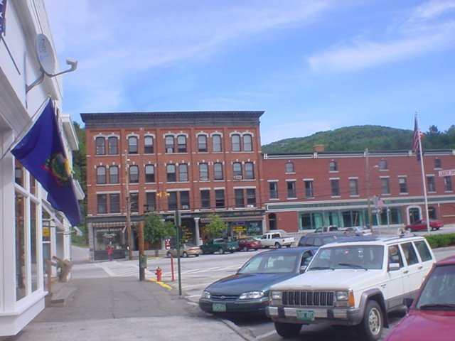
44°15′21″N 72°34′47″W / 44.255833°N 72.579722°WMontpelier 3 Barre City Hall and Opera House January 18, 1973 12 N. Main St.
44°11′48″N 72°30′10″W / 44.196667°N 72.502778°WBarre 4 Barre Downtown Historic District September 4, 1979 Vermont Route 302
44°11′50″N 72°30′09″W / 44.197222°N 72.5025°WBarre 5 Beck and Beck Granite Shed September 29, 2011 30 Granite St.
44°11′58″N 72°30′23″W / 44.199444°N 72.506389°WBarre 6 Bridge 31 August 9, 2006 Winooski St.
44°20′21″N 72°45′51″W / 44.339167°N 72.764167°WWaterbury 7 Bridge No. 27 January 11, 2006 Town Highway 61, Lover's Ln.
44°11′22″N 72°38′27″W / 44.189444°N 72.640833°WBerlin 8 Central Vermont Railway Depot 
April 1, 1975 Western end of Depot Sq.
44°08′55″N 72°39′30″W / 44.148611°N 72.658333°WNorthfield 9 Coburn Covered Bridge October 9, 1974 Northeast of East Montpelier between Vermont Route 14 and U.S. Route 2, over the Winooski River
44°16′51″N 72°27′18″W / 44.280833°N 72.455°WEast Montpelier 10 Colby Mansion September 10, 1979 North of Waterbury on 100
44°20′59″N 72°44′35″W / 44.349722°N 72.743056°WWaterbury 11 College Hall April 23, 1975 Vermont College campus, Ridge St.
44°15′19″N 72°34′04″W / 44.255278°N 72.567778°WMontpelier 12 Currier Park Historic District September 27, 1990 Properties bordering Currier Park on Park, North, East and Academy Sts. and adjacent properties on Averill and Cliff Sts
44°11′53″N 72°33′12″W / 44.198056°N 72.553333°WBarre City 13 Parley Davis House September 18, 1989 Address Restricted East Montpelier 14 East Village Meetinghouse June 30, 1980 U.S. Routes 2 and 14
44°16′19″N 72°29′16″W / 44.271944°N 72.487778°WEast Montpelier 15 Gale-Bancroft House November 15, 1984 Brook Rd.
44°16′31″N 72°25′25″W / 44.275278°N 72.423611°WPlainfield 16 Goddard College Greatwood Campus March 7, 1996 Junction of U.S. Route 2 and Vermont Route 214
44°16′43″N 72°26′04″W / 44.278611°N 72.434444°WPlainfield 17 Great Eddy Covered Bridge September 6, 1974 East of Vermont Route 100 over Mad River
44°11′22″N 72°49′26″W / 44.189444°N 72.823889°WWaitsfield 18 Green Mountain Seminary 
January 30, 1978 Off Vermont Route 100
44°22′39″N 72°43′05″W / 44.3775°N 72.718056°WWaterbury Center 19 Italian Baptist Church April 23, 1975 10 N. Brook St.
44°12′13″N 72°30′34″W / 44.203611°N 72.509444°WBarre 20 Jones Brothers Granite Shed April 26, 2002 720 N. Main St., Vermont Route 302
44°12′43″N 72°31′26″W / 44.211944°N 72.523889°WBarre 21 Joslin Farm 
October 27, 1988 E. Warren Rd., 1.5 mi (2.4 km) east of junction with Bridge St.
44°10′07″N 72°48′36″W / 44.168611°N 72.81°WWaitsfield 22 Kents Corner Historic District May 8, 1973 Kent's Corner; also Kent Hill, Old West Church, Robinson Cemetery, Fowler, and Bliss Pond Roads
44°21′54″N 72°29′18″W / 44.365°N 72.488333°WCalais Second set of addresses represents a boundary increase 23 Chauncey B. Leonard House March 9, 1995 Northern side of Shed Rd., about 0.2 mi (0.32 km) west of Scott Hill Rd.
44°12′39″N 72°34′48″W / 44.210833°N 72.58°WBerlin 24 Lower Cox Brook Covered Bridge October 15, 1974 Off Vermont Route 12
44°10′21″N 72°39′12″W / 44.1725°N 72.653333°WNorthfield Falls 25 Mad River Valley Rural Historic District August 5, 1994 Roughly along Vermont Routes 100 and 100B from Waitsfield to Moretown and parts of North and River Rds.
44°13′16″N 72°47′29″W / 44.221111°N 72.791389°WMoretown and Waitsfield 26 Martin Covered Bridge 
October 9, 1974 Northeast of Plainfield, over the Winooski River
44°17′07″N 72°24′48″W / 44.285278°N 72.413333°WPlainfield 27 Mayo Building July 14, 1983 Main and East Sts.
44°08′54″N 72°39′22″W / 44.148333°N 72.656111°WNorthfield 28 McLaughlin Farm January 22, 1996 Town Highway 17 (Bragg Hill Rd.)
44°11′37″N 72°50′45″W / 44.193611°N 72.845833°WFayston 29 Middlesex-Winooski River Bridge November 14, 1991 U.S. Route 2 over the Winooski River
44°18′22″N 72°41′48″W / 44.306111°N 72.696667°WMiddlesex 30 Mill Village Historic District June 12, 1979 Roughly bounded by Vermont Route 100, Interstate 89, and Stowe St.
44°20′35″N 72°44′52″W / 44.343056°N 72.747778°WWaterbury 31 Montpelier Historic District November 3, 1978 U.S. Route 2 and Vermont Route 12; also 70–101 E. State St. and 1 West St.
44°15′41″N 72°34′37″W / 44.261389°N 72.576944°WMontpelier Second set of addresses represents a boundary increase 32 National Clothespin Factory 
December 16, 2005 One Granite St.
44°15′08″N 72°34′16″W / 44.252222°N 72.571111°WMontpelier Was the last manufacturer of wooden clothespins in the US; building now houses martial arts studios and other businesses; see also Grave of Jack Crowell 33 Nichols House January 31, 1978 Southwest of East Barre off Vermont Route 110
44°08′59″N 72°27′31″W / 44.149722°N 72.458611°WEast Barre 34 North Calais Village Historic District September 24, 2010 N. Calais Rd., Foster Hill Rd., Upper Rd., Moscow Hills Rd., G.A.R. Rd.
44°23′27″N 72°26′37″W / 44.390833°N 72.443611°WCalais 35 Northfield Falls Covered Bridge August 13, 1974 North of Northfield off Vermont Route 12, over Dog River
44°10′20″N 72°39′18″W / 44.172222°N 72.655°WNorthfield 36 Old Red Mill October 20, 1977 Vermont Route 12
44°07′07″N 72°39′27″W / 44.118611°N 72.6575°WSouth Northfield 37 Old West Church 
May 8, 1973 0.8 mi (1.3 km) south of Kent's Corner
44°21′31″N 72°29′37″W / 44.358611°N 72.493611°WCalais 38 Pine Brook Covered Bridge 
June 13, 1974 Northeast of Waitsfield over Pine Brook
44°12′21″N 72°47′32″W / 44.205833°N 72.792222°WWaitsfield 39 Plainfield Village Historic District February 3, 1983 High, School, Main and Water Sts., and Brook Rd.
44°16′43″N 72°25′32″W / 44.278611°N 72.425556°WMarshfield and Plainfield 40 Roxbury Fish Hatchery March 24, 1994 Western side of Vermont Route 12A, about 1.0 mile south of Roxbury
44°03′46″N 72°44′38″W / 44.062778°N 72.743889°WRoxbury 41 Scampini Block March 13, 2007 289 N. Main St.
44°12′07″N 72°30′16″W / 44.201944°N 72.504444°WBarre 42 Slaughterhouse Covered Bridge June 13, 1974 North of Northfield off Vermont Route 12 over Dog River
44°10′07″N 72°39′17″W / 44.168611°N 72.654722°WNorthfield 43 E. L. Smith Roundhouse Granite Shed September 26, 2011 23 Burnham Meadows
44°11′51″N 72°30′19″W / 44.1975°N 72.505278°WBarre 44 Socialist Labor Party Hall October 22, 1998 46 Granite St.
44°11′54″N 72°30′27″W / 44.198333°N 72.5075°WBarre City 45 Stony Brook Covered Bridge November 20, 1974 Southwest of Northfield off Vermont Route 12A, over Stony Brook
44°07′16″N 72°41′25″W / 44.121111°N 72.690278°WNorthfield 46 Joshua Twing Gristmill December 29, 1978 450 N. Main St.
44°12′18″N 72°30′46″W / 44.205°N 72.512778°WBarre 47 Union Co-operative Store Bakery November 13, 2003 46½ Granite St.
44°11′55″N 72°30′26″W / 44.198611°N 72.507222°WBarre 48 Union Meetinghouse June 30, 1980 Center Rd.
44°17′00″N 72°31′39″W / 44.283333°N 72.5275°WEast Montpelier 49 Upper Cox Brook Covered Bridge October 1, 1974 North of Northfield off Vermont Route 12 over Cox Brook
44°10′25″N 72°39′20″W / 44.173611°N 72.655556°WNorthfield 50 Vermont Statehouse 
December 30, 1970 State St.
44°15′44″N 72°34′51″W / 44.262222°N 72.580833°WMontpelier 51 Waitsfield Common Historic District November 8, 2001 Joslin Hill Rd., North Rd., East Rd., and Common Rd.
44°11′16″N 72°47′47″W / 44.187778°N 72.796389°WWaitsfield 52 Waitsfield Village Historic District August 11, 1983 Vermont Route 100 and Bridge St.
44°11′26″N 72°49′22″W / 44.190556°N 72.822778°WWaitsfield 53 Warren Covered Bridge August 7, 1974 Off Vermont Route 100, over the Mad River
44°06′40″N 72°51′26″W / 44.111111°N 72.857222°WWarren 54 Warren Village Historic District November 20, 1992 Along Town Highways 1, 4, 16 and 17
44°06′49″N 72°51′24″W / 44.113611°N 72.856667°WWarren 55 Waterbury Center Methodist Church January 9, 1978 Vermont Route 100
44°22′51″N 72°43′13″W / 44.380833°N 72.720278°WWaterbury Center 56 Waterbury Village Historic District August 24, 1978 U.S. Route 2
44°20′06″N 72°45′17″W / 44.335°N 72.754722°WWaterbury 57 Wheelock Law Office June 18, 1975 135 N. Main St.
44°11′53″N 72°30′13″W / 44.198056°N 72.503611°WBarre City 58 Theodore Wood House February 10, 2005 1420 Hollister Hill Rd.
44°18′07″N 72°24′51″W / 44.301944°N 72.414167°WMarshfield 59 Woodbury Graded School September 30, 1993 Junction of Town Highway 22 and Vermont Route 14
44°26′24″N 72°24′59″W / 44.440008°N 72.416291°WWoodbury 60 Woodbury Town Hall March 31, 1995 Vermont Route 14
44°26′26″N 72°24′57″W / 44.440556°N 72.415833°WWoodbury 61 Worcester Town Hall November 9, 2005 12 Worcester Village Rd.
44°22′31″N 72°33′00″W / 44.375278°N 72.55°WWorcester 62 Worcester Village School November 9, 2005 17 Calais Rd.
44°22′21″N 72°32′55″W / 44.3725°N 72.548611°WWorcester See also
- List of National Historic Landmarks in Vermont
- National Register of Historic Places listings in Vermont
References
- ^ The latitude and longitude information provided in this table was derived originally from the National Register Information System, which has been found to be fairly accurate for about 99% of listings. For about 1% of NRIS original coordinates, experience has shown that one or both coordinates are typos or otherwise extremely far off; some corrections may have been made. A more subtle problem causes many locations to be off by up to 150 yards, depending on location in the country: most NRIS coordinates were derived from tracing out latitude and longitudes off of USGS topographical quadrant maps created under the North American Datum of 1927, which differs from the current, highly accurate WGS84 GPS system used by Google maps. Chicago is about right, but NRIS longitudes in Washington are higher by about 4.5 seconds, and are lower by about 2.0 seconds in Maine. Latitudes differ by about 1.0 second in Florida. Some locations in this table may have been corrected to current GPS standards.
- ^ "National Register of Historic Places: Weekly List Actions". National Park Service, United States Department of the Interior. Retrieved on November 10, 2011.
- ^ Numbers represent an ordering by significant words. Various colorings, defined here, differentiate National Historic Landmark sites and National Register of Historic Places Districts from other NRHP buildings, structures, sites or objects.
- ^ "National Register Information System". National Register of Historic Places. National Park Service. . http://nrhp.focus.nps.gov/natreg/docs/All_Data.html.
U.S. National Register of Historic Places Topics Lists by states Alabama • Alaska • Arizona • Arkansas • California • Colorado • Connecticut • Delaware • Florida • Georgia • Hawaii • Idaho • Illinois • Indiana • Iowa • Kansas • Kentucky • Louisiana • Maine • Maryland • Massachusetts • Michigan • Minnesota • Mississippi • Missouri • Montana • Nebraska • Nevada • New Hampshire • New Jersey • New Mexico • New York • North Carolina • North Dakota • Ohio • Oklahoma • Oregon • Pennsylvania • Rhode Island • South Carolina • South Dakota • Tennessee • Texas • Utah • Vermont • Virginia • Washington • West Virginia • Wisconsin • WyomingLists by territories Lists by associated states Other Municipalities and communities of Washington County, Vermont Cities Barre | Montpelier

Towns Barre | Berlin | Cabot | Calais | Duxbury | East Montpelier | Fayston | Marshfield | Middlesex | Moretown | Northfield | Plainfield | Roxbury | Waitsfield | Warren | Waterbury | Woodbury | Worcester
Villages Cabot | Marshfield | Northfield | Waterbury
CDPs East Barre | Graniteville | South Barre | Websterville
Other
communitiesCategories:- National Register of Historic Places in Vermont by county
- Washington County, Vermont
-


Wikimedia Foundation. 2010.