- National Register of Historic Places listings in Rutland County, Vermont
-
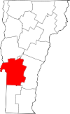 Location of Rutland County in Vermont
This is a list of the National Register of Historic Places listings in Rutland County, Vermont.
This is intended to be a complete list of the properties and districts on the National Register of Historic Places in Rutland County, Vermont, United States. Latitude and longitude coordinates are provided for many National Register properties and districts; these locations may be seen together in a Google map.[1]
There are 73 properties and districts listed on the National Register in the county.
-
- This National Park Service list is complete through NPS recent listings posted November 10, 2011.[2]
Contents: Counties in Vermont Addison - Bennington - Caledonia - Chittenden - Essex - Franklin - Grand Isle - Lamoille - Orange - Orleans - Rutland - Washington - Windham - Windsor Current listings
[3] Landmark name [4] Image Date listed Location City or town Summary 1 Nathan Allen House October 27, 1988 VT 30
43°21′45″N 73°11′07″W / 43.3625°N 73.185278°WPawlet 2 H. H. Baxter Memorial Library August 24, 1978 96 Grove St.
43°36′44″N 72°58′53″W / 43.612222°N 72.981389°WRutland 3 Benson Village November 17, 1978 Stage and Benson Landing Sts.
43°42′33″N 73°18′38″W / 43.709167°N 73.310556°WBenson 4 Braintree School May 3, 2010 9 Warren Switch Rd.43°22′8.73″N 73°14′6.14″W / 43.3690917°N 73.2350389°W Pawlet 5 Brandon State School November 12, 1999 U.S. Route 7
43°48′42″N 73°06′30″W / 43.811667°N 73.108333°WBrandon 6 Brandon Village Historic District December 22, 1976 U.S. Route 7
43°47′52″N 73°05′18″W / 43.797778°N 73.088333°WBrandon 7 Bridge 4 November 5, 2009 Vermont Route 31
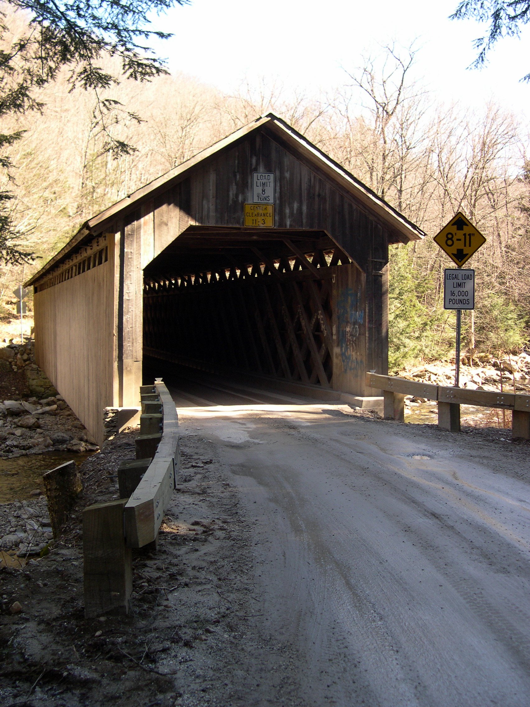
43°30′47″N 73°14′00″W / 43.513056°N 73.233333°WPoultney 8 Brown Covered Bridge 
January 21, 1974 2.9 mi (4.7 km) east of North Clarendon across the Cold River
43°33′58″N 72°55′10″W / 43.566111°N 72.919444°WNorth Clarendon 9 Castleton Medical College Building 
March 11, 1971 South St.
43°36′36″N 73°10′43″W / 43.61°N 73.178611°WCastleton 10 Castleton Village Historic District April 26, 1979 Irregular pattern along Main and South Sts.
43°36′39″N 73°10′47″W / 43.610833°N 73.179722°WCastleton 11 Chaffee-Moloney Houses November 19, 2001 194 and 196-98 Columbian Ave.
43°36′27″N 72°59′32″W / 43.6075°N 72.992222°WRutland 12 Clarendon Congregational Church 
July 12, 1984 Middle Rd.
43°31′06″N 72°58′16″W / 43.518333°N 72.971111°WClarendon 13 Clarendon House 
May 17, 1976 Off VT 133
43°32′55″N 73°01′18″W / 43.548611°N 73.021667°WClarendon Springs 14 Clementwood September 27, 1980 Clement Rd.
43°35′59″N 73°00′25″W / 43.599722°N 73.006944°WRutland 15 Colburn Bridge October 11, 1990 U.S. Route 7 over Sugar Hollow Brook
43°42′25″N 73°01′17″W / 43.706944°N 73.021389°WPittsford 16 Cold River Bridge November 14, 1991 VT 7B over the Cold River
43°34′12″N 72°57′59″W / 43.57°N 72.966389°WClarendon Demolished in 2006 17 Cooley Covered Bridge January 24, 1974 1.2 mi (1.9 km) south of Pittsford across Furnace Brook
43°41′24″N 73°01′45″W / 43.69°N 73.029167°WPittsford 18 Crowley Cheese Factory 
October 11, 1979 Southwest of Healdville on Healdville Rd.
43°25′26″N 72°47′13″W / 43.423889°N 72.786944°WHealdville 19 Danby Village Historic District February 10, 1983 Main St., Mt. Tabor Ave., Depot St., and Borough Hill Rd.
43°20′50″N 72°59′47″W / 43.347222°N 72.996389°WDanby 20 Dean Covered Bridge September 10, 1974 South of Brandon, over Otter Creek
43°46′43″N 73°05′51″W / 43.778611°N 73.0975°WBrandon 21 Depot Covered Bridge January 21, 1974 .8 mi (1.3 km) west of Pittsford across Otter Creek
43°42′34″N 73°02′36″W / 43.709444°N 73.043333°WPittsford 22 East Clarendon Railroad Station 
March 8, 1999 VT 103 and East Rd.
43°31′34″N 72°56′00″W / 43.526111°N 72.933333°WClarendon 23 East Poultney Historic District January 31, 1978 Village green and environs
43°31′31″N 73°12′24″W / 43.525278°N 73.206667°WEast Poultney 24 Fair Haven Green Historic District 
November 24, 1980 Park Pl., Adams and Main Sts.
43°35′35″N 73°15′57″W / 43.593056°N 73.265833°WFair Haven 25 Forest Dale Iron Furnace June 13, 1974 VT 73 and Furnace Rd.
43°49′55″N 73°02′54″W / 43.831944°N 73.048333°WBrandon 26 Fort Vengeance Monument Site March 15, 2006 U.S. Route 7, .57 mi (0.92 km) south of the town line
43°44′51″N 73°02′53″W / 43.7475°N 73.048056°WPittsford 27 Fox-Cook Farm November 26, 1986 Off U.S. Route 7 on Cook Rd.
43°27′23″N 72°59′28″W / 43.456389°N 72.991111°WWallingford 28 Gifford Woods State Park April 23, 2002 VT 100
43°40′29″N 72°48′44″W / 43.674722°N 72.812222°WKillington 29 Gorham Covered Bridge February 12, 1974 North of Proctor across Otter Creek off VT 3
43°40′48″N 73°02′17″W / 43.68°N 73.038056°WProctor 30 Hager Farm November 26, 1986 U.S. Route 7
43°26′10″N 72°59′26″W / 43.436111°N 72.990556°WWallingford 31 Gen. Robinson Hall House November 26, 1986 U.S. Route 7
43°25′47″N 72°59′24″W / 43.429722°N 72.99°WWallingford 32 Hammond Covered Bridge 
January 21, 1974 Northwest of Pittsford across Otter Creek
43°43′14″N 73°03′14″W / 43.720556°N 73.053889°WPittsford 33 Hosford-Sherman Farm May 12, 1995 VT 30
43°34′04″N 73°13′25″W / 43.567778°N 73.223611°WPoultney 34 Hubbardton Battlefield 
March 11, 1971 Junction of Castleton-Hubbardton Rd. and Old Military Rd. to Independence
43°41′49″N 73°08′38″W / 43.696944°N 73.143889°WHubbardton 35 Hulett Farm November 26, 1986 U.S. Route 7
43°26′01″N 72°59′28″W / 43.433611°N 72.991111°WWallingford 36 Hyde's Hotel April 11, 1980 South of Sudbury on VT 30
43°47′06″N 73°12′15″W / 43.785°N 73.204167°WSudbury 37 Hydeville School November 21, 1978 West of Castleton on VT 4A
43°36′19″N 73°13′48″W / 43.605278°N 73.23°WCastleton 38 Kazon Building July 28, 2004 50 Marble St.
43°35′53″N 73°02′55″W / 43.598056°N 73.048611°WWest Rutland 39 Asahel Kidder House February 7, 1997 VT 22A, south of its junction with Bolger Rd.
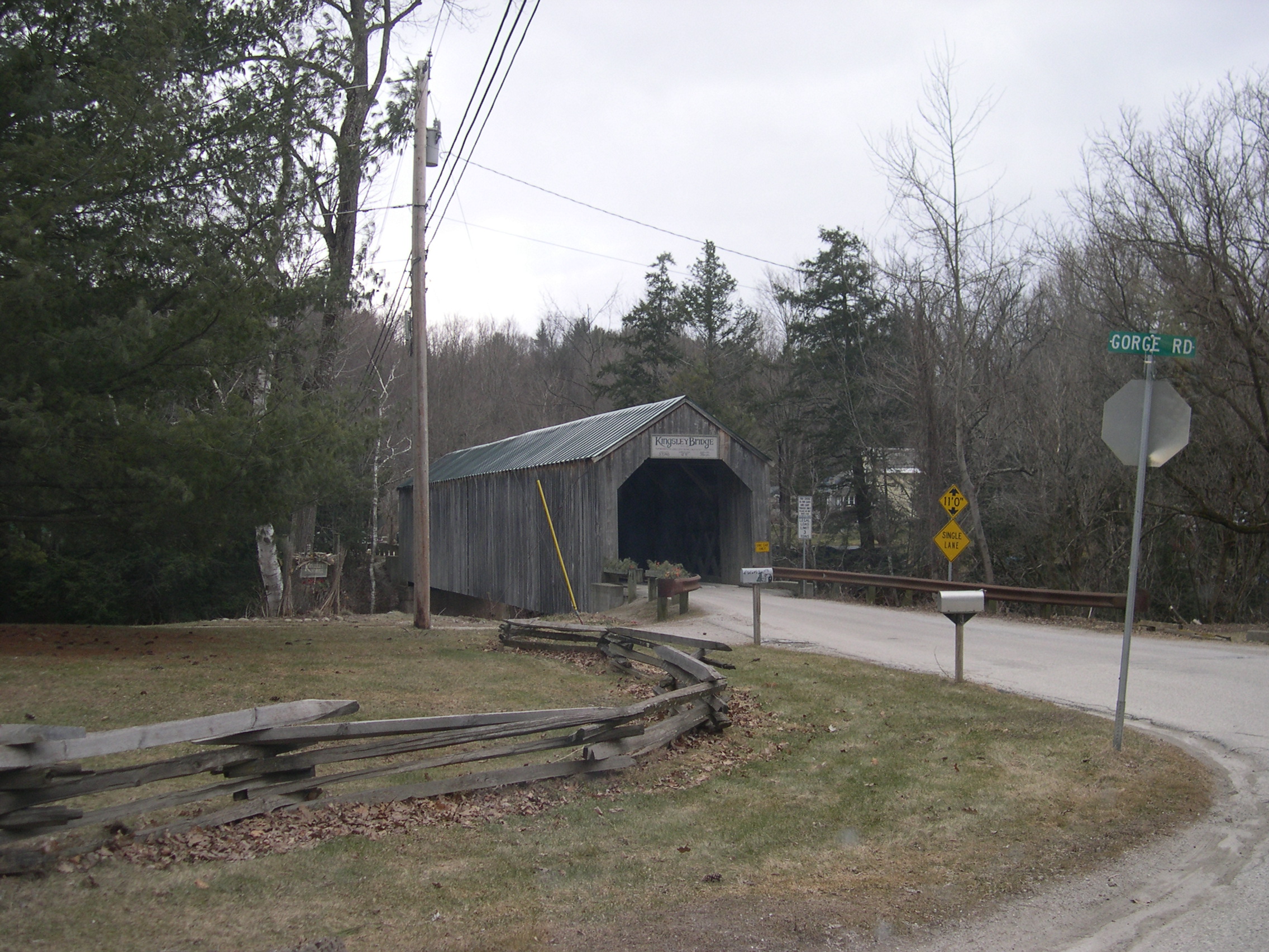
43°34′26″N 73°15′50″W / 43.573889°N 73.263889°WFair Haven 40 Kingsley Covered Bridge 
February 12, 1974 Southwest of East Clarendon across the Mill River
43°31′25″N 72°56′30″W / 43.523611°N 72.941667°WEast Clarendon 41 Kingsley Grist Mill Historic District November 8, 2007 East St. and Gorge Rd.
43°31′27″N 72°56′26″W / 43.524167°N 72.940556°WClarendon 42 Laurel Glen Mausoleum-Laurel Hall 
November 23, 1998 VT 103, .5 mi (0.80 km) southeast of Cuttingsville
43°29′05″N 72°52′49″W / 43.484722°N 72.880278°WShrewsbury 43 Linden Terrace August 23, 2007 191 Grove St.
43°37′01″N 72°59′07″W / 43.616944°N 72.985278°WRutland 44 Longfellow School December 12, 1976 6 Church St.
43°36′31″N 72°58′42″W / 43.608611°N 72.978333°WRutland 45 Marble Bridge November 14, 1991 Main St. over Otter Creek
43°39′40″N 73°02′02″W / 43.661111°N 73.033889°WProctor 46 Marble Street Historic District March 1, 1990 87-132 Marble St. and 10 Smith Ave.
43°35′51″N 73°02′40″W / 43.5975°N 73.044444°WWest Rutland 47 Middletown Springs Historic District October 17, 1985 East, North, South, and West Sts., Montvert Ave., and Schoolhouse Rd.
43°29′03″N 73°07′07″W / 43.484167°N 73.118611°WMiddletown Springs 48 Mission of the Church of Our Savior October 29, 1992 Mission Farm Rd.
43°37′09″N 72°45′25″W / 43.619167°N 72.756944°WSherburne 49 Mountain View Stock Farm October 30, 1989 VT 22A, north of Lake Rd.
43°42′30″N 73°17′50″W / 43.708333°N 73.297222°WBenson 50 Thomas H. Palmer House December 29, 1978 Southeast of Pittsford on U.S. Route 7
43°42′02″N 73°00′36″W / 43.700556°N 73.01°WPittsford 51 Pawlet Town Hall December 13, 1995 School St.
43°20′45″N 73°10′47″W / 43.345833°N 73.179722°WPawlet 52 Arthur Perkins House September 27, 1988 242 S. Main St.
43°35′30″N 72°58′08″W / 43.591667°N 72.968889°WRutland 53 Pittsford Green Historic District May 13, 1982 Main St.
43°42′26″N 73°01′44″W / 43.707222°N 73.028889°WPittsford 54 Poultney Central School March 25, 1977 Main St.
43°31′04″N 73°14′06″W / 43.517778°N 73.235°WPoultney 55 Poultney Main Street Historic District June 2, 1988 Roughly Main St., E. Main St., Depot St., Knapp Ave., Beaman St., Grove St., Maple Ave., and College Ave.
43°31′02″N 73°14′05″W / 43.517222°N 73.234722°WPoultney 56 Proctor-Clement House June 17, 1982 Field Ave.
43°37′36″N 72°59′11″W / 43.626667°N 72.986389°WRutland 57 Rural Otter Creek Valley Historic District March 31, 1987 Roughly U.S. Route 7 west of Otter Creek
43°27′03″N 72°59′13″W / 43.450833°N 72.986944°WWallingford 58 Rutland Courthouse Historic District September 8, 1976 U.S. Route 7
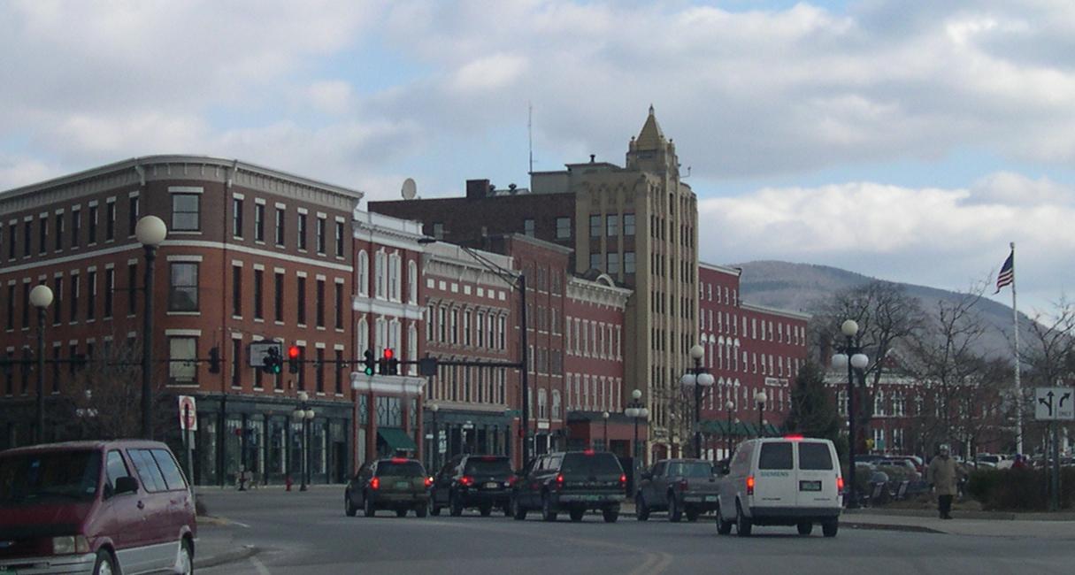
43°36′25″N 72°58′29″W / 43.606944°N 72.974722°WRutland 59 Rutland Downtown Historic District 
August 22, 1980 Roughly bounded by Strongs Ave., State, Wales, Washington, Pine, and Cottage Sts.
43°36′05″N 72°58′52″W / 43.601389°N 72.981111°WRutland 60 St. Stanislaus Kostka School and Convent House June 18, 2010 95 & 113 Barnes St.
43°35′53″N 73°03′07″W / 43.598075°N 73.051858°WWest Rutland 61 Sanderson Covered Bridge June 13, 1974 W of Brandon over Otter Creek
43°47′22″N 73°06′45″W / 43.789444°N 73.1125°WBrandon 62 Anthony Scoville House August 24, 2007 Dawley Rd.
43°28′25″N 72°50′02″W / 43.473611°N 72.833889°WMount Holly 63 Simeon Smith House March 3, 1983 W. Haven Rd.
43°38′11″N 73°18′00″W / 43.636389°N 73.3°WWest Haven 64 Simeon Smith Mansion November 21, 1991 Smith Rd. west of junction with VT 22A
43°37′57″N 73°18′15″W / 43.6325°N 73.304167°WWest Haven 65 St. Peter's Church and Mount St. Joseph Convent Complex October 3, 1980 Convent Ave., Meadow and River Sts.
43°36′08″N 72°59′10″W / 43.602222°N 72.986111°WRutland 66 Sudbury Congregational Church October 28, 1977 VT 30
43°47′58″N 73°12′15″W / 43.799444°N 73.204167°WSudbury 67 Sudbury School No. 3 November 2, 1978 Junction of VT 30 and VT 73
43°47′47″N 73°12′22″W / 43.796389°N 73.206111°WSudbury 68 Tinmouth Historic District June 25, 1980 VT 140 and VT 2
43°26′55″N 73°03′06″W / 43.448611°N 73.051667°WTinmouth 69 Homer Waldo Farm November 26, 1986 Waldo Ln.
43°27′53″N 72°58′57″W / 43.464722°N 72.9825°WWallingford 70 Wallingford Main Street Historic District 
November 1, 1984 Main and School Sts.
43°28′17″N 72°58′38″W / 43.471389°N 72.977222°WWallingford 71 Wells Village School October 7, 1993 Northern side of Main St. (VT 30)
43°25′05″N 73°12′25″W / 43.418056°N 73.206944°WWells 72 West Haven Baptist Church 
March 13, 2007 48 Book Rd.
43°39′02″N 73°20′53″W / 43.650556°N 73.348056°WWest Haven 73 West Rutland Town Hall July 28, 1983 Main and Marble Sts.
43°35′42″N 73°02′56″W / 43.595°N 73.048889°WWest Rutland See also
- List of National Historic Landmarks in Vermont
- National Register of Historic Places listings in Vermont
References
- ^ The latitude and longitude information provided in this table was derived originally from the National Register Information System, which has been found to be fairly accurate for about 99% of listings. For about 1% of NRIS original coordinates, experience has shown that one or both coordinates are typos or otherwise extremely far off; some corrections may have been made. A more subtle problem causes many locations to be off by up to 150 yards, depending on location in the country: most NRIS coordinates were derived from tracing out latitude and longitudes off of USGS topographical quadrant maps created under the North American Datum of 1927, which differs from the current, highly accurate WGS84 GPS system used by Google maps. Chicago is about right, but NRIS longitudes in Washington are higher by about 4.5 seconds, and are lower by about 2.0 seconds in Maine. Latitudes differ by about 1.0 second in Florida. Some locations in this table may have been corrected to current GPS standards.
- ^ "National Register of Historic Places: Weekly List Actions". National Park Service, United States Department of the Interior. Retrieved on November 10, 2011.
- ^ Numbers represent an ordering by significant words. Various colorings, defined here, differentiate National Historic Landmark sites and National Register of Historic Places Districts from other NRHP buildings, structures, sites or objects.
- ^ "National Register Information System". National Register of Historic Places. National Park Service. . http://nrhp.focus.nps.gov/natreg/docs/All_Data.html.
U.S. National Register of Historic Places Topics Lists by states Alabama • Alaska • Arizona • Arkansas • California • Colorado • Connecticut • Delaware • Florida • Georgia • Hawaii • Idaho • Illinois • Indiana • Iowa • Kansas • Kentucky • Louisiana • Maine • Maryland • Massachusetts • Michigan • Minnesota • Mississippi • Missouri • Montana • Nebraska • Nevada • New Hampshire • New Jersey • New Mexico • New York • North Carolina • North Dakota • Ohio • Oklahoma • Oregon • Pennsylvania • Rhode Island • South Carolina • South Dakota • Tennessee • Texas • Utah • Vermont • Virginia • Washington • West Virginia • Wisconsin • WyomingLists by territories Lists by associated states Other Municipalities and communities of Rutland County, Vermont City 
Towns Benson | Brandon | Castleton | Chittenden | Clarendon | Danby | Fair Haven | Hubbardton | Ira | Killington | Mendon | Middletown Springs | Mount Holly | Mount Tabor | Pawlet | Pittsfield | Pittsford | Poultney | Proctor | Rutland | Shrewsbury | Sudbury | Tinmouth | Wallingford | Wells | West Haven | West Rutland
Village CDPs Other
communitiesBelmont | Florence
Categories:- National Register of Historic Places in Vermont by county
- Rutland County, Vermont
-


Wikimedia Foundation. 2010.