- National Register of Historic Places listings in Windham County, Vermont
-
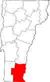 Location of Windham County in Vermont
This is a list of the National Register of Historic Places listings in Windham County, Vermont.
This is intended to be a complete list of the properties and districts on the National Register of Historic Places in Windham County, Vermont, United States. Latitude and longitude coordinates are provided for many National Register properties and districts; these locations may be seen together in a Google map.[1]
There are 94 properties and districts listed on the National Register in the county, including 2 National Historic Landmarks.
-
- This National Park Service list is complete through NPS recent listings posted November 10, 2011.[2]
Contents: Counties in Vermont Addison - Bennington - Caledonia - Chittenden - Essex - Franklin - Grand Isle - Lamoille - Orange - Orleans - Rutland - Washington - Windham - Windsor Current listings
[3] Landmark name [4] Image Date listed Location City or town Summary 1 Adams Gristmill Warehouse January 22, 1990 Bridge St.
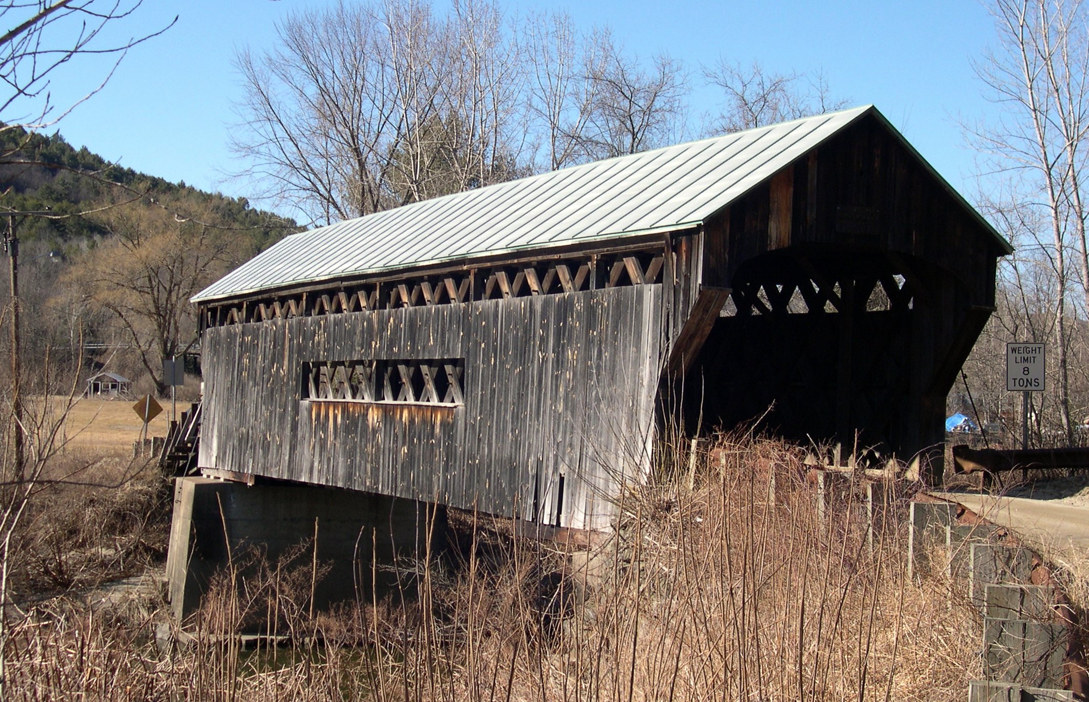
43°07′55″N 72°27′18″W / 43.131944°N 72.455°WRockingham 2 Bartonsville Covered Bridge 
July 2, 1973 Across the Williams River at the southern end of Bartonsville
43°13′27″N 72°32′12″W / 43.224167°N 72.536667°WBartonsville Destroyed in 2011 by flash flooding caused by Hurricane Irene.[5] 3 Bellows Falls Co-operative Creamery Complex January 22, 1990 Island St.
43°07′56″N 72°26′34″W / 43.132222°N 72.442778°WRockingham 4 Bellows Falls Downtown Historic District August 16, 1982 Depot, Canal, Rockingham, Bridge, Mill, and Westminster Sts.
43°08′04″N 72°26′42″W / 43.134444°N 72.445°WBellows Falls 5 Bellows Falls Neighborhood Historic District January 17, 2002 Atkinson, Westminster, School, and Hapgood Sts., Hapgood Pl., and Burt St., Henry St., South St., Hadley St., and Temple Pl.; also Center, Front, Old Terrace, and Pine Sts.
43°07′53″N 72°26′57″W / 43.131389°N 72.449167°WRockingham Second set of streets represents a boundary increase 6 Bellows Falls Petroglyph Site (VT-WD-8) January 22, 1990 Address Restricted Bellows Falls 7 Bellows Falls Times Building January 22, 1990 Bridge and Island Sts.
43°07′54″N 72°26′58″W / 43.131667°N 72.449444°WRockingham 8 Brattleboro Downtown Historic District February 17, 1983 Main St. from Vernon to Walnut, Flat, Elliot, High, and Grove Sts.; also Plaza Park, Main St. at its junction with Canal St., Vermont Routes 119 and 142, and 1 Holstein Place
42°51′13″N 72°33′35″W / 42.853611°N 72.559722°WBrattleboro Second set of streets represents a boundary increase 9 Brattleboro Retreat 
April 12, 1984 Linden St. and Upper Dummerston Rd.
42°51′52″N 72°34′17″W / 42.864444°N 72.571389°WBrattleboro 10 Bridge 19 September 28, 2007 Grassy Brook Rd.
42°59′50″N 72°38′16″W / 42.997222°N 72.637778°WBrookline 11 Broad Brook House August 4, 2011 475 Coolidge Hwy.
42°49′04″N 72°34′31″W / 42.817778°N 72.575278°WGuilford 12 Brooks House February 1, 1980 4 High St. and 128 Main St.
42°51′12″N 72°33′31″W / 42.853333°N 72.558611°WBrattleboro 13 Butterfield House August 6, 2005 204 Main St.
43°10′24″N 72°36′25″W / 43.173333°N 72.606944°WGrafton 14 Canal Street Schoolhouse August 19, 1977 Canal St.
42°51′01″N 72°33′29″W / 42.850278°N 72.558056°WBrattleboro 15 Canal Street-Clark Street Neighborhood Historic District July 8, 1993 Roughly bounded by Canal, S. Main, Lawrence and Clark Sts.
42°50′56″N 72°33′35″W / 42.848889°N 72.559722°WBrattleboro 16 Christ Church May 13, 1982 Melendy Rd. and U.S. Route 5
42°48′58″N 72°34′30″W / 42.816111°N 72.575°WGuilford 17 Corse-Shippee House May 7, 2008 11 Dorr Fitch Rd.
42°56′08″N 72°50′52″W / 42.935501°N 72.847767°WDover 18 Theophilus Crawford House March 9, 1995 Southwestern side of Hickory Ridge Rd., about 2 mi (3.2 km) north of Putney
42°59′55″N 72°32′14″W / 42.998611°N 72.537222°WPutney 19 Creamery Covered Bridge August 28, 1973 West of Brattleboro off Vermont Route 9
42°50′58″N 72°35′12″W / 42.849444°N 72.586667°WBrattleboro 20 Crows Nest May 18, 1998 36 Sturgis Dr.
42°54′43″N 72°53′01″W / 42.911944°N 72.883611°WWilmington 21 Dickinson Estate Historic District November 9, 2005 Dickinson and Kipling Rds.
42°53′37″N 72°33′55″W / 42.893611°N 72.565278°WBrattleboro 22 District No. 1 Schoolhouse April 20, 1992 Somerset Rd.
42°57′40″N 72°59′02″W / 42.961111°N 72.983889°WSomerset 23 Dover Town Hall September 1, 1988 School House Rd.
42°56′38″N 72°48′08″W / 42.943889°N 72.802222°WDover 24 East Putney Brook Stone Arch Bridge December 12, 1976 Spans East Putney Brook off River Rd.
42°59′09″N 72°28′09″W / 42.985833°N 72.469167°WEast Putney 25 Estey Organ Company Factory April 17, 1980 Birge St.; also 68 Birge St.
42°50′51″N 72°34′04″W / 42.8475°N 72.567778°WBrattleboro 68 Birge represents a boundary increase 26 First Congregational Church and Meetinghouse November 15, 2002 Near the junction of Vermont Routes 30 and 35
43°02′49″N 72°40′10″W / 43.046944°N 72.669444°WTownshend 27 Follett Stone Arch Bridge Historic District December 12, 1976 West of Townshend off Vermont Route 30
43°02′48″N 72°41′59″W / 43.046667°N 72.699722°WTownshend 28 George-Pine-Henry Street Historic District July 13, 2010 5-22 George St.; 1-17 Pine St.; 32-44 Henry St.
43°07′52″N 72°27′02″W / 43.131111°N 72.450556°WRockingham 29 Grafton Congregational Church and Chapel December 10, 1979 Main St.
43°10′24″N 72°36′42″W / 43.173333°N 72.611667°WGrafton 30 Grafton District Schoolhouse No. 2 August 11, 2005 217 Main St.
43°10′25″N 72°36′24″W / 43.173611°N 72.606667°WGrafton 31 Grafton Post Office August 6, 2005 205 Main St.
43°10′26″N 72°36′25″W / 43.173889°N 72.606944°WGrafton 32 Grafton Village Historic District April 7, 2010 Main St., Vermont Route 121 E., Townshend Rd., Chester Hill Rd., Hidder Hill Rd., Pleasant St., School St., Middletown Rd., and Hinck
43°10′18″N 72°36′24″W / 43.17165°N 72.606733°WGrafton 33 Green River Covered Bridge August 28, 1973 Across the Green River
42°46′31″N 72°40′04″W / 42.775278°N 72.667778°WGreen River 34 Green River Crib Dam April 7, 1995 Green River Rd. (Town Highway 5)
42°46′32″N 72°40′04″W / 42.775556°N 72.667778°WGuilford 35 Lewis Grout House November 7, 1996 382 Western Ave.
42°51′13″N 72°36′06″W / 42.853611°N 72.601667°WBrattleboro 36 Guilford Center Meetinghouse May 13, 1982 Guilford Center Rd.
42°47′31″N 72°37′32″W / 42.791944°N 72.625556°WGuilford 37 Hall Covered Bridge August 28, 1973 West of Bellows Falls across the Saxtons River, off Vermont Route 121
43°08′12″N 72°29′16″W / 43.136667°N 72.487778°WBellows Falls 38 William A. Hall House May 5, 1999 1 Hapgood St.
43°07′48″N 72°26′44″W / 43.13°N 72.445556°WRockingham 39 William Harris House December 18, 1978 140 Western Ave.
42°51′00″N 72°35′18″W / 42.85°N 72.588333°WBrattleboro 40 Deacon John Holbrook House March 19, 1982 Corner of Linden and Chapin Sts., NE.
42°51′19″N 72°33′50″W / 42.855278°N 72.563889°WBrattleboro 41 Homestead-Horton Neighborhood Historic District April 3, 2009 Homestead Pl., Horton Pl., and Canal St.
42°50′49″N 72°33′42″W / 42.846944°N 72.561667°WBrattleboro 42 Howard Hardware Storehouse January 22, 1990 Bridge St.
43°07′55″N 72°26′34″W / 43.131944°N 72.442778°WRockingham 43 Kidder Covered Bridge July 2, 1973 Southeast of Grafton
43°10′08″N 72°36′21″W / 43.168889°N 72.605833°WGrafton 44 Londonderry Town House July 14, 1983 Middletown Rd.
43°11′41″N 72°48′54″W / 43.194722°N 72.815°WSouth Londonderry 45 Mechanicsville Historic District September 16, 2010 Route 121 E. Grafton 46 Medburyville Bridge November 8, 1990 Town Highway 31 over the Deerfield River
42°52′16″N 72°55′12″W / 42.871111°N 72.92°WWilmington 47 Middletown Rural Historic District March 21, 2011 Middletown Rd., Avery Park Dr., Middletown Cemetery Rd., Woodchuck Hill Rd., Vermont Route 121
43°01′16″N 72°37′24″W / 43.021111°N 72.623333°WGrafton 48 Milldean and Alexander-Davis House May 24, 1990 Main St. near town center
43°10′19″N 72°36′28″W / 43.171944°N 72.607778°WGrafton 49 Miss Bellows Falls Diner 
February 15, 1983 90 Rockingham St.
43°08′06″N 72°26′51″W / 43.135°N 72.4475°WBellows Falls 50 Moore and Thompson Paper Mill Complex March 16, 1984 Bridge St.
43°08′01″N 72°26′33″W / 43.133611°N 72.4425°WBellows Falls 51 Naulakha 
April 11, 1979 Off U.S. Route 5
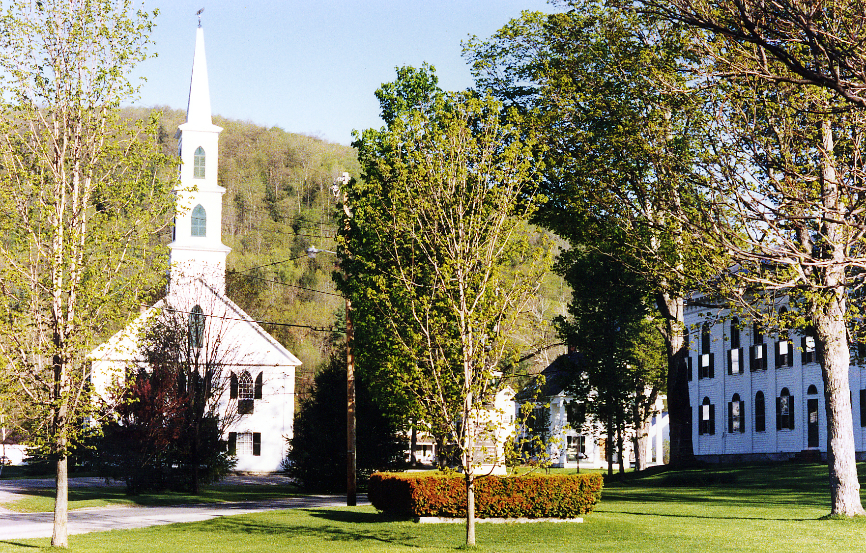
42°53′55″N 72°33′51″W / 42.898611°N 72.564167°WDummerston Home where Rudyard Kipling wrote The Jungle Book 52 Newfane Village Historic District 
July 21, 1983 Main, West, Church, Court, Depot, and Cross Sts.
42°59′16″N 72°39′26″W / 42.987778°N 72.657222°WNewfane 53 Oak Hill Cemetery Chapel November 14, 1991 Off Pleasant St.
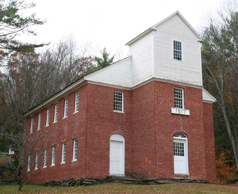
43°07′32″N 72°27′10″W / 43.125556°N 72.452778°WBellows Falls 54 Old Brick Church 
November 30, 1979 Off Vermont Route 35
43°07′23″N 72°34′42″W / 43.123056°N 72.578333°WAthens 55 Park Farm August 4, 2003 26 Woodchuck Hill Rd.
43°11′35″N 72°39′56″W / 43.193056°N 72.665556°WGrafton 56 Parker Hill Rural Historic District May 20, 1993 Parker Hill and Lower Parker Hill Rds.
43°13′25″N 72°28′46″W / 43.223611°N 72.479444°WRockingham 57 Pond Road Chapel May 9, 1985 Pond Rd., Town Highway 2
42°44′49″N 72°30′43″W / 42.746944°N 72.511944°WVernon 58 Putney Village Historic District 
February 20, 1986 Westminster W Rd., U.S. Route 5, Christian Sq., Old U.S. Route 5, and Depot Rd.
42°58′30″N 72°31′27″W / 42.975°N 72.524167°WPutney 59 Rice Farm Road Bridge November 7, 1995 Town Highway 62, off Vermont Route 30
42°54′58″N 72°36′48″W / 42.916111°N 72.613333°WDummerston 60 Robertson Paper Company Complex January 22, 1990 Island St.
43°07′56″N 72°26′58″W / 43.132222°N 72.449444°WRockingham 61 Rockingham Meetinghouse 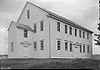
September 10, 1979 Off Vermont Route 103
43°11′16″N 72°29′13″W / 43.187778°N 72.486944°WRockingham A rare 18th century New England meetinghouse of the "second period" type. 62 Rockingham Village Historic District 
January 4, 2008 Meeting House Rd., Rockingham Hill Rd. Rockingham 63 Round Schoolhouse November 23, 1977 South of Brookline
43°01′17″N 72°36′17″W / 43.021389°N 72.604722°WBrookline 64 Sabin-Wheat Farm July 28, 2004 346 Westminster Rd.
42°59′58″N 72°31′55″W / 42.999444°N 72.531944°WPutney 65 Sacketts Brook Stone Arch Bridge December 12, 1976 Off U.S. Route 5 on Mill Rd.
42°58′29″N 72°31′05″W / 42.974722°N 72.518056°WPutney 66 Saxtons River Village Historic District September 29, 1988 Roughly bounded by Burk Hill and Belleview Rds., Oak St., the Saxtons River, and Westminster West Rd.
43°08′19″N 72°30′34″W / 43.138611°N 72.509444°WSaxtons River 67 Scott Covered Bridge August 28, 1973 West of Townshend off Vermont Route 30
43°02′53″N 72°41′50″W / 43.048056°N 72.697222°WTownshend 68 Scott Farm Historic District November 19, 2001 707 Kipling Rd.
42°54′34″N 72°34′14″W / 42.909444°N 72.570556°WDummerston 69 Simpsonville Stone Arch Bridge April 11, 1977 North of Townshend on Vermont Route 35
43°04′13″N 72°39′19″W / 43.070278°N 72.655278°WTownshend 70 Samuel Gilbert Smith Farmstead July 20, 2000 375 Orchard St.
42°51′38″N 72°35′19″W / 42.860556°N 72.588611°WBrattleboro 71 South Londonderry Village Historic District July 24, 1986 Church, Main, River, School, and Farnum Sts., and Melendy Hill Rd.
43°11′18″N 72°48′43″W / 43.188333°N 72.811944°WSouth Londonderry 72 South Newfane Bridge September 8, 1992 Town Highway 26 (Parish Rd.) over the Rock River
42°56′16″N 72°42′18″W / 42.937778°N 72.705°WNewfane 73 South Windham Village Historic District October 27, 1988 Town Highways 1 and 26
43°07′42″N 72°42′47″W / 43.128333°N 72.713056°WWindham 74 Stratton Mountain Lookout Tower June 17, 1992 Summit of Stratton Mountain in the Green Mountain National Forest
43°05′09″N 72°55′30″W / 43.085833°N 72.925°WStratton 75 Tontine Building May 2, 2008 500 Coolidge Highway
42°49′03″N 72°34′31″W / 42.817487°N 72.575169°WGuilford 76 Townshend State Park February 14, 2002 2755 State Forest Rd.
43°02′13″N 72°42′15″W / 43.036944°N 72.704167°WTownshend 77 Union Station June 7, 1974 Junction of Bridge St. and Boston and Maine railroad tracks
42°51′05″N 72°33′25″W / 42.851389°N 72.556944°WBrattleboro 78 Vernon District Schoolhouse No. 4 November 9, 2005 4201 Fort Bridgman Rd.
42°44′14″N 72°28′11″W / 42.737142°N 72.469664°WVernon 79 West Brattleboro Green Historic District June 24, 2002 870-950 Western Ave., 19-35 South St., and town common.
42°51′09″N 72°36′00″W / 42.8525°N 72.6°WBrattleboro 80 West Dover Village Historic District October 24, 1985 Vermont Route 100, Valley View, Cross Town, Parsonage, Dorr Fitch, and Bogle Rds.
42°56′14″N 72°51′03″W / 42.937222°N 72.850833°WDover 81 West Dummerston Covered Bridge 
May 8, 1973 Dummerston Center Rd. and Vermont Route 30, over the West River
42°56′12″N 72°36′49″W / 42.936667°N 72.613611°WDummerston 82 West Townshend Stone Arch Bridge April 18, 1977 Spans Tannery Brook
43°05′03″N 72°42′36″W / 43.084167°N 72.71°WWest Townshend 83 West Townshend Village Historic District September 11, 1986 Roughly Main St. from Old Vermont Route 30 to Vermont Route 30 and Town Roads 7, 23, 47, 49, and 50
43°04′55″N 72°42′38″W / 43.081944°N 72.710556°WWest Townshend 84 Westminster Terrace Historic District July 13, 2010 Along Westminster Terrace and Westminster St.
43°07′36″N 72°26′34″W / 43.126667°N 72.442778°WRockingham 85 Westminster Village Historic District July 14, 1988 Main and School Sts., and Grout Ave.
43°04′03″N 72°27′42″W / 43.0675°N 72.461667°WWestminster 86 Wheelock House May 8, 1986 County Road 30
43°02′01″N 72°39′49″W / 43.033611°N 72.663611°WTownshend 87 Whitingham Village Historic District March 15, 2006 Vermont Route 100, School St., Brook St., and Stimpson Hill Rd.
42°47′25″N 72°52′49″W / 42.790278°N 72.880278°WWhitingham 88 Williams River Route 5 Bridge November 14, 1991 U.S. Route 5 over the Williams River
43°10′57″N 72°27′36″W / 43.1825°N 72.46°WRockingham 89 Williams Street Extension Historic District July 13, 2010 51-58, 61-68, 70 Williams St.
43°08′08″N 72°27′09″W / 43.135556°N 72.4525°WRockingham 90 Williamsville Covered Bridge August 14, 1973 Southwest of Newfane at Williamsville
42°56′34″N 72°41′17″W / 42.942778°N 72.688056°WNewfane 91 Wilmington Village Historic District August 11, 1980 Vermont Routes 9 and 100
42°52′09″N 72°52′30″W / 42.869167°N 72.875°WWilmington 92 Windham Village Historic District November 1, 1984 Town Hill Rd.
43°10′37″N 72°43′38″W / 43.176944°N 72.727222°WWindham 93 Worrall Covered Bridge 
July 16, 1973 North of Rockingham across the Williams River
43°12′42″N 72°32′09″W / 43.211667°N 72.535833°WRockingham 94 Arthur D. and Emma J. Wyatt House May 10, 2005 125 Putney Rd.
42°51′39″N 72°33′31″W / 42.860833°N 72.558611°WBrattleboro See also
- List of National Historic Landmarks in Vermont
- National Register of Historic Places listings in Vermont
References
- ^ The latitude and longitude information provided in this table was derived originally from the National Register Information System, which has been found to be fairly accurate for about 99% of listings. For about 1% of NRIS original coordinates, experience has shown that one or both coordinates are typos or otherwise extremely far off; some corrections may have been made. A more subtle problem causes many locations to be off by up to 150 yards, depending on location in the country: most NRIS coordinates were derived from tracing out latitude and longitudes off of USGS topographical quadrant maps created under the North American Datum of 1927, which differs from the current, highly accurate WGS84 GPS system used by Google maps. Chicago is about right, but NRIS longitudes in Washington are higher by about 4.5 seconds, and are lower by about 2.0 seconds in Maine. Latitudes differ by about 1.0 second in Florida. Some locations in this table may have been corrected to current GPS standards.
- ^ "National Register of Historic Places: Weekly List Actions". National Park Service, United States Department of the Interior. Retrieved on November 10, 2011.
- ^ Numbers represent an ordering by significant words. Various colorings, defined here, differentiate National Historic Landmark sites and National Register of Historic Places Districts from other NRHP buildings, structures, sites or objects.
- ^ "National Register Information System". National Register of Historic Places. National Park Service. . http://nrhp.focus.nps.gov/natreg/docs/All_Data.html.
- ^ Flooding takes toll on historic bridges, WCAX.com
U.S. National Register of Historic Places Topics Lists by states Alabama • Alaska • Arizona • Arkansas • California • Colorado • Connecticut • Delaware • Florida • Georgia • Hawaii • Idaho • Illinois • Indiana • Iowa • Kansas • Kentucky • Louisiana • Maine • Maryland • Massachusetts • Michigan • Minnesota • Mississippi • Missouri • Montana • Nebraska • Nevada • New Hampshire • New Jersey • New Mexico • New York • North Carolina • North Dakota • Ohio • Oklahoma • Oregon • Pennsylvania • Rhode Island • South Carolina • South Dakota • Tennessee • Texas • Utah • Vermont • Virginia • Washington • West Virginia • Wisconsin • WyomingLists by territories Lists by associated states Other Municipalities and communities of Windham County, Vermont Towns Athens | Brattleboro | Brookline | Dover | Dummerston | Grafton | Guilford | Halifax | Jamaica | Londonderry | Marlboro | Newfane | Putney | Rockingham | Somerset‡ | Stratton | Townshend | Vernon | Wardsboro | Westminster | Whitingham | Wilmington | Windham

Villages CDPs Other
communitiesFootnotes ‡ Disincorporated
Categories:- National Register of Historic Places in Vermont by county
- Windham County, Vermont
-


Wikimedia Foundation. 2010.