- Shaghur
-
Shaghur Hebrew transcription(s) – Hebrew שגור – ISO 259 Šagor – Also spelled Shagor (official) Arabic transcription(s) – Arabic الشاغور Skyline of eastern Shaghur
 Shaghur
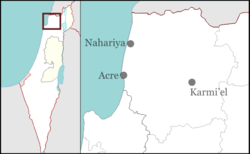
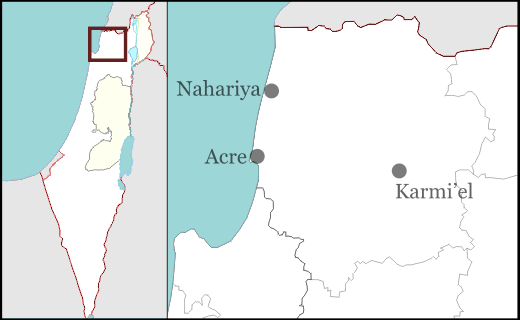
Coordinates: 32°55′35″N 35°15′50″E / 32.92639°N 35.26389°ECoordinates: 32°55′35″N 35°15′50″E / 32.92639°N 35.26389°E District North Government – Type City (from 2005) – Mayor Salih Debbah Area – Total 17,737 dunams (17.7 km2 / 6.8 sq mi) Population (2007) – Total 29,900 Name meaning "Valley" Shaghur or Shagor (Hebrew: שגור; Arabic: الشاغور, ash-Shaghur) is an Israeli-Arab city in the North District of Israel located east of the coastal city of Acre (Akka). It was formed in 2003 with the merger of three Arab local councils – Majd al-Krum, Deir al-Asad and Bi'ina. It was declared a city in 2005. It is the third largest Arab locality in the North District after Nazareth and Shefa-'Amr. The name Shaghur comes from the name of the nearby valley which borders the al-Araas mountain in which the city is built upon.[1] The city had a population of 29,900 at the end of 2007.[2]
Contents
History
Shaghur's components, Majd al-Kurum, Deir al-Asad and Bi'ina – like most Arab villages in the Galilee – were largely agricultural. The main crops were olives, figs, citrus and pomegranates. The three villages were captured by Israeli forces on October 30, 1948 in Operation Dekel during the 1948 Arab-Israeli War. In 1956 about 1,275 acres (5.16 km2) of land from the villages that make up Shaghur were labeled "closed areas" by the Israeli government. In 1961 the restricted area was used to form the nearby city of Karmiel.[1][3] During the 2006 Lebanon War between Israel and Hezbollah, as many as 43 of the latter's Katyusha rockets landed in or near Shaghur's neighborhoods, killing four civilians. The Jewish city of Karmiel – which is adjacent to Shaghur – and an alleged artillery installment on a nearby hill were Hezbollah's apparent target.[4][5] The killed were Muhammad Subhi Mana, Baha Karim, Miriam Assadi and Fathi Assadi.[4]
Majd al-Kurum
Majd al-Kurum (Arabic: مجد الكروم, Hebrew: מַגְ'ד אל-כֻּרוּם) covers the entire western portion of Shaghur. Its name probably come from the "watch-house of the vineyard" in Arabic.[6] Majd al-Kurum receives it name for its history of growing grapes. Ancient ruins (located on the outskirts of the town), consisting of pits built into the rocks where the residents used their feet to press their grape crop to make wine. In 2003, Majd al-Kurum had a population of 13,800.
In 1596, Majdal Kurum appeared in Ottoman tax registers as being in the Nahiya of Akka of the Liwa of Safad. It had a population of 90 Muslim households including 5 bachelors and paid taxes on wheat, barley, olives or fruit trees, cotton, and goats or beehives.[7] In the late 19th century, it was described as a village of 6–800 Muslims, built of stone. It was surrounded by olive trees and arable land.[8]
At the time of the 1931 census, Majd al-Kurum had 226 occupied houses and a population of 1006 Muslims.[9] By 1945, Majd al-Kurum had 1,400 inhabitants, all classified as Arabs. They owned a total of 17,828 dunams of land, while 2214 dunams were public.[10]
According to an eyewitness, Israeli forces picked 12 men at random, blindfolded them and had them shot during the capture of Majd al-Kurum in the 1948 War.[11]
Deir al-Asad
Deir al-Asad (Arabic: دير الأسد, Hebrew: דֵיר אל-אַסַד) makes up the majority of eastern Shaghur. Its name literally means "the lion's monastery" in Arabic.[12]
In the late 19th century, it was described as a village of 600 Muslims, and a few ruins. It was surrounded by olive-trees and arable land, with a spring nearby.[8] The town is mostly populated by the Asadi and Dabbah families. According to the 1931 British census, Deir al-Asad had 858 Muslim residents living in 179 houses.[9] By 1945, Deir el Asad had 1,100 inhabitants, all classified as Arabs. They owned a total of 8,366 dunams of land, while 7 dunams were public.[10] In 1970 population was 2,920, while in 2003, it was 8,400.
 View of Deir al-Asad from the roof of Abu-Salim/Yahyah Asadi -photo by Carisa Lea 05/2007
Before 1961, Deir al-Asad was self-sufficient in food as it produced satisfactory amounts of meat, fruit, wheat and vegetables for subsistence use and sold most surplus in Acre or Nazareth. After the confiscation of village lands, only 10% of the labor force is able to work on the land and over 80% have to commute daily to businesses in Haifa or work as laborers on Jewish-owned farms.[13][1]
Bi'ina
Bi'ina (Arabic: بعنة, Hebrew: בִּעְנָה) forms the remainder of the eastern Shaghur. The village was established in the Crusader period, and continued to be inhabited after the Mamluks had conquered Palestine. Al-Qalqasandi (d .1418) mentioned the place as "a village in the district of al-Sajur with a monastery". The monastery was also mentioned later.[14] In 1596, al Bi'na appeared in Ottoman tax registers as being in the Nahiya of Akka of the Liwa of Safad. It had a population of 16 Muslim households and 15 Christian households and paid taxes on wheat, barley, olives, cotton, goats or beehives and a press for grapes or olives.[7]
French scholar Victor Guérin visited in the 1870s, and wrote that population was divided between Druze and "Schismatic Greek". He saw a mosque and a Greek Church, both were according to Guérin build on the site of old churches.[15] In the late 19th century, it was described as a village of 300 Muslims and 100 Christians, surrounded by olives and arable land. Water was supplied by a spring.[8] At the time of the 1931 census, Bi'ina had 133 occupied houses and a population of 441 Muslims and 270 Christians.[9] By 1945, Bi'ina had 830 inhabitants, all classified as Arabs. They owned a total of 14,839 dunams of land, while 57 dunams were public.[10] The town's population in 2003 was 5,600. In 1981, Bedouins from the Sawaed tribe based in Rame settled in the town and formed a new neighborhood.
Demographics
Arab citizens of Israel Politics Balad (al-Tajamu)
Hadash (al-Jabha) Avoda · Kadima · Likud
Abnaa el-Balad
Internally Displaced Palestinians
The Koenig Memorandum
Land Day
October 2000 eventsReligion Basilica of the Annunciation
Dome of the Rock
Al-Aqsa Mosque
Mary's Well
St. George's Orthodox Church
Church of the Holy SepulchreCulture Music · Dance · Cuisine
Palestinian Arabic
Negev BedouinsMajor population centers Nazareth · Umm al-Fahm · Rahat
Tayibe · Shefa-'Amr · Baqa-Jatt
Shaghur · Tamra · Sakhnin
Carmel City · Tira · ArrabaPersonalities Hiam Abbass · Hany Abu-Assad
Mohammed Bakri · Azmi Bishara
Emile Habibi · Samih al-Qasim
Abbas Suan · Elia Suleiman
Hisham Zreiq · Ali Suliman
See also Template:Palestinians
 A former Tegart fort in the Majd al-Krum area that was transformed into a restaurant
 Houses in central Majd al-Krum
According to the Israeli Central Bureau of Statistics (CBS), in 2007, Shaghur had a mostly Muslim population of 29,200, with a minority of Christian residents in the central eastern part of the city. In 1948, the majority of the villages' residents remained in the area and received several refugees from nearby al-Birwa. However, a number of Arabs did flee from Majd al-Krum and settled in the Shatila refugee camp in Lebanon. According to Abu Nisa, a refugee from Majd al-Krum, some of these refugees return to visit their home towns as well as Islamic holy places, such as the al-Aqsa Mosque and the Cave of the Patriarchs after obtaining European citizenships.[16]
The gender makeup in 2005 was 14,600 males and 13,900 females. The age distribution was 49.4% 19 years of age or younger, 17% between the ages of 20–29, 19.8% between the ages of 30–44, 10.6% between the ages of 45–64 and 3.2% 65 and older. The percentage of families with four or more children was 34.01% in 2003.[17] The city's population increased by 7% in 2005 and in total, approximately by 2,500 persons. Its current population is 28,500 and was expected to increase to 29,200 in 2006.[18]
Economy
The city has rapidly drifted from a mostly agricultural-based economy into a commercial center and midway between the Galilee's coastal cities and Nazareth and for surrounding villages and local councils. It remains in friendly and cooperative communication with the neighboring city of Karmiel and the nearby Arab local councils of Nahf and Rame. The city is filled with restaurants, various shops and stores and three gas stations as well as a weekly souk or open-air market.
Despite the merger of the three old municipalities, Shaghur's economy is not improving as expected and the city still remains quite poor and unmanaged due to political boycotts. According to the CBS, in 2004, there were 6,674 salaried workers. The mean monthly salary was 3,663 NIS The city's average income per capita decreased by −1.04 NIS to 1,093 NIS ranking it Israel's 19th poorest municipality. The amount of employed persons in the city that received above twice the average wage was 1.45% in 2003.[17] Its population density is also increasing because of the city's inability to expand residentially and commercially beyond its jurisdiction.
Education
According to the CBS, Shaghur has eighteen schools (nine elementary, three middle and six secondary). In total, there are 7,473 students; 4,276 in elementary, 1,822 in middle and 1,375 in middle school. In 2005, 43.5% of 12th grade students received matriculation certificates – an increase of 11.45% in 2003. The percentage of students aged 20–25 was 5.64% in 2003.[17]
Politics
The recently formed city has experienced a lack of cooperation between its two major components, Majd al-Krum and Deir al-Asad, in the wake of recent elections for city mayor won by a candidate from Deir al-Asad, Ahmed Saleh Dabbah. The residents of Majd al-Krum refusing to abide by the leadership of a Deir al-Asad man boycotted the new local government, and this particular area consequently is at an economic and social disadvantage relative to the other neighborhoods that make up Shaghur.
Sports
Shaghur does not have any official sports teams to represent the city, however, two of its components maintain football teams. In 2005–2006, Maccabi Bi'ina, Beitar Bi'ina, Deir al-Asad participated in the Northern Divisions of Liga Gimel.
Notable people associated with Shaghur
- Mohammad Bakri – actor and film-maker; former resident of Bi'ina
- Mahmoud Darwish – Palestinian poet; partly educated in Deir al-Asad
- Uri Davis – academic and activist; took sanctuary in Deir al-Asad while evading IDF service
- Jihad Dabbah (Abu Lehye) – Arabian intellectual who is best known for his provocative writings against the political figures in Israel, born and still lives in Deir al-Asad
See also
- List of Arab localities in Israel
- List of cities in Israel
- Upper Galilee
References
- ^ a b c H. Amun, Uri Davis and N. D. San´allah: Deir al-Asad: The Destiny of an Arab Village in Galilee, in Palestinian Arabs in Israel: Two Case Studies, Ithaca Press, London 1977, pp. 4–5.
- ^ "Table 3 – Population of Localities Numbering Above 1,000 Residents and Other Rural Population" (PDF). Israel Central Bureau of Statistics. 2008-06-30. http://www.cbs.gov.il/population/new_2009/table3.pdf. Retrieved 2008-10-18.
- ^ Sabri Jiryis: The Arabs in Israel 1st American edition 1976 ISBN 0-85345-377-2 (updated from the 1966 ed.) With a foreword by Noam Chomsky. (First English edition; Beirut, Institute for Palestine Studies, 1968). Chapter 5.
- ^ a b Civilians under assault, Case Studies: Karmiel, Majd al-Kurum and Deir al-Assad Human Rights Watch
- ^ The Arab citizens in Israel and the 2006 War with Lebanon Mossawa Center
- ^ Palmer, 1881, p. 52
- ^ a b Wolf-Dieter Hütteroth and Kamal Abdulfattah (1977). Historical Geography of Palestine, Transjordan and Southern Syria in the Late 16th Century. Erlanger Geographische Arbeiten, Sonderband 5. Erlangen, Germany: Vorstand der Fränkischen Geographischen Gesellschaft. p. 191.
- ^ a b c Conder and Kitchener, 1881, SWP, p. 150
- ^ a b c E. Mills, ed (1932). Census of Palestine 1931. Population of Villages, Towns and Administrative Areas. Jerusalem: Government of Palestine. pp. 100–101.
- ^ a b c Government of Palestine, Department of Statistics. Village Statistics, April, 1945. Quoted in S. Hadawi, Village Statistics, 1945. PLO Research Center, 1970 p.40
- ^ Chapter 9, Part 2 or 2, Encyclopedia of the Palestine Problem
- ^ Palmer, 1881, p. p.42
- ^ David Gilmour: Dispossessed. The Ordeal of the Palestinians. Sphere books, Great Britain, 1983, (first published in 1980). pp.108
- ^ Ellenblum, 2003, p. 169
- ^ Guérin, 1880, p. 445, as translated by Conder and Kitchener, 1881, SWP, p.150
- ^ Inside a Palestinian refugee camp: Palestine Pilgrim BBC News 2008-05-17.
- ^ a b c Local Councils and Municipalities – Rank, Cluster Membership, Variable and Standardized Values and Ranking for Variables Used Israel Central Bureau of Statistics
- ^ Populations of Localities Numbering Above 1,000 Residents Israel Central Bureau of Statistics
Bibliography
- Conder, Claude Reignier and H.H. Kitchener (1881): The Survey of Western Palestine: memoirs of the topography, orography, hydrography, and archaeology. London:Committee of the Palestine Exploration Fund. vol 1, map III
- Ellenblum, Ronnie (2003), Frankish Rural Settlement in the Latin Kingdom of Jerusalem, Cambridge University Press, ISBN 0521521874, 9780521521871 pp. 167- 169
- Guérin, M. V. (1880): Description Géographique, Historique et Archéologique de la Palestine. Galilee 1 part. (Deir al-Asad: p. 446, Majd al-Kurum: pp 437, 444)
- Hadawi, Sami (1970), Village Statistics of 1945: A Classification of Land and Area ownership in Palestine, Palestine Liberation Organization Research Center, http://www.palestineremembered.com/Articles/General-2/Story3150.html
- Palmer, E. H. (1881): The survey of Western Palestine: Arabic and English name lists collected during the survey by Lieutenants Conder and Kitchener, R. E. Transliterated and explained by E.H. Palmer.
- Petersen, Andrew (2001): A Gazetteer of Buildings in Muslim Palestine: Volume I (British Academy Monographs in Archaeology) p. 131-132
- Pringle, Denys (1993), The Churches of the Crusader Kingdom of Jerusalem: A-K (excluding Acre and Jerusalem), Cambridge University Press, http://books.google.ca/books?id=BgQ6AAAAIAAJ .p.80 -92
Old municipalities Baqa al-Gharbiyye · Bi'ina · Binyamina · Daliyat al-Karmel · Deir al-Asad · Giv'at Ada · Isfiya · Jat · Kadima · Maccabim-Re'ut · Majd al-Krum · Modi'in · Neve Monosson · Tzoran · Tzur Yigal · YehudCategories:- North District (Israel)
- Cities in Israel
- Arab localities in Israel


Wikimedia Foundation. 2010.