- Mound Key Archeological State Park
-
Mound Key Archeological State Park / Mound Key Site IUCN Category V (Protected Landscape/Seascape)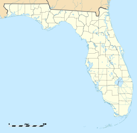

Location Lee County, Florida, USA Nearest city Fort Myers Beach, Florida Coordinates 26°25′20″N 81°51′55″W / 26.42222°N 81.86528°WCoordinates: 26°25′20″N 81°51′55″W / 26.42222°N 81.86528°W Area 113 acres (0.46 km2) Established August 12, 1970 Governing body Florida Department of Environmental Protection Mound Key Archeological State Park is a Florida State Park, located in Estero Bay, near the mouth of the Estero River. One hundred and thirteen of the island's one hundred and twenty-five acres are managed by the park system. It is a complex of mounds and accumulated shell, fish bone, and pottery middens that rises more than 30 feet above the waters of the bay.
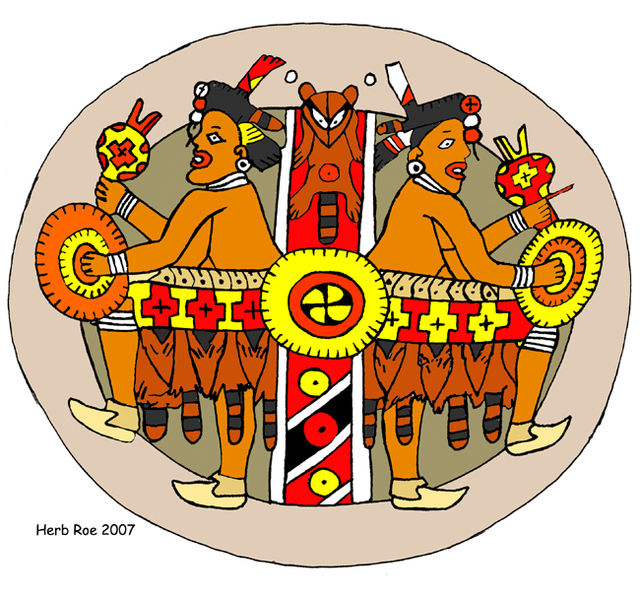
Mound Key was an important site of the Calusa tribe, and most experts believe it to be the site of their capital, Calos. The Mound Key Site on the island was added to the U.S. National Register of Historic Places on August 12, 1970. The island is only accessible by boat, from the Koreshan State Historic Site or Lovers Key State Park.
Contents
History
Mound Key was created over 2,000 years ago by the Calusa. The Calusa culture is carbon-dated back to 1150 B.C. at Mound Key. The site likely began as a low-lying oyster bar on Estero Bay. The site would have been rich in marine food resources, and very appealing to the Calusa, who were actually hunter-gatherers. As the human population grew, food waste was heaped into the middens that form the island. It served for many years as the ceremonial center for their kingdom, which extended over numerous shell midden islands they made up and down the southwest coast of Florida. It is also believed by most researchers to have been the site of Calos, the capital of their kingdom. Their kingdom spanned from Tampa Bay southward to the Ten Thousand Islands and eastward to Lake Okeechobee.
The arrival of the Spanish was the beginning of the end for the Calusa. In 1566, the appointment of Spain's first Governor of Florida happened on the island. This was closely followed by the establishment there of a fort and settlement, in an effort to colonize the area. A Jesuit mission was also founded there at the same time by Juan Rogel, a priest of that order. Called San Antonio de Carlos, it was the first such mission in the Spanish New World. There was frequent conflict with the Calusa, though, and eventually the island was abandoned by the Spanish in 1569.
The Spanish brought with them diseases to which the Calusa had no immunity. These diseases and warfare with the Spanish eventually ended the Calusa civilization around 1750.
In subsequent years, the island was used and sometimes inhabited by pirates, fishermen (Cuban, Portuguese and Spanish), and American pioneers, among others.
Frank Johnson and his wife, Grandma Johnson, were given a homestead on Mound Key in 1891. This marked a period of European immigration to the former Calusa capital.
Grandma Johnson remained at Mound Key and allowed several families — Luettich, Hawkins, Hanson and Fernandez — to build homes on the island.
She taught them to fish, to farm, how to build houses that would stay cool in the summer and protect them against Florida’s abusive sun and summer storms. By the turn of the 20th century, most all Mound Key settlers had moved up river to Estero, then a citrus and cow farming town. The Johnsons sold the island to the Koreshans, a utopian cult, in 1905.
In 1894, the followers of a scientific/religious belief system known as Koreshanity arrived in the area. They built a community based on their utopian ideas, growing over the next two decades. During this time, part of the property they acquired included most of the parcels on Mound Key.
After the death of their leader, Cyrus Teed, in 1908, their numbers declined. In 1961, the remaining Koreshans decided to give over ownership of the key, as well as other land in nearby Estero, to the state. It was used to form the park, which is administered by the Koreshan State Historic Site. Approximately nine acres still remain privately owned by the McGee family.
Recreational Activities
The park has such amenities as boating, fishing, wildlife viewing and interpretive exhibits. Nature trails and information kiosks are being developed but no restroom facilities are available at the park. The only access to the island is by boat; there are no facilities. Interpretive displays can be found along a trail that spans the width of the island. Located in Estero Bay, the park is a few miles by boat from both the Koreshan State Historic Site and Lovers Key / Carl E. Johnson State Park.
References and external links
- Lee County listings at National Register of Historic Places
- Lee County listings at Florida's Office of Cultural and Historical Programs
- Mound Key Archeological State Park at Florida State Parks
- History of Mound Key Archeological State Park at Florida State Parks
- Mound Key Archeological State Park at Wildernet
- Estero Historical Society
- Prehistoric Times - Early Human Life in Coastal Southwest Florida
- The History of Ft. Myers Beach
- Calusa Indian Art
- Calusa Indian site pictures
- Mound Key State Archeological Site
- Mound Key Video Clips
- Shelling in Florida
References
Protected Areas of Florida Federal Archie Carr • Arthur R. Marshall Loxahatchee • Caloosahatchee • Cedar Keys • Chassahowitzka • Crocodile Lake • Crystal River • Egmont Key • Florida Panther • Great White Heron • Hobe Sound • Island Bay • J.N. 'Ding' Darling • Key West • Lake Wales Ridge • Lake Woodruff • Lower Suwannee • Matlacha Pass • Merritt Island • National Key Deer • Okefenokee • Passage Key • Pelican Island • Pine Island • Pinellas • St. Johns • St. Marks • St. Vincent • Ten Thousand IslandsFlorida Keys National Marine Sanctuary • Big Cypress National Preserve • Timucuan Ecological and Historic Preserve •
Canaveral National Seashore • Gulf Islands National Seashore •
Apalachicola National Estuarine Research Reserve • Guana Tolomato Matanzas National Estuarine Research Reserve • Rookery Bay National Estuarine Research ReserveState Amelia Island • Anastasia • Avalon • Bahia Honda • Bald Point • Big Lagoon • Big Talbot Island • Bill Baggs Cape Florida • Bulow Creek • Caladesi Island • Camp Helen • Cayo Costa • Collier-Seminole • Curry Hammock • Delnor-Wiggins Pass • Devil's Millhopper • Don Pedro Island • Eden Gardens • Egmont Key • Falling Waters • Faver-Dykes • Florida Caverns • Fort Clinch • Fort Cooper • Fort George Island • Fort Pierce Inlet • Fred Gannon Rocky Bayou • Gasparilla Island • George Crady Bridge Fishing Pier • Highlands Hammock • Hontoon Island • Hugh Taylor Birch • John D. MacArthur Beach • John Pennekamp Coral Reef • John U. Lloyd Beach • Jonathan Dickinson • Little Talbot Island • Long Key • Lovers Key / Carl E. Johnson • Mike Roess Gold Head Branch • Navarre Beach • North Peninsula • O'Leno • Oscar Scherer • Ravine Gardens • River Bluff Picnic Site • Sebastian Inlet • Skyway Fishing Pier • St. George Island • St. Joseph Peninsula • Stephen Foster Folk Culture Center • Stump Pass Beach • Tomoka • Torreya • Windley Key Fossil Reef
Deer Lake • Lake Griffin • Lake June in Winter Scrub • Lake Kissimmee • Lake Louisa • Lake Manatee • Lake Talquin • Alafia River • Blackwater River • Econfina River • Guana River • Hillsborough River • Little Manatee River • Myakka River • Ochlockonee River • Silver River • Suwannee River • Blue Spring • De Leon Springs • Edward Ball Wakulla Springs • Fanning Springs • Homosassa Springs Wildlife • Ichetucknee Springs • Lafayette Blue Springs • Madison Blue Springs • Manatee Springs • Rainbow Springs • Troy Springs • Weeki Wachee Springs • Wekiwa Springs • Werner-Boyce Salt Springs • Wes Skiles Peacock Springs
Cedar Key Museum • Constitution Convention Museum • Forest Capital Museum • John Gorrie State Museum • Ybor City Museum • The Barnacle • Bulow Plantation Ruins • Dade Battlefield • DeSoto Site • Dudley Farm • Fort Foster • Fort Mose • Fort Zachary Taylor • Gamble Plantation • Indian Key • Koreshan • Marjorie Kinnan Rawlings Homestead • Natural Bridge Battlefield • Olustee Battlefield • Orman House • Paynes Creek • San Marcos de Apalache • Yellow Bluff Fort • Yulee Sugar Mill Ruins • Crystal River • Lake Jackson Mounds • Letchworth Mounds • Madira Bickel Mound • Mound Key • San Pedro Underwater
Anclote Key • Cedar Key Scrub • Charlotte Harbor • Crystal River • Estero Bay • Fakahatchee Strand • Grassy Lake • Hal Scott • Kissimmee Prairie • Lower Wekiva River • Paynes Prairie • Pumpkin Hill Creek • River Rise • Rock Springs Run • San Felasco Hammock • Savannas • Seabranch • St. Lucie Inlet • St. Sebastian River • Tarkiln Bayou • Topsail Hill • Tosohatchee • Waccasassa Bay • Yellow River Marsh
Belmore • Big Shoals Public Lands • Blackwater River • Carl Duval Moore • Cary • Cottage Hill • Deep Creek • Etoniah Creek • Four Creeks • Goethe • Holopaw • Indian Lake • Jennings • John Bethea • Lake George • Lake Talquin • Lake Wales Ridge • Little Big Econ • Matanzas • Myakka • Okaloacoochee Slough • Picayune Strand • Pine Log • Point Washington • Ralph E. Simmons Memorial • Ross Prairie • Seminole • Tate's Hell • Tiger Bay • Twin Rivers • Wakulla • Watson Island • Welaka • Withlacoochee
Categories:- IUCN Category V
- Calusa
- Mounds in the United States
- Native American history of Florida
- Archaeological sites in Florida
- Florida state parks
- National Register of Historic Places in Lee County, Florida
- Protected areas established in 1970
- Parks in Lee County, Florida

Wikimedia Foundation. 2010.