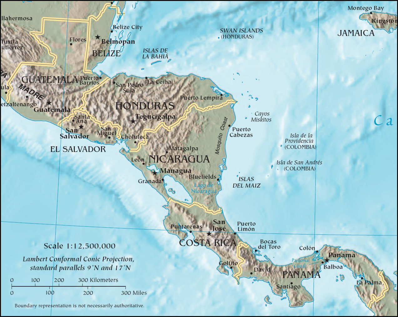
- Central America
-
For other uses, see Central America (disambiguation).
Central America 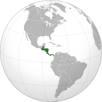
Area 523,780 km2 (202,233 sq mi)[1] Population 41,739,000 (2009 est.)[1] Density 77 /km2 (200 /sq mi) Countries 7 Demonym Central American, American GDP $107.7 billion (exchange rate) (2006)
$ 226.3 billion (purchasing power parity) (2006).GDP per capita $2,541 (exchange rate) (2006)
$5,339 (purchasing power parity) (2006).Languages Spanish, English, Mayan languages, Garifuna, Kriol, European languages, and many others Time Zones UTC - 6:00, UTC - 5:00 Largest cities (2002) Guatemala City
San Salvador
Tegucigalpa
Managua
San Pedro Sula
Panama City
San José, Costa Rica
Santa Ana, El Salvador
León
San Miguel[2]Central America (Spanish: América Central or Centroamérica) is the central geographic region of the Americas. It is the southernmost, isthmian portion of the North American continent, which connects with South America on the southeast.[3][4] When considered part of the unified continental model, it is considered a subcontinent. Central America consists of the seven states of Belize, Costa Rica, El Salvador, Guatemala, Honduras, Nicaragua, and Panama. Central America is part of the Mesoamerican biodiversity hotspot, which extends from Northern Guatemala through central Panama.[5] It is bordered by Mexico to the north, the Caribbean Sea to the east, the North Pacific Ocean to the west, and Colombia to the south-east.
Central America has an area of 524,000 square kilometers (202,000 sq mi), or almost 0.1% of the Earth's surface. As of 2009, its population was estimated at 41,739,000. It has a density of 77 people per square kilometer or 206 people per square mile.
Contents
History
Main article: History of Central America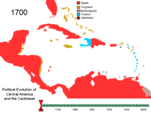 Political Evolution of Central America and the Caribbean from 1700 to present
In pre-Columbian times, the north-western areas of modern Central America were part of the Mesoamerican civilization. The Native American societies of Mesoamerica occupied the land ranging from central Mexico in the north to Costa Rica in the south. Most notable among these were the Maya, who had built numerous cities throughout the region, and the Aztecs, who created a vast empire. The pre-Columbian cultures of Panama traded with both Mesoamerica and South America, and can be considered transitional between those two cultural areas.
Following Christopher Columbus's discovery of the Americas for Spain, the Spanish sent numerous expeditions to the region, and they began their conquest of Maya lands in the 1520s. In 1540, Spain established the Captaincy General of Guatemala, which extended from southern Mexico to Costa Rica, and thus encompassed most of what is currently known as Central America, with the exception of British Honduras (present-day Belize). This lasted nearly three centuries, until a rebellion (which followed closely on the heels of the Mexican War of Independence) in 1821.
After the dissolution of Spanish authority, the former Captaincy General remained intact as part of the short-lived First Mexican Empire. Central America then emerged as a distinct political entity upon the independence of the Federal Republic of Central America a representative democracy with its capital at Guatemala City. This union consisted of the present day nations of Guatemala (which included the former state of Los Altos), El Salvador, Honduras, Nicaragua, Costa Rica (which included a region which is now part of Panama, and the Guanacaste Province which was once part of Nicaragua), and Soconusco, a portion of the modern Mexican state of Chiapas. The Republic lasted from 1823 to 1838, when it began to disintegrate due to civil wars.
Belize was contested between the Spanish Empire and the British Empire, a dispute that continued after the independence of Guatemala, who considered Belize to be a Guatemalan department. It was declared a British colony and given the name British Honduras in 1871, gaining independence as Belize in 1981.
Panama, situated in the very south of Central America on the Isthmus of Panama, has for much of its history been culturally linked to South America. Panama was a part of the Spanish Viceroyalty of New Granada, and then, following independence, became part of Gran Colombia. Only after independence from Colombia in 1903 did some begin to regard Panama as a North or Central American entity.
Central American integration
Sistema de Integración Centroamericana
Central American Integration System
Motto: «Peace, Development, Liberty and Democracy»
Anthem: La Granadera
Area 560,988 km² Population 50,807,778 hab. Countries  Belize
 Costa Rica
 Guatemala
 Honduras
 Nicaragua
 Panama
 El Salvador
 Dominican Republic
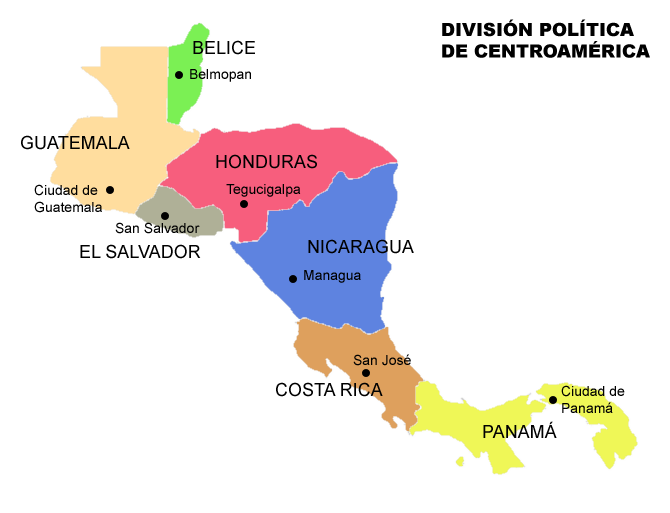
 Countries and capitals of Central America.Main article: Central American Integration System
Central America is currently undergoing a process of political, economic and cultural transformation that started in 1907 with the creation of the Central American Court of Justice.
In 1951 the integration process continued with the signature of the San Salvador Treaty, which created the ODECA, the Organization of Central American States. However, the unity of the ODECA was limited by conflicts between several member states.
In 1991, the integration agenda was further advanced by the creation of the SICA, Sistema para la Integración Centroamericana or System for the Central American Integration. The SICA provided a clear legal basis to avoid disputes between the member states. The SICA membership includes the 7 nations of Central America plus the Dominican Republic, a state that is traditionally considered part of the Caribbean.
On December 6, 2008 SICA announced an agreement to pursue a common currency and common passport for the member nations. No timeline for implementation was discussed.
Central America already has several supranational institutions such as the Central American Parliament, the Central American Bank for Economic Integration and the Central American Common Market.
On July 22, 2011 president Funes of El Salvador became the first president pro tempore to the SICA. El Salvador also became the headquarters of SICA in the inauguration of a new building.[6]
Geography
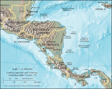 Map of Central America
Central America has an area of 524,000 square kilometers (202,000 sq mi), or almost 0.1% of the Earth's surface. As of 2009, its population was estimated at 41,739,000. It has a density of 77 people per square kilometer or 206 people per square mile.
Physical geography
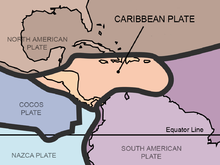 Central America and the Caribbean Plate
Physiographically, Central America is the tapering isthmus of southern North America, with unique and varied features extending from the north-western borders of Belize and Guatemala southeastward to the Isthmus of Panama where it connects to the Colombian Pacific Lowlands in northwestern South America. Alternatively, some physiographists locate its northern border at some point in the Isthmus of Tehuantepec, Mexico.[7]
Central America has an area of some 592,000 square kilometres. The Pacific Ocean lies to the southwest, the Caribbean Sea lies to the northeast, and the Gulf of Mexico lies to the north. Most of Central America rests atop the Caribbean Plate.
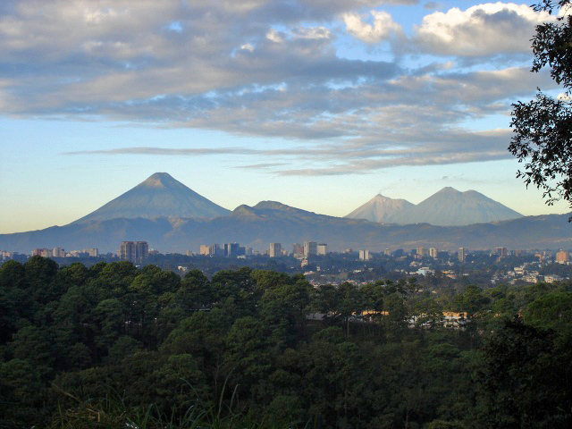
The region is geologically active, with volcanic eruptions and earthquakes occurring from time to time. In 1976 Guatemala was hit by a major earthquake, killing 23,000 people; Managua, the capital of Nicaragua, was devastated by earthquakes in 1931 and 1972, the last one killed about 5,000 people; three earthquakes devastated El Salvador, one in 1986 and two in 2001; one earthquake devastated northern and central Costa Rica in 2009 killing at least 34 people; in Honduras a powerful earthquake killed 7 people in 2009.
Volcanic eruptions are common in the region. In 1968 the Arenal Volcano, in Costa Rica, erupted and killed 87 people. Fertile soils from weathered volcanic lavas have made it possible to sustain dense populations in the agriculturally productive highland areas.
Central America has many mountain ranges; the longest are the Sierra Madre de Chiapas, the Cordillera Isabelia and the Cordillera de Talamanca. Between the mountain ranges lie fertile valleys that are suitable for the people; in fact most of the population of Honduras, Costa Rica and Guatemala live in valleys. Valleys are also suitable for the production of coffee, beans and other crops.
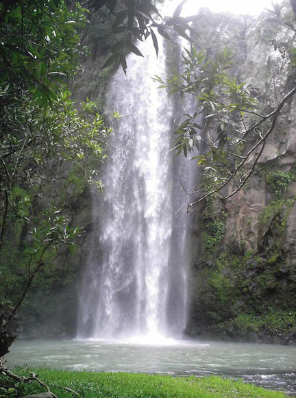
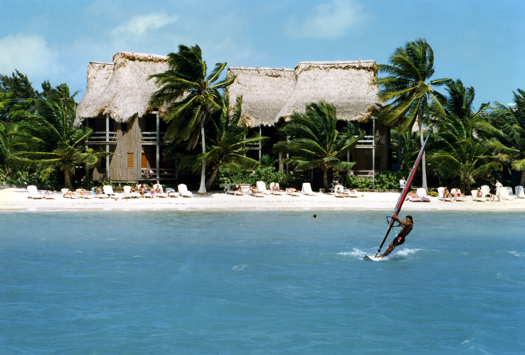
Biodiversity
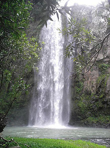 El Chorreron, El Salvador.
 San Pedro Beach in Ambergris Caye, Belize
Central America is part of the Mesoamerican Biodiversity hotspot, boasting 7% of the world's biodiversity.[8] As a bridge between North and South America, Central America has many species from the Nearctic and the Neotropic ecozones. However the southern countries (Costa Rica and Panama) of the region have more biodiversity than the northern countries (Guatemala and Belize), meanwhile the central countries (Honduras, Nicaragua and El Salvador) have least biodiversity.[8] The table shows current statistics for the seven countries:
Country Amphibians Birds Mammals Reptiles Wildlife diversity Vascular Plants Biodiversity Belize46[9] 544[9] 147[9] 140[9] 877[9] 2894[9] 3771[9] Costa Rica183[10] 838[10] 232[10] 258[10] 1511[10] 12119[10] 13630[10] El Salvador30[11] 434[11] 137[11] 106[11] 707[11] 2911[11] 3618[11] Guatemala133[12] 684[12] 193[12] 236[12] 1246[12] 8681[12] 9927[12] Honduras101[13] 699[13] 201[13] 213[13] 1214[13] 5680[13] 6894[13] Nicaragua61[14] 632[14] 181[14] 178[14] 1052[14] 7590[14] 8642[14] Panama182[15] 904[15] 241[15] 242[15] 1569[15] 9915[15] 11484[15] Foreign relations
Until recently, all Central American countries have maintained diplomatic relations with the Republic of China (Taiwan) instead of the People's Republic of China.[16] President Oscar Arias of Costa Rica, however, established diplomatic relations with the People's Republic of China in 2007, severing formal diplomatic ties with the Republic of China (Taiwan).
Human geography
 Guatemala City is the largest city in Central AmericaSee also: Ethnic groups in Central America and Demographics of Latin America
Countries of Central America Name of territory,
with flagArea
(km²)[1]Population
(July 2009 est.)Population density
(per km²)Capital Official
language Belize22,966 307,000 13 Belmopan English Costa Rica51,100 4,579,000 90 San José Spanish El Salvador21,040 6,163,000 292 San Salvador Spanish Guatemala108,890 14,027,000 129 Guatemala City Spanish Honduras112,090 7,466,000 67 Tegucigalpa Spanish Nicaragua130,373 5,743,000 44 Managua Spanish Panama78,200 3,454,000 44 Panama City Spanish Total 523,780 41,739,000 80 - - Largest metropolitan areas in Central America City Country Population Census Year % of National
populationGuatemala City Guatemala 3,700,000 2010 26% Managua Nicaragua 2,408,000 2010 42% San Salvador El Salvador 2,290,790 2009 37% San Jose [17] Costa Rica 1,715,485 2006 37% San Pedro Sula Honduras 1,542,364 2010 21% Tegucigalpa Honduras 1,324,000 2010 18% Ciudad de Panamá Panama 1,272,672 2010 37% Infrastructure
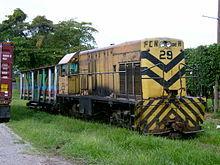 City rail in La Ceiba, Honduras is one of the few remaining passenger train services in Central America
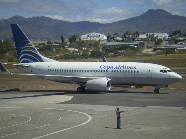
 A Copa Boeing 737-700 in Honduras
Roads
The Pan-American Highway runs through Central America, and except for an 87 kilometres (54 mi) rainforest break, called the Darién Gap, the road links the mainland nations of the Americas in a connected highway system. According to Guinness World Records, the Pan-American Highway is the world's longest "motorable road". However, because of the Darién Gap, it is not possible to cross between South America and Central America by traditional motor vehicle.
Rail
Main article: Rail transport in Central America- Belize: see Rail transport in Belize
- Costa Rica: see Rail transport in Costa Rica
- El Salvador: see Rail transport in El Salvador
- Guatemala: see Rail transport in Guatemala
- Honduras: see Rail transport in Honduras
- Nicaragua: see Rail transport in Nicaragua
- Panama: see Rail transport in Panama
Airlines
Main article: List of largest airlines in Central America & the CaribbeanUsage
"Central America" may mean different things to various people in the world based upon different contexts:
- In English speaking countries, Central America is considered a region of the North American continent.[18] Geopolitically, it usually comprises seven countries – Belize, Guatemala, El Salvador, Honduras, Nicaragua, Costa Rica, and Panama.[19] Mexico, in whole or in part, is sometimes included, regardless of correctness, by Britons.[20] Some geographers include the five states of Campeche, Chiapas, Tabasco, Quintana Roo, and Yucatán,[19] together representing 12.1% of the country's total area.
- In Latin America, Iberia, and some other parts of Europe, the Americas are considered to be a single continent, and Central America is considered a region of this continent. In Ibero-America, the region is defined as seven nations – Belize, Guatemala, El Salvador, Honduras, Nicaragua, Costa Rica, and Panama – and may occasionally include Mexico's southernmost region.[21] Geopolitically, Mexico is considered part of North America.[22]
- Occasionally, regardless of correctness, the term Central America is used synonymously with Middle America.[23] Among some German geographers, Mittelamerika may be used to refer to the territories on the Central American isthmus.[23]
- In German, Zentralamerika may be used to refer to the territories on the Central American isthmus.[citation needed]
- The UN geoscheme defines the region as all states of mainland North America south of the United States; conversely, the European Union excludes Belize and Mexico from its definition of the region.[24][25]
See also
Main article: Index of Central America-related articlesReferences
- ^ a b c Areas and population estimates taken from the 2008 CIA World Factbook, whose population estimates are as of July 2007.
- ^ Largest Cities in Central America, Rhett Butler. Accessed on line January 10, 2008.
- ^ Central America, MSN Encarta. Accessed on line January 10, 2008. Archived 2009-10-31.
- ^ "Central America", vol. 3, Micropædia, The New Encyclopædia Britannica, Chicago: Encyclopædia Britannica, Inc., 1990, 15th ed. ISBN 0-85229-511-1.
- ^ Mesoamerica, Biodiversity Hotspots, Conservation International. Accessed on line January 10, 2008.
- ^ http://www.presidencia.gob.sv/novedades/noticias/item/1306-presidente-funes-inaugura-nueva-sede-del-sica.html
- ^ "Central America". Encyclopedia Britannica. http://www.britannica.com/EBchecked/topic/102196/Central-America. Retrieved 28 June 2011.
- ^ a b http://www.webng.com/jerbarker/home/eia-toolkit/downloads/Van04/RojasVancouver.pdf
- ^ a b c d e f g "Belize Deforestation Rates and Related Forestry Figures". Rainforests.mongabay.com. http://rainforests.mongabay.com/deforestation/2000/Belize.htm. Retrieved 2010-04-17.
- ^ a b c d e f g "Costa Rica Deforestation Rates and Related Forestry Figures". Rainforests.mongabay.com. 2005-06-30. http://rainforests.mongabay.com/deforestation/2000/Costa_Rica.htm. Retrieved 2010-04-17.
- ^ a b c d e f g "El Salvador Deforestation Rates and Related Forestry Figures". Rainforests.mongabay.com. 2005-06-30. http://rainforests.mongabay.com/deforestation/2000/El_Salvador.htm. Retrieved 2010-04-17.
- ^ a b c d e f g "Guatemala Deforestation Rates and Related Forestry Figures". Rainforests.mongabay.com. http://rainforests.mongabay.com/deforestation/2000/Guatemala.htm. Retrieved 2010-04-17.
- ^ a b c d e f g "Honduras Deforestation Rates and Related Forestry Figures". Rainforests.mongabay.com. http://rainforests.mongabay.com/deforestation/2000/Honduras.htm. Retrieved 2010-04-17.
- ^ a b c d e f g "Nicaragua Deforestation Rates and Related Forestry Figures". Rainforests.mongabay.com. http://rainforests.mongabay.com/deforestation/2000/Nicaragua.htm. Retrieved 2010-04-17.
- ^ a b c d e f g "Panama Deforestation Rates and Related Forestry Figures". Rainforests.mongabay.com. http://rainforests.mongabay.com/deforestation/2000/Panama.htm. Retrieved 2010-04-17.
- ^ "Ministry of Foreign Affairs, Republic of China". Mofa.gov.tw. http://www.mofa.gov.tw/webapp/ct.asp?xItem=11624&CtNode=1143&mp=1. Retrieved 2010-04-17.
- ^ ccp.ucr.ac.cr/bvp/pdf/proye/distrital.pdf
- ^ "Central America." Merriam-Webster's Collegiate Dictionary.
- ^ a b "Central America". Encyclopædia Britannica. 2006. Chicago: Encyclopedia Britannica, Inc.
- ^ Burchfield, R. W. 2004. "America". Fowler's Modern English Usage (ISBN 0-19-861021-1) New York: Oxford University Press, p. 48.
- ^ Centroamérica (Mexican version)"/Centroamérica (Spaniard version). Encarta Online Encyclopedia.. Archived 2009-10-31.
- ^ "Norteamérica". Archived from the original on 2009-10-31. http://www.webcitation.org/5kwQijGaa.
- ^ a b Augelli, John P. (1962 (Jun.)). The Rimland-Mainland Concept of Culture Areas in Middle America. Annals of the Association of American Geographers. pp. 52 (2): 119–129. JSTOR 2561309. "Occasionally, the term "Central America" is used synonymously with "Middle America," and for some German geographers "Mittelamerika" refers to the isthmian territories from Panama to Guatemala."
- ^ Standard Country and Area Codes Classifications (M49). United Nations Statistics Division.
- ^ The EU's relations with Central America, European Commission. Accessed on line October 17, 2007.
Sources
- "Central America". The Columbia Encyclopedia, 6th ed. 2001-6. New York: Columbia University Press.
- American Heritage Dictionaries, Central America.
- WordNet Princeton University: Central America.
- "Central America". The Columbia Gazetteer of the World Online. 2006. New York: Columbia University Press.
- Consuelo Hernández."Reconstruyendo a Centroamérica a través de la poesía." Voces y perspectivas en la poesia latinoamericana del siglo XX. Madrid: Visor, 2009
External links
Central America Sovereign states Belize · Costa Rica · El Salvador · Guatemala · Honduras · Nicaragua · Panama

Regions of the world 
Africa Northern · Sub-Saharan (Central · Southern · Western · Eastern) 
Oceania Australasia (Australia) · Melanesia · Micronesia · Polynesia 
America North (Northern • Middle • Central • Caribbean) · South (Southern • Northern • Western) · Anglo · Latin 
Polar Arctic · Antarctic 
Asia Central · Eastern (Northeastern) · Northern · Southeastern · Southern (Indian subcontinent) · Western (Middle East) 
Oceans World · Arctic · Atlantic · Indian · Pacific · Southern 
Europe Central · Eastern · Northern · Southeastern · Southern · Western Seas List of seas Related Continents of the world · List of seas · Physical Earth Categories:


Wikimedia Foundation. 2010.