- Mud Lake Canal
-
Mud Lake Canal

Location: Monroe County, Florida  United States
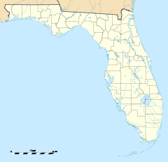
Nearest city: Flamingo[1] Coordinates: 25°10′26″N 80°56′17″W / 25.17389°N 80.93806°WCoordinates: 25°10′26″N 80°56′17″W / 25.17389°N 80.93806°W Governing body: Everglades National Park NRHP Reference#: 06000979[1][2][3] Significant dates Added to NRHP: September 20, 2006[2] Designated NHL: September 20, 2006[1][2] The Mud Lake Canal is a prehistoric long-distance canoe canal near Flamingo, Florida, U.S.. It is located at Cape Sable, in the Everglades National Park. On September 20, 2006, it was designated a National Historic Landmark and added to the U.S. National Register of Historic Places.[1][2]
References
- ^ a b c d "Mud Lake Canal". National Historic Landmark summary listing. National Park Service. http://tps.cr.nps.gov/nhl/detail.cfm?ResourceId=866475245&ResourceType=Site. Retrieved 2008-06-21.
- ^ a b c d Weekly List Of Actions Taken On Properties: 9/25/06 through 9/29/06
- ^ "National Register Information System". National Register of Historic Places. National Park Service. 2008-06-21. http://nrhp.focus.nps.gov/natreg/docs/All_Data.html.
U.S. National Register of Historic Places in Florida Lists by county Alachua • Baker • Bay • Bradford • Brevard • Broward • Calhoun • Charlotte • Citrus • Clay • Collier • Columbia • DeSoto • Dixie • Duval • Escambia • Flagler • Franklin • Gadsden • Gilchrist • Glades • Gulf • Hamilton • Hardee • Hendry • Hernando • Highlands • Hillsborough • Holmes • Indian River • Jackson • Jefferson • Lafayette • Lake • Lee • Leon • Levy • Liberty • Madison • Manatee • Marion • Martin • Miami-Dade • Monroe • Nassau • Okaloosa • Okeechobee • Orange • Osceola • Palm Beach • Pasco • Pinellas • Polk • Putnam • Santa Rosa • Sarasota • Seminole • St. Johns • St. Lucie • Sumter • Suwannee • Taylor • Union • Volusia • Wakulla • Walton • Washington
Lists by city Other lists Keeper of the Register • History of the National Register of Historic Places • Property types • Historic district • Contributing property Categories:- National Register of Historic Places in Monroe County, Florida
- National Historic Landmarks in Florida
- Canals on the National Register of Historic Places
- Everglades National Park
- Florida Registered Historic Places building and structure stubs


Wikimedia Foundation. 2010.