- Tory Island
-
Toraigh
Tory— Populated place — Toraigh from the mainland Location in Ireland
 Toraigh
Coordinates: 55°15′45″N 8°13′00″W / 55.2626°N 8.2168°WCoordinates: 55°15′45″N 8°13′00″W / 55.2626°N 8.2168°W Country Ireland Province Ulster County County Donegal Government – Dáil Éireann Donegal South West Time zone WET (UTC+0) – Summer (DST) IST (WEST) (UTC-1) Area code(s) 074, +353 74 Irish Grid Reference B853466 Toraigh is the only official name. The anglicized spelling Tory has no official status. Toraigh (anglicised as Tory and Tory Island)[1] is an inhabited island 14.5 km (9 mi) off the northwest coast of County Donegal, Ireland. It is also known in Irish as Oileán Thoraigh, Oileán Thoraí or (historically) Oileán Thúr Rí.[2]
Contents
Language
The main spoken language on the island is Irish, but English is also understood. Tory is part of the Donegal Gaeltacht and Ulster Irish is the main Irish dialect in use.
Geography and transport
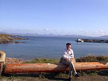
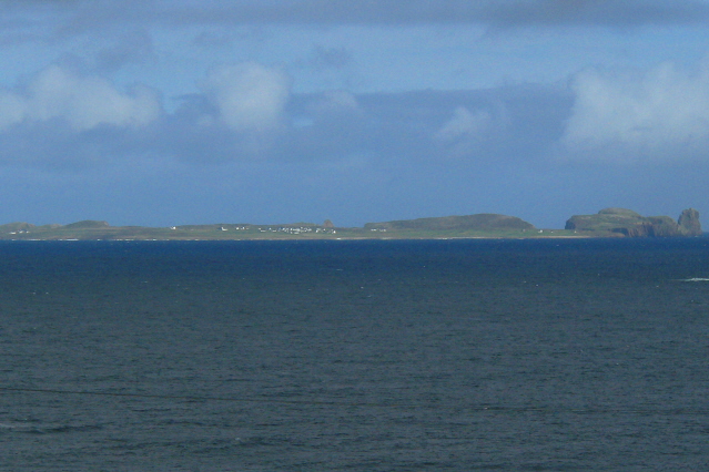
 Tory in the evening
The island is approximately 5 km (3 mi) long and 1 km (0.6 mi) wide.[3] The 2002 census recorded a population of 133.[4][5][6] The population is divided among four towns — An Baile Thoir (East Town), An Baile Thiar (West Town), An Lár (Middletown) and Úrbaile (Newtown).[2] In August 2010, the King of Tory confirmed that there were 96 people living on the island.[citation needed]
Petrol and diesel are available from Tory Oil at prices significantly higher than on the mainland.[7][not in citation given]
Tory has no airport, but has regular ferry connections from mainland County Donegal.[8] The ferry travels daily from April to October and five times a week for the rest of the year. The ferry does not take cars, but holds up to 70 passengers.[9] During the winter months sea crossings may not be possible due to rough seas - but from November to March a small 4-seater helicopter runs from Falcarragh to Tory every other Thursday.
History
Ancient history
In the apocryphal history of Ireland, Lebor Gabála Érenn, Tory Island was the site of Conand's Tower, the stronghold of the Fomorians, before they were defeated by the Nemedians in a great battle on the island. The later Fomorian king Balor of the evil eye also lived here.[10] Balor would imprison Ethlinn in a tower built atop Tor Mór (or Túr Mór in Old Irish, meaning The High Tower). Tor Mór is the island's highest point.
A monastery was founded on Tory in the 6th century by Colmcille. The monastery dominated life on the island until 1595, when it was plundered and destroyed by English troops, waging a war of suppression against local chieftains. The monastery's bell tower is the largest structure to survive and was built in the 6th or 7th century.[citation needed]
The Battle of Tory Island, the last action in the Irish Rebellion of 1798, took place at sea nearby.
 The "King of Tory", Patsy Dan Rodgers, waiting near the harbour to welcome visitors to the island
Recent history
Since the 1950s, the island has been home to a small community of artists, and has its own art gallery. The English artist Derek Hill was associated with the Tory artist community.[11]
Reflecting a long-standing tradition, a "king" is chosen by consensus of the islanders. This is a unique tradition that does not exist anywhere else in Ireland.[citation needed] The current Rí Thoraí (Irish for King of Tory) is painter Patsaí Dan Mac Ruaidhrí. The king has no formal powers; though duties include being a spokesperson for the island community and welcoming people to the island.[12]
Power is generated on the island today from three diesel electricity generators. These have a total capacity of 4 MW and burn through approximately 500 litres of fuel every day.
Public attention was focused on the island in 2009, when a one-time resident was awarded a payout following a court case after his house was demolished and the grounds used as a car park.[13]
Tourism
Despite its small size, Tory Island has a number of historical and mythological sites:
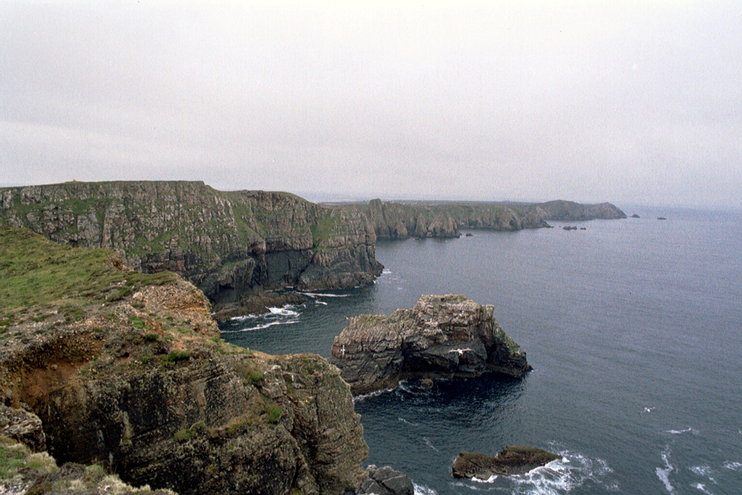
- Dún Bhaloir (Balor's fort) is located on the island's eastern side. This peninsula is surrounded on three sides by 90m-high cliffs. Balor's fort is only accessible by crossing a narrow isthmus, defended by four earthen embankments.[14]
 View from Dún Bhaloir
- An Eochair Mhór (The big key) is a long, steep-sided spur jutting from the east side of the peninsula and ending in a crag called An Tor Mór (the big rock). The spur has prominent rocky pinnacles - these are known as "Balor's soldiers". (Saighdiúirí Bhaloir ) They give the spur a 'toothed' appearance and contribute to the name, "The big key".
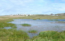 A view of East Town (An Baile Thoir), Tory Island.
- The Wishing Stone is a precipitous flat-topped rock beside the northern cliff-face of Balor's Fort. Traditionally, a wish is granted to anyone foolhardy enough to step onto the rock, or who succeeds in throwing three stones onto it.
- An Cloigtheach (The Bell Tower) is the largest structure to have survived the destruction of the monastery (see history section above). The tower was built in the 6th or 7th century.
- The Tau Cross (a t-shaped cross) is believed to date from the 12th century. It is one of only two Tau crosses in Ireland (the other in Kilnaboy, County Clare).
- Móirsheisear (Grave of the Seven): Móirsheisear, which actually translates as 'big six' — an archaic term for seven — is the tomb of seven people, six men and one woman, who drowned when their boat capsized off Scoilt an Mhóirsheisear (the cleft of the seven) on the island's northwest coast. According to local superstition, clay from the woman's grave has the power to ward off vermin.[14]
- The Lighthouse, standing at the west end of the island, was built between 1828 and 1832 to a design by George Halpin, a noted designer of Irish lighthouses. In April 1990 the lighthouse was automated. The lighthouse is one of three in Ireland in which a reference station for the Differential Global Positioning System (DGPS) is installed. The lighthouse is at coordinates 55°16.357′N 8°14.964′W / 55.272617°N 8.2494°W
- The Torpedo: A torpedo can be seen midway between An Baile Thiar and An Baile Thoir. It washed ashore during World War II and was defused and erected at its present location.[14]
Flora and fauna
The island is a breeding site for Corn Crakes (Crex crex) a globally threatened species whose numbers have fallen with the intensification of agriculture. In 2007 Tory Island recorded 18 calling males; down from a recent years maximum of 34 calling males in 2003. In addition to its indigenous bird life, the island records many vagrants.[15]
Ancient records of the flora and fauna of this island can be found in Hyndman's notes on the history of the island.[16] Algae found locally includes: Fucus vesiculosus, Fucus nodosus, Himanthalia lorea, Laminaria digitata, Rhodomenia laciniata, Plocamium coccineum, Ptilota plumosa, Conferva rupestrus, Codium tomtntosum, Codium adhaerens det Dr Harvey.[16]
See also
- List of abbeys and priories in County Donegal
References and further reading
- ^ Placenames (Ceantair Ghaeltachta) Order 2004
- ^ a b The Tory Islanders, a 1978 ethnographic account by R. Fox
- ^ A place of bewitching beauty — BBC News article
- ^ CSO.ie - 2002 Census
- ^ Geological Survey of Ireland - Draft Groundwater Body Report - September 2005
- ^ Donegal County Council Report - Taobh Tíre (a better library service for rural areas) - July 2003
- ^ Pumps.ie - Tory Oil, West Town, Tory Island
- ^ Ferries departurt from Magheroarty and Bunbeg, with occasional services from Portnablath. The shortest crossing (Magheroarty to Tory Island) takes about 45 minutes. Oileanthorai.com — Official Tory Island Tourism Website - Travel details
- ^ Tory Island Ferry, County Donegal
- ^ G. H. Kinahan "Donegal Folk-lore: Ballor of the Evil Eye." The Folk-Lore Journal. Volume 5, 1894.
- ^ Funeral arrangements made for artist Derek Hill — RTÉ News article, 31 July 2000
- ^ "Patsy Dan Rodgers - Tory Island Artist, Musician and King of Tory, County Donegal". Patsydanrodgers.littleireland.ie. http://patsydanrodgers.littleireland.ie/. Retrieved 2008-11-10.
- ^ Telegraph.co.uk - Hotel turned film director's home into a car park - 11 Nov 2009
- ^ a b c Oileanthorai.com — Official Tory Island Tourism Website - Places of Interest
- ^ Birds and Wildlife of Tory Island, leaflet published by Bird Watch Ireland
- ^ a b Hyndman, G.C. 1852. Notes on the natural history of Tory Island. Ulster J.Archaeol. 1: 34 - 3
- Hunter, J. 2006. The Waves of Tory. Colin-Smyth Ltd. ISBN 9780861404568
- Williams H.G "Tory Island, County Donegal: a study on geographical isolation" Irish Geography, Dublin 1952
- The Crosses of Tory Island, Dorothy Kelly, in Seanchas:Studies in Early and Medieval Irish Archaeology, History and Literature in Honour of Francis John Byrne, ed. Alfred P. Smyth, pp. 53–63, Four Courts Press, Dublin, 2000
Places in County Donegal Towns 
Villages - Annagry
- Ardara
- Ballintra
- Ballyliffin
- Bridgend
- Bruckless
- Burtonport
- Carrigans
- Carrigart
- Castlefin
- Churchill
- Cloghan
- Clonmany
- Creeslough
- Doochary
- Dunfanaghy
- Dunkineely
- Fahan
- Falcarragh
- Fintown
- Frosses
- Glen
- Glencolmcille
- Glenties
- Greencastle
- Gweedore
- Inver
- Kerrykeel
- Kilcar
- Killea
- Killygordon
- Laghey
- Lettermacaward
- Loughanure
- Malin
- Manorcunningham
- Milford
- Mountcharles
- Muff
- Narin
- Newtowncunningham
- Pettigo
- Portnablagh
- Quigley's Point
- Rathmullan
- Rossnowlagh
- St. Johnston
- Teelin
Townlands Islands - Arranmore
- Glashedy
- Gola
- Inishbofin
- Inishtrahull Island
- Rotten Island
- Rutland
- Tory Island
- List of townlands in County Donegal
- Category:Mountains and hills of County Donegal
- Category:Rivers of County Donegal
- Category:Geography of County Donegal
Irish lighthouses Lighthouses are shown in anti-clockwise sequence beginning from the north and proceeding west, south, east, and back to north.County Donegal 
County Sligo Blackrock · Lower Rosses Point · Metal Man · Oyster Island
County Mayo Broadhaven · Eagle Island · Blackrock · Blacksod Bay · Achillbeg · Inishgort
County Galway Slyne Head Cashla Bay · Eeragh · Straw Island · Inisheer
County Clare Blackhead · Loop Head · Kilcredaun Head · Corlis Point Front · Corlis Point Rear · Scattery Island
County Kerry Little Samphire Island · Inishtearaght · Cromwell Point · Valentia Rear · Valentia Front · Skelligs
County Cork Bull Rock · Ardnakinna · Castletown Directional Light · Roancarrig · Sheep's Head · Mizen Head · Crookhaven · Copper Point · Fastnet Rock · Baltimore Beacon · Galley Head · Old Head of Kinsale · Charlesfort · Roches Point · Ballycotton · Youghal
County Waterford Mine Head · Ballinacourty Point · Dunmore East
County Wexford County Wicklow County Dublin Muglins · Poolbeg · Kish Bank · Baily · Howth Head · Rockabill
County Louth County Down Green Island · Vidal Bank · Haulbowline · St. John's Point · ` Angus Rock · Donaghadee · Mew Island
County Antrim Blackhead · Chaine Tower · The Maidens · Rathlin East · Rue Point · Rathlin West
List of lighthouses in Ireland · Lightvessels in Ireland · Commissioners of Irish Lights · Category:Lighthouses in Ireland · List of islands of Ireland · Coastal landforms of IrelandCategories:- Islands of County Donegal
- Gaeltacht places in County Donegal
- Lighthouses in the Republic of Ireland
- National Monuments in County Donegal


Wikimedia Foundation. 2010.