- Clinton, Dutchess County, New York
-
For other places named Clinton, New York, see Clinton, New York (disambiguation).
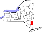
Clinton, New York — Town — Location within the state of New York
 Clinton, New York
Coordinates: 41°51′29″N 73°48′44″W / 41.85806°N 73.81222°WCoordinates: 41°51′29″N 73°48′44″W / 41.85806°N 73.81222°W Country United States State New York County Dutchess Government - Type Town Council - Town Supervisor Jeffrey G. Burns (R) - Town Council Members' ListArea - Total 38.8 sq mi (100.6 km2) - Land 38.5 sq mi (99.6 km2) - Water 0.4 sq mi (1.0 km2) Elevation 551 ft (168 m) Population (2000) - Total 4,010 - Density 104.3/sq mi (40.3/km2) Time zone Eastern (EST) (UTC-5) - Summer (DST) EDT (UTC-4) FIPS code 36-16408 GNIS feature ID 0978841
Clinton is a town in Dutchess County, New York, United States. The population was 4,010 at the 2000 census. The town is named after George Clinton, an early governor of New York.The Town of Clinton is in the northwest quadrant of Dutchess County. It contains over 70 miles (110 km) of roads.[citation needed]
Contents
History
Clinton was first settled around 1755. The town was part of the Great Nine Partners Patent of 1697. The town was established in 1786 from territory from the Towns of "Charlotte" and Rhinebeck. In 1821, Clinton split to form the current Towns of Hyde Park and Pleasant Valley. Clinton participated in the Civil War with men enlisting in the 128th and 150th regiments. After the war ended, the hamlet of Clinton Corners served as a stop for the Poughkeepsie and Eastern Railroad. This contributed to the development of the Grove amusement Park near Upton Lake. After the Poughkeepsie and Eastern declined with the advent of the automobile, the park closed. During the last half of the 20th century, the Town of Clinton has transformed from an agricultural to a residential center.
Geography
According to the United States Census Bureau, the town has a total area of 38.8 square miles (100 km2), of which, 38.5 square miles (100 km2) of it is land and 0.4 square miles (1.0 km2) of it (0.95%) is water.
The Taconic State Parkway passes through the town.
Demographics
As of the census[1] of 2000, there were 4,010 people, 1,502 households, and 1,120 families residing in the town. The population density was 104.3 people per square mile (40.3/km²). There were 1,734 housing units at an average density of 45.1 per square mile (17.4/km²). The racial makeup of the town was 96.03% White, 1.60% African American, 0.35% Native American, 1.02% Asian, 0.22% from other races, and 0.77% from two or more races. Hispanic or Latino of any race were 1.75% of the population.
There were 1,502 households out of which 34.3% had children under the age of 18 living with them, 65.1% were married couples living together, 6.6% had a female householder with no husband present, and 25.4% were non-families. 19.2% of all households were made up of individuals and 6.9% had someone living alone who was 65 years of age or older. The average household size was 2.63 and the average family size was 3.02.
In the town the population was spread out with 24.7% under the age of 18, 4.1% from 18 to 24, 29.8% from 25 to 44, 30.0% from 45 to 64, and 11.4% who were 65 years of age or older. The median age was 41 years. For every 100 females there were 100.2 males. For every 100 females age 18 and over, there were 98.6 males.
The median income for a household in the town was $66,406, and the median income for a family was $71,908. Males had a median income of $45,511 versus $32,750 for females. The per capita income for the town was $29,565. About 3.4% of families and 3.7% of the population were below the poverty line, including 1.9% of those under age 18 and 4.0% of those age 65 or over.
Communities and locations in Clinton
- Bulls Head – A hamlet by the north town line.
- Clinton Corners – A hamlet in the southeast corner of the town.
- Clinton Hollow – A hamlet northwest of Clinton Corners.
- Dewitt Mills – A hamlet near the west town line, northewest of Pleasant Plains.
- Hibernia – A hamlet south of Clinton Corners.
- Pleasant Plains – A hamlet west of Clinton Hollow.
- Silver Lake – A small lake by the north town line.
- Schultzville – A hamlet between Clinton Hollow and Bulls Head.
References
McDermott, William. Clinton: Dutchess County, NY: A History of a Town (1987).
- ^ "American FactFinder". United States Census Bureau. http://factfinder.census.gov. Retrieved 2008-01-31.
External links
Municipalities and communities of Dutchess County, New York County seat: Poughkeepsie Cities Beacon | Poughkeepsie
Towns Amenia | Beekman | Clinton | Dover | East Fishkill | Fishkill | Hyde Park | LaGrange | Milan | North East | Pawling | Pine Plains | Pleasant Valley | Poughkeepsie | Red Hook | Rhinebeck | Stanford | Union Vale | Wappinger | Washington
Villages CDPs Other
hamletsAnnandale-on-Hudson | Barrytown | Boston Corner‡ | Chelsea | Linden Acres | Mabbettsville | New Hamburg | Pleasant Plains | Quaker Hill | Rhinecliff | Salt Point | Shekomeko | Sylvan Lake | Van Keurens | Verbank | Wassaic
Footnotes ‡This populated place also has portions in an adjacent county or counties
Categories:- Towns in New York
- Poughkeepsie–Newburgh–Middletown metropolitan area
- Populated places in Dutchess County, New York


Wikimedia Foundation. 2010.