- Maryland Route 440
-
Maryland Route 440
Dublin Road 
Route information Maintained by MDSHA Length: 5.65 mi[1] (9.09 km) Major junctions West end:  MD 543 in Ady
 MD 136 in Dublin
East end:  US 1 near Dublin
Location Counties: Harford Highway system Maryland highway system
Interstate • US • State • Minor • Former • Turnpikes←  MD 439
MD 443  →
→Maryland Route 440 (MD 440) is a state highway in the U.S. state of Maryland. Known as Dublin Road, the state highway runs 5.65 miles (9.09 km) from MD 543 in Ady east to U.S. Route 1 (US 1) near Dublin. MD 440 was built between Ady and MD 136 in Dublin in the early 1930s and extended to US 1 in 1956.
Contents
Route description
MD 440 begins at an intersection with MD 543 (Ady Road) in the hamlet of Ady. The state highway heads east as a two-lane road through farmland. MD 440 passes by the forested Scarboro Conservation Area and passes through the hamlet of Scarboro before intersecting MD 136 (Whiteford Road) in the village of Dublin. The state highway crosses Peddler Run before reaching its eastern terminus at US 1 (Conowingo Road) between Dublin and Darlington.[1][2]
History
MD 440 was constructed as a macadam road from MD 543 at Ady to MD 136 in Dublin between 1930 and 1933.[3][4] The state highway was extended east to US 1 in 1956.[5]
Junction list
The entire route is in Harford County.
Location Mile[1] Destinations Notes Ady 0.00 MD 543 (Ady Road) – Pylesville, HickoryWestern terminus Dublin 3.85 MD 136 (Whiteford Road) – Whiteford, Churchville5.65 US 1 (Conowingo Road) – Bel Air, DarlingtonEastern terminus 1.000 mi = 1.609 km; 1.000 km = 0.621 mi References
- ^ a b c "Highway Location Reference: Harford County" (PDF). Maryland State Highway Administration. 2009. http://www.marylandroads.com/Location/2009_HARFORD.pdf. Retrieved 2011-03-02.
- ^ Google, Inc. Google Maps – Maryland Route 440 (Map). Cartography by Google, Inc. http://maps.google.com/maps?f=d&source=s_d&saddr=MD-440+E%2FDublin+Rd&daddr=MD-440+E%2FDublin+Rd&hl=en&geocode=FWDXXAIdpkBz-w%3BFeIOXQIdfrx0-w&mra=ls&sll=39.651269,-76.236706&sspn=0.007468,0.01929&ie=UTF8&t=h&z=13. Retrieved 2011-03-02.
- ^ Report of the State Roads Commission of Maryland. 1927-1930. Baltimore: Maryland State Roads Commission. 1930-10-01. p. 214. http://www.archive.org/details/reportofstateroa1927mary. Retrieved 2011-03-02.
- ^ Maryland Geological Survey. Map of Maryland Showing State Road System: State Aid Roads and Improved County Road Connections (Map) (1933 ed.).
- ^ Maryland State Roads Commission. Maryland: Official Highway Map (Map) (1956 ed.).
External links
Roads in Harford County, Maryland State highways 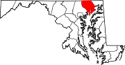
U.S. Highways Interstate Highways Categories:- State highways in Maryland
- Roads in Harford County, Maryland


Wikimedia Foundation. 2010.