- Drumoyne
-
Coordinates: 55°51′19″N 4°19′57″W / 55.855152°N 4.332379°W
Drumoyne 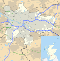
 Drumoyne
Drumoyne shown within GlasgowOS grid reference NS541649 Council area Glasgow City Council Lieutenancy area Glasgow Country Scotland Sovereign state United Kingdom Post town GLASGOW Postcode district G51 Dialling code 0141 Police Strathclyde Fire Strathclyde Ambulance Scottish EU Parliament Scotland UK Parliament Glasgow South West Scottish Parliament Glasgow Govan Glasgow List of places: UK • Scotland • Glasgow Drumoyne is a district in the Scottish city of Glasgow. It is situated south of the River Clyde.
It is the birthplace of Sir Alex Ferguson, manager of Manchester United football club since November 1986 and now the most successful manager in English football. He was born at 357 Shieldhall Road on 31 December 1941, the home of his grandparents, although he grew up at a tenement in nearby Govan. His birthplace still exists today.
Categories:- Districts of Glasgow
- Govan
- Glasgow geography stubs

Wikimedia Foundation. 2010.