- Muirend
-
Coordinates: 55°48′44″N 4°16′43″W / 55.812119°N 4.278729°W
Muirend
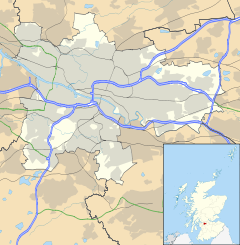
 Muirend shown within Glasgow
OS grid reference NS573600 Council area Glasgow City Council Lieutenancy area Glasgow Country Scotland Sovereign state United Kingdom Post town GLASGOW Postcode district G43 Dialling code 0141 Police Strathclyde Fire Strathclyde Ambulance Scottish EU Parliament Scotland UK Parliament Glasgow South Scottish Parliament Glasgow Cathcart Glasgow List of places: UK • Scotland • Glasgow Muirend is an area on the Southside of the city of Glasgow, Scotland. Although most of the district falls within the city proper, part of Muirend lies outwith the city boundary in the adjoining council area of East Renfrewshire. Neighbouring areas include Cathcart, Newlands, Merrylee, Giffnock and Netherlee.
Amenities
Muirend is largely residential in character, although there is a nucleus of shops situated on Clarkston Road at its junction with Muirend Road, including a former Safeway supermarket - the first in Scotland. Adjacent to the store until its closure in 2003 was the Toledo Cinema; this local landmark was the last traditional suburban picture house on the Southside. Although the rest of the building was demolished to make way for residential flats, the facade of the cinema was preserved and has been incorporated into the new development.
In June 2006, Muirend acquired its first ever pub, The Bank Cafe Bar, located in the former Glasgow Savings Bank building on Clarkston Road.
Public transport
Muirend railway station is located off Muirend Road, just behind the supermarket. It is served by local commuter services between Glasgow Central and Neilston on the Neilston branch of the Cathcart Circle Lines. Local bus services run by First Glasgow which connect Muirend to the city centre and elsewhere are the 44/A (Knightswood to Newton Mearns or Eaglesham) and the 66 (Mountblow to East Kilbride).
External links
East Renfrewshire Towns Villages Other settlements and suburbs See also Website: www.eastrenfrewshire.gov.uk Categories:- Districts of Glasgow
- Suburbs in East Renfrewshire
- Glasgow geography stubs
Wikimedia Foundation. 2010.

