- Clark's Harbour, Nova Scotia
-
Clark's Harbour — Town — Location of Clark's Harbour, Nova Scotia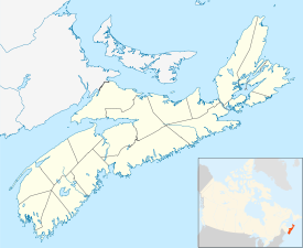
 Clark's Harbour
Coordinates: 43°26′33″N 65°37′44″W / 43.4425°N 65.628889°W[1] Country  Canada
Province  Nova Scotia
County Shelburne Municipal district Barrington Founded 1773 Incorporated March 4, 1919 Government - Type Town Council - Mayor Leigh Stoddart - MLA Sterling Belliveau (NDP) - MP Gerald Keddy (C) Area[2] - Land 2.90 km2 (1.1 sq mi) Elevation 2 m (7 ft) Population (2006)[2] - Total 860 - Density 296.5/km2 (767.9/sq mi) - Change (2001-06)  8.9%
8.9%- Dwellings 407 Time zone AST (UTC-4) - Summer (DST) ADT (UTC-3) Postal code(s) B0W 1P0 Area code(s) 902 (745) Access Routes  Route 330
Website www.clarksharbour.com Clark's Harbour is a town on Cape Sable Island in southwestern Nova Scotia, Canada, located in the Barrington municipal district of Shelburne County.[3] The main industry is lobster fishing. The community is noted as the birthplace of the Cape Islander fishing boat. Clark's Harbour is the southernmost town in Nova Scotia.
Contents
Demographics
Population trend[4]
Census Population Change (%) 2006 860 8.9%2001 944 3.7%1996 980 8.9%1991 1,076 N/A Mother tongue language (2006)[2]
Language Population Pct (%) English 855 98.84% French 10 1.16% Ethnic Groups (2006)[2]
Race Population Pct (%) White 860 100% Religious make-up (2001)[5]
Religion Population Pct (%) Protestant 815 85.79% Catholic 80 8.42% No religious affiliation 55 5.79% Income (2006)[2]
Income type By CAD Per capita income $18,326 Median Household Income $35,830 Median Family Income $49,977 Economy
The economy of Clark's Harbour and its surrounding areas is driven largely by the fishing industry, and in particular the seasonal lobster fishery. Shelburne County (in which Clark's Harbour is located) is generally accepted as the lobster capital of Nova Scotia (and a nearby sign boasts the claim that it is the Lobster Capital of Canada). The fishery has also given rise to various secondary and tertiary industries such as further seafood processing and packaging, and boatbuilding. Lobster that is trapped by Clark's Harbour fishers is exported around the world, but primarily to the New England market.
There are several other employers in Clark's Harbour, including a general store, a bank, two service stations, a pizza parlour, and a takeout restaurant. However, the economic impact of these businesses are generally small compared to the fishery.
Public library
 Clark's Harbour Branch Library
Located at 2648 Main Street in Clark's Harbour, the Clark's Harbour Branch Library is one of the 10 branches of Western Counties Regional Library. It joined the Western Counties Regional Library in July 1971 but it did not have a physical location in Clark's Harbour until the first branch opened on March 4, 1974 . The branch was relocated to its present site as part of the Clark's Harbour Civic Centre on December 11, 2007.[6]
Stone Church
One of the more notable attractions in Clark's Harbour is the United Baptist Stone Church, which is a popular destination for visitors. It is noted primarily for its unique architecture,
The Stone Church was first started on September 5, 1921, by Lieutenant-Governor MacCallum Grant. The foundation is made of native granite, and three feet in thickness. The granite that was used was all cut by hand using chisels. The walls are made of cobble stones gathered from the shore and surrounding islands. This church is eighty-five feet by fifty-five feet, and has a seating capacity of five hundred. The inside of the church is decorated in rich wood, and the windows are stained glass.
Mr. Thomas Doucette was given the task of constructing the Stone Church from blueprints. The blueprints were designed by a Halifax architect named S.P. Dumaresq. Thomas Doucette began building the church, even though he could not read or write, and had the blueprints read to him only once. It took ten years to complete the erection of the church.
See also
References
- ^ Nova Scotia Geographical Names: Clark's Harbour
- ^ a b c d e 2006 Statistics Canada Community Profile: Clark's Harbour, Nova Scotia
- ^ Government of Nova Scotia website: Community Counts
- ^ Statistics Canada: 1996, 2001, 2006 census
- ^ Statistics Canada Religious make-up, for Yarmouth, 2001 census - 100% data
- ^ WCRL – Clark's Harbour Branch Library. Retrieved August 12, 2010.
External links

West Head Newellton Atlantic Ocean 
South Side  Clark's Harbour

Lower Clarks Harbour Categories:- Communities in Shelburne County, Nova Scotia
- Towns in Nova Scotia
- General Service Areas in Nova Scotia
- Populated coastal places in Canada


Wikimedia Foundation. 2010.