- Mynydd Isa
-
Coordinates: 53°10′N 3°07′W / 53.17°N 3.12°W
Mynydd Isa 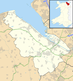
 Mynydd Isa
Mynydd Isa shown within FlintshireOS grid reference SJ2564 Principal area Flintshire Ceremonial county Clwyd Country Wales Sovereign state United Kingdom Post town MOLD Postcode district CH7 Dialling code +44-1352 / +44-1244 Police North Wales Fire North Wales Ambulance Welsh EU Parliament Wales UK Parliament Delyn Welsh Assembly Delyn List of places: UK • Wales • Flintshire Mynydd Isa [mənɪð ɪsɒː][stress?] is a village in Flintshire, in north-east Wales. It lies between the county town of Mold, and Buckley. Mynydd Isa was originally a small hamlet on the north side of the Mold to Buckley road (now the A549 road) just downhill from the now demolished Calvanistic Chapel. It does not appear on Ordnance Survey maps until after the 1840s.
Its placename is Welsh for "lower mountain".
Names of other old hamlets in the area included Pant-y-Fownog, a hamlet on the same road nearer Buckley (centred on the Griffin Inn) and although the name was used well into the 1900s on picture postcards of the area and by the local Co-Op shop next to the Inn, it has long since become disused (lending its name to a road only).
Bryn-y-Baal is an old hamlet now much enlarged since the 1970s and now contiguous with Mynydd Isa but not part of Mynydd Isa. Bryn-y-Baal takes its name from the a Middle English word "bale" (rhymes with "Carl") meaning small hill. Later it was then written in a Welsh language form as 'bâl' with a tô bach (little roof or circumflex in English) over the "â". This has the effect in Welsh of lengthening the "a" rather than the usual short "a" (as in cat) in Welsh. This form appears on early Ordnance Survey maps. Eventually it was written in the Anglicised form 'Baal' - still correctly pronounced to rhyme with "Carl".[1].
The local community council is Argoed Community Council (Cyngor Cymunedol Argoed in Welsh) - Argoed being the name of the ancient township which had covered the area since the Middle Ages, which also lends its name to the local secondary school.
Schools located in the village are a secondary school known as Argoed High School a primary school (Mynydd Isa Junior School, or Ysgol y Bryn) in Bryn-y-Baal, and a local infant school (Wat's Dyke Infants) in Mynydd Isa.
Amenities include a pub The Griffin on Mold Road. (The Mercia on Mercia Drive closed in 2010), newsagents, shop, hair salon, chemist in the village centre alongside the village centre which houses the library and other clubs and associations.
The village has a large youth organisation (est 1984) with teams representing the village in the county league from 7 to 16 years old and adult football dating back to the 1930's however the adult team disbanded in 2009.
References
- ^ Flintshire Place Names by Hwyl Wyn Owen ISBN 978-0-7083-1242-1 (1995)
External links
Categories:- Villages in Flintshire
- Clwyd geography stubs

Wikimedia Foundation. 2010.