- Jefferson County, West Virginia
-
"Jefferson County, Virginia" redirects here. For the county now part of Kentucky, see Jefferson County, Kentucky.
Jefferson County, West Virginia 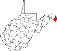
Location in the state of West Virginia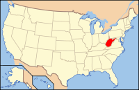
West Virginia's location in the U.S.Founded 1801 Seat Charles Town Area
- Total
- Land
- Water
212 sq mi (549 km²)
210 sq mi (544 km²)
2 sq mi (5 km²), 0.96%Population
- (2010)
- Density
53,498
202/sq mi (78/km²)Website www.jeffersoncountywv.org Jefferson County is a county located in the U.S. state of West Virginia. As of 2010, the population was 53,498. Its county seat is Charles Town[1]. Jefferson County is part of the Washington Metropolitan Area.
Contents
History
Formation
Jefferson County was formed from Berkeley County in 1801 and named for Thomas Jefferson, author of the Declaration of Independence and third President of the United States. Virginia previously had a Jefferson County, which was lost to form the new state of Kentucky. Accordingly, in the State records of Virginia, there will be listings for Jefferson County from 1780-1792 and Jefferson County from 1801-1863. Neither is still located in Virginia and despite naming a county after him twice, Virginia no longer has a county named for its hero Thomas Jefferson.
John Brown Rebellion
The county's courthouse was the site of the trial for the abolitionist John Brown after his October 1859 raid on the federal armory in Harpers Ferry. Some 90 U.S. Marines serving under then Army Colonel Robert E. Lee and Lieutenants J.E.B. Stuart and Israel Green put down the rebellion.
Brown was sentenced to death for murder, treason against the Commonwealth of Virginia, and conspiring with slaves to rebel. On 2 December 1859 John Brown was taken from the Charles Town jail a short distance to an open field and hanged. Among those attending the Brown execution was a contingent of 1500 cadets from Virginia Military Institute sent by the Governor of Virginia Henry A. Wise under the supervision of Major William Gilham and Major Thomas J. Jackson. In the ranks of a Richmond militia company stood John Wilkes Booth.
Jefferson County in the Civil War
The county was a frequent site of conflict during the civil war, as Union and Confederate lines moved back and forth along the Shenandoah valley. Some towns in the county changed hands between the Union and Confederacy over a dozen times.
Jefferson County is the only part of modern-day West Virginia not exempted from the effects of the Emancipation Proclamation (as Berkeley County and the 48 counties designated as West Virginia had been). Slaves in the county were legally free as of January 1, 1863.
Joining West Virginia
Both Berkeley and Jefferson counties had voted for secession in the vote taken on May 23, 1861. However, these counties lying on the Potomac River east of the mountains, with the consent of the Reorganized Government of Virginia supposedly voted in favor of annexation to West Virginia in 1863 in a dubious election supervised by the occupying Union Army. Virginia tried to nullify this after the American Civil War, but the counties were forced to remain part of West Virginia. The two counties are sometimes thus referred to as West Virginia's "stolen counties".
The question of the constitutionality of the formation of the new state was brought before the Supreme Court of the United States in the following manner: Berkeley and Jefferson County, West Virginia, counties lying on the Potomac east of the mountains, in 1863, with the consent of the Reorganized Government of Virginia, had supposedly voted in favor of annexation to West Virginia. However, many voters were absent in the Confederate Army when the vote was taken and they refused to accept the transfer upon their return. The Virginia General Assembly repealed the Act of Secession and in 1866 brought suit against West Virginia, asking the Supreme Court to declare the counties still part of Virginia. The Republican controlled Congress, on March 10, 1866, passed a joint resolution recognizing the transfer. The Supreme Court, in 1871, also decided in favor of West Virginia.[2]
Rural Free Delivery
In October 1896, Jefferson became the first county in the United States to begin Rural Free Delivery service.
Geography
According to the U.S. Census Bureau, the county has a total area of 212 square miles (549.1 km2), of which 210 square miles (543.9 km2) is land and 2 square miles (5.2 km2) (0.96%) is water. It is the only West Virginia county where the Blue Ridge Mountains and Shenandoah River that John Denver sang about in the song "Take Me Home, Country Roads" can be found. The lowest point in the state of West Virginia is located on the Potomac River (just east of Harpers Ferry) in Jefferson County, where it flows out of West Virginia and into Maryland.
National protected area
Major highways
 U.S. Highway 340
 West Virginia Route 9
 West Virginia Route 45
 West Virginia Route 51
 West Virginia Route 115 (Old West Virginia Route 9)
Adjacent counties
- Washington County, Maryland (north, across the Potomac River)
- Loudoun County, Virginia (east)
- Clarke County, Virginia (southwest)
- Berkeley County (northwest)
Rivers and streams
Magisterial districts

- Charles Town
- Harpers Ferry
- Kabletown
- Middleway
- Shepherdstown
Historic Buildings and Structures
- Middleway Historic District (1734)
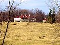
- White House Farm (1740)
- Hopewell (Millville, West Virginia) (1765)
- Harewood (West Virginia) (1770)
- Mount Ellen (ca 1790)
- New Hopewell[disambiguation needed
 ] (1774)
 - Happy Retreat (1780)
- Blakeley (West Virginia) (1820)
- Claymont Court (1820)
- Cedar Lawn (1825)
- Barleywood Manor (1846)
- Grace Episcopal Church (1851)
- Kabletown Church (1861)
- Brown Shugart House (1885)
Photo Gallery
-

Mount Ellen
-

Happy Retreat
-

Blakeley
-
Claymont Court
-

Grace Episcopal Church
-

Kabletown Church
Google Earth Placemarks
- Middleway Historic District
- White House Farm
- Mount Ellen
- Blakeley
- Claymont Court
- Grace Episcopal Church
- Kabletown Church
Demographics
As of the census[3] of 2000, there were 42,190 people, 16,165 households, and 11,315 families residing in the county. The population density was 201 people per square mile (78/km²). There were 17,623 housing units at an average density of 84 per square mile (32/km²). The racial makeup of the county was 91.02% White, 6.09% Black or African American, 0.60% Asian, 0.28% Native American, 0.04% Pacific Islander, 0.60% from other races, and 1.37% from two or more races. 1.74% of the population were Hispanics or Latinos of any race.
Historical populations Census
yearPopulation 1810 11,851 1820 13,087 1830 12,927 1840 14,082 1850 15,357 1860 14,535 1870 13,219 1880 15,005 1890 15,553 1900 15,935 1910 15,889 1920 15,729 1930 15,780 1940 16,762 1950 17,184 1960 18,665 1970 21,280 1980 30,311 1990 35,926 2000 42,190 2010 53,498 There were 16,165 households out of which 31.90% had children under the age of 18 living with them, 55.90% were married couples living together, 10.00% had a female householder with no husband present, and 30.00% were non-families. 23.20% of all households were made up of individuals and 8.50% had someone living alone who was 65 years of age or older. The average household size was 2.54 and the average family size was 2.99.
In the county, the population was spread out with 23.90% under the age of 18, 10.00% from 18 to 24, 29.90% from 25 to 44, 25.10% from 45 to 64, and 11.20% who were 65 years of age or older. The median age was 37 years. For every 100 females there were 97.90 males. For every 100 females age 18 and over, there were 95.40 males.
The median income for a household in the county was $44,374, and the median income for a family was $51,351. Males had a median income of $35,235 versus $26,531 for females. The per capita income for the county was $20,441. About 7.20% of families and 10.30% of the population were below the poverty line, including 11.40% of those under age 18 and 9.40% of those age 65 or over.
Cities and towns
Incorporated towns & cities
Unincorporated communities
See also
- Jefferson County Schools
- List of routes in Jefferson County, West Virginia
- Jefferson County Sheriff's Department
Jefferson County links
- Jefferson County Chamber of Commerce
- Jefferson County Commission
- Jefferson County Convention & Visitors Bureau
- Jefferson County Development Authority
- Jefferson County Historic Landmarks Commission
- Jefferson County Local Emergency Planning Committee
- Jefferson County Public Service District
- Jefferson County Schools
- Jefferson County Sheriff's Office
- Jefferson County Fair
- Mountain Heritage Arts and Crafts Festival
- Jefferson County Citizens for Economic Preservation
- Virtual tour of Jefferson County
- Citizens Fire Company

Berkeley County Washington County, Maryland 
Loudoun County, Virginia  Jefferson County, West Virginia

Clarke County, Virginia Municipalities and communities of Jefferson County, West Virginia Cities 
Towns CDPs Unincorporated
communitiesBakerton | Bardane | Blair | Bloomery | Blue Ridge Acres | Browns Corner | Clips Mill | Duffields | Egypt | Engle | Franklintown | Halltown | Jamestown | Johnsontown | Kabletown | Kearneysville | Keyes Ferry Acres | Leetown | Mannings | Mechanicstown | Mechlenberg Heights | Meyerstown | Millville | Moler Crossroads | Mountain Mission | Reedson | Rippon | Riverside | Silver Grove | Skeetersville | Summit Point | Uvilla | Wheatland
 State of West Virginia
Topics Cities · Towns · Villages · Census-designated places · History · Geography · People · Governors · Delegations · Colleges and universities · Visitor Attractions
Regions Allegheny Mountains · Allegheny Plateau · Baltimore-Washington Metropolitan Area · Blue Ridge · Charleston Metropolitan Area · Cumberland Plateau · Cumberland Mountains · Eastern Panhandle · Huntington Metropolitan Area · North-Central West Virginia · Northern Panhandle · Potomac Highlands · Ridge-and-valley Appalachians · Shenandoah Valley · Southern West Virginia · Western West Virginia
Major cities Smaller cities Beckley · Bluefield · Clarksburg · Elkins · Fairmont · Martinsburg · Weirton
Counties Barbour · Berkeley · Boone · Braxton · Brooke · Cabell · Calhoun · Clay · Doddridge · Fayette · Gilmer · Grant · Greenbrier · Hampshire · Hancock · Hardy · Harrison · Jackson · Jefferson · Kanawha · Lewis · Lincoln · Logan · Marion · Marshall · Mason · McDowell · Mercer · Mineral · Mingo · Monongalia · Monroe · Morgan · Nicholas · Ohio · Pendleton · Pleasants · Pocahontas · Preston · Putnam · Raleigh · Randolph · Ritchie · Roane · Summers · Taylor · Tucker · Tyler · Upshur · Wayne · Webster · Wetzel · Wirt · Wood · Wyoming
Coordinates: 39°19′N 77°52′W / 39.31°N 77.86°W
References
- ^ "Find a County". National Association of Counties. http://www.naco.org/Counties/Pages/FindACounty.aspx. Retrieved 2011-06-07.
- ^ http://www.newsgroups-index.com/group/soc_-answers_l51.html
- ^ "American FactFinder". United States Census Bureau. http://factfinder.census.gov. Retrieved 2008-01-31.
Categories:- West Virginia counties
- Jefferson County, West Virginia
- Washington metropolitan area
- Potomac River counties
- 1801 establishments in the United States
- Populated places established in 1801


Wikimedia Foundation. 2010.