- Craighead County, Arkansas
-
Craighead County, Arkansas 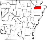
Location in the state of Arkansas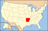
Arkansas's location in the U.S.Founded February 19, 1859 Seat Jonesboro (western district);
Lake City (eastern district)Area
- Total
- Land
- Water
712.98 sq mi (1,847 km²)
710.84 sq mi (1,841 km²)
2.14 sq mi (6 km²), 0.30%Population
- (2010)
- Density
96,443
135/sq mi (52.3/km²)Congressional district 1st Craighead County is a county located in the U.S. state of Arkansas. As of the 2010 census, the population was 96,443. It is included in the Jonesboro, Arkansas Metropolitan Statistical Area. Craighead County is Arkansas's 58th county, formed on February 19, 1859, and named for state Senator Thomas Craighead. The county has two county seats — Jonesboro and Lake City.[1] It is one of several dry counties within the state of Arkansas, in which the sale of alcoholic beverages is largely prohibited.
Contents
History
Craighead County was part of the territory claimed by France on April 9, 1682 by René Robert Cavelier, Sieur de La Salle who laid claim to all of the land drained by the Mississippi River and its assorted tributaries. LaSalle's claim was named Louisiana in honor of Louis XIV, King of France.
The Treaty of Fontainebleau (1762) was signed between France and Spain and ownership of the Louisiana territory west of the Mississippi River was transferred to the Spanish crown as a result of the Seven Years' War and Craighead County became a Spanish possession.
Spain remained in control of the territory encompassing the county until October 1, 1800 when Napoleon Bonaparte forced Spain to return the lost territories to France under the Treaty of Ildefonso. Napoleon maintained grandiose plans to establish a vast French Empire in Louisiana but the Royal Navy prevented him from transferring troops or settlers to the acquired territories.
Fear was high in the United States that Napoleon would attempt to close the Mississippi River to American trade. President Thomas Jefferson inquired about purchasing an area near the mouth of the river to ensure that it would stay open to American goods. Napoleon, having realized that his plans could not come to fruition, offered to sell the United States the entire territory of Louisiana, including Craighead County, for $23,213,568.
The treaty was finalized in 1803 and the land that would become Craighead County became the possession of the United States.
Craighead County remained in the Louisiana Territory until the State of Louisiana was admitted to the Union. At that time the territory that includes modern day Arkansas was attached to the Missouri Territory.
In 1813 the area was included in a new political subdivision known as Arkansas County which was a political subdivision of the Arkansas District of the Territory of Missouri. In 1815 the county was further subdivided and Lawrence County was formed with its seat at Davidsonville. This new county included most of what is now northern Arkansas. The modern Craighead county lay partially within Arkansas County and partially within Lawrence County.
Residents of the Missouri Territory soon began petitioning Congress for admission to the Union. Their request did not include the District of Arkansas and Arkansas residents petitioned for separate territorial status for their district. In 1819 the Arkansas Territory was formed.
In 1838, Poinsett County was formed and included most of present day Craighead County. This situation persisted until 1850 when residents of the area complained about the distance to the Poinsett County seat.
In 1858 State Senator William A. Jones campaign platform included a promise to seek the formation of a new county for the area. His election was successful and helped push legislation for the formation of the new county.
The new county was to be formed from lands taken from Greene, Mississippi, and Poinsett counties, and it was to be named "Crowley County" in honor of Crowley's Ridge which runs through the center of the county.
Senator Thomas Craighead represented Mississippi County, and opposed the bill because the farmland it took from Mississippi County (commonly known as the Buffalo Island area) was a major source of property taxes for the county.
One day while Senator Craighead was away from the floor, Senator Jones amended the bill to change the county's name to "Craighead County". The Senate, thinking it was a compromise, approved the bill as amended; by the time Senator Craighead returned, the bill had already left the Senate, and he took no further action.
Craighead County was officially formed February 19, 1859; in gratitude, the citizens then named the main county seat Jonesboro, for Senator Jones. (Some sources say the name was actually proposed by Senator Craighead in a resolution.) Lake City, just across the St. Francis River from the Buffalo Island area, was added as a second county seat in 1883.
On January 1st 2011 Ed Hill was sworn in as Craighead County Judge.
On May 5th 2011 Craighead County Computer Services opened Craighead County first Data Center in the basement of the Craighead Courthouse Annex. Information Technology Director- Erin Johnson
Geography
According to the 2000 census, the county has a total area of 712.98 square miles (1,846.6 km2), of which 710.84 square miles (1,841.1 km2) (or 99.70%) is land and 2.14 square miles (5.5 km2) (or 0.30%) is water.[2] Crowley's Ridge is the county's most prominent geological feature.
List Of Highways
 I-555 (future)
 U.S. 49
 U.S. 63
 U.S. 63 Business
 U.S. 67
 Highway 1
 Highway 1 Business
 Highway 18
 Highway 18 Spur
 Highway 69
 Highway 91
 Highway 135
 Highway 139
 Highway 141
 Highway 148
 Highway 158
 Highway 226
 Highway 230
 Highway 349
 Highway 351
 Highway 463
Adjacent counties
- Greene County (north)
- Dunklin County, Missouri (northeast)
- Mississippi County (east)
- Poinsett County (south)
- Jackson County (west)
- Lawrence County (northwest)
Demographics
Historical populations Census Pop. %± 1860 3,066 — 1870 4,577 49.3% 1880 7,037 53.7% 1890 12,025 70.9% 1900 19,505 62.2% 1910 27,627 41.6% 1920 37,541 35.9% 1930 44,740 19.2% 1940 47,200 5.5% 1950 50,613 7.2% 1960 47,303 −6.5% 1970 52,068 10.1% 1980 63,239 21.5% 1990 68,956 9.0% 2000 82,148 19.1% 2010 96,443 17.4% [3][4][5]  Age pyramid Craighead County[6]
As of the census[7] of 2000, there were 82,148 people, 32,301 households, and 22,093 families residing in the county. The population density was 116 people per square mile (45/km²). There were 35,133 housing units at an average density of 49 per square mile (19/km²). The racial makeup of the county was 89.27% White, 7.78% Black or African American, 0.33% Native American, 0.60% Asian, 0.02% Pacific Islander, 0.93% from other races, and 1.06% from two or more races. 2.12% of the population were Hispanic or Latino of any race.
There were 32,301 households out of which 32.30% had children under the age of 18 living with them, 53.30% were married couples living together, 11.40% had a female householder with no husband present, and 31.60% were non-families. 25.20% of all households were made up of individuals and 9.10% had someone living alone who was 65 years of age or older. The average household size was 2.46 and the average family size was 2.96.
In the county the population was spread out with 24.10% under the age of 18, 14.00% from 18 to 24, 28.70% from 25 to 44, 21.40% from 45 to 64, and 11.80% who were 65 years of age or older. The median age was 33 years. For every 100 females there were 93.80 males. For every 100 females age 18 and over, there were 90.50 males.
The median income for a household in the county was $32,425, and the median income for a family was $40,688. Males had a median income of $30,366 versus $21,109 for females. The per capita income for the county was $17,091. About 11.60% of families and 15.40% of the population were below the poverty line, including 19.40% of those under age 18 and 13.40% of those age 65 or over.
Cities and towns
- Lester
- Lunsford
- Monette
- Otwell
Townships
 Townships in Craighead County, Arkansas as of 2010
Townships in Arkansas are the divisions of a county. Each township includes unincorporated areas and some may have incorporated towns or cities within part of their space. Townships have limited purposes in modern times. However, the US Census does list Arkansas population based on townships (often referred to as "minor civil divisions"). Townships are also of value for historical purposes in terms of genealogical research. Each town or city is within one or more townships in an Arkansas county based on census maps. The townships of Craighead County are listed below with the town(s) and/or city that are fully or partially inside them listed in parentheses. [8]
- Big Creek (Bono)
- Black Oak (Caraway)
- Brookland (Brookland)
- Buffalo (Monette)
- Gilkerson (part of Jonesboro)
- Greenfield (small part of Jonesboro)
- Herndon
- Jonesboro (largest portion of Jonesboro)
- Lake City
- Lester
- Little Texas (small part of Cash)
- Maumelle (Bay, part of Jonesboro)
- Nettleton (part of Jonesboro)
- Powell
- Prairie
- Promised Land (Egypt)
- Taylor
- Texas (most of Cash)
Education
School districts include:
- Jonesboro Public Schools
- Nettleton Public Schools
- Valley View Public Schools
- Westside Consolidated School District
Universities:- Arkansas State University
See also
References
- ^ "Find a County". National Association of Counties. http://www.naco.org/Counties/Pages/FindACounty.aspx. Retrieved 2011-06-07.
- ^ "Census 2000 U.S. Gazetteer Files: Counties". United States Census. http://www.census.gov/tiger/tms/gazetteer/county2k.txt. Retrieved 2011-02-13.
- ^ http://www.census.gov/population/www/censusdata/cencounts/files/ar190090.txt
- ^ http://factfinder2.census.gov
- ^ http://mapserver.lib.virginia.edu/
- ^ Based on 2000 census data
- ^ "American FactFinder". United States Census Bureau. http://factfinder.census.gov. Retrieved 2008-01-31.
- ^ US Census Bureau. 2011 Boundary and Annexation Survey (BAS): Craighead County, AR (Map). http://www2.census.gov/geo/pvs/bas/bas11/st05_ar/cou/c05031_craighead/BAS11C20503100000_000.pdf. Retrieved 20110804.

Lawrence County Greene County Dunklin County, Missouri Jackson County 
Mississippi County  Craighead County, Arkansas

Poinsett County Municipalities and communities of Craighead County, Arkansas Cities 
Towns Unincorporated
communitiesAetna | Antioch | Apt | Bowman | Buck Snort | Bunney | Burnt Hill | Cary | Childress | Chilson | Claunch | Cottonwood Corner | Davis Spur | Deep Landing | Degelow | Delfore | Denton Island | Dixie | Dorothy | Dryden | Elm Grove | Fallis | Farrville | Fiftysix | Fisher | Gibson | Gilkerson | Glendale | Goobertown | Greensboro | Gum Point | Hancock | Hancock Junction | Hergett | Herman | Herndon | Jonesboro Junction | Lake View | Lepanto Junction | Lester | Longwill | Lunsford | Macey | Mangrum | Nalle | Needham | Nemo Nettleton | Oak Ridge | Otwell | Pauls Switch | Philadelphia | Phillips | Pleasant Grove | Poplar Ridge | Ridge | Riggs | Risher | Sandy | Southland | Sterling Springs | Stier | Upper Poplar Ridge | Valley View | Winesburg |
 State of Arkansas
Topics - Index
- Arkansans
- Constitution
- Delegations
- Geography
- Government
- Governor (List)
- History
- Images
- Places
- Transportation
- Visitor Attractions
Society - Culture
- Crime
- Demographics
- Economy
- Education
- Politics
Regions Metros Largest cities Other cities Counties - Arkansas
- Ashley
- Baxter
- Benton
- Boone
- Bradley
- Calhoun
- Carroll
- Chicot
- Clark
- Clay
- Cleburne
- Cleveland
- Columbia
- Conway
- Craighead
- Crawford
- Crittenden
- Cross
- Dallas
- Desha
- Drew
- Faulkner
- Franklin
- Fulton
- Garland
- Grant
- Greene
- Hempstead
- Hot Spring
- Howard
- Independence
- Izard
- Jackson
- Jefferson
- Johnson
- Lafayette
- Lawrence
- Lee
- Lincoln
- Little River
- Logan
- Lonoke
- Madison
- Marion
- Miller
- Mississippi
- Monroe
- Montgomery
- Nevada
- Newton
- Ouachita
- Perry
- Phillips
- Pike
- Poinsett
- Polk
- Pope
- Prairie
- Pulaski
- Randolph
- Saline
- Scott
- Searcy
- Sebastian
- Sevier
- Sharp
- St. Francis
- Stone
- Union
- Van Buren
- Washington
- White
- Woodruff
- Yell
Categories:- Arkansas counties
- Craighead County, Arkansas
- 1935 establishments
- Jonesboro metropolitan area
- Jonesboro-Paragould Combined Statistical Area


Wikimedia Foundation. 2010.