- Oakland Park, Florida
-
Oakland Park — City — 
LogoLocation of Oakland Park in Broward County, Florida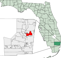
Coordinates: 26°10′35″N 80°08′40″W / 26.17639°N 80.14444°WCoordinates: 26°10′35″N 80°08′40″W / 26.17639°N 80.14444°W Country  United States
State  Florida
County Broward Settled
(Colahatchee)1910 Incorporated (Floranada) 25 November 1925 Incorporated (Oakland Park) 19 June 1929 Government – Type Commission-Manager – Mayor Suzanne Boisvenue[1] – City Manager John Stunson[2] Area[3] – City 6.90 sq mi (17.9 km2) – Land 6.30 sq mi (16.3 km2) – Water 0.60 sq mi (1.6 km2) 8.7% Elevation 9 ft (1 m) Population (2010) – City 41,363 – Density 5,994.6/sq mi (2,314.5/km2) – Metro 5,564,635 Time zone EST (UTC-5) – Summer (DST) EDT (UTC-4) ZIP code 33304-33309, 33311, 33334 Area code(s) 754, 954 FIPS code 12-50575[4] GNIS feature ID 0288013[5] Website http://www.oaklandparkfl.org Oakland Park is a city in Broward County, Florida, United States. Originally named Floranada (a portmanteau of Florida and Canada), the town was forced into bankruptcy after the hurricane of 1926. When the town reincorporated, residents chose the name Oakland Park. As of the 2010 census, the population was 41,363, mainly due to annexation of North Andrews Gardens and Twin Lakes South. It is part of the Miami–Fort Lauderdale–Pompano Beach Metropolitan Statistical Area, which was home to 5,564,635 people at the 2010 census.
Contents
Geography
Oakland Park is located at 26°10′35″N 80°8′40″W / 26.17639°N 80.14444°W (26.176362, -80.144509)[6]. According to the United States Census Bureau, the city has a total area of 6.9 square miles (18 km2). 6.30 square miles (16 km2) of it is land and 0.6 square miles (2 km2) of it (8.70%) is water.
Oakland Park is bisected by the Florida East Coast Railway, which runs parallel to Dixie Highway through the city's downtown. The City of Oakland Park has put into place new zoning regulations intended to transform downtown Oakland Park into a mixed-use pedestrian community. One element of the proposal is the creation of a new commuter rail station on the FEC rail line.
Oakland Park borders the city of Wilton Manors, which is experiencing a tremendous amount of new development. Increased property prices in Wilton Manors have pushed up prices in Oakland Park and spurred interest in the city's downtown redevelopment plan.[7]
Demographics
As of the census[4] of 2000, there were 30,000 people, 13,502 households, and 6,940 families residing in the city. The population density was 4,914.7 per square mile (1,897.8/km²). There were 14,500 housing units at an average density of 2,302.7 per square mile (889.2/km²). The racial makeup of the city was 65.98% White (53.9% were Non-Hispanic White,)[8] 22.65% African American, 0.23% Native American, 1.94% Asian, 0.13% Pacific Islander, 4.45% from other races, and 4.62% from two or more races. Hispanic or Latino of any race were 17.94% of the population.
There were 13,502 households out of which 24.5% had children under the age of 18 living with them, 32.3% were married couples living together, 13.3% had a female householder with no husband present, and 48.6% were non-families. 35.1% of all households were made up of individuals and 7.4% had someone living alone who was 65 years of age or older. The average household size was 2.26 and the average family size was 3.00.
In the city the population was spread out with 20.9% under the age of 18, 9.0% from 18 to 24, 38.7% from 25 to 44, 21.3% from 45 to 64, and 10.2% who were 65 years of age or older. The median age was 36 years. For every 100 females there were 109.1 males. For every 100 females age 18 and over, there were 109.8 males.
The median income for a household in the city was $35,493, and the median income for a family was $38,571. Males had a median income of $30,269 versus $25,514 for females. The per capita income for the city was $18,873. About 13.3% of families and 16.5% of the population were below the poverty line, including 22.1% of those under age 18 and 11.3% of those age 65 or over.
As of 2000, English as a first language comprised 66.52%, while 18.16% spoke Spanish, 6.95% spoke French Creole as theirs, 3.32% spoke Portuguese, 1.99% spoke French, Italian was at 0.64%, and German as a mother tongue made up 0.52% of the population.[9]
As of 2000, Oakland Park was the fifteenth most Brazilian-populated area in the US (tied with several other areas) at 2.1%,[10] and it had the twenty-fifth highest percentage of Haitians in the US, with 7% of the population (tied with Ramapo, New York.)[11]
Also, as of 2000, the North Andrews Gardens section of Oakland Park is the sixty-third most Cuban-populated area in the US at 5.76%, while the rest of Oakland Park had the 113th highest percentage of Cubans with 2.03% of all residents.[12] The North Andrews Gardens section was also the thirty-third most Peruvian-populated area in the US, at 1.51% of the population,[13] as well as having the seventy-fourth highest percentage of Colombians in the US, at 2.03% of all residents.[14]
Government and infrastructure
The United States Postal Service operates post offices in Oakland Park, including the Oakland Park Post Office at 3350 NE 12th Avenue,[15] the Fort Lauderdale Main Post Office at 1900 West Oakland Park Boulevard,[16] the North Andrews Annex at 3400 North Andrews Avenue,[17] and the North Ridge Annex at 4350 North Andrews Avenue.[18]
Economy
The movie theater chain Muvico has its headquarters in Oakland Park.[19][20]
Media
Oakland Park is a part of the Miami-Fort Lauderdale-Hollywood media market, which is the twelfth largest radio market[21] and the seventeenth largest television market[22] in the United States. Its primary daily newspapers are the South Florida Sun-Sentinel and The Miami Herald, and their Spanish-language counterparts El Sentinel and El Nuevo Herald.
Education
The city is served by Broward County Public Schools.
Oakland Park Elementary School is a 1925 school building on the National Register of Historic Places.
References
- ^ Oakland Park, FL City Commission bios
- ^ Oakland Park, FL City Manager bio
- ^ "Florida by Place. Population, Housing, Area, and Density: 2000". US Census Bureau. http://factfinder.census.gov/servlet/GCTTable?_bm=y&-geo_id=04000US12&-_box_head_nbr=GCT-PH1&-ds_name=DEC_2000_SF1_U&-format=ST-7. Retrieved 2007-09-23.
- ^ a b "American FactFinder". United States Census Bureau. http://factfinder.census.gov. Retrieved 2008-01-31.
- ^ "US Board on Geographic Names". United States Geological Survey. 2007-10-25. http://geonames.usgs.gov. Retrieved 2008-01-31.
- ^ "US Gazetteer files: 2010, 2000, and 1990". United States Census Bureau. 2011-02-12. http://www.census.gov/geo/www/gazetteer/gazette.html. Retrieved 2011-04-23.
- ^ "Oakland Park Main Street". Oakland Park Main Street. http://www.oaklandparkmainstreet.com/index.html. Retrieved 2007-09-24.
- ^ "Demographics of Oakland Park, FL". MuniNetGuide.com. http://www.muninetguide.com/states/florida/municipality/Oakland_Park.php. Retrieved 2007-11-15.
- ^ "MLA Data Center Results for Oakland Park, FL". Modern Language Association. http://www.mla.org/map_data_results&state_id=12&county_id=&mode=place&zip=&place_id=50575&cty_id=&ll=&a=&ea=&order=r. Retrieved 2007-09-24.
- ^ "Ancestry Map of Brazilian Communities". Epodunk.com. http://www.epodunk.com/ancestry/Brazilian.html. Retrieved 2007-10-22.
- ^ "Ancestry Map of Haitian Communities". Epodunk.com. http://www.epodunk.com/ancestry/Haitian.html. Retrieved 2007-10-22.
- ^ "Ancestry Map of Cuban Communities". Epodunk.com. http://www.epodunk.com/ancestry/Cuban.html. Retrieved 2007-10-22.
- ^ "Ancestry Map of Peruvian Communities". Epodunk.com. http://www.epodunk.com/ancestry/Peruvian.html. Retrieved 2007-10-22.
- ^ "Ancestry Map of Colombian Communities". Epodunk.com. http://www.epodunk.com/ancestry/Colombian.html. Retrieved 2007-10-22.
- ^ "Post Office Location - OAKLAND PARK." United States Postal Service. Retrieved on May 6, 2009.
- ^ "Post Office Location - FORT LAUDERDALE." United States Postal Service. Retrieved on May 6, 2009.
- ^ "Post Office Location - NORTH ANDREWS ANNEX." United States Postal Service. Retrieved on May 6, 2009.
- ^ "Post Office Location - NORTH RIDGE ANNEX." United States Postal Service. Retrieved on May 6, 2009.
- ^ "Oakland Park city, Florida." U.S. Census Bureau. Retrieved on January 7, 2011.
- ^ "Contact Us." Muvico. Retrieved on January 7, 2011. "Address: MUVICO THEATERS 3101 N. Federal Hwy. 6th Floor Fort Lauderdale, FL 33306-1042."
- ^ "Top 50 Radio Markets Ranked By Metro 12+ Population, Spring 2005". Northwestern University Media Management Center. Archived from the original on 2007-08-07. http://web.archive.org/web/20070807070323/http://www.mediainfocenter.org/compare/top50/#radio. Retrieved 2007-09-24.
- ^ "Top 50 TV markets ranked by households". Northwestern University Media Management Center. Archived from the original on 2007-08-07. http://web.archive.org/web/20070807070323/http://www.mediainfocenter.org/compare/top50/#tv. Retrieved 2007-09-24.
External links
- City of Oakland Park official site
Municipalities and communities of Broward County, Florida Cities Coconut Creek | Cooper City | Coral Springs | Dania Beach | Deerfield Beach | Fort Lauderdale | Hallandale Beach | Hollywood | Lauderdale Lakes | Lauderhill | Lighthouse Point | Margate | Miramar | North Lauderdale | Oakland Park | Parkland | Pembroke Pines | Plantation | Pompano Beach | Sunrise | Tamarac | West Park | Weston | Wilton Manors

Towns Villages CDPs Unincorporated
communityIndian reservations Ghost town South Florida metropolitan area Largest city Counties
(by population)Cities and towns
100k-250kCities and towns
25k-99kAventura • Boca Raton • Boynton Beach • Coconut Creek • Cooper City • Coral Gables • Dania Beach • Davie • Deerfield Beach • Delray Beach • Doral • Greenacres • Hallandale Beach • Homestead • Jupiter • Lake Worth • Lauderdale Lakes • Lauderhill • Margate • Miami Beach • North Lauderdale • North Miami • North Miami Beach • Oakland Park • Palm Beach Gardens • Plantation • Riviera Beach • Sunrise • Tamarac • West Park • Weston • Wilton ManorsCities and towns
10k-25kA list of cities under 10,000 is available here.Categories:- Cities in Broward County, Florida


Wikimedia Foundation. 2010.