- Dodcott cum Wilkesley
-
Coordinates: 52°58′52″N 2°34′01″W / 52.981°N 2.567°W
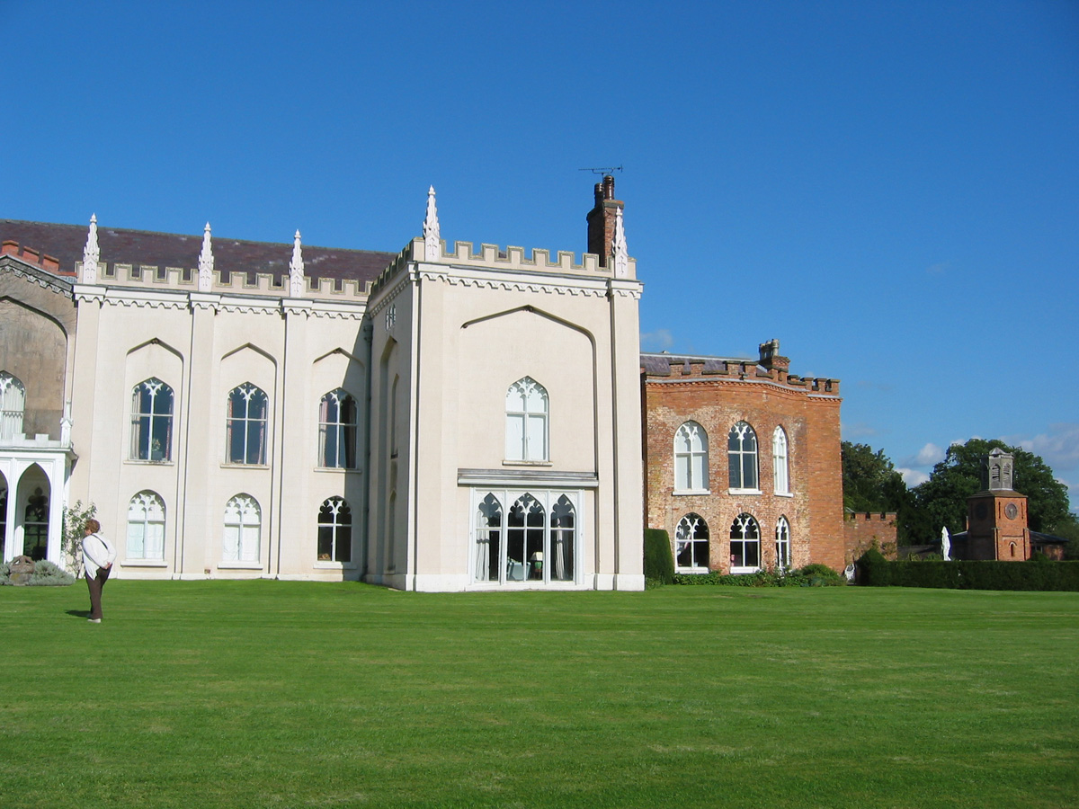
 Combermere Abbey: Abbot's House and clock tower
Dodcott cum Wilkesley is a civil parish in the unitary authority of Cheshire East and the ceremonial county of Cheshire, England. The hamlet of Wilkesley (at SJ628410) lies 2½ miles to the west of Audlem and 7 miles to the south west of Nantwich. The parish also includes the small settlements of Butterley Heyes, Cheshire Fields, Combermere, Lightwood Green, Royal's Green and part of Burleydam.[1] It also formerly contained the settlements of Pinsley Green and Smeaton Wood, now located in Wrenbury cum Frith civil parish.[citation needed] Nearby villages include Adderley, Audlem, Calverhall, Newhall and Wrenbury.
According to the 2001 census, the parish had a population of 380.[2]
Contents
Governance
From 1974 the civil parish was served by Crewe and Nantwich Borough Council, which was succeeded on 1 April 2009 by the new unitary authority of Cheshire East .[3] Dodcott cum Wilkesley falls in the parliamentary constituency of Eddisbury,[4] and has been represented by Stephen O'Brien since 1999.
Geography and transport
 Comber Mere
The park of Combermere Abbey forms much of the area of the civil parish. Outside the park, there are several areas of woodland within the civil parish including Kent's Rough, Walkmill Covert and Wilkesley Covert.
The A525 and A530 roads run east–west and north–south, respectively, through the civil parish.
Combermere Abbey
Combermere Abbey is a former Cistercian monastery which was founded in 1133 and is listed at grade I.[5] Its park includes the large lake of Comber Mere and several areas of mixed woodland, including Poole's Riding Wood.
Places of worship
St Mary and St Michael's Church is located in the village of Burleydam.[1] It dates from 1769 and is listed at grade II.[6]
References
- ^ a b Genuki: Dodcott cum Wilkesley (accessed 14 August 2007)
- ^ Neighbourhood Statistics: Dodcott cum Wilkesley CP (accessed 12 August 2007)
- ^ Cheshire (Structural Changes) Order 2008
- ^ Cheshire County Council: Interactive Mapping: Eddisbury (accessed 27 January 2009)
- ^ Latham FA, ed. Acton, pp. 18–19 (The Local History Group; 1995) (ISBN 0-9522284-1-6)
- ^ Images of England: Church of St Michael (accessed 12 January 2008)
External links
 Media related to Dodcott cum Wilkesley at Wikimedia Commons
Ceremonial county of Cheshire Unitary authorities Major settlements Rivers Topics - History
- Museums
Categories:- Civil parishes in Cheshire
- Villages in Cheshire

Wikimedia Foundation. 2010.