- Worleston
-
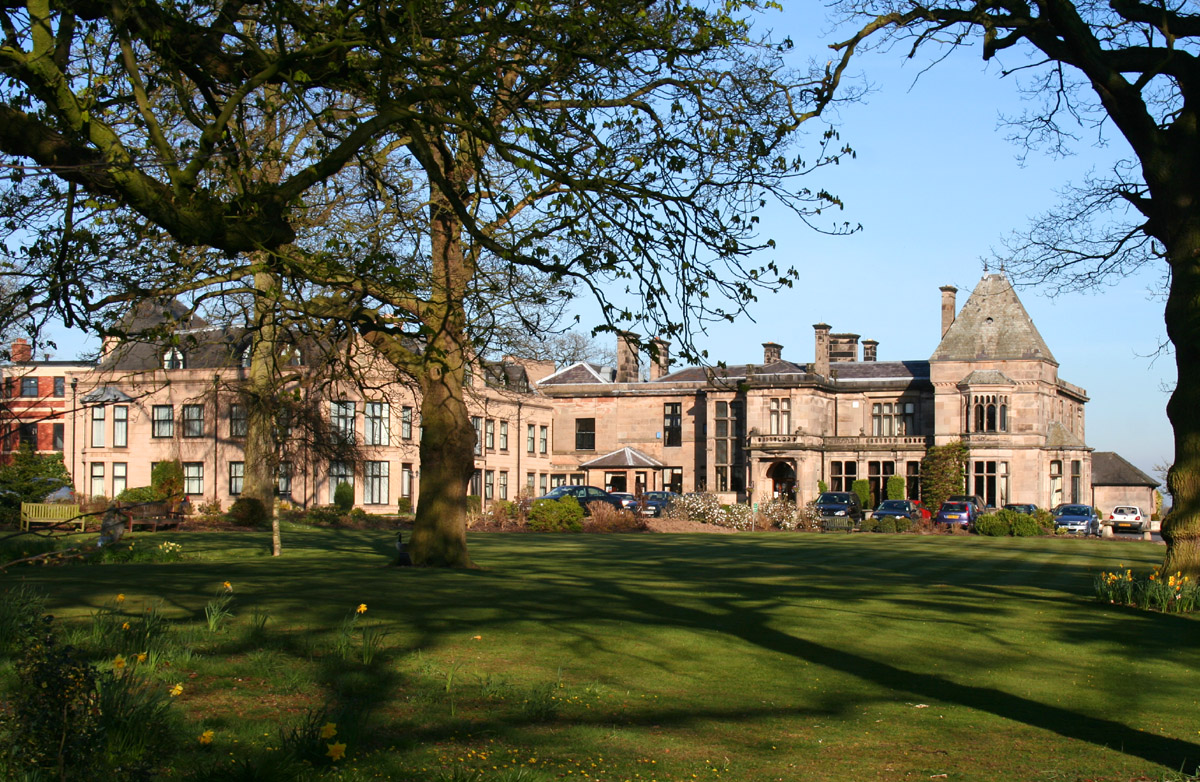
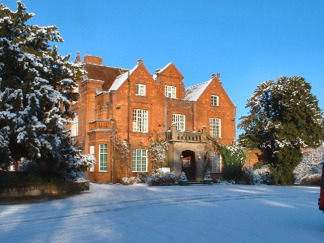
 Rookery Hall
Worleston is a village (at SJ658564) and civil parish in the unitary authority of Cheshire East and the ceremonial county of Cheshire, England. The village lies 2½ miles north of Nantwich and 3 miles west of Crewe. The civil parish also includes the settlements of Beambridge, Rease Heath, Mile End and Rookery, with a total population of a little over 400.[1]
Contents
History
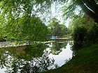
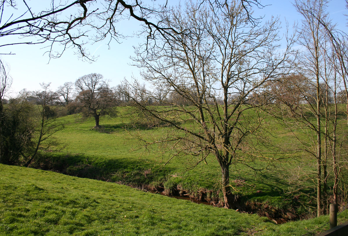
 Tributary of the Weaver
Historically, Worleston civil parish was included within the ancient parish of Acton, and St Mary's Church, Acton was the parish church.[2] The small civil parish of Alvaston was added to Worleston in 1899, and part of the parish was transferred to Nantwich in 1936.[1]
Geography and transport
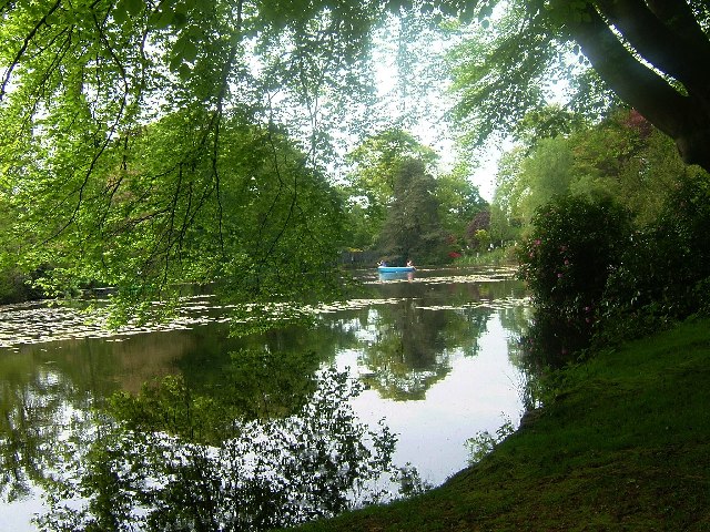
Nearby villages include Acton, Aston juxta Mondrum, Willaston and Wistaston. The River Weaver forms the eastern boundary of the parish, with a tributary running east–west across the parish, south of Rookery Hall. Other Weaver tributaries form parts of the south-eastern, western and northern parish boundaries. The Reaseheath College at Rease Heath has a lake, and there are numerous small meres and ponds scattered across the farmland.
 Reaseheath College lake
The A51 runs east–west along the southern boundary of the parish, and the B5074 road runs north–south through it, crossing the tributary of the Weaver at Rookery Bridge. The Crewe–Chester railway line crosses the northern tip of the parish. The civil parish has relatively few public footpaths, with none to the east of the B5074; the longest footpath cuts west from the B5074 to Rease Heath.[3]
Demographics
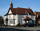 Royal Oak
According to the 2001 census, the parish had a population of 404, with 96 households.[4] The historical population figures were 269 (1801), 337 (1851), 485 (1901) and 383 (1951);[1] the changes partly reflect boundary alterations (described previously).
Landmarks
 Reaseheath College
Rookery Hall, a grade-II-listed mansion dating from 1816, is located off the B5074 near Worleston village; it is now a hotel and restaurant.[5] The Royal Oak public house, on the B5074 in Worleston village, is a timber-framed building dating originally from the 1730s.[6]
The small settlement of Rease Heath (also spelled Reaseheath), adjacent to Nantwich, contains Reaseheath College, as well as the grade-II-listed Rease Heath Old Hall, an L-shaped farmhouse in red brick dating from the late 18th century.[7] A moated site (SJ65095423) at Rease Heath is a scheduled ancient monument.[8]
Places of worship
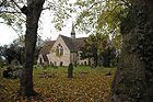 St Oswald's Church
The grade-II-listed St Oswald's Church, founded 1873, is in Worleston village (within Aston juxta Mondrum civil parish).[1] A major fire in 1997 damaged the roof, chancel and organ loft; the church has since been restored.[9][10] St Oswald's has been administered since 1991 as a united benefice, the Cross Country Group of Parish Churches, with St Mary's, Acton, St Bartholomew's, Church Minshull, and St David's, Wettenhall. It falls into the rural deanery of Nantwich and the diocese of Chester.[2] Since 2007, the vicar has been the Reverend Peter Lillicrap.[11] A magazine, Cross Country, is circulated across all four churches.[12]
Worleston Methodist Chapel was founded in 1871 and closed in 1969.[1]
Education
The village is served by the nearby St Oswald's CE Primary School (SJ652567), originally Worleston National School, on Church Road, Aston juxta Mondrum.[13]
See also
References
- ^ a b c d e Genuki: Worleston (accessed 15 August 2007)
- ^ a b Latham, p. 9
- ^ Cheshire County Council: Interactive Mapping: Worleston (accessed 29 February 2008)
- ^ Neighbourhood Statistics: Worleston CP (accessed 29 February 2008)
- ^ Images of England: Rookery Hall (accessed 29 February 2008)
- ^ Latham, p. 98
- ^ Images of England: Reaseheath Old Hall (accessed 29 February 2008)
- ^ Borough of Crewe & Nantwich: Scheduled Ancient Monuments (accessed 29 February 2008)
- ^ Cross Country Group of Parish Churches: History of St Oswald's Church (accessed 29 February 2008)
- ^ Geograph: St. Oswald's Church, Worleston after the fire & St. Oswald's Church, Worleston after the fire (accessed 29 February 2008)
- ^ Cross Country Group of Parish Churches: Church Officers: Reverend Peter Lillicrap (accessed 26 February 2008)
- ^ Acton, Edleston and Henhull Parish Plan (accessed 17 August 2007)
- ^ Latham, pp. 91–2
Source
- Latham FA, ed. Acton (The Local History Group; 1995) (ISBN 0 9522284 1 6)
External links
 Media related to Worleston at Wikimedia Commons
Ceremonial county of Cheshire Unitary authorities Major settlements Rivers Topics - History
- Museums
Categories:- Civil parishes in Cheshire
- Villages in Cheshire


Wikimedia Foundation. 2010.