- Mathonville
-
Mathonville

 MathonvilleLocation within Upper Normandy region
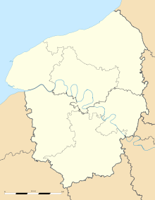 Mathonville
Administration Country France Region Upper Normandy Department Seine-Maritime Arrondissement Dieppe Canton Saint-Saëns Intercommunality Saint-Saëns-Portes de Bray Mayor Patrick Guerard Statistics Elevation 170–229 m (560–751 ft)
(avg. 220 m/720 ft)Land area1 4.09 km2 (1.58 sq mi) Population2 223 (2006) - Density 55 /km2 (140 /sq mi) INSEE/Postal code 76416/ 76680 1 French Land Register data, which excludes lakes, ponds, glaciers > 1 km² (0.386 sq mi or 247 acres) and river estuaries. 2 Population without double counting: residents of multiple communes (e.g., students and military personnel) only counted once. Coordinates: 49°37′20″N 1°22′59″E / 49.6222222222°N 1.38305555556°E
Mathonville is a commune in the Seine-Maritime department in the Haute-Normandie region in northern France.
Its inhabitants are called Mathonville and Mathonvillaises.
Contents
Geography
A small farming village situated in the Pays de Bray, some 35 miles (56 km) southeast of Dieppe at the junction of the D118 and the D38 roads.
Surrounded by the municipalities of Bosc-Bordel , Montérolier and Buchy , Mathonville is located 28 km northeast of Mont-Saint-Aignan, the largest city nearby. [1]
Population
Population history 1962 1968 1975 1982 1990 1999 2006 108 110 139 137 154 174 223 Starting in 1962: Population without duplicates See also
References
External links
- Mathonville on the Quid website (French)
Categories:- Communes of Seine-Maritime
- Dieppe geography stubs


Wikimedia Foundation. 2010.