- National Register of Historic Places listings in Missouri, Counties L–N
-
List of Registered Historic Places in Missouri, Counties L–N:
Contents: Counties in Missouri A–B · C · D–I · Jackson · J–K · L–N · O–St. · St. Louis · Ste.–Z Laclede – Lafayette – Lawrence – Lewis – Lincoln – Linn – Livingston – Macon – Madison – Maries – Marion – McDonald – Mercer – Miller – Mississippi – Moniteau – Monroe – Montgomery – Morgan – New Madrid – Newton – Nodaway -
- This National Park Service list is complete through NPS recent listings posted November 10, 2011.[1]
Laclede County
[2] Landmark name Image Date listed Location City or town Summary 1 Bennett Spring State Park Hatchery-Lodge Area Historic District 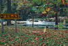
March 4, 1985 MO A64
37°43′31″N 92°51′24″W / 37.725278°N 92.856667°WBennett Spring 2 Ralph E. Burley House July 7, 1994 389 S. Adams Ave.
37°40′44″N 92°39′36″W / 37.678889°N 92.66°WLebanon 3 Joe Knight Building September 6, 2005 201 W. Commercial St.
37°40′54″N 92°39′54″W / 37.681667°N 92.665°WLebanon 4 Laclede County Jail March 27, 1980 Adams and 3rd Sts.
37°40′59″N 92°39′52″W / 37.683056°N 92.664444°WLebanon 5 Ploger-Moneymaker Place September 23, 1982 291 Harwood Ave.
37°41′08″N 92°39′47″W / 37.685556°N 92.663056°WLebanon 6 Wallace House March 22, 1984 230 Harwood Ave.
37°41′05″N 92°39′46″W / 37.684722°N 92.662778°WLebanon Lafayette County
Lawrence County
[2] Landmark name Image Date listed Location City or town Summary 1 Lawrence County Bank Building March 10, 2005 100 W. Commercial St.
36°56′41″N 94°00′10″W / 36.944722°N 94.002778°WPierce City 2 Lawrence County Courthouse September 23, 1980 City Sq.
37°06′12″N 93°49′06″W / 37.103333°N 93.818333°WMount Vernon 3 Old Spanish Fort Archeological Site 
January 25, 1971 Address Restricted Mount Vernon 4 Pierce City Fire Station, Courthouse and Jail August 28, 1998 Walnut St.
36°56′44″N 94°00′11″W / 36.945556°N 94.003056°WPierce City Lewis County
[2] Landmark name Image Date listed Location City or town Summary 1 William Gray House June 3, 1999 407 Washington
40°02′34″N 91°30′07″W / 40.042778°N 91.501944°WLa Grange 2 Dr. J.A. Hay House June 3, 1999 406 W. Monroe St.
40°02′43″N 91°30′06″W / 40.045278°N 91.501667°WLa Grange 3 Henderson Hall October 2, 1978 College Hill
40°07′50″N 91°31′49″W / 40.130556°N 91.530278°WCanton 4 Joseph Hipkins House May 8, 2008 500 S. 3rd St. La Grange 5 Lewis County Courthouse January 12, 2005 100 E. Lafayette St.
40°07′05″N 91°42′51″W / 40.118056°N 91.714167°WMonticello 6 Lincoln School February 10, 1983 MO B
40°07′31″N 91°31′01″W / 40.125278°N 91.516944°WCanton 7 Lock and Dam No. 20 Historic District March 10, 2004 0.5 mi. N of Henderson St. Canton 8 John McKoon House June 3, 1999 500 W. Monroe St.
40°02′43″N 91°30′07″W / 40.045278°N 91.501944°WLa Grange 9 Quincy, Missouri, and Pacific Railroad Station May 7, 1979 Off MO 16
40°05′11″N 91°48′26″W / 40.086389°N 91.807222°WLewistown 10 Fred Rhoda House June 3, 1999 200 S. Second St.
40°02′27″N 91°29′57″W / 40.040833°N 91.499167°WLa Grange 11 A.C. Waltman House June 3, 1999 302 Lewis St.
40°02′25″N 91°30′02″W / 40.040278°N 91.500556°WLa Grange Lincoln County
[2] Landmark name Image Date listed Location City or town Summary 1 Camp Sherwood Forest Historic District March 4, 1985 SW of Elsberry in Cuivre State Park
39°02′35″N 90°54′57″W / 39.043056°N 90.915833°WElsberry 2 Cuivre River State Park Administrative Area Historic District March 4, 1985 SW of Elsberry in Cuivre State Park
39°00′22″N 90°55′36″W / 39.006111°N 90.926667°WElsberry Administrative area within Cuivre River State Park 3 Lock and Dam No. 25 Historic District March 10, 2004 10 Sandy Slough Rd. Winfield 4 Old Rock House October 18, 1972 2nd and Mill Sts.
38°56′57″N 90°54′53″W / 38.949167°N 90.914722°WMoscow Mills Linn County
[2] Landmark name Image Date listed Location City or town Summary 1 Linn County Courthouse October 14, 1999 108 High St.
39°52′46″N 93°11′21″W / 39.879444°N 93.189167°WLinneus 2 Linn County Jail and Sheriff's Residence January 16, 2001 102 N. Main St.
39°52′45″N 93°11′18″W / 39.879167°N 93.188333°WLinneus 3 Locust Creek Covered Bridge May 19, 1970 3 mi. W of Laclede off U.S. 36
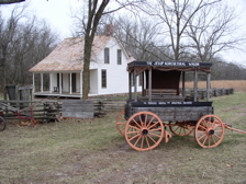
39°47′30″N 93°14′03″W / 39.791667°N 93.234167°WLaclede Longest of four surviving covered bridges in Missouri 4 Gen. John J. Pershing Boyhood Home 
May 21, 1969 State and Worlow Sts.
39°47′17″N 93°10′08″W / 39.788056°N 93.168889°WLaclede 5 Plum Grove School October 22, 1994 County Rd. 350, 3/8 mi. N of jct. with County Rd. 346
39°48′48″N 93°12′04″W / 39.813333°N 93.201111°WLaclede Livingston County
[2] Landmark name Image Date listed Location City or town Summary 1 Chillicothe Commercial Historic District October 16, 2002 Roughly bounded Clay, Ann, Washington, and Locust Sts.
39°47′32″N 93°33′09″W / 39.792222°N 93.5525°WChillicothe 2 Chillicothe Industrial Home for Girls April 19, 2010 1500 Third St.
39°47′22″N 93°33′45″W / 39.789467°N 93.562547°WChillicothe 3 Courthouse Square Historic District October 16, 2002 Roughly bounded by Calhoun, Jackson, Washington, and Elm Sts.
39°47′39″N 93°33′09″W / 39.794167°N 93.5525°WChillicothe 4 Grace Episcopal Church and Building September 17, 1980 421 Elm St.
39°47′30″N 93°32′23″W / 39.791667°N 93.539722°WChillicothe Macon County
[2] Landmark name Image Date listed Location City or town Summary 1 Blees Military Academy October 11, 1979 U.S. 63
39°43′14″N 92°28′00″W / 39.720556°N 92.466667°WMacon 2 Lester and Norma Dent House May 18, 1990 225 N. Church St.
40°01′31″N 92°29′41″W / 40.025278°N 92.494722°WLa Plata 3 John T. and Mary M. Doneghy House March 22, 1990 301 N. Owensby St.
40°01′33″N 92°29′35″W / 40.025833°N 92.493056°WLa Plata 4 Gardner and Tinsley Filling Station April 25, 2002 Old US 36, near jct. with MO 149 New Cambria 5 Gilbreath-McLorn House November 16, 1978 225 N. Owenby
40°01′31″N 92°29′36″W / 40.025278°N 92.493333°WLa Plata 6 La Plata Square Historic District November 20, 2008 Along portions of Gex, Sanders, and Moore St. La Plata 7 Macon County Courthouse and Annex December 8, 1978 Courthouse Sq.
39°44′32″N 92°28′22″W / 39.742222°N 92.472778°WMacon 8 Johnson Morrow House July 7, 1994 Second St. W of jct. with Pine St.
39°45′44″N 92°37′33″W / 39.762222°N 92.625833°WCallao 9 Wardell House March 12, 1986 1 Wardell Rd.
39°44′32″N 92°28′37″W / 39.742222°N 92.476944°WMacon Madison County
[2] Landmark name Image Date listed Location City or town Summary 1 Fredericktown Courthouse Square Historic District July 8, 2009 110-145 E. Main St., 106-125 W. Main St., 110-120 S. Main St. and Court Square
37°33′35″N 90°17′30″W / 37.559639°N 90.291667°WFredericktown 2 Fredericktown Missouri Pacific Railroad Depot February 10, 2000 406 Villar St.
37°33′52″N 90°17′30″W / 37.564444°N 90.291667°WFredericktown 3 Fredericktown United States Post Office October 8, 2009 155 S. Main St.
37°33′31″N 90°17′40″W / 37.558647°N 90.294492°WFredericktown 4 Madison County Courthouse December 28, 2000 1 Courthouse Sq.
37°33′34″N 90°17′40″W / 37.559444°N 90.294444°WFredericktown 5 St. Louis, Iron Mountain and Southern Railroad Depot October 19, 2005 Allen St., 150 ft. No of Jct. of Allen and Kelly Sts.
37°34′03″N 90°17′35″W / 37.5675°N 90.293056°WFredericktown Maries County
[2] Landmark name Image Date listed Location City or town Summary 1 Maries County Jail and Sheriff's House March 1, 2002 Jct. of Fifth and Mill Sts.
38°11′11″N 91°56′46″W / 38.186389°N 91.946111°WVienna Marion County
McDonald County
[2] Landmark name Image Date listed Location City or town Summary 1 Pineville Site July 28, 1999 Address Restricted Pineville 2 Powell Bridge April 20, 2011 .04 miles (0.064 km) southwest of Powell on Cowan Ridge Rd. off Highway E
36°36′57″N 94°10′56″W / 36.615833°N 94.182222°WPowell vicinity Mercer County
[2] Landmark name Image Date listed Location City or town Summary 1 Herbert Cain and Corah Brantley Casteel House July 14, 1995 Address Restricted Princeton 2 Leo Ellis Post No. 22, American Legion Building April 26, 1996 804 Grant St.
40°24′01″N 93°35′03″W / 40.400278°N 93.584167°WPrinceton Miller County
[2] Landmark name Image Date listed Location City or town Summary 1 Bagnell Dam and Osage Power Plant 
August 27, 2008 617 River Rd.
38°12′14″N 92°37′27″W / 38.203889°N 92.624167°WLake Ozark 2 Boeckman Bridge March 19, 1979 Southeast of St. Elizabeth over Big Tavern Creek
38°13′35″N 92°14′23″W / 38.226389°N 92.239722°WSt. Elizabeth 3 Iberia Academy and Junior College September 4, 1980 Missouri Route 17 and Missouri Route 42
38°05′25″N 92°17′48″W / 38.090278°N 92.296667°WIberia 4 Lake of the Ozarks State Park Highway 134 Historic District February 26, 1985 West of Brumley along Missouri Route 134
38°06′37″N 92°34′00″W / 38.110278°N 92.566667°WBrumley 5 Olean Railroad Depot December 23, 1993 Main St. east of junction with California St.
38°24′38″N 92°31′42″W / 38.410556°N 92.528333°WOlean 6 P.A. Sanning Store June 16, 2005 256 MO H
38°18′22″N 92°21′29″W / 38.306111°N 92.358056°WMary's Home 7 Union Electric Administration Building-Lakeside April 13, 1998 1 Willmore Ln.
38°12′37″N 92°37′26″W / 38.21028°N 92.62389°W
Boundary increase (listed June 23, 2011): 1 Willmore Ln.Lakeside Mississippi County
[2] Landmark name Image Date listed Location City or town Summary 1 Beckwith's Fort Archeological Site July 29, 1969 Address Restricted Wolf Island 2 Crosno Fortified Village Archeological Site May 21, 1969 Address Restricted Crosno 3 Hearnes Site November 26, 1973 Address Restricted Charleston 4 Hess Archeological Site July 12, 1974 Address Restricted East Prairie 5 Hoecake Village Archeological Site January 13, 1972 Address Restricted East Prairie 6 Missouri Pacific Depot November 30, 1972 E of intersecting branches of Missouri Pacific RR.
36°50′51″N 89°21′28″W / 36.8475°N 89.357778°WCharleston 7 Moore House September 18, 1980 403 N. Main St.
36°55′22″N 89°21′00″W / 36.922778°N 89.35°WCharleston 8 Mueller Archeological Site August 13, 1974 Address Restricted East Prairie 9 O'Bryan Ridge Archeological District November 9, 1972 Address Restricted Wyatt 10 Jacob Swank House April 13, 1973 0.2 mi. W of Charleston on U.S. 60 and 62
36°55′19″N 89°22′15″W / 36.921944°N 89.370833°WCharleston Moniteau County
[2] Landmark name Image Date listed Location City or town Summary 1 Louis Bruce Farmstead Historic District January 7, 1992 MO V N of jct. with MO A, at Rock Enon Cr.
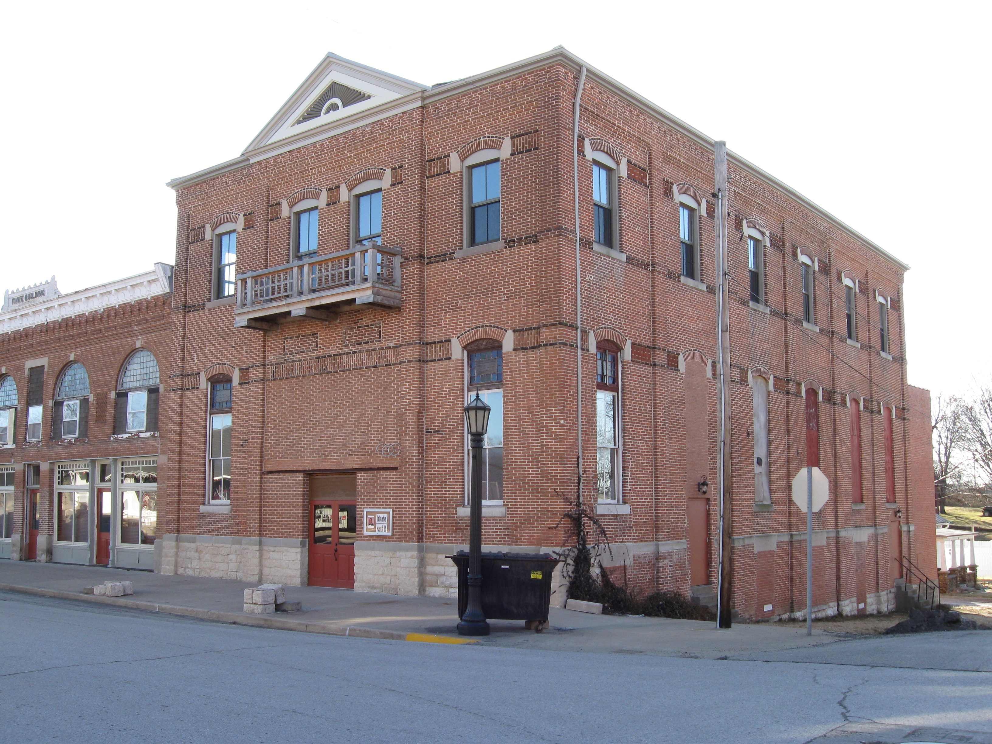
38°27′53″N 92°31′07″W / 38.464722°N 92.518611°WRussellville 2 Finke Opera House 
March 22, 2004 312 N. High St.
38°38′07″N 92°33′55″W / 38.635278°N 92.565278°WCalifornia 3 Geiger Archeological Site July 29, 1969 Address Restricted Sandy Hook 4 Gray-Wood Buildings 
January 19, 1984 401-407 N. High St.
38°38′15″N 92°33′55″W / 38.6375°N 92.565278°WCalifornia 5 High Point Historic District January 26, 2005 61235-61243 MO C
38°29′04″N 92°35′24″W / 38.484444°N 92.59°WHigh Point 6 Maclay Mansion February 26, 1979 209 W. Howard St.
38°39′35″N 92°46′54″W / 38.659722°N 92.781667°WTipton 7 Moniteau County Courthouse Square 
October 15, 1970 Public Sq.
38°38′11″N 92°33′53″W / 38.636389°N 92.564722°WCalifornia 8 Old Barnhill Building April 12, 1982 301 N. High St.
38°38′05″N 92°33′56″W / 38.634722°N 92.565556°WCalifornia 9 Old California City Hall and Fire Station April 12, 1982 101 N. High St.
38°37′58″N 92°33′55″W / 38.632778°N 92.565278°WCalifornia Monroe County
[2] Landmark name Image Date listed Location City or town Summary 1 Crigler Mound Group Archeological Site May 21, 1969 Address Restricted Florida 2 Holliday Petroglyphs January 11, 1974 Address Restricted Holliday 3 Mark Twain State Park Picnic Shelter at Buzzard's Roost March 4, 1985 Off MO 107
39°28′23″N 91°47′37″W / 39.473056°N 91.793611°WSanta Fe 4 Paris Male Academy July 19, 1990 411 E. Monroe St.
39°28′56″N 91°59′40″W / 39.482222°N 91.994444°WParis 5 St. Jude's Episcopal Church November 22, 2000 301 N. Main St.
39°39′16″N 91°44′05″W / 39.654444°N 91.734722°WMonroe City 6 Mark Twain Birthplace Cabin May 21, 1969 Mark Twain State Park, 2.5 mi. S of Florida on MO 107
39°30′48″N 91°45′06″W / 39.513333°N 91.751667°WFlorida 7 Union Covered Bridge June 15, 1970 6 mi. W of Paris on Elk Fork of the Salt River Paris 8 Merritt Violette House September 8, 1983 Off MO 107
39°29′37″N 91°47′06″W / 39.493611°N 91.785°WFlorida 9 Washington School December 29, 1994 529 S. Locust St.
39°38′17″N 91°44′12″W / 39.638056°N 91.736667°WMonroe City Montgomery County
[2] Landmark name Image Date listed Location City or town Summary 1 Sylvester Marion and Frances Anne Stephens Baker House August 20, 1999 60 Boonslick Rd.
38°54′30″N 91°31′37″W / 38.908333°N 91.526944°WMontgomery City 2 Farmers Mercantile Co. Building June 16, 2004 872 Boone's Lick Rd.
38°52′41″N 91°23′04″W / 38.878056°N 91.384444°WHigh Hill 3 Heinrich Gloe House February 7, 2007 358 Hwy P
38°45′18″N 91°33′32″W / 38.755°N 91.558889°WRhineland 4 Graham Cave 
October 15, 1966 0.5 mi. N of Mineola
38°54′19″N 91°34′23″W / 38.905278°N 91.573056°WMineola 5 High Hill School November 14, 1980 Off U.S. 40
38°52′42″N 91°22′52″W / 38.878333°N 91.381111°WHigh Hill 6 McKittrick Farmers Mercantile June 7, 2010 500 Washington St McKittrick 7 Mount Horeb Baptist Church September 27, 1980 W of Mineola
38°50′40″N 91°38′31″W / 38.844444°N 91.641944°WMineola 8 Pinnacle Lake Rock Shelter July 29, 1969 Address Restricted Big Spring 9 Shrine of Our Lady of Sorrows September 9, 1982 SR P
38°44′02″N 91°33′10″W / 38.733889°N 91.552778°WStarkenburg Morgan County
[2] Landmark name Image Date listed Location City or town Summary 1 Martin Hotel September 6, 1978 118 N. Monroe St.
38°25′57″N 92°50′29″W / 38.4325°N 92.841389°WVersailles 2 Morgan County Courthouse January 10, 1980 Courthouse Sq.
38°25′53″N 92°51′11″W / 38.431389°N 92.853056°WVersailles 3 Old St. Patrick's Church March 2, 1979 S of Gravois Mills on SR 0
38°17′43″N 92°49′16″W / 38.295278°N 92.821111°WGravois Mills 4 Jesse Ratcliff House April 12, 1982 NE of Barnett
38°24′09″N 92°38′17″W / 38.4025°N 92.638056°WBarnett New Madrid County
[2] Landmark name Image Date listed Location City or town Summary 1 Double Bridges Archeological Site July 25, 1974 Address Restricted Portageville 2 Hurricane Ridge Site November 9, 1972 Address Restricted Catron 3 King II Archeological Site June 26, 1975 Address Restricted Howardville 4 La Plant Archeological Site July 25, 1974 Address Restricted La Forge 5 Lilbourn Fortified Village Archeological Site July 29, 1969 Address Restricted Lilbourn 6 Portwood Village and Mound November 25, 1977 Address Restricted Portageville 7 Sikeston Fortified Village Archeological Site February 12, 1971 Address Restricted Sikeston 8 St. Johns-Laplant IV Archeological District August 28, 1975 Address Restricted Bayouville Newton County
[2] Landmark name Image Date listed Location City or town Summary 1 First Battle of Newtonia Historic District December 23, 2004 Jct. of MO 86 and MO 0
36°53′05″N 94°11′02″W / 36.884722°N 94.183889°WNewtonia 2 Bonnie & Clyde Garage Apartment 
May 15, 2009 3 mi. S of Monument
36°59′07″N 94°21′18″W / 36.985278°N 94.355°WJoplin 3 George Washington Carver National Monument 
October 15, 1966 3 mi. S of Monument
36°59′07″N 94°21′18″W / 36.985278°N 94.355°WDiamond 4 Jolly Mill October 13, 1983 SW of Pierce City
36°53′50″N 94°04′18″W / 36.897222°N 94.071667°WPierce City 5 Lentz-Carter Merchandise Store August 19, 2008 744 Ozark St. Stella 6 Neosho Commercial Historic District August 12, 1993 Along sections of Main, Spring, Washington and Wood Sts.; also 114, 116, 118-120, 120, and 124-126 S. Wood St.
36°52′11″N 94°22′03″W / 36.869722°N 94.3675°WNeosho Second set of boundaries represents a boundary increase of April 18, 2007 7 Neosho High School August 30, 2002 W. McCord and N. Wood Sts.
36°52′17″N 94°22′08″W / 36.871389°N 94.368889°WNeosho 8 Mathew H. Ritchey House December 5, 1978 Mill St.
36°52′39″N 94°10′58″W / 36.8775°N 94.182778°WNewtonia 9 Second Baptist Church January 4, 1996 430 W. Grant St.
36°52′31″N 94°22′29″W / 36.875278°N 94.374722°WNeosho 10 Second Battle of Newtonia Site December 23, 2004 Roughly an area NW,SW and SE of jct. of MO 86 and Rte 0 at Newtonia
36°52′19″N 94°11′36″W / 36.871944°N 94.193333°WNewtonia Nodaway County
See also
References
- ^ "National Register of Historic Places: Weekly List Actions". National Park Service, United States Department of the Interior. Retrieved on November 10, 2011.
- ^ Numbers represent an ordering by significant words. Various colorings, defined here, differentiate National Historic Landmark sites and National Register of Historic Places Districts from other NRHP buildings, structures, sites or objects.
U.S. National Register of Historic Places Topics Lists by states Alabama • Alaska • Arizona • Arkansas • California • Colorado • Connecticut • Delaware • Florida • Georgia • Hawaii • Idaho • Illinois • Indiana • Iowa • Kansas • Kentucky • Louisiana • Maine • Maryland • Massachusetts • Michigan • Minnesota • Mississippi • Missouri • Montana • Nebraska • Nevada • New Hampshire • New Jersey • New Mexico • New York • North Carolina • North Dakota • Ohio • Oklahoma • Oregon • Pennsylvania • Rhode Island • South Carolina • South Dakota • Tennessee • Texas • Utah • Vermont • Virginia • Washington • West Virginia • Wisconsin • WyomingLists by territories Lists by associated states Other Categories:- National Register of Historic Places in Missouri
-


Wikimedia Foundation. 2010.