- North Weald Bassett
-
Coordinates: 51°43′09″N 0°09′46″E / 51.71930°N 0.16284°E
North Weald 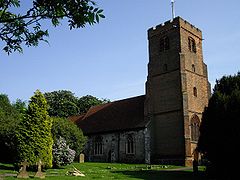
St Andrews Church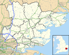
 North Weald
North Weald shown within EssexPopulation 6,039 [1] OS grid reference TL495045 Parish North Weald Bassett District Epping Forest Shire county Essex Region East Country England Sovereign state United Kingdom Post town EPPING Postcode district CM16 Dialling code 01992 Police Essex Fire Essex Ambulance East of England EU Parliament East of England UK Parliament Brentwood and Ongar List of places: UK • England • Essex North Weald Bassett (locally known as North Weald) is a village and civil parish in the Epping Forest district of the county of Essex, England. It is located 3.0 miles (4.8 km) east of Epping, 3.5 miles (5.6 km) south-east of Chipping Ongar and 3.2 miles (5.1 km) south of Harlow.
The village is known in the South East of England for its market, held every Saturday and Bank Holiday Monday at North Weald Airfield. The market is the biggest open air market in the country.[2] To the east of the village can be found the first organic farm in Essex[citation needed], Ashlyns Organic Farm.
Contents
Transport
Bus
Number Route Operation Operator 7/7A/7B Ivy Chimneys Spotted Dog/Epping Station  to Chelmsford Bus Station via Ongar
Mon-Fri Regal Busways 20/21 Brentwood Warley Old Ford/Ongar Two Brewers to Harlow Bus Station via Epping Station Mon-Sat. Route 20 operates Ongar-Epping-Harlow, route 21 operates Brentwood-Ongar-Epping-Harlow. SM Coaches 380/381/382 
Ongar/Toot Hill/Coopersale to Harlow Bus Station via Epping, Epping Green, Roydon Mon-Sat. Essex CC contract. Regal Busways 381 Ongar/Toot Hill/Coopersale via Epping, Epping Green, Roydon Mon-Sat. SM Coaches 501 Ongar Two Brewers to Harlow Bus Station via Epping Sundays only. Essex CC contract. Arriva Shires & Essex Also see List of bus routes in Essex.
Train
Since the closure of the Central Line between Epping and Ongar in 1994, there is no longer a daily commuter train service in the village. The Epping Ongar Railway operates the former Central Line track, from North Weald Station on Sundays every hour to Ongar Station.
The nearest London Underground service to the village is Epping which is served by the Central Line. The closest National Rail service is from Harlow Town, which is served by the West Anglia Main Line and is operated by National Express East Anglia.
Sport
North Weald is home to Bantham and Ongar Bowls Club who play behind the Talbot pub and North Weald Wireless Station Bowls Club who play next to the old BT Telecom site. North Weald is also home to North Weald Cricket Club who play on the Memorial Playing Fields on School Green Lane. There is also two football teams, Weald Bassett who are a junior side and North Weald who play in the Bishop's Stortford and District Football League their first team play at Stonards Hill in Epping whilst the reserves play at the Memorial Playing Fields.
Place of Interest
The Redoubt / Mobilisation Centre [3] at North Weald was built at the end of the 19th century. It was one of several built to provide ammunition to protect London if war ever broke out. One Allen Williams Turret still survives there, 199 of these were built in the UK. This is possibly one of the last survivors. Two were built at North Weald to protect a nearby radio station.
See also
 Media related to North Weald Bassett at Wikimedia Commons
External links
- North Weald Bassett Parish Council
- North Weald Market
- Flying Group trips from North Weald
- North Weald Golf Club
- The Kings Head Pub
- North Weald Airfield Users Group
- North Weald Fire Rescue
- Epping Ongar Railway
- North Weald Cricket Club
- North Weald Airfield history
- History of North Weald Redoubt
- Queens Hall Community Centre
References
- ^ http://www.eppingforestdc.gov.uk/council_services/planning/census/northwealdbassett.asp
- ^ http://www.hughmark.co.uk/nw_video.html
- ^ http://www.undergroundkent.co.uk/north_weald_redoubt.htm
The District of Epping Forest Parishes Abbess Beauchamp and Berners Roding • Bobbingworth • Buckhurst Hill • Chigwell • Epping • Epping Upland • Epping Green • Fyfield • High Laver and Little Laver • High Ongar • Lambourne • Loughton • Magdalen Laver • Matching • Matching Green • Matching Tye • Moreton • Nazeing • North Weald Bassett • Chipping Ongar • High Ongar • Roydon • Sheering • Stanford Rivers • Stapleford Abbotts • Stapleford Tawney • Theydon Bois • Theydon Garnon • Theydon Mount • Waltham Abbey • WillingaleAttractions Constituencies Categories:- Epping Forest
- Villages in Essex


Wikimedia Foundation. 2010.