- Rochford (district)
-
Rochford District — Non-metropolitan district — Rochford shown within Essex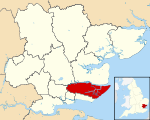
Sovereign state United Kingdom Constituent country England Region East of England Non-metropolitan county Essex Status Non-metropolitan district Admin HQ Rochford Incorporated 1 April 1974 Government – Type Non-metropolitan district council – Body Rochford District Council – Leadership Alternative - Sec. 31 (Conservative) – MPs James Duddridge
Mark FrancoisArea – Total 65.4 sq mi (169.49 km2) Area rank 177th (of 326) Population (2010 est.) – Total 83,400 – Rank 279th (of 326) – Density 1,274.4/sq mi (492.1/km2) – Ethnicity 96.5% White
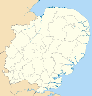
1.2% S.AsianTime zone GMT (UTC0) – Summer (DST) BST (UTC+1) ONS code 22UL OS grid reference TQ876904 Website www.rochford.gov.uk Rochford is a local government district in Essex, England. It is named for one of its main settlements, Rochford, though the major centre of population in the district is the town of Rayleigh. Other places in the district include Hockley, Ashingdon, Great Wakering, Canewdon and Hullbridge.
It was formed on 1 April 1974 by the merger of the Rayleigh Urban District and the Rochford Rural District.
Rochford District is twinned with the German town of Haltern.
Energy and environment policy
In October 2009, the Rochford District was commended at a national level for its outstanding progress in boosting domestic recycling rates from "below 20 per cent to nearly 70 per cent",[1] in the National Recycling Awards.[2] Rochford District was nominated in the Local Authority Target Success category, and beat four other short-listed local authorities to claim the award.[3]
In May 2006, a report commissioned by British Gas[4] showed that housing in the district of Rochford produced the 9th highest average carbon emissions in the country at 7,219 kg of carbon dioxide per dwelling.
- See also: Energy efficiency in British housing.
References
- ^ Rochford District Council wins National Recycling Award Rochford District Council MattersOnline
- ^ National Recycling Awards
- ^ Winners 2009 The National Recycling Award
- ^ http://www.britishgasnews.co.uk/managed_content/files/pdf/greenCity.pdf britishbasnews.co.uk
External links
 Districts of the East of England
Essex Basildon • Braintree • Brentwood • Castle Point • Chelmsford • Colchester • Epping Forest • Harlow • Maldon • Rochford • Southend-on-Sea • Tendring • Thurrock • Uttlesford
Hertfordshire Bedfordshire Cambridgeshire Norfolk Suffolk Categories:- Rochford
- Local government in Essex
- Non-metropolitan districts of Essex
- Local government districts of the East of England


Wikimedia Foundation. 2010.