- Nova Scotia Highway 104
-
Highway 104 Miners Memorial Highway
Trans-Canada HighwayRoute information Maintained by Nova Scotia Department of Transportation and Infrastructure Renewal Length: 320 km[citation needed] (199 mi) Existed: 1970[citation needed] – present Major junctions West end:  Route 2 (TCH) towards Moncton, NB
 Hwy 102 in Truro
 Hwy 106 (TCH) near New Glasgow
 Hwy 105 (TCH) near Port Hawkesbury
East end:  Trunk 4 near St. Peter's
Highway system Provincial highways in Nova Scotia
←  Hwy 103
Hwy 105 (TCH) →Highway 104 in Nova Scotia runs from the New Brunswick border near Amherst to St. Peter's. Except for the portion on Cape Breton Island between Port Hawkesbury and St. Peter's, it is part of the Trans-Canada Highway.
Highway 104 mostly supplants the former route of Trunk 4. In 1970, all sections of Trunk 4 west of New Glasgow were renumbered, although the number was added back in the Mount Thom and Wentworth Valley areas in the 1990s when new alignments of Highway 104 opened to traffic.
The provincial government named the length of the highway between the New Brunswick border and the Canso Causeway the Miner's Memorial Highway on 8 September 2008 one month before the 50th anniversary of the Springhill Mining Disaster of 23 October 1958.[1]
Contents
Route
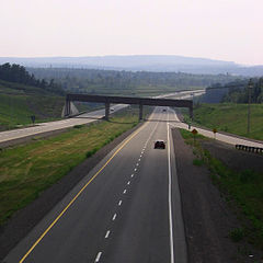 Highway 104 outside Westville, Nova Scotia (Exit 21).
The route is 320 kilometres (200 mi) long, of which the western 177 km (110 mi) is a 4-lane divided freeway. From Amherst, the highway runs east to Oxford, then southeast on a tolled section through the Cobequid Pass that opened in 1997. Tolls for this section are $4 for cars and $3.50 per axle for commercial vehicles. It meets Highway 102 near Truro then turns back northeast past Mount Thom to New Glasgow.
East of New Glasgow, the highway becomes 2 lanes and undivided, and portions have no controlled access. There are traffic lights in the Antigonish area, although construction has begun on a four-laned bypass. This bypass will keep traffic moving at 110 km/h (70 mph), and eliminate the various bottlenecks between Antigonish and Heatherton, including stretches of road with a posted speed limit of 60 km/h (40 mph). Beginning at Heatherton (19 km to the east), Highway 104 is a two-lane freeway to Auld's Cove, where several gas stations and motels are located. The highway then crosses the Canso Causeway to Cape Breton Island. The highway is unsigned as it follows Trunk 4 through the town of Port Hawkesbury. From there, another 37 km (23 mi) two-lane freeway segment follows the southern coast of Cape Breton Island to its end at Trunk 4 in St. Peter's. An extension of Highway 104 to Sydney has been proposed in the past.
The Nova Scotia provincial government has designated the entire length of Highway 104 from Amherst to St. Peters as a "strategic highway" to qualify for federal cost-sharing of maintenance and future upgrades. This designation has also been applied to the remaining Trunk 4 corridor in Cape Breton along the south shore of Bras d'Or Lake from St. Peters to Sydney. It is eventually envisioned that the Trans-Canada Highway will follow the entire length of Highway 104 from Amherst to Sydney as a 4-lane freeway, upgraded from the existing two-lane freeway and uncontrolled access sections of the highway.
Fatal crashes prompt calls for twinning
In August 2010, 6 people were killed on the untwinned portion of Highway 104 between Sutherland's River, Nova Scotia, and the Canso Causeway. The mayor of Port Hawkesbury, Billy Joe MacLean, was quoted as saying to the government of Nova Scotia, "...if you thought you had people getting killed this year, there's more coming in 2011 and 2012. So please answer what we're asking for. Give us a date and time for completion of highway twinning." The province is currently building a bypass around the Town of Antigonish, but is not expected to be completed until 2012. In their recently released 5-year paving plan, Nova Scotia's Department of Transportation and Infrastructure Renewal has no plans to twin Highway 104 to the Canso Causeway.[2]
Exit list
Kilometre distances[citation needed] are approximate.
Location km # Destinations Notes Fort Lawrence 1 1 
 Trunk 2 (Laplanche Street) to Trunk 6 – Amherst, Fort Lawrence
Amherst 5 3 Trunk 6 (Victoria Street, Sunrise Trail) – Amherst, Tatamagouche, Amherst7 4 Trunk 2 (South Albion Street) – Amherst, Springhill, ParrsboroSpringhill, Salt Springs Station 30 5  Hwy 142 – Springhill, Parrsboro
Oxford 40 6 

 Route 321 to Route 204 / Route 301 – Oxford, Pugwash, River Philip
Thompson Station 49 7 Trunk 4 – Mahoney's Corner, Wentworth, Folly Lake, Thompson StationWestchester Valley 59 8 To Trunk 4 / Wentworth-Collingwood Road – Westchester StationGreat Village 83 10 To Trunk 2 / Trunk 4 – Great Village, Bass River, LondonderryGlenholme 89 11 Trunk 4 to Trunk 2 – Glenholme, Economy, Five Islands, Folly Lake, WentworthMasstown 93 12 Trunk 2 / Trunk 4 west – Masstown, Glenholme, Lower DebertWest end of Trunk 4 overlap Lower Onslow, Debert 98 13 Debert, Lower Onslow Truro 107 15 Hwy 102 south – Truro, Halifax Regional MunicipalityOnly exit to Halifax Valley 116 17  To Route 311 (Trunk 4 east) – Bible Hill, Truro, Tatamagouche
East end of Trunk 4 overlap Kemptown 126 18 Stevens Cross Road - Kemptown, Riversdale Mount Thom 133 18A Trunk 4 – Mount ThomSalt Springs 146 19 Route 376 - Trunk 4 – Salt Springs, West River, DurhamAlma 155 20 To Trunk 4 – Pleasant Valley, Greenhill, Union CentreWestville 159 21  Trunk 4 west to Route 289 / Cowan Street – Alma, Westville
West end of Trunk 4 overlap Mount William 161 22 Hwy 106 (TCH) – Pictou, P.E.I. FerryNew Glasgow 164 23 Trunk 4 / Route 289 – New Glasgow, Westville, TrentonNew Glasgow, Stellarton 165 24 Route 374- New Glasgow, Stellarton, Trenton New Glasgow, Plymouth 167 25 Route 348- East River Road, Trunk 4 New Glasgow, Stellarton, Trenton Thorburn 170 26 Route 348- to Trunk 4 – Thorburn, SherbrookeSutherlands River 178 27A Trunk 4 westWest end of Trunk 4 overlap; at-grade 179 27 Trunk 4 eastRoute 245East end of Trunk 4 overlap; at-grade Lower Barney's River 198 29 Trunk 4 westWest end of Trunk 4 overlap; at-grade Marshy Hope 204 Trunk 4 eastEast end of Trunk 4 overlap; at-grade James River 210 30 To Trunk 4 / Beaver Mountain Road – James RiverWest River 219 31A Trunk 4 westWest end of Trunk 4 overlap; at-grade Antigonish 221 31 Trunk 4 eastEast end of Trunk 4 overlap; at-grade 222 32  Trunk 7
At-grade 223 33 Church Street At-grade Greenwold 226 34 Trunk 4 westWest end of Trunk 4 overlap; at-grade Lower South River 230 35 Route 316 At-grade Heatherton 238 36 Summerside Road At-grade 240 36A Trunk 4 eastEast end of Trunk 4 overlap; at-grade Monastery 252 37  Trunk 4 to Trunk 16 – Monastery, Guysborough, Tracadie
Havre Boucher 262 38 Havre Boucher, Frankville, Linwood Auld's Cove 270 39 Trunk 4 westWest end of Trunk 4 overlap; at-grade 271 40 Route 344 At-grade Port Hastings 274 41  Hwy 105 (TCH) east / Trunk 4 east / Trunk 19 north
Signs Used As Exit 1 Instead Port Hawkesbury - St. Peter's section
Location Exit km Intersecting Roads Notes Port Hawkesbury 43 283  Trunk 4
Lower River Inhabitants 44 293 Lower River Road, Port Malcolm Road at-grade Evanston 45 295 Evanston Road, Whiteside Road at-grade Louisdale 46 306 Route 320 River Bourgeois 47 316 Sporting Mountain Road St. Peter's - - Trunk 4at-grade References
- ^ "Province to Honour Mining Heritage" (Press release). Government of Nova Scotia. 2008-09-08. http://www.gov.ns.ca/news/details.asp?id=20080908002. Retrieved 2009-12-25.
- ^ "Fatal accidents prompt call for road twinning". CBC News. 26 August 2010. http://www.cbc.ca/canada/nova-scotia/story/2010/08/26/ns-highway-twinning-call.html.
Preceded by
NB Route 2Trans-Canada Highway
Highway 104Succeeded by
Highway 105Preceded by
Highway 106 Portions of the Trans-Canada Highway
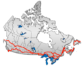 British Columbia: Highway 1 • Highway 5 • Highway 16 | Alberta: Highway 1 • Highway 16
Saskatchewan: Highway 1 • Highway 16 | Manitoba: Highway 1 • Highway 16 • Highway 100
Ontario: Highway 17 • Highway 69 • Highway 400 • Highway 12 • Highway 7 • Highway 71 • Highway 11 • Highway 66 • Highway 417
Quebec: Autoroute 40 • Autoroute 25 • Autoroute 20 • Autoroute 85 • Route 185 • Route 117 • Autoroute 15
New Brunswick: Route 2 • Route 16 | Confederation Bridge | Prince Edward Island: Route 1 | Nova Scotia: Highway 104 • Highway 105 • Highway 106
Newfoundland: Route 1 Category ·
  Portal ·
  WikiProject
Roads and highways in Nova Scotia 100-series Trunk Routes Collector roads 201 · 202 · 203 · 204 · 205 · 206 · 207 · 208 · 209 · 210 · 211 · 212 · 213 · 214 · 215 · 216 · 217 · 219 · 221 · 223 · 224 · 236 · 239 · 242 · 245 · 246 · 247 · 252 · 253 · 255 · 256 · 276 · 277 · 289 · 301 · 302 · 303 · 304 · 305 · 306 · 307 · 308 · 309 · 311 · 312 · 316 · 318 · 320 · 321 · 322 · 324 · 325 · 326 · 327 · 328 · 329 · 330 · 331 · 332 · 333 · 334 · 335 · 336 · 337 · 340 · 341 · 344 · 347 · 348 · 349 · 354 · 357 · 358 · 359 · 360 · 362 · 366 · 368 · 374 · 376 · 395Scenic routes Categories:- Nova Scotia provincial highways
- Trans-Canada Highway
- Limited-access roads in Canada
- Roads in Antigonish County, Nova Scotia
- Roads in Colchester County, Nova Scotia
- Roads in Cumberland County, Nova Scotia
- Roads in Guysborough County, Nova Scotia
- Roads in Inverness County, Nova Scotia
- Roads in Pictou County, Nova Scotia
- Roads in Richmond County, Nova Scotia


Wikimedia Foundation. 2010.