- Corrimal, New South Wales
-
Corrimal
Wollongong, New South Wales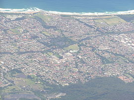
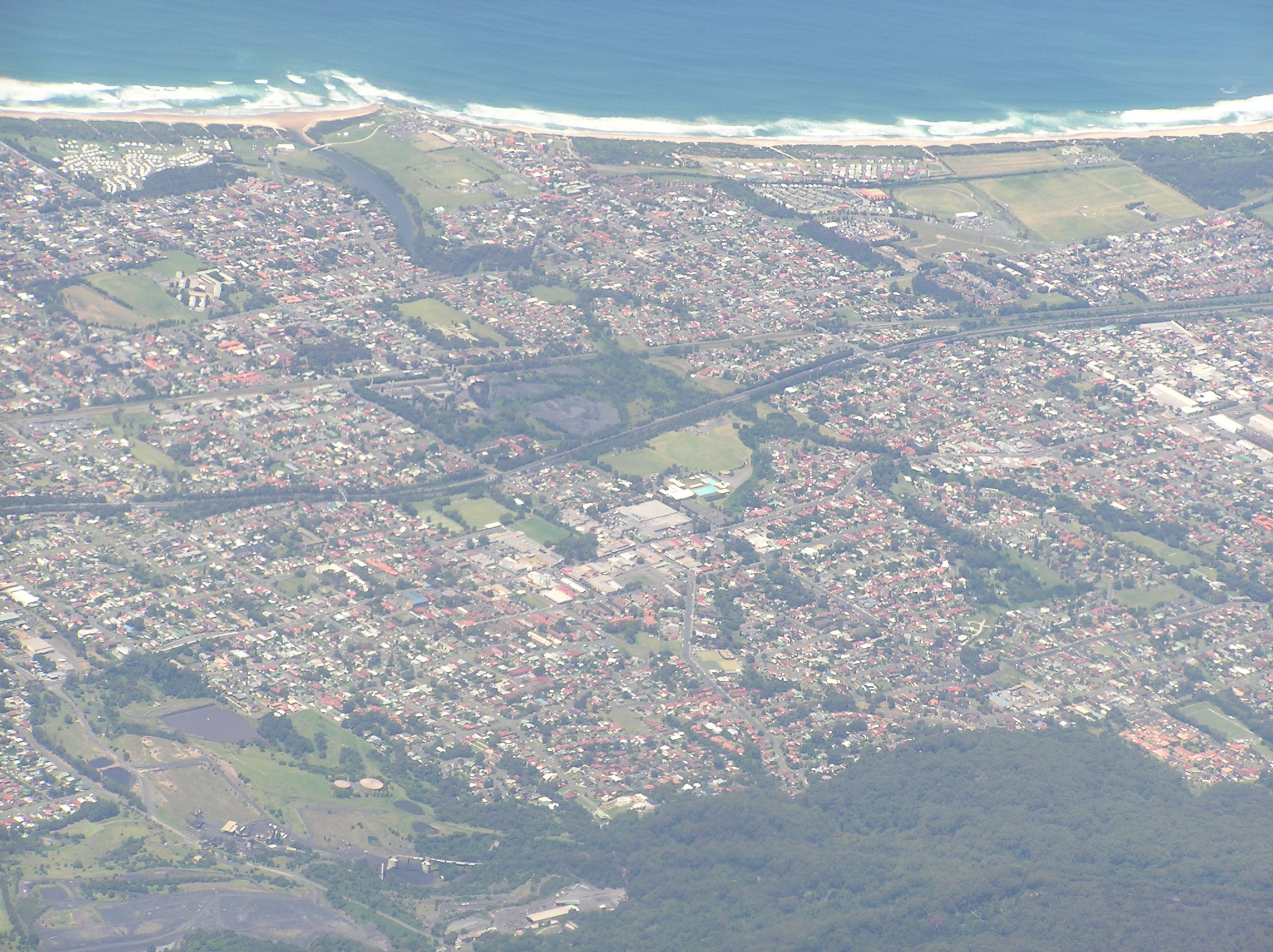
Aerial photo of Corrimal to TarrawannaPopulation: 6,534[1] Postcode: 2518 Coordinates: 34°22′S 150°53.5′E / 34.367°S 150.8917°ECoordinates: 34°22′S 150°53.5′E / 34.367°S 150.8917°E LGA: City of Wollongong State District: Keira Federal Division: Cunningham Suburbs around Corrimal: Russell Vale Bellambi Corrimal East Corrimal Tarrawanna Fernhill Towradgi Corrimal is a northern suburb of the city of Wollongong, New South Wales, Australia. Corrimal's CBD is situated on the Princes Highway, and several streets adjacent to it. The main shopping centres are Stockland Corrimal and Corrimal Park Mall next to the park on the highway. Outside this centre is an old locomotive that Corrimal is known for, the welcome signs featuring it. It ran on the Bulli Colliery Line (no longer existent) to Bellambi Haven from 1909 to 1967. To the west is a lawn bowls club and a wealthy foothill neighbourhood of residences bordering bushland.
Corrimal is served by Corrimal railway station on the South Coast Line, located on Railway Street which connects the station to the heart of the town.
Immediately west of Corrimal railway station is the Corrimal Cokeworks, open to the public on Tuesdays. The towers are a prominent local sight and can be seen from Wollongong. The railway crosses the first level crossing north of Wollongong immediately north of the station.
On the second Sunday in September Corrimal hosts the annual Spring Into Corrimal festival, which includes market stalls on the closed main streets, a parade, contest and other activities. 2009 was the 30th anniversary of the parade. In the 2007 festival the world's largest skateboard was displayed.
Corrimal has four primary schools and one high school. St Columbkille's Corrimal is Corrimal's leading Catholic School.There is also Corrimal Public School, The Illawarra Advestist School, Corrimal High and The South Coast School For Children with Autism.
History
The suburb takes its name from a point on the bordering Illawarra escarpment which was known as Mount Corrimal (named after the Aboriginal Dreamtime warrior Kurimul) and now called Broker's Nose.[2]
The first industry and settlement at Corrimal was that of logging, followed by mining operations. In 1830 the first grant of land was made, to James Martin, of 50 acres (200,000 m2). Corrimal was first recorded in 1839 when a grant was sold at Corrimal.
In 1834 the Bulli Parish road was made with convict labour, directed by Major Mitchell. In 1883 Thomas Bertram opened the Corrimal colliery[3], also known as the Corrimal-Balgownie Colliery. Corrimal station opened in 1887. In 1887 bullock teams stopped transporting coal from the mine to the railway, being replaced by a private colliery mine constructed by the Southern Coal Company, which had taken over operations from Bertram. In 1889 Broker's Nose Colliery was renamed Corrimal Colliery.
Streets ice cream was founded there in the 1930s.[4]
The colliery closed in 1985.
See also
- Broker's Nose
- Corrimal High School
- Corrimal railway station
- East Corrimal
References
- ^ Australian Bureau of Statistics (25 October 2007). "Corrimal (State Suburb)". 2006 Census QuickStats. http://www.censusdata.abs.gov.au/ABSNavigation/prenav/LocationSearch?collection=Census&period=2006&areacode=SSC15076&producttype=QuickStats&breadcrumb=PL&action=401. Retrieved 2009-01-18.
- ^ "Place names of the Wollongong region". Wollongong City Council. http://www.wollongong.nsw.gov.au/library/placenames.asp. Retrieved 2009-03-07.
- ^ The Corrimal Railway Singleton, C.C. Australian Railway Historical Society Bulletin, January, 1957 pp1-7
- ^ "Streets Ice cream History". Unilever Australia. http://www.streets.com.au/f_index.asp?sid=733Dt422C7E459F334739t4E220F7F&m1=13&m2=&m3=&url=/home/noflash.asp/. Retrieved 17 October 2006.[dead link]
Suburbs and Localities of Wollongong, New South Wales Albion Park · Albion Park Rail · Austinmer · Avon · Avondale · Balarang · Balgownie · Barrack Heights · Barrack Point · Bellambi · Berkeley · Blackbutt · Bombo · Broughton Village · Brownsville · Bulli · Burning Palms · Calderwood · Carrington Falls · Cleveland · Clifton · Coalcliff · Coledale · Coniston · Cordeaux · Cordeaux Heights · Corrimal · Cringila · Croom · Curramore · Dapto · Darkes Forest · Dombarton · Dunmore · East Corrimal · Fairy Meadow · Farmborough Heights · Fernhill · Figtree · Flinders · Foxground · Gerringong · Gerroa · Gwynneville · Haywards Bay · Helensburgh · Horsley · Huntley · Jamberoo · Jerrara · Kanahooka · Keiraville · Kembla Grange · Kembla Heights · Kemblawarra · Kiama · Kiama Downs · Kiama Heights · Knights Hill · Koonawarra · Lake Heights · Lake Illawarra · Lilyvale · Macquarie Pass · Maddens Plains · Mangerton · Marshall Mount · Minnamurra · Mount Keira · Mount Kembla · Mount Ousley · Mount Pleasant · Mount Saint Thomas · Mount Warrigal · North Macquarie · North Wollongong · Oak Flats · Otford · Penrose · Port Kembla · Primbee · Rose Valley · Russell Vale · Saddleback Mountain · Scarborough · Shell Cove · Shellharbour · Shellharbour City Centre · Spring Hill · Stanwell Park · Stanwell Tops · Tarrawanna · Thirroul · Tongarra · Toolijooa · Towradgi · Tullimbar · Unanderra · Upper Kangaroo Valley · Warilla · Warrawong · Werri Beach · West Wollongong · Willow Vale · Windang · Wollongong · Wombarra · Wongawilli · Woonona · Yallah · Yellow Rock
Categories:- Suburbs of Wollongong, New South Wales
Wikimedia Foundation. 2010.