- Albion Park, New South Wales
-
Albion Park
Wollongong, New South Wales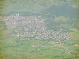
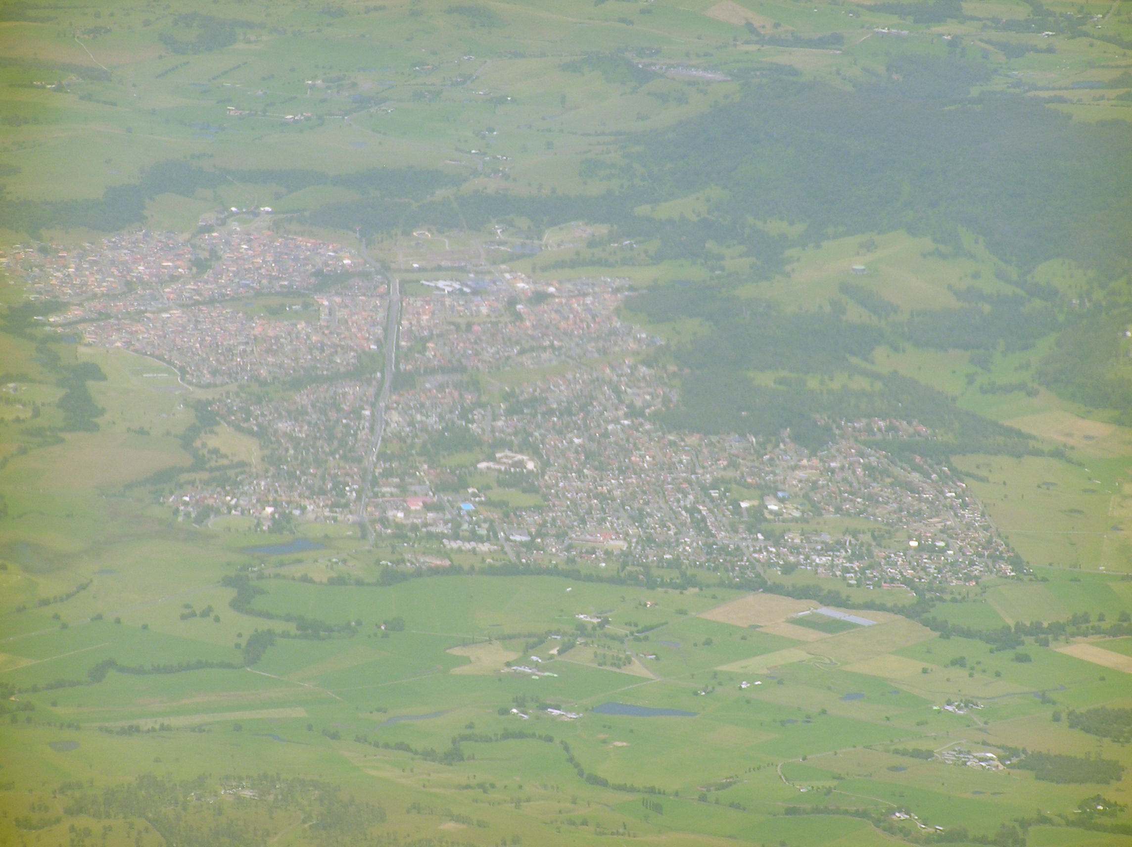
An aerial picture of the suburbPopulation: 11,261[1] Postcode: 2527 Coordinates: 34°34′S 150°48′E / 34.567°S 150.8°ECoordinates: 34°34′S 150°48′E / 34.567°S 150.8°E Location: - 104 km (65 mi) south of Sydney
- 18 km (11 mi) south of Wollongong
LGA: City of Shellharbour State District: Kiama, Shellharbour Federal Division: Throsby Suburbs around Albion Park: North Macquarie Calderwood Albion Park Rail Tullimbar Albion Park Croom Yellow Rock Curramore Croom Albion Park is a suburb in the City of Shellharbour, which is in turn one of the three local government areas that comprise the Wollongong Metropolitan Area, New South Wales, Australia. Currently Albion Park has a population of approximately 11,261[1] and continues to expand by a rate of 12.5% per year.
The Illawarra escarpment is to the west, Dapto is to the north, Jamberoo is to the south and Shellharbour is to the east.
Contents
History
The area around Albion Park was cleared by cedar cutters, and they were quickly followed by graziers who recognised the potential of this well-watered area. The arrival of the railway line in 1887, and the completion of the road through Macquarie Pass to the Southern Highlands hastened the town’s growth.
Etymology
The term "Albion", is an ancient name of Great Britain.[2] the name was given by the original land grant owner around 1815.
Infrastructure
Trains
In order to avoid the highest parts of the ridge between Albion Park and Minnamurra, the railway needed to keep closer to the shore of Lake Illawarra. After the opening of Albion Park railway station two km to the east in 1887, a new town grew up next to it, now known as Albion Park Rail.
Roads
The Illawarra Highway runs through Albion Park and joins the Princes Highway just north of the suburb. This road brings many people through the region. Albion Park is also the main link between Jamberoo Action Park and Sydney as the fastest way for people to get to Jamberoo coming from the north is to pass through Albion Park.
Education
There are currently 3 Primary Schools and 3 High Schools in Albion Park:
- Albion Park Public School
- Albion Park High School
- Mount Terry Public School
- St. Joseph's Catholic School, Albion Park
- St. Paul's Catholic School, Albion Park
- Illawarra Christian School (Tongarra Campus)
- Tullimbar Public School
- Mount terry public school
Recreation
Albion Park is home to the Shellharbour Regional Sporting Complex[citation needed], which consists of two all-weather hockey fields, several football (rugby league) fields, a multi-purpose indoor basketball stadium, a turf cricket field, an athletics field, a BMX track, a remote control car racing track, and several tennis courts. A cycleway also courses it's way through the Sporting Complex and links it to a polo field and a complex of soccer fields. Albion Park is also home to a Shellharbour Council Swimming Pool, which is open during the summer months and now costs a fee of $1 entry, to a pool paid for by the members of the town.
Clubs and Pubs
Albion Park is home to three clubs where people to eat and drink including:
- Albion Park Hotel
- Albion Park RSL
- Albion Park Bowls and Recreation Club
Sport
Albion Park is also home to various sporting teams such as:
- Albion Park-Oak Flats Eagles
- Albion Park Hockey Club
- Albion Park Bowls and Recreation Club
- Albion Park Cricket Club
- Albion Park White Eagles
- Albion Park Crows Junior AFL Club
Museums
Albion Park has the Tongarra Museum, which showcases the history of the region, and the Historical Aircraft Restoration Society Museum located at the Illawarra Regional Airport.
Commercial area
Albion Park has a small shopping centre known as Centro Albion Park.
References
- ^ a b Australian Bureau of Statistics (25 October 2007). "Albion Park (State Suburb)". 2006 Census QuickStats. http://www.censusdata.abs.gov.au/ABSNavigation/prenav/LocationSearch?collection=Census&period=2006&areacode=SSC15006&producttype=QuickStats&breadcrumb=PL&action=401. Retrieved 2008-11-20.
- ^ Albion – Online Etymology Dictionary
Suburbs and Localities of Wollongong, New South Wales Albion Park · Albion Park Rail · Austinmer · Avon · Avondale · Balarang · Balgownie · Barrack Heights · Barrack Point · Bellambi · Berkeley · Blackbutt · Bombo · Broughton Village · Brownsville · Bulli · Burning Palms · Calderwood · Carrington Falls · Cleveland · Clifton · Coalcliff · Coledale · Coniston · Cordeaux · Cordeaux Heights · Corrimal · Cringila · Croom · Curramore · Dapto · Darkes Forest · Dombarton · Dunmore · East Corrimal · Fairy Meadow · Farmborough Heights · Fernhill · Figtree · Flinders · Foxground · Gerringong · Gerroa · Gwynneville · Haywards Bay · Helensburgh · Horsley · Huntley · Jamberoo · Jerrara · Kanahooka · Keiraville · Kembla Grange · Kembla Heights · Kemblawarra · Kiama · Kiama Downs · Kiama Heights · Knights Hill · Koonawarra · Lake Heights · Lake Illawarra · Lilyvale · Macquarie Pass · Maddens Plains · Mangerton · Marshall Mount · Minnamurra · Mount Keira · Mount Kembla · Mount Ousley · Mount Pleasant · Mount Saint Thomas · Mount Warrigal · North Macquarie · North Wollongong · Oak Flats · Otford · Penrose · Port Kembla · Primbee · Rose Valley · Russell Vale · Saddleback Mountain · Scarborough · Shell Cove · Shellharbour · Shellharbour City Centre · Spring Hill · Stanwell Park · Stanwell Tops · Tarrawanna · Thirroul · Tongarra · Toolijooa · Towradgi · Tullimbar · Unanderra · Upper Kangaroo Valley · Warilla · Warrawong · Werri Beach · West Wollongong · Willow Vale · Windang · Wollongong · Wombarra · Wongawilli · Woonona · Yallah · Yellow Rock
Categories:- Shellharbour, New South Wales
- Suburbs of Wollongong, New South Wales
Wikimedia Foundation. 2010.