- Hood River County, Oregon
-
Hood River County, Oregon 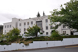
Hood River County Courthouse in Hood River 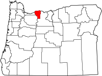
Location in the state of Oregon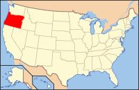
Oregon's location in the U.S.Founded June 23, 1908 Seat Hood River Area
- Total
- Land
- Water
534 sq mi (1,383 km²)
522 sq mi (1,352 km²)
11 sq mi (28 km²), 2.10%Population
- (2010)
- Density
22,346
43/sq mi (16.5/km²)Website www.co.hood-river.or.us Hood River County is a county located in the U.S. state of Oregon. The county was established in 1908 and is named for the Hood River, a tributary of the Columbia River. In 2010, the county's population was 22,346. The county seat is the city of Hood River.[1]
Contents
Economy
Agriculture, timber, lumber and recreation are the major sources of revenue and industry. Fruit grown in the fertile valley is of such exceptional quality the county leads the world in Anjou pear production. A 1997 census recorded 15,553 acres (62.94 km2) of commercial orchards growing pears, apples, cherries and peaches. Hood River County also has two ports and two boat basins, one serving local barge traffic, a steel boat manufacturing firm and Mid-Columbia yachting interests. The Forest Service owns 64% of the county's land.
The Columbia River, which runs right by the city of Hood River, has become a premier windsurfing destination, attracting windsurfers from throughout the United States and around the world. Cool, moist coastal air is drawn through the Columbia River Gorge as the desert to the east heats up on warm days, creating winds between 15-35 knots most days in the summer. With the current in the Columbia River flowing from east to west, and the wind blowing from west to east, large swells are created on the river that windsurfers enjoy riding like waves. Windsurfing has affected the local economy in many ways: windsurfing-oriented businesses and upscale restaurants catering to visiting windsurfers have reinvigorated the downtown area, many people who first visited Hood River in search of wind and waves have settled in the area and become an integral part of the community, and the local economy has been infused with much needed tourist dollars.
In 1987, a local group of businessmen purchased the 22-mile (35 km) branch line to Parkdale from the Union Pacific Railroad for $600,000, renaming it the Mount Hood Railroad. This rail line offers tourist rides and carries fruit from the local orchards.
Geography
According to the U.S. Census Bureau, the county has a total area of 534 square miles (1,383.1 km2), of which 522 square miles (1,352.0 km2) is land and 11 square miles (28.5 km2) (2.10%) is water.
Adjacent Counties
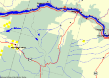 Map of Hood River County
 U.S. Forest Service landBureau of Land Management land
- Multnomah County, Oregon - west
- Clackamas County, Oregon - southwest
- Wasco County, Oregon - south, east
- Klickitat County, Washington - northeast
- Skamania County, Washington - north

Skamania County, Washington Klickitat County, Washington Multnomah County 
Wasco County  Hood River County, Oregon

Clackamas County Wasco County National protected area
- Mount Hood National Forest (part)
Demographics
Historical populations Census Pop. %± 1910 8,016 — 1920 8,315 3.7% 1930 8,938 7.5% 1940 11,580 29.6% 1950 12,740 10.0% 1960 13,395 5.1% 1970 13,187 −1.6% 1980 15,835 20.1% 1990 16,903 6.7% 2000 20,411 20.8% 2010 22,346 9.5% [2][3][4] As of the census[5] of 2000, there were 20,411 people, 7,248 households, and 5,175 families residing in the county. The population density was 39 people per square mile (15/km²). There were 7,818 housing units at an average density of 15 per square mile (6/km²). The racial makeup of the county was 78.87% White, 0.57% Black or African American, 1.12% Native American, 1.47% Asian, 0.12% Pacific Islander, 15.37% from other races, and 2.46% from two or more races. 25.02% of the population were Hispanic or Latino of any race. 12.6% were of German, 10.7% English, 10.4% American and 6.8% Irish ancestry according to Census 2000. 76.0% spoke English and 22.8% Spanish as their first language.
There were 7,248 households out of which 35.70% had children under the age of 18 living with them, 58.60% were married couples living together, 8.80% had a female householder with no husband present, and 28.60% were non-families. 22.70% of all households were made up of individuals and 9.90% had someone living alone who was 65 years of age or older. The average household size was 2.70 and the average family size was 3.15.
In the county, the population was spread out with 28.00% under the age of 18, 8.20% from 18 to 24, 29.40% from 25 to 44, 21.50% from 45 to 64, and 12.90% who were 65 years of age or older. The median age was 35 years. For every 100 females there were 98.90 males. For every 100 females age 18 and over, there were 99.20 males.
The median income for a household in the county was $38,326, and the median income for a family was $41,422. Males had a median income of $31,658 versus $24,382 for females. The per capita income for the county was $17,877. About 9.80% of families and 14.20% of the population were below the poverty line, including 17.30% of those under age 18 and 7.80% of those age 65 or over.
History
The first permanent settlers in present-day Hood River County filed a donation land claim in 1854. The first school was built in 1863 and a road from The Dalles was completed in 1867. By 1880 there were 17 families living in the valley. By the latter part of the nineteenth century farmers of Japanese, Finnish, German, and French ethnicity had settled in the valley.
At the turn of the twentieth century, the people of the Hood River region in the northwest portion of Wasco County expressed a desire for political separation from the parent county. The passage of a statewide initiative established Hood River as the thirty-fourth county of the state. It was made official by a governor's proclamation on June 23, 1908. The Columbia River Highway was completed in 1922 from Portland to The Dalles, improving access between both those cities as well as to Hood River.
In response to controversy surrounding county approval of locating a destination resort at Cooper Spur ski area on Mount Hood, on November 5, 2003 62% of the voters approved a measure requiring voter approval on residential developments of 25 units or more on land zoned for forest use. Opponents claimed that this measure was not enforceable and would end up in court.
Communities
Incorporated cities
Unincorporated communities and CDPs
- Dee
- Lenz
- Lost Lake Resort[6]
- Mount Hood
- Oak Grove
- Odell
- Parkdale
- Pine Grove
- Rockford
Stations and other locales
- Bloucher (historical)
- Conway (historical)
- Dukes Valley (historical)
- Holstein (historical)
- Summit
- Wyeth
See also
References
- ^ "Find a County". National Association of Counties. http://www.naco.org/Counties/Pages/FindACounty.aspx. Retrieved 2011-06-07.
- ^ http://www.census.gov/population/www/censusdata/cencounts/files/or190090.txt
- ^ http://factfinder2.census.gov
- ^ http://mapserver.lib.virginia.edu/
- ^ "American FactFinder". United States Census Bureau. http://factfinder.census.gov. Retrieved 2008-01-31.
- ^ U.S. Geological Survey Geographic Names Information System: Lost Lake Resort
External links
- Hood River County, Oregon (official website)
- Hood River County listing in the Oregon Blue Book
Municipalities and communities of Hood River County, Oregon Cities 
CDPs Communities Dee | Lenz | Mount Hood | Pine Grove | Wyeth
Coordinates: 45°31′03″N 121°38′58″W / 45.5175°N 121.64944°W
Categories:- Oregon counties
- Hood River County, Oregon
- 1908 establishments in the United States
- Columbia River Gorge
- Populated places established in 1908


Wikimedia Foundation. 2010.