- Dixmoor, Illinois
-
Dixmoor, Illinois County: Cook Township: Thornton Incorporated: Village, 1923 Mayor: Keevan Grimmett ZIP code(s): 60406, 60418, 60426 Area code(s): 708 Population (2000): 3,934 Change from 1990: up 7.87% Density: 3,164.6/mi² (1,224.9/km²) Area: 1.2 mi² (3.2 km²) Per capita income: $11,712
(median: $26,677)Home value: $86,513 (2000)
(median: $57,100)Demographics (2000)[1] White Black Hispanic Asian 30.81% 57.12% 18.20% 0.15% Islander Native Other 0.00% 0.25% 9.48% Dixmoor (formerly Specialville) is a village in Cook County, Illinois, United States. The population was 3,934 at the 2000 census.
Dixmoor is adjacent to Harvey, Illinois, and keeps Harvey's east-west numbering system, even though most of the village lies west of Ashland Avenue/Wood Street.
Contents
Geography
Dixmoor is located at 41°37′51″N 87°39′59″W / 41.63083°N 87.66639°WCoordinates: 41°37′51″N 87°39′59″W / 41.63083°N 87.66639°W (41.630784, -87.666446)[2].
According to the United States Census Bureau, the village has a total area of 1.2 square miles (3.1 km2), all of it land.
Demographics
As of the 2000 census[3], there were 3,934 people, 1,372 households, and 887 families residing in the village. The population density was 3,164.6 people per square mile (1,224.9/km²). There were 1,471 housing units at an average density of 1,183.3 per square mile (458.0/km²). The racial makeup of the village was 57.12% African American, 30.81% White, 0.25% Native American, 0.15% Asian, 9.48% from other races, and 2.19% from two or more races. Hispanic or Latino of any race were 18.20% of the population, including 16.2% of Mexican descent. The top three non-African, non-Hispanic ancestries reported in Dixmoor as of the 2000 census were German (6.6%), Irish (6.0%) and Polish (4.8%).[4]
There were 1,372 households out of which 30.3% had children under the age of 18 living with them, 34.2% were married couples living together, 22.1% had a female householder with no husband present, and 35.3% were non-families. 29.7% of all households were made up of individuals and 12.2% had someone living alone who was 65 years of age or older. The average household size was 2.83 and the average family size was 3.56.
In the village the population was spread out with 30.4% under the age of 18, 9.9% from 18 to 24, 29.0% from 25 to 44, 18.3% from 45 to 64, and 12.5% who were 65 years of age or older. The median age was 32 years. For every 100 females there were 92.2 males. For every 100 females age 18 and over, there were 88.8 males.
The median income for a household in the village was $26,677, and the median income for a family was $30,423. Males had a median income of $29,777 versus $30,714 for females. The per capita income for the village was $11,712. About 21.1% of families and 30.3% of the population were below the poverty line, including 46.6% of those under age 18 and 10.7% of those age 65 or over.
Government
Dixmoor is divided between two congressional districts. The area east of the Dan Ryan Expressway (Interstate 57) and south of 142nd Street is in Illinois' 2nd congressional district, as are the area between 141st and 142nd Streets east of Wood Street and the area northeast of the Ashland Avenue-Thornton Road intersection; the rest of the village is in the 1st district.
References
- ^ 2000 United States Census Data
- ^ "US Gazetteer files: 2010, 2000, and 1990". United States Census Bureau. 2011-02-12. http://www.census.gov/geo/www/gazetteer/gazette.html. Retrieved 2011-04-23.
- ^ "American FactFinder". United States Census Bureau. http://factfinder.census.gov. Retrieved 2008-01-31.
- ^ Profile of General Demographic Characteristics, Dixmoor, IllinoisPDF (38.6 KiB). U.S. Census Bureau. Accessed 2007-07-11.
External links
Chicago metropolitan area Major city 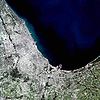
Cities
(over 30,000 in 2010)Aurora, Illinois · Berwyn, Illinois · Calumet City, Illinois · Chicago Heights, Illinois · Crystal Lake, Illinois · DeKalb, Illinois · Des Plaines, Illinois · Elgin, Illinois · Elmhurst, Illinois · Evanston, Illinois · Gary, Indiana · Hammond, Indiana · Joliet, Illinois · Kenosha, Wisconsin · Naperville, Illinois · North Chicago, Illinois · Park Ridge, Illinois · Portage, Indiana · St. Charles, Illinois · Valparaiso, Indiana · Waukegan, Illinois · Wheaton, IllinoisTowns and villages
(over 30,000 in 2010)Addison, Illinois · Algonquin, Illinois · Arlington Heights, Illinois · Bartlett, Illinois · Bolingbrook, Illinois · Buffalo Grove, Illinois · Carol Stream, Illinois · Carpentersville, Illinois · Cicero, Illinois · Downers Grove, Illinois · Elk Grove Village, Illinois · Glendale Heights, Illinois · Glenview, Illinois · Gurnee, Illinois · Hanover Park, Illinois · Hoffman Estates, Illinois · Lombard, Illinois · Merrillville, Indiana · Mount Prospect, Illinois · Mundelein, Illinois · Northbrook, Illinois · Oak Lawn, Illinois · Oak Park, Illinois · Orland Park, Illinois · Oswego, Illinois · Palatine, Illinois · Plainfield, Illinois · Romeoville, Illinois · Schaumburg, Illinois · Skokie, Illinois · Streamwood, Illinois · Tinley Park, Illinois · Wheeling, Illinois · Woodridge, IllinoisCounties Cook County, Illinois · DeKalb County, Illinois · DuPage County, Illinois · Grundy County, Illinois · Jasper County, Indiana · Kane County, Illinois · Kendall County, Illinois · Kenosha County, Wisconsin · Lake County, Illinois · Lake County, Indiana · McHenry County, Illinois · Newton County, Indiana · Porter County, Indiana · Will County, IllinoisRegions Sub-regions  State of Illinois
Topics - Index
- Buildings and structures
- Communications
- Culture
- Delegations
- Economy
- Education
- Environment
- Geography
- Government
- Health
- History
- Music
- People
- Portal
- Society
- Sports
- Tourism
- Transportation
- Windmills
Regions - American Bottom
- Central Illinois
- Champaign–Urbana metropolitan area
- Chicago metropolitan area
- Driftless Area
- Forgottonia
- Fox Valley
- Illinois–Indiana–Kentucky Tri-State Area
- Metro East
- Mississippi Alluvial Plain
- North Shore
- Northern Illinois
- Northwestern Illinois
- Peoria metropolitan area
- Quad Cities
- River Bend
- Rockford metropolitan area
- Southern Illinois
- Streatorland
- Wabash Valley
Major cities,
towns and villages- Alton/Granite City/Edwardsville
- Arlington Heights/Palatine
- Aurora/Naperville/Oswego/Plainfield
- Bartlett/Hanover Park/Streamwood
- Belleville/East St. Louis/Collinsville/O'Fallon
- Berwyn/Cicero
- Bloomington/Normal
- Bolingbrook/Romeoville
- Buffalo Grove/Wheeling
- Calumet City
- Canton
- Carbondale
- Carol Stream/Glendale Heights
- Centralia
- Champaign/Urbana
- Charleston/Mattoon
- Chicago
- Chicago Heights
- Crystal Lake/Algonquin
- Danville
- Decatur
- DeKalb/Sycamore
- Des Plaines/Mount Prospect/Park Ridge
- Dixon
- Downers Grove/Woodridge
- Effingham
- Elgin/Carpentersville
- Elmhurst/Lombard/Addison
- Evanston/Skokie
- Freeport
- Galesburg
- Glenview/Northbrook
- Harrisburg
- Jacksonville
- Joliet
- Kankakee/Bradley/Bourbonnais
- Lincoln
- Macomb
- Marion/Herrin
- Moline/East Moline/Rock Island
- Mount Vernon
- Mundelein
- Oak Lawn
- Oak Park
- Orland Park/Tinley Park
- Ottawa/Streator/LaSalle/Peru
- Peoria/Pekin/East Peoria/Morton
- Pontiac
- Quincy
- Rochelle
- Rockford/Belvidere/Machesney Park/Loves Park
- St. Charles
- Schaumburg/Hoffman Estates/Elk Grove Village
- Springfield
- Sterling/Rock Falls
- Taylorville
- Waukegan/North Chicago/Gurnee
- Wheaton
Counties - Adams
- Alexander
- Bond
- Boone
- Brown
- Bureau
- Calhoun
- Carroll
- Cass
- Champaign
- Christian
- Clark
- Clay
- Clinton
- Coles
- Cook
- Crawford
- Cumberland
- DeKalb
- DeWitt
- Douglas
- DuPage
- Edgar
- Edwards
- Effingham
- Fayette
- Ford
- Franklin
- Fulton
- Gallatin
- Greene
- Grundy
- Hamilton
- Hancock
- Hardin
- Henderson
- Henry
- Iroquois
- Jackson
- Jasper
- Jefferson
- Jersey
- Jo Daviess
- Johnson
- Kane
- Kankakee
- Kendall
- Knox
- LaSalle
- Lake
- Lawrence
- Lee
- Livingston
- Logan
- Macon
- Macoupin
- Madison
- Marion
- Marshall
- Mason
- Massac
- McDonough
- McHenry
- McLean
- Menard
- Mercer
- Monroe
- Montgomery
- Morgan
- Moultrie
- Ogle
- Peoria
- Perry
- Piatt
- Pike
- Pope
- Pulaski
- Putnam
- Randolph
- Richland
- Rock Island
- Saline
- Sangamon
- Schuyler
- Scott
- Shelby
- St. Clair
- Stark
- Stephenson
- Tazewell
- Union
- Vermilion
- Wabash
- Warren
- Washington
- Wayne
- White
- Whiteside
- Will
- Williamson
- Winnebago
- Woodford
Categories:- Villages in Illinois
- Populated places in Illinois with African American majority populations
- Chicago metropolitan area
- Populated places in Cook County, Illinois

Wikimedia Foundation. 2010.