- Mannsville, Albany County, New York
-
This article is about the Mannsville in Albany County. For the village of Mannsville in Jefferson County please see Mannsville, New York.
Mannsville, Albany County Mannville Hamlet Official name: Mannsville, New York Name origin: for Francis N. Mann Country United States State New York Region Capital District County Albany Municipality Town of Colonie Coordinates 42°43′30″N 73°42′42″W / 42.725°N 73.71167°W Area .029 sq mi (0 km2) Population appr. 175 (1998) Density 6,034.48 / sq mi (2,330 / km2) Settled 1875 Timezone EST (UTC-5) - summer (DST) EDT (UTC-4) ZIP Code 12189 Area code 518 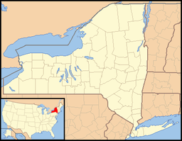
 Location of Mannsville within the state of New York
Mannsville is a hamlet within the town of Colonie, Albany County, New York. It is a small community west of the city of Watervliet and is inaccessible to the rest of Colonie by car without driving through Watervliet first. Though then-town historian Jean Olton stated in 1987 that Mannsville was no longer considered "an official hamlet" of the town it is still listed on the Town of Colonie's Town Historian website as a hamlet (misspelled as Mansville).[1][2]
Contents
History
In 1875 Francis N. Mann purchased most of what is now Mannsville from John Schuyler. Mann was a judge in the Town of Watervliet (not to be confused with the neighboring city of Watervliet). He died a few months later, and his children- Francis N. Mann Jr., Elias P. Mann and Emily Mann inherited the land. In 1905 they moved to England without disposing of the land or arranging for the property taxes to be paid. Albany County eventually foreclosed, auctioning the land off in lots leading to a boom in new housing in the 1970s.[1]
In 1998 the neighboring city of Watervliet attempted to annex the small hamlet, which at that time consisted of roughly 175 inhabitants. Colonie Town Supervisor Mary Brizzell stated the pros for staying with Colonie as being- lower taxes, access to the town golf course, youth services, and community development grant money. Watervliet Mayor Robert Carlson put forth in favor of annexation the facts that emergency and fire response times would improve, the city provides municipal garbage pick up, does not charge a fire district tax (Colonie does), the children of Mannsville already attend the Watervliet City School District, and most residents attend Watervliet churches.[3]
Geography
Mannsville is roughly 18.5 acres (75,000 m2) in area,[3] though like all hamlets, it has an ill-defined boundary. Mannsville is usually considered to be an area defined on the south by NY Route 155; to the north by 15th Street (Watervliet city line); to the east by Elbow Alley, which runs between Eighth and Ninth avenues, again the Watervliet city line; and to the west by railroad tracks.[1] Mannsville is flat and of low elevation, since 1995 residents have complained of frequent flooding due partly to beaver dams on the Kromma Kill diverting that watershed north to creeks that flow towards Mannsville, and due to increased residential construction uphill and upstream from the hamlet.[4][5]
Location

City of Watervliet Hamlet of Latham 
City of Watervliet  Hamlet of Mannsville

City of Watervliet
Watervliet ArsenalCapital District of New York Central communities Albany (History · City Hall · Coat of Arms) · Schenectady (City Hall) · Troy (History) · List of all incorporated places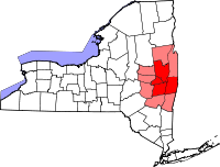
Largest communities
(over 20,000 in 2000)Medium-sized communities
(10,000 to 20,000 in 2000)City of Amsterdam · Brunswick · Cohoes · East Greenbush · Glens Falls · Gloversville · Halfmoon · Malta · North Greenbush · Schodack · Watervliet · WiltonSmall communities
(5,000 to 10,000 in 2000)Town of Amsterdam · Ballston Spa · Cobleskill · Village of Colonie · Duanesburg · City of Johnstown · Town of Johnstown · Kinderhook · Mechanicville · New Scotland · Rensselaer · Sand Lake · Scotia · Town of Stillwater · WaterfordCounties Albany · Columbia · Fulton · Greene · Montgomery · Rensselaer · Saratoga · Schenectady · Schoharie · Warren · WashingtonHistory Mohawks · Mahicans · Fort Orange · Rensselaerswyck · Beverwyck · Albany Plan of Union · Timeline of town creation · Toponymies of places · Tech ValleyGeography Hudson River (Valley) · Mohawk River · Erie Canal · Lake Albany · Lake George · Albany Pine Bush (Rensselaer Lake · Woodlawn Preserve) · Adirondack Mountains · Catskill Mountains · Rensselaer PlateauReligion and culture Culture in New York's Capital District · Sports in New York's Capital District · Episcopal Diocese of Albany · Roman Catholic Diocese of AlbanyEducation Public school districtsList of school districts in New York's Capital DistrictHigher educationNewspapers TV/Radio Broadcast television in the Capital District Local stations WRGB (6.1 CBS, 6.2 This TV) • WTEN (10.1 ABC, 10.2 Weather, 10.3 RTV) • WNYT (13.1 NBC, 13.2 Weather, 13.3 Weather Radar) • WMHT (17.1 PBS, 17.2 ThinkBright, 17.3 HD) • WXXA (23.1 Fox, 23.2 The Cool TV) • WNGN-LP 35 / WNGX-LP 42 (FN) • WCWN (45.1 The CW, 45.2 Uni Sp) • WNYA / WNYA-CD (51.1 MNTV, 51.2 Antenna TV) • W52DF 52 (silent)
Outlying area stations WVBK-CA 2 (RSN' Manchester, VT) • W04AJ 4 (PBS; Glens Falls) • W04BD 4 (PBS; Schoharie) •
WNCE-CA 8 (A1; Glens Falls) • WYBN-CA 14 (RSN; Cobleskill) • WCDC (19.1 ABC; Adams, MA) • WVBG-LP 25 (RSN; Greenwich) • W36AX 36 (PBS / VPT; Manchester, VT) • W47CM 47 (silent; Glens Falls) • WYPX (55.1 Ion, 55.2 qubo, 55.3 Life; Amsterdam) • W53AS 53 (PBS / VPT; Bennington, VT)Adjacent locals Cable-only stations YNN Capital Region • TW3 • YES • SNY • MSG Network
Defunct stations New York State television: Albany/Schenectady • Binghamton • Buffalo • Burlington/Plattsburgh • Elmira • New York City • Rochester • Syracuse • Utica • Watertown
Vermont Broadcast television: Albany/Schenectady • Boston, MA • Burlington/Plattsburgh
Massachusetts television: Albany • Boston • Providence • Springfield
Radio stations in the Albany / Schenectady / Troy market by FM frequency 88.3 · 89.1² · 89.7 · 89.9 · 90.3/93.1² · 90.7/94.9 · 90.7 · 90.7 · 90.9 · 91.1 · 91.5 · 92.3 · 92.9 · 93.5 · 93.7 · 94.5 · 94.7 · 95.5 · 95.9 · 96.3 · 96.7 · 97.3 · 97.5 · 97.7 · 97.9 · 98.3² · 98.5 · 98.5 · 99.1 · 99.5² · 100.3 · 100.9 · 101.3 · 101.7 · 101.9 · 102.3² · 102.7 · 103.1² · 103.5 · 103.9 · 104.5 · 104.9 · 105.7² · 106.1 · 106.5² · 107.1 · 107.7²by AM frequency NOAA Weather Radio frequency 162.550by callsign W226AC · W235AY · W256BU · W291BY · WABY · WAJZ · WAMC (AM) · WAMC-FM² · WBAR · WBPM · WCDB · WCKL · WCKM · WCQL · WCSS · WCTW · WDCD · WDCD-FM · WDDY² · WENT · WEQX · WEXT · WFFG · WFLY · WFNY · WGDJ · WGNA² · WGXC · WGY¹² · WGY-FM² · WHAZ · WHAZ-FM · WHUC · WHVP · WIZR · WJIV · WKBE · WKKF² · WKLI · WLJH · WMHT² · WMYY · WNYQ · WOFX² · WOPG · WPGL · WPYX² · WQAR · WQBJ · WQBK · WQSH² · WRIP · WROW · WRPI · WRUC · WRVE² · WSDE · WTMM · WTRY² · WUAM · WVCR · WVKZ · WVTL · WXL34 · WYAI · WYJB · WYKV · WZCR · WZMRDefunct stations New York Radio Markets: Albany-Schenectady-Troy • Binghamton • Buffalo-Niagara Falls • Elmira-Corning • Hamptons-Riverhead • Ithaca • Nassau-Suffolk (Long Island) • New York City • Newburgh-Middletown (Mid Hudson Valley) • Olean • Plattsburgh • Poughkeepsie • Rochester • Syracuse • Utica-Rome • Watertown
Other New York Radio Regions: Jamestown-Dunkirk • North Country • Saratoga
See also: List of radio stations in New York Capital District Portal
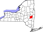
Municipalities and communities of Albany County, New York County seat: Albany Cities Albany | Cohoes | Watervliet
Towns Berne | Bethlehem | Coeymans | Colonie | Green Island | Guilderland | Knox | New Scotland | Rensselaerville | Westerlo
Villages Altamont | Colonie | Green Island | Menands | Ravena | Voorheesville
CDPs Other
hamletsAlcove | Boght Corners | Clarksville | Crescent Station | Dunsbach Ferry | Elsmere | Feura Bush | Fort Hunter | Fullers | Glenmont | Guilderland | Guilderland Center | Karner | Latham | Lisha Kill | Loudonville | Mannsville | McKownville | New Salem | Newtonville | Normansville | Roessleville | Selkirk | Slingerlands | South Bethlehem | Verdoy | West Albany
References
- ^ a b c Michael McKeon (August 25, 1987). "Mannsville: Former Colonie Hamlet or Just a State of Mind". Albany Knickerbocker News. p. 4A. http://archives.timesunion.com/mweb/wmsql.wm.request?oneimage&imageid=5430662. Retrieved 2010-02-13.
- ^ "Town of Colonie Historian's Office: Frequently Asked Questions". Town of Colonie. June 19, 2008. http://www.colonie.org/historian/index.html. Retrieved 2010-02-13.
- ^ a b Bechetta Jackson (February 8, 1998). "In Mannsville, the Question is Annexation". Albany Times Union. p. D3. http://archives.timesunion.com/mweb/wmsql.wm.request?oneimage&imageid=5908181. Retrieved 2010-02-13.
- ^ Mike Fricano (January 21, 2001). "Storm Causing Flood of Problems". Albany Times Union. p. E1. http://archives.timesunion.com/mweb/wmsql.wm.request?oneimage&imageid=6088592. Retrieved 2010-02-13.
- ^ Mike Fricano. "Flooding Remedies Could Exceed $1M". Albany Times Union. p. B4. http://archives.timesunion.com/mweb/wmsql.wm.request?oneimage&imageid=6115458. Retrieved 2010-02-13.
Categories:- Colonie, New York
- Hamlets in New York
- Populated places in Albany County, New York


Wikimedia Foundation. 2010.