- Cumberland Gap National Historical Park
-
Cumberland Gap National Historical Park IUCN Category V (Protected Landscape/Seascape)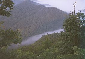
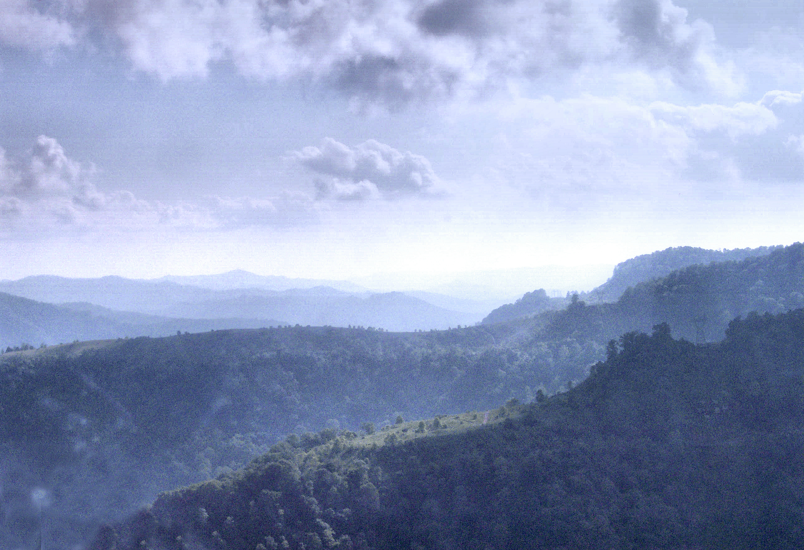
Fog forming over the gap.

Location Kentucky, Tennessee, and Virginia, USA Nearest city Middlesboro, Kentucky Coordinates 36°36′15″N 83°41′14″W / 36.60417°N 83.68722°WCoordinates: 36°36′15″N 83°41′14″W / 36.60417°N 83.68722°W Area 20,508 acres (8,299 ha) Established June 11, 1940 Visitors 883,663[1] (in 2009) Governing body National Park Service Established on June 11, 1940, Cumberland Gap National Historical Park is a United States National Historical Park located at the border between Kentucky, Tennessee, and Virginia.[2] The Cumberland Gap is a sizable natural break in the Appalachian Mountains.
The park lies in parts of Bell and Harlan counties in Kentucky, Claiborne County in Tennessee, and Lee County in Virginia. The park contains the Kentucky-Virginia-Tennessee tri-state area, accessible via a short trail.
Cumberland Gap National Historical Park covers 20,508 acres (8,299 ha), and saw 883,663 visitors in 2009.[1]
The Cumberland Gap Visitor Center is located on U.S. Highway 25E just southeast of Middlesboro, Kentucky and just northwest of the Cumberland Gap Tunnel and Cumberland Gap, Tennessee. The visitor center features a museum with interactive exhibits about the Gap's role as a transportation corridor, an auditorium that shows films about the area's cultural and natural history, a book store and the Cumberland Crafts gift shop. The visitor center is open each day of the year except Christmas Day.[3]
Contents
History
The gap was long used by Native Americans, as many species of migratory animals passed through it from north to south each year. It was fertile hunting territory and the only easy cut through the mountains from the southern wintering grounds of wild deer and buffalo to their northern summer range.[2] Starting around 1775, the Gap became the primary route of transit for American settlers moving west into Kentucky; between 1775 and 1810 as many as 300,000 settlers may have used the Gap.[4]
Two families by the name of Hensley and Gibbons moved to Brush Mountain to escape the many changes that were taking place in the early 1900s. Eventually, more family members followed and a community was begun. A church and school was established under the jurisdiction of the Bell County School System of Bell County, Kentucky.
Settlers continued their pioneer lifestyle until future generations began accepting employment and marriage partners off the mountain. Sherman Hensley, the founder of the settlement, was the last to leave in 1951.[5]
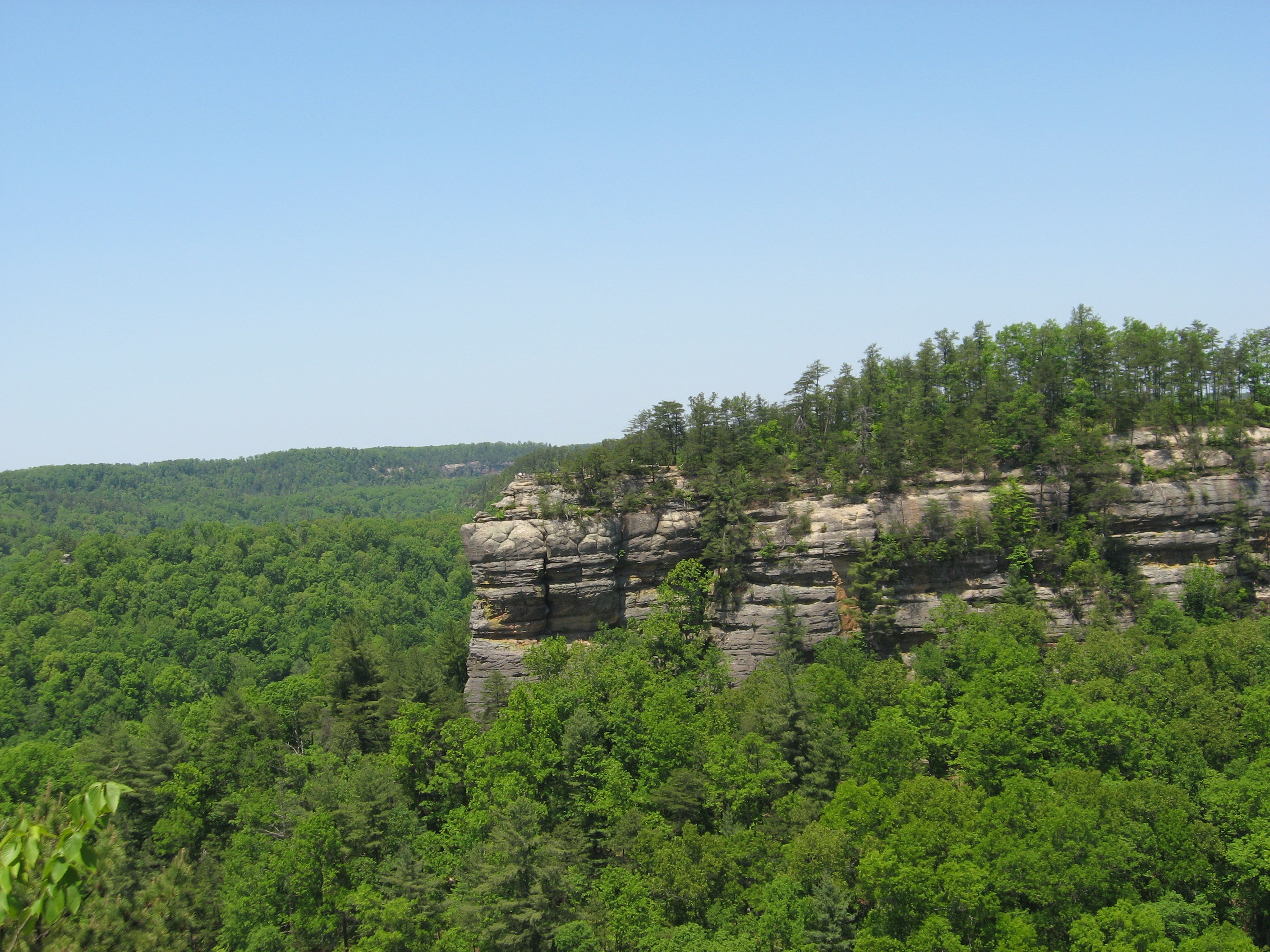
 View from Pinnacle Overlook
Preservation
The park preserves the natural beauty of the surrounding area while focusing on historic preservation. Included in the park is Hensley Settlement, an early 20th century Kentucky mountain community that has been preserved by the park service as representative of the early settler's life on top of Brush Mountain.
Tours through the old Hensley Settlement, trips into Gap Cave, also known as Cudjo's Cave, (once used for shelter by traveling Indians and settlers), living history events, campfire programs and demonstrations of the settlers' lifestyle provide a glimpse of life in the past, Appalachian music festivals and concerts provide another view of the life in this area.
The former roadbed of U.S. Highway 25E through the park has been restored to an early 19th century wagon path. This was made possible with the 1996 completion of the Cumberland Gap Tunnel, which rerouted US 25E under the park.[6]
See also
- Hensley Settlement
References
- ^ a b Cumberland Gap NHP Annual Visitation (All Years) National Park Service. Retrieved on 2010-09-12
- ^ a b Luckett, William W. (1993, reprint). Cumberland Gap National Historical Park. Tennessee Historical Quarterly. Retrieved on 2009-09-13
- ^ Visitor Center National Park Service. Retrieved on 2010-09-13
- ^ Kriplen, Nancy (September 13, 2009). "The Cumberland Gap, the Notch America Squeezed Through". The New York Times. http://travel.nytimes.com/2009/09/13/travel/13journeys.html. Retrieved 2010-09-13.
- ^ Eddy, Pam (July 8, 2009). "Protecting the Pioneer Spirit at Hensley Settlement". The Middlesboro Daily News. http://www.middlesborodailynews.com/pages/full_story/push?article-Protecting+the+Pioneer+Spirit+at+Hensley+Settlement%20&id=2892758-Protecting+the+Pioneer+Spirit+at+Hensley+Settlement. Retrieved 2010-09-13.
- ^ Cumberland Gap Tunnel Retrieved on 2010-09-13
External links
- Cumberland Gap National Historical Park
- Cumberland Gap at American Byways
- Guide to records (administrative files) from the Cumberland Gap National Historical Park
Visitor Attractions of the Eastern Mountain Coal Fields Parks StateBuckhorn Lake • Carr Creek • Carter Caves • Cumberland Falls • Dr. Thomas Walker • Fishtrap Lake • Grayson Lake • Greenbo Lake • Jenny Wiley • Kingdom Come • Levi Jackson Wilderness Road • Natural Bridge • Paintsville Lake • Pine Mountain • Pine Mountain Trail • Yatesville Lake
FederalBig South Fork • Cumberland Gap
Interstate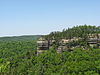


Museums Barthell Coal Mining Camp • Bell County Coal House & Museum • Bell County Historical Society Museum • Big Sandy Heritage Center • Blue Heron Coal Mining Camp • Bobby Davis Museum and Park • Breathitt County Museum • C.B. Caudill Store & History Center • Cloverfork Museum • Coal Miners' Museum • Cumberland Inn Museum • David A. Zegeer Coal-Railroad Museum • East Kentucky Science Center • Elkhorn City Railroad Museum • Harland Sanders Café & Museum • Highlands Museum and Discovery Center • Kentucky Coal Mining Museum • Kentucky Folk Art Center • Knox Historical Museum • Magoffin County Pioneer Village and Museum • Marie Stewart Museum & Craft Shop • McCreary County Museum • Morgan County History Museum • Mountain Homeplace • Mountain Life Museum • Northeastern Kentucky Museum • Swamp Valley Museum • U.S. 23 Country Music Highway Museum • Wolfe County History Museum
Forests Daniel Boone • Dewey Lake • Jefferson • Kentenia • Kentucky Ridge • Robinson • Tygarts
Reservoirs Buckhorn Lake • Carr Creek Lake • Cave Run Lake • Cranks Creek Lake • Lake Cumberland • Dewey Lake • Fishtrap Lake • Grayson Lake • Greenbo Lake • Laurel River Lake • Martins Fork Lake • Paintsville Lake • Yatesville Lake
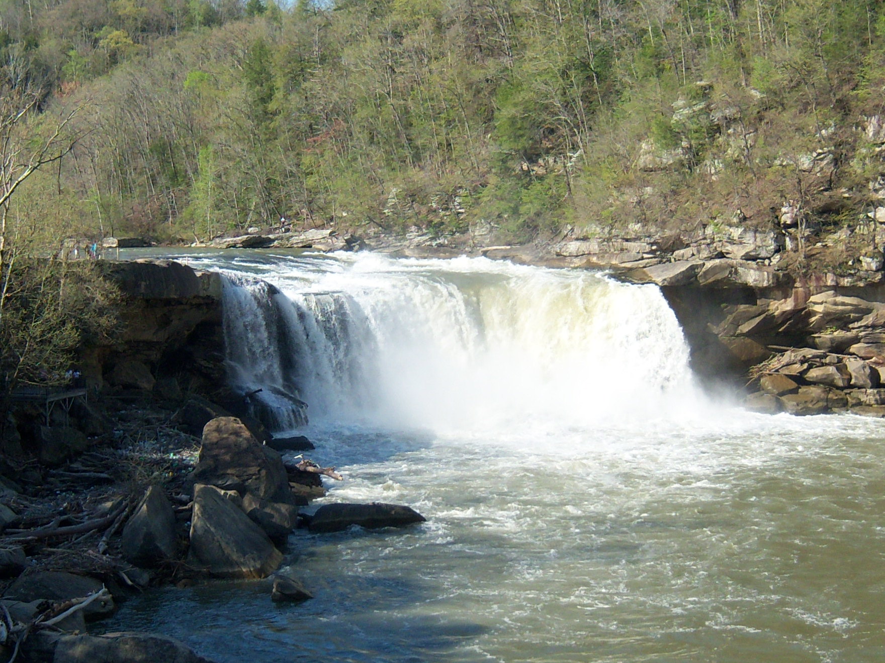
Natural features Black Mountain • Cumberland Falls • Cumberland Gap • Eagle Falls • Middlesboro crater • Pine Mountain • Pound Gap • Raven Rock • Red River Gorge • Tri-State Peak • Yahoo Arch • Yahoo Falls
Miscellaneous Bad Branch Falls State Nature Preserve • Bat Cave and Cascade Caverns State Nature Preserves • Big South Fork Scenic Railway • Black Mountain Off-Road Adventure Area • Cumberland Gap Tunnel • Mayo Mansion • Middle Creek Battlefield • Pikeville Cut-Through • Samuel May House • Sheltowee Trace Trail
Protected Areas of Tennessee Federal National ParksAndrew Johnson National Historic Site · Cumberland Gap National Historical ParkChickamauga and Chattanooga National Military Park · Fort Donelson National Battlefield · Fort Donelson National Cemetery · Shiloh National Cemetery • Shiloh National Military Park • Stones River National Battlefield • Stones River National CemeteryAppalachian National Scenic Trail • Natchez Trace National Scenic Trail • Overmountain Victory National Historic Trail • Trail of Tears National Historic TrailChickasaw • Cross Creeks • Hatchie • Lake Isom • Lower Hatchie • Reelfoot • Tennessee
Wilderness AreasBald River Gorge • Big Frog • Big Laurel Branch • Citico Creek • Cohutta • Gee Creek • Joyce Kilmer-Slickrock • Little Frog Mountain • Pond Mountain • Sampson Mountain • Unaka Mountain
Natchez Trace Parkway • Obed Wild and Scenic RiverState Big Ridge • Booker T. Washington • Cove Lake • Cumberland Mountain • Justin P. Wilson Cumberland Trail • Davy Crockett Birthplace • Fort Loudoun • Frozen Head • Harrison Bay • Hiwassee/Ocoee • Indian Mountain • Norris Dam • Panther Creek • Pickett • Red Clay • Roan Mountain • Sycamore Shoals • Warriors' Path
Bicentennial Capitol Mall • Bledsoe Creek • Burgess Falls • Cedars Of Lebanon • Cordell Hull Birthplace • David Crockett • Dunbar Cave • Edgar Evins • Fall Creek Falls • Harpeth River • Henry Horton • Johnsonville • Long Hunter • Montgomery Bell • Mousetail Landing • Old Stone Fort • Port Royal • Radnor Lake • Rock Island • Sgt. Alvin C. York • South Cumberland • Standing Stone • Tims Ford
Big Cypress Tree • Big Hill Pond • Chickasaw • Fort Pillow • Meeman-Shelby • N. B. Forrest • Natchez Trace • Paris Landing • Pickwick Landing • Pinson Mounds • Reelfoot Lake • Ross Cross Landing • T.O. Fuller
Bledsoe • Cedars of Lebanon • Chickasaw • Chuck Swan • Franklin • Lewis • Lone Mountain • Martha Sundquist • Natchez Trace • Pickett • Prentice Cooper • Scott • Standing Stone • Stewart
Honey Creek * Piney Falls • Laurel-Snow • North Chickamauga Creek Gorge • Stinging Fork Falls • Virgin Falls
Other OtherTennessee Department of Environment and Conservation (web) - Tennessee Department of Agriculture {web} Protected Areas of Virginia Federal Alexandria · Arlington · Balls Bluff · City Point · Cold Harbor · Culpeper · Danville · Fort Harrison · Fredericksburg · Glendale · Hampton · Hampton VA · Poplar Grove · Quantico · Richmond · Seven Pines · Staunton · Winchester · Yorktown
National TrailsGeorge Washington · Jefferson · Mount Rogers National Recreation Area · Mountain Lake Wilderness · Ramsey's Draft Wilderness · Rough Mountain Wilderness · Saint Mary's Wilderness
State Bear Creek Lake · Belle Isle · Biscuit Run · Breaks Interstate · Caledon Natural Area · Chippokes Plantation · Claytor Lake · Douthat · Fairy Stone · False Cape · First Landing · Grayson Highlands · High Bridge Trail · Holliday Lake · Hungry Mother · James River · Kiptopeke · Lake Anna · Leesylvania · Mason Neck · Natural Tunnel · New River Trail · Occoneechee · Pocahontas · Sailor's Creek Battlefield · Shot Tower · Shenandoah River · Sky Meadows · Smith Mountain Lake · Southwest Virginia Museum · Staunton River · Staunton River Battlefield · Tabb Monument · Twin Lakes · Westmoreland · Wilderness Road · York River
Appomattox-Buckingham · Big Woods · Bourassa · Browne · Channels · Chilton Woods · Conway-Robinson · Crawfords · Cumberland · Devil's Backbone · Dragon Run · Hawks · Lesesne · Matthews · Moore's Creek · Niday Place · Paul · Prince Edward-Gallion · Sandy Point · Whitney · Zoar
Antioch Pines · Bethel Beach · Big Spring Bog · Blackwater · Buffalo Mountain · Bull Run Mountains · Bush Mill Stream · Camp Branch Wetlands · Cape Charles Coastal Habitat · The Cedars · The Channels · Cherry Orchard Bog · Chestnut Creek Wetlands · Chestnut Ridge · Chotank Creek · Chub Sandhill · Cleveland Barrens · Clover Hollow · Cowbane Prairie · Crow's Nest · Cumberland Marsh · Dameron Marsh · Deep Run Ponds · Dendron Swamp · Difficult Creek · Elklick Woodlands · False Cape · Folly Mills Creek Fen · Goshen Pass · Grafton Ponds · Grassy Hill · Grayson Glades · Hickory Hollow · Hughlett Point · Johnsons Creek · Magothy Bay · Mark's and Jack's Island · Mount Joy Pond · Mutton Hunk Fen · Naked Mountain · New Point Comfort · North Landing River · Northwest River · Ogdens Cave · Parkers Marsh · Parramore Island · Pedlars Hill · Pinnacle · Poor Mountain · Red Rock Mountain · Savage Neck Dunes · Unthanks Cave · William B. Trower Bayshore · Wreck Island
Wildlife
Management AreasAmelia · Big Survey · Briery Creek · Chester F. Phelps · Cavalier · Chickahominy · Clinch Mountain · Crooked Creek · Dick Cross · Fairystone Farms · Featherfin · G. Richard Thompson · Game Farm Marsh · Goshen and Little North Mountain · Hardware River · Havens · Hidden Valley · Highland · Hog Island · Horsepen Lake · James River · Land's End · Mockhorn Island · Pettigrew · Powhatan · Princess Anne · Ragged Island · Rapidan · Saxis · Stewarts Creek · T. M. Gathright · Turkeycock · Weston · White Oak Mountain
Other Counties A–B · C · D–G · H–M · N–R · S–Z · Bridges · National Historic Landmarks
Virginia Department of Conservation and Recreation · Virginia Department of Forestry · Virginia Department of Game and Inland Fisheries · Virginia Landmarks Register National Historical Parks of the United States Abraham Lincoln Birthplace • Adams • Appomattox Court House • Boston • Cane River Creole • Cedar Creek and Belle Grove • Chaco Culture • Chesapeake and Ohio Canal • Colonial • Cumberland Gap • Dayton Aviation Heritage • George Rogers Clark • Harpers Ferry • Hopewell Culture • Independence • Jean Lafitte • Kalaupapa • Kaloko-Honokōhau • Keweenaw • Klondike Gold Rush • Lewis and Clark • Lowell • Lyndon B. Johnson • Marsh-Billings-Rockefeller • Minute Man • Morristown • Natchez • New Bedford Whaling • New Orleans Jazz • Nez Perce • Palo Alto Battlefield • Paterson Great Falls • Pecos • Puʻuhonua o Hōnaunau • Roosevelt Campobello International Park • Rosie the Riveter/World War II Home Front • Salt River Bay • San Antonio Missions • San Francisco Maritime • San Juan Island • Saratoga • Sitka • Thomas Edison • Tumacácori • Valley Forge • War in the Pacific • Women's Rights
Full Alphabetical List U.S. National Register of Historic Places Topics Lists by states Alabama • Alaska • Arizona • Arkansas • California • Colorado • Connecticut • Delaware • Florida • Georgia • Hawaii • Idaho • Illinois • Indiana • Iowa • Kansas • Kentucky • Louisiana • Maine • Maryland • Massachusetts • Michigan • Minnesota • Mississippi • Missouri • Montana • Nebraska • Nevada • New Hampshire • New Jersey • New Mexico • New York • North Carolina • North Dakota • Ohio • Oklahoma • Oregon • Pennsylvania • Rhode Island • South Carolina • South Dakota • Tennessee • Texas • Utah • Vermont • Virginia • Washington • West Virginia • Wisconsin • WyomingLists by territories Lists by associated states Other  Category:National Register of Historic Places •
  Portal:National Register of Historic PlacesCategories:
- IUCN Category V
- Protected areas of Claiborne County, Tennessee
- Parks in Lee County, Virginia
- National Historical Parks of the United States
- National Register of Historic Places in Bell County, Kentucky
- National Register of Historic Places in Harlan County, Kentucky
- National Register of Historic Places in Tennessee
- National Register of Historic Places in Virginia
- Parks in Kentucky
- Parks in Tennessee
- Parks in Virginia
- Open air museums in Kentucky
- Museums in Bell County, Kentucky
- Rural history museums in the United States
- Protected areas established in 1940
- United States National Park Service areas in Kentucky
- United States National Park Service areas in Tennessee
- Protected areas of Bell County, Kentucky
- Protected areas of Harlan County, Kentucky
- National Register of Historic Places in Kentucky


Wikimedia Foundation. 2010.