- Cumberland County, Virginia
-
Cumberland County, Virginia 
Seal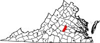
Location in the state of Virginia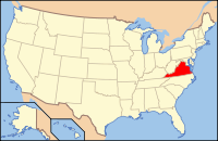
Virginia's location in the U.S.Founded 1749 Seat Cumberland Area
- Total
- Land
- Water
300 sq mi (777 km²)
298 sq mi (772 km²)
1 sq mi (3 km²), 0.43%Population
- Density
10,052
31/sq mi (12/km²)Website www.cumberlandcounty.virginia.gov Cumberland County is a county located in the Commonwealth of Virginia. As of 2010, the population was 10,052[1]. Its county seat is Cumberland[2].
Contents
History
Cumberland County was established in 1749 from Goochland County. The county is named for William Augustus, Duke of Cumberland, second son of King George II of Great Britain. Cumberland County was also home to the Fleming family, which included Judge John Fleming and his son Judge William Fleming.
From 1749 until the creation of Powhatan County in 1777, Mosby Tavern served as the county courthouse, and the tavern subsequently became known as "Old Cumberland Courthouse."
Geography
According to the U.S. Census Bureau, the county has a total area of 300 square miles (777.0 km2), of which 298 square miles (771.8 km2) are land and 1 square mile (2.6 km2) (0.43%) is water.
Adjacent Counties
- Goochland County - northeast
- Powhatan County - east
- Amelia County - southeast
- Prince Edward County - south
- Buckingham County - west
- Fluvanna County - northwest
Demographics
Historical populations Census Pop. %± 1790 8,153 — 1800 9,839 20.7% 1810 9,992 1.6% 1820 11,023 10.3% 1830 11,690 6.1% 1840 10,399 −11.0% 1850 9,751 −6.2% 1860 9,961 2.2% 1870 8,142 −18.3% 1880 10,540 29.5% 1890 9,482 −10.0% 1900 8,996 −5.1% 1910 9,195 2.2% 1920 9,111 −0.9% 1930 7,535 −17.3% 1940 7,505 −0.4% 1950 7,252 −3.4% 1960 6,360 −12.3% 1970 6,179 −2.8% 1980 7,881 27.5% 1990 7,825 −0.7% 2000 9,017 15.2% 2010 10,052 11.5%
As of the census[3] of 2000, there were 9,017 people, 3,528 households, and 2,487 families residing in the county. The population density was 30 people per square mile (12/km²). There were 4,085 housing units at an average density of 14 per square mile (5/km²). The racial makeup of the county was 60.37% White, 37.44% Black or African American, 0.18% Native American, 0.35% Asian, 0.59% from other races, and 1.06% from two or more races. 1.66% of the population were Hispanic or Latino of any race.There were 3,528 households out of which 30.00% had children under the age of 18 living with them, 51.60% were married couples living together, 14.30% had a female householder with no husband present, and 29.50% were non-families. 24.80% of all households were made up of individuals and 10.70% had someone living alone who was 65 years of age or older. The average household size was 2.55 and the average family size was 3.03.
In the county, the population was spread out with 24.70% under the age of 18, 7.30% from 18 to 24, 28.00% from 25 to 44, 25.10% from 45 to 64, and 14.80% who were 65 years of age or older. The median age was 38 years. For every 100 females there were 91.00 males. For every 100 females age 18 and over, there were 88.20 males.
The median income for a household in the county was $31,816, and the median income for a family was $37,965. Males had a median income of $28,846 versus $22,521 for females. The per capita income for the county was $15,103. 15.10% of the population and 11.90% of families were below the poverty line. Out of the total people living in poverty, 19.60% are under the age of 18 and 16.10% are 65 or older.
Communities
Incorporated
Unincorporated
- Cartersville
- Cumberland
- Tamworth
Attractions & Events
Bear Creek Lake State Park is located 4.5 miles (7.2 km) northwest of the town of Cumberland. Bear Creek Lake features overnight cabins, a lodge, permanent camp sites, and picnic shelters. Swimming and boating are allowed at the lake, and boat rentals are available. The park also has trails for hiking and running.
The 16,233-acre (65.69 km2) Cumberland State Forest is north of U.S. Route 60, west of State Route 45 and bordered on the west by the Willis River. The Forest has multiple purposes, including watershed protection, recreation, timber production, hunting, fishing, and applied forest research. There are two self-guided trails at Cumberland State Forest that are open for walking, hiking, horses, and mountain bikes. These are the Cumberland Multi-Use Trail (14 miles) and the Willis River Hiking Trail (16-miles). White-tailed deer, wild turkey and bobcats are common residents of this natural area. The State forest also features five lakes which may be fished from with a Virginia State fishing license, including: Oak Hill Lake, Bear Creek Lake, Winston Lake, Arrowhead Lake, and Bonbrook Lake.
See also
References
- ^ [1]. Weldon Cooper Center 2010 Census Count Retrieved September 9, 2011
- ^ "Find a County". National Association of Counties. http://www.naco.org/Counties/Pages/FindACounty.aspx. Retrieved 2011-06-07.
- ^ "American FactFinder". United States Census Bureau. http://factfinder.census.gov. Retrieved 2008-01-31.
External links
- Cumberland County's Official Website
- http://www.cucps.k12.va.us/ (Cumberland County Public Schools)
- http://www.cumberlandva.com/

Fluvanna County Goochland County Buckingham County 
Powhatan County  Cumberland County, Virginia

Prince Edward County Amelia County The Greater Richmond Region Regional Divisions The West End · The Fan · Downtown · Southside · North Side · Mechanicsville · The East End · Tri-Cities / Petersburg · Varina-Enon
Surrounding Counties Chesterfield · Hanover · Henrico · Goochland
Other Counties Amelia · Caroline · Charles City · Cumberland · Dinwiddie · King and Queen · King William · Louisa · New Kent · Powhatan · Prince George · Sussex
Municipalities and communities of Cumberland County, Virginia Town 
CDP Unincorporated
communitiesAngola | Ashby | Cartersville | Clinton | Cotton Town | Guinea Mills | Hamilton | Hatcher | Hawk | Hillcrest | Kimberly Hills | Lakeside Village | McRae | Oak Forest | Raines Tavern | Reeds | Stoddert | Sunny Side‡ | Tamworth | Trenton Mills | Trents Mill | Whiteville
Footnotes ‡This populated place also has portions in an adjacent county or counties
Categories:- Virginia counties
- Cumberland County, Virginia
- 1749 establishments
- Counties on the James River (Virginia)


Wikimedia Foundation. 2010.