- Northampton County, Virginia
-
Northampton County, Virginia 
Seal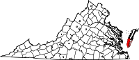
Location in the state of Virginia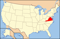
Virginia's location in the U.S.Founded 1634 Seat Eastville Area
- Total
- Land
- Water
795 sq mi (2,059 km²)
207 sq mi (536 km²)
588 sq mi (1,523 km²), 73.93%Population
- Density
12,389
62/sq mi (24/km²)Website www.co.northampton.va.us Northampton County is a county located in the Commonwealth of Virginia. As of 2010, the population was 12,389.[1] Its county seat is Eastville.[2]
Northampton and Accomack Counties comprise the Eastern Shore of Virginia.
The county is the epicenter of the late Eocene meteor strike that resulted in the Chesapeake Bay impact crater.
Contents
History
When English colonists first arrived in the area in the early 1600s, the Virginia Eastern Shore region was governed by Debedeavon (aka "The Laughing King"), paramount chief of the Accawmacke clans who numbered around 2000 at the time.
The county has a long history as a home for free African Americans during the era of slavery. One of the most notable was Anthony Johnson (colonist). Free blacks in America were first documented in Northampton County, Virginia, in 1662.[3]
Geography
According to the U.S. Census Bureau, the county has a total area of 795 square miles (2,060 km2), of which 207 square miles (540 km2) is land and 588 square miles (1,520 km2) (73.93%) is water.
Adjacent County and Independent City
- Accomack County - north
- Virginia Beach, Virginia - south
National protected areas
- Eastern Shore of Virginia National Wildlife Refuge
- Fisherman Island National Wildlife Refuge
Demographics
Historical populations Census Pop. %± 1790 6,889 — 1800 6,763 −1.8% 1810 7,474 10.5% 1820 7,705 3.1% 1830 8,641 12.1% 1840 7,715 −10.7% 1850 7,498 −2.8% 1860 7,832 4.5% 1870 8,046 2.7% 1880 9,152 13.7% 1890 10,313 12.7% 1900 13,770 33.5% 1910 16,672 21.1% 1920 17,852 7.1% 1930 18,565 4.0% 1940 17,597 −5.2% 1950 17,300 −1.7% 1960 16,966 −1.9% 1970 14,442 −14.9% 1980 14,625 1.3% 1990 13,061 −10.7% 2000 13,093 0.2% 2010 12,389 −5.4%
As of the census[4] of 2010, there were 12,389 people, 5,321 households, and 3,543 families residing in the county. The population density was 63 people per square mile (24/km²). There were 6,547 housing units at an average density of 32 per square mile (12/km²). The racial makeup of the county was 57.9% White, 36.5% Black or African American, 0.2% Native American, 0.7% Asian, 0.1% Pacific Islander, 3.2% from other races, and 1.4% from two or more races. 7.1% of the population were Hispanic or Latino of any race.As of the 2000 census the largest ancestry groups in Northampton County include: African American (49%), English American (15%), German (7%), Irish (6%) and Italian (3%)
There were 5,321 households out of which 25.70% had children under the age of 18 living with them, 45.30% were married couples living together, 17.50% had a female householder with no husband present, and 33.40% were non-families. 29.40% of all households were made up of individuals and 15.60% had someone living alone who was 65 years of age or older. The average household size was 2.39 and the average family size was 2.94.
In the county, the population was spread out with 23.30% under the age of 18, 7.10% from 18 to 24, 23.60% from 25 to 44, 24.80% from 45 to 64, and 21.20% who were 65 years of age or older. The median age was 42 years. For every 100 females there were 87.90 males. For every 100 females age 18 and over, there were 84.10 males.
The median income for a household in the county was $28,276, and the median income for a family was $35,034. Males had a median income of $26,842 versus $21,839 for females. The per capita income for the county was $16,591. About 15.80% of families and 20.50% of the population were below the poverty line, including 29.20% of those under age 18 and 16.50% of those age 65 or over.
Northampton County is home to the United States' oldest continuous court records.
Towns
 Cape Charles, VA.
- Belle Haven
- Cape Charles
- Cheriton
- Eastville
- Exmore
- Nassawadox
- Oyster (unincorporated)
Transportation
Education
Northampton County Public Schools operates public schools in the county.
Notable residents
- Abel Upshur (1791-1844), born in Northampton County, United States Secretary of State and United States Secretary of the Navy[5]
See also
References
- ^ [http://www.coopercenter.org/demographics Weldon Cooper Center 2010 Census Count Retrieved January 26, 2011
- ^ "Find a County". National Association of Counties. http://www.naco.org/Counties/Pages/FindACounty.aspx. Retrieved 2011-06-07.
- ^ Africana: The Encyclopedia of the African and African American Experience By Anthony Appiah, Kwame Anthony Appiah, Henry Louis Gates Page 299
- ^ "American FactFinder". United States Census Bureau. http://factfinder.census.gov. Retrieved 2008-01-31.
- ^ http://history.state.gov/departmenthistory/people/upshur-abel-parker
External links

Accomack County Chesapeake Bay 
Atlantic Ocean  Northampton County, Virginia

City of Virginia Beach  Commonwealth of Virginia
Topics - Climate
- Colleges and universities
- Colony
- Congressional Districts
- Culture
- Delegations
- Demographics
- Economy
- Education
- Environment
- Furniture
- Geography
- Government
- Governors
- History
- Historic Landmarks
- Magisterial Districts
- Homes
- Music
- People
- Police
- Politics
- Rights
- Rivers
- School divisions
- Scouting
- Slogan
- Sports teams
- State Fair
- State parks
- Symbols
- Towns
- Transportation
- Tribes
- Visitor Attractions
Regions - Allegheny Mountains
- Atlantic Coastal Plain
- Blue Ridge
- Chesapeake Bay
- Cumberland Mountains
- Delmarva Peninsula
- Eastern Shore
- Hampton Roads
- Middle Peninsula
- Northern Neck
- Northern Virginia
- Piedmont
- Ridge-and-Valley Appalachians
- Shenandoah Valley
- South Hampton Roads
- Southside
- Southwest Virginia
- Tennessee Valley
- Tidewater
- Tri-Cities
- Virginia Peninsula
Metro areas - Blacksburg-Christiansburg-Radford
- Bluefield
- Bristol
- Charlottesville
- Culpeper
- Danville
- Fredericksburg
- Harrisonburg
- Lynchburg
- Martinsville
- Richmond
- Roanoke
- Staunton
- Hampton Roads
- Washington-Arlington-Alexandria
- Waynesboro
- Winchester
Counties - Accomack
- Albemarle
- Alleghany
- Amelia
- Amherst
- Appomattox
- Arlington
- Augusta
- Bath
- Bedford
- Bland
- Botetourt
- Brunswick
- Buchanan
- Buckingham
- Campbell
- Caroline
- Carroll
- Charles City
- Charlotte
- Chesterfield
- Clarke
- Craig
- Culpeper
- Cumberland
- Dickenson
- Dinwiddie
- Essex
- Fairfax
- Fauquier
- Floyd
- Fluvanna
- Franklin
- Frederick
- Giles
- Gloucester
- Goochland
- Grayson
- Greene
- Greensville
- Halifax
- Hanover
- Henrico
- Henry
- Highland
- Isle of Wight
- James City
- King and Queen
- King George
- King William
- Lancaster
- Lee
- Loudoun
- Louisa
- Lunenburg
- Madison
- Mathews
- Mecklenburg
- Middlesex
- Montgomery
- Nelson
- New Kent
- Northampton
- Northumberland
- Nottoway
- Orange
- Page
- Patrick
- Pittsylvania
- Powhatan
- Prince Edward
- Prince George
- Prince William
- Pulaski
- Rappahannock
- Richmond
- Roanoke
- Rockbridge
- Rockingham
- Russell
- Scott
- Shenandoah
- Smyth
- Southampton
- Spotsylvania
- Stafford
- Surry
- Sussex
- Tazewell
- Warren
- Washington
- Westmoreland
- Wise
- Wythe
- York
Independent
cities- Alexandria
- Bedford
- Bristol
- Buena Vista
- Charlottesville
- Chesapeake
- Colonial Heights
- Covington
- Danville
- Emporia
- Fairfax
- Falls Church
- Franklin
- Fredericksburg
- Galax
- Hampton
- Harrisonburg
- Hopewell
- Lexington
- Lynchburg
- Manassas
- Manassas Park
- Martinsville
- Newport News
- Norfolk
- Norton
- Petersburg
- Poquoson
- Portsmouth
- Radford
- Richmond
- Roanoke
- Salem
- Staunton
- Suffolk
- Virginia Beach
- Waynesboro
- Williamsburg
- Winchester
Categories:- Virginia counties
- Northampton County, Virginia
- 1634 establishments in the Thirteen Colonies
- Populated places established in 1634


Wikimedia Foundation. 2010.