- Duncan, British Columbia
-
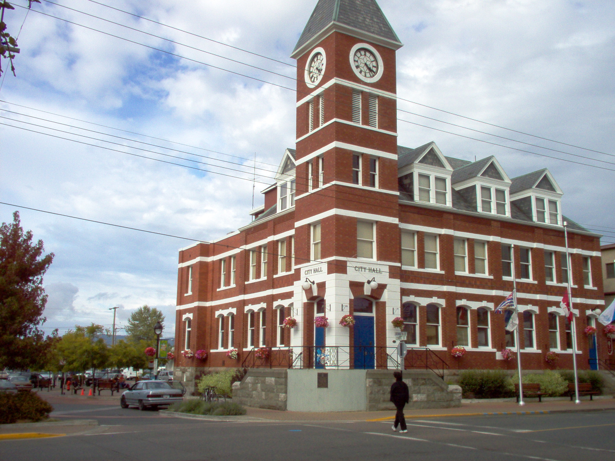
City of Duncan — City — City Hall
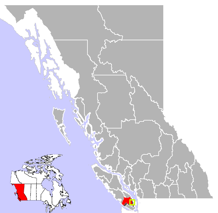
Motto: City of Totems Location of Duncan in British Columbia
Coordinates: 48°46′43″N 123°42′28″W / 48.77861°N 123.70778°W Country  Canada
Province  British Columbia
Region Vancouver Island Regional district Cowichan Valley Incorporated 1912 Government - Governing body Duncan City Council - Mayor Phil Kent Area - City 2.05 km2 (0.8 sq mi) Elevation 20 m (66 ft) Population (2009) - City 5,035 - Urban 41,387 - Urban density 111.3/km2 (288.3/sq mi) Time zone PST (UTC−8) - Summer (DST) PDT (UTC−7) Highways 1 Waterways Cowichan River Website City of Duncan Duncan (pop. 5,035) is a city on southern Vancouver Island in British Columbia, Canada.
Contents
History
The community is named after William Chalmers Duncan[1] (born 1836 in Sarnia, Ontario). He arrived in Victoria in May 1862, then in August of that year he was one of the party of a hundred settlers which Governor Douglas took to Cowichan Bay. After going off on several gold rushes, Duncan settled close to the present city of Duncan. He married in 1876, and his son Kenneth became the first mayor of Duncan. A street bears his name today.
Duncan's farm was named Alderlea, and this was the first name of the adjacent settlement. In August 1886, the Esquimalt and Nanaimo Railway was opened. No stop had been scheduled at Alderlea for the inaugural train bearing Sir John A. Macdonald and Robert Dunsmuir. However, at Duncan's Crossing, the level crossing nearest Alderlea, a crowd of 2,000 had assembled around a decorated arch and the train came to an unplanned halt, quite literally putting it on the map.
In the early 1900s, Duncan's Chinatown was the social centre for the Cowichan Valley's Chinese population. Chinatown was concentrated in a single block in the southwestern corner of Duncan. At its largest point, Duncan's Chinatown included six Chinese families and 30 merchants supplying loggers, millworkers and cannery and mine workers. As immigration laws became more restrictive, businesses closed and the buildings became run down. The city tore the buildings down in 1969 to build a new law courts complex. Some materials from the original buildings was used at Whippletree Junction.[2]
In the 1980s, Duncan was linked to the 1985 bombings at Narita Airport in Japan and aboard Air India Flight 182, Canada's largest murder case. Resident Inderjit Singh Reyat purchased bomb parts and a radio used to conceal a bomb at Duncan stores. Less than two weeks prior to the bombings, Reyat and suspected Air India mastermind Talwinder Singh Parmar were observed testing explosives in the woods outside of Duncan by the Canadian Security Intelligence Service (CSIS).[3]
Location
The railroad continues to cross Duncan as does the Trans-Canada Highway. The city is about 50 kilometres from both Victoria to the south and Nanaimo to the north. Although the City of Duncan has a population of just over 5000 it serves the Cowichan Valley, which has a population of approximately 78,000, many of whom live in North Cowichan contiguous with Duncan, giving Duncan a much larger "greater" population than that contained within the strict city limits. People in areas of North Cowichan bordering on Duncan use "Duncan" as their mailing address. Duncan is the seat of the Cowichan Valley Regional District. It derives the name from Quw’utsun’ > Khowutzun > Cowichan, literally translated from Coast Salish into "The Warm Land".
Tourist attractions
Duncan's tourism slogan is "The City of Totems". The city has 80 totem poles around the entire town, which were erected in the late 1980s, including the world's largest totem pole (in diameter), carved by First Nations artisan Simon Charlie.
Duncan has a large First Nations community and is the traditional home of the Cowichan Tribes, who are the largest band among the Coast Salish people. The Coast Salish men and women of the Cowichan Tribes are makers of the world famous Cowichan Sweaters.
Duncan is home to the BC Forest Discovery Centre. Before the U.S.-Canada softwood lumber dispute, Duncan and the whole Cowichan Valley were a thriving lumber centre in British Columbia.
Duncan is also home to Pacific Northwest Raptors, where travelers can see hawks, falcons, eagles, vultures and owls in flight. At this centre, you can also learn about the art of falconry, and take courses on how to care for, and hunt with, hawks and falcons.
Duncan has the world's largest ice hockey stick, officially recognised by Guinness World Records on July 14, 2008,[4] which is on display on the side of the local (formerly known) arena- the Cowichan Community Centre. The centre is now called The 'Island Savings Centre', (in 2008 Island Savings entered into a 10 year/one million dollar naming rights agreement with the CVRD).[5] The stick was made specifically for Expo 86 in Vancouver, and purchased by Duncan at the end of the event.
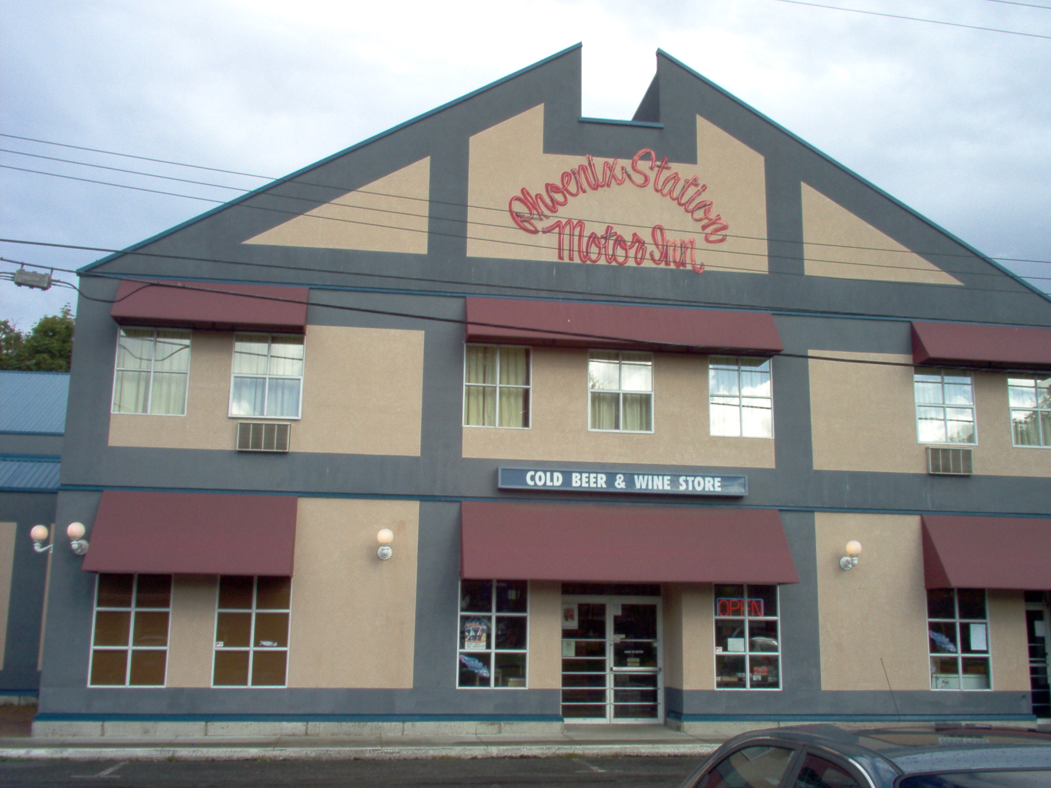
Duncan Garage Heritage Building (see photo below), beside the Phoenix Station Motor Inn in Duncan, construction started in 1912, by Robert McClay, for Norman Corefield, owner/operator of the Duncan Garage. It was completed early 1913, and appeared in Canadian Motorist Magazine(May 1913 issue) as; " The most complete and up-to-date fireproof garage on Vancouver Island". In 2002, Brant Weninger spearheaded "The Duncan Garage Restoration Project" and completely restored the Duncan Garage, creating which is now a community gathering place and focal point in Duncan. It was designated a heritage building in 2002 and added to Duncan's heritage building inventory. Other milestones for the Duncan Garage; In 1911 Norman Corefield drove the first car over the Malahat Hwy. opening up vehicle traffic to Duncan. The Duncan Garage set a provincial record for the longest operating business in one location(65 years) Duncan Garage mechanical team invented the first Ford Station Wagon, They also invented the first automobile air lift.
Climate
Climate data for Duncan Month Jan Feb Mar Apr May Jun Jul Aug Sep Oct Nov Dec Year Record high °C (°F) 15
(59)19.4
(66.9)21.1
(70.0)25.6
(78.1)33.5
(92.3)36
(97)38.2
(100.8)37.5
(99.5)34.5
(94.1)28.4
(83.1)18.9
(66.0)17
(63)38.2
(101)Average high °C (°F) 6.1
(43.0)8
(46)10.6
(51.1)13.9
(57.0)17.4
(63.3)20.3
(68.5)23.3
(73.9)23.6
(74.5)20.3
(68.5)14.8
(58.6)8.8
(47.8)6.3
(43.3)14.5 Average low °C (°F) −1.1
(30.0)0.1
(32.2)1.2
(34.2)3
(37)6.2
(43.2)9.1
(48.4)10.7
(51.3)10.5
(50.9)7.2
(45.0)3.8
(38.8)1.2
(34.2)−0.5
(31.1)4.3 Record low °C (°F) −21.1
(−6.0)−15.5
(4.1)−12
(10)−3.9
(25.0)−2.2
(28.0)1.7
(35.1)3.3
(37.9)2.2
(36.0)−3
(27)−6.7
(19.9)−17
(1)−21.7
(−7.1)−21.7
(−7.1)Precipitation mm (inches) 145.3
(5.72)130.1
(5.122)101.7
(4.004)54
(2.13)44.4
(1.748)37.3
(1.469)20.3
(0.799)25.3
(0.996)46.7
(1.839)80
(3.15)168.8
(6.646)185.5
(7.303)1,039.2
(40.913)Source: Environment Canada[6] Education
Vancouver Island University (formerly Malaspina University-College) has a regional campus in Duncan that offers programs and courses in university transfer, access, trades and applied technology, health and human services, and career and academic preparation. The campus also has a Continuing Education department that offers certificate programs, personal and professional development courses, and online courses. A new 55,000-square-foot (5,100 m2) campus opened for classes in June of 2011.
Duncan has one public secondary school, Cowichan Secondary School, as well as several elementary and middle schools. It also has one private secondary university preparatory school, Queen Margaret's School, established in 1921 which has a co-ed junior school included. There is also an independent Catholic school, Queen of Angels which continues up to Grade 9. The city is also home to Duncan Christian School. The head offices for School District 79 Cowichan Valley are also located in Duncan.
In 2007 the city of Duncan deemed copyright privileges of the totem poles in the city. The use of the totems images in any form require the City of Duncan's approval. [7]
Sports
Duncan is the home city of the British Columbia Hockey League's Cowichan Valley Capitals, who play in the Island Savings Centre.
Transportation
Public transit is provided in conjunction between BC Transit and the Cowichan Valley Regional Transit System.
Notable residents
See also Category:People from Duncan, British Columbia
- Greg Adams former NHL player.
- Robin Bawa former NHL player
- Doug Bodger former NHL player.
- Geoff Courtnall former NHL player.
- Russ Courtnall former NHL player.
- Matt Ellison former NHL player.
- Matt Evans Canadian international Rugby union player
- Mitch Guindon former drummer for rock band Nickelback
- Mike Sweeney former soccer player (played for Canada at the 1986 World Cup).
- Alan Wilson former CFL player.
Gallery
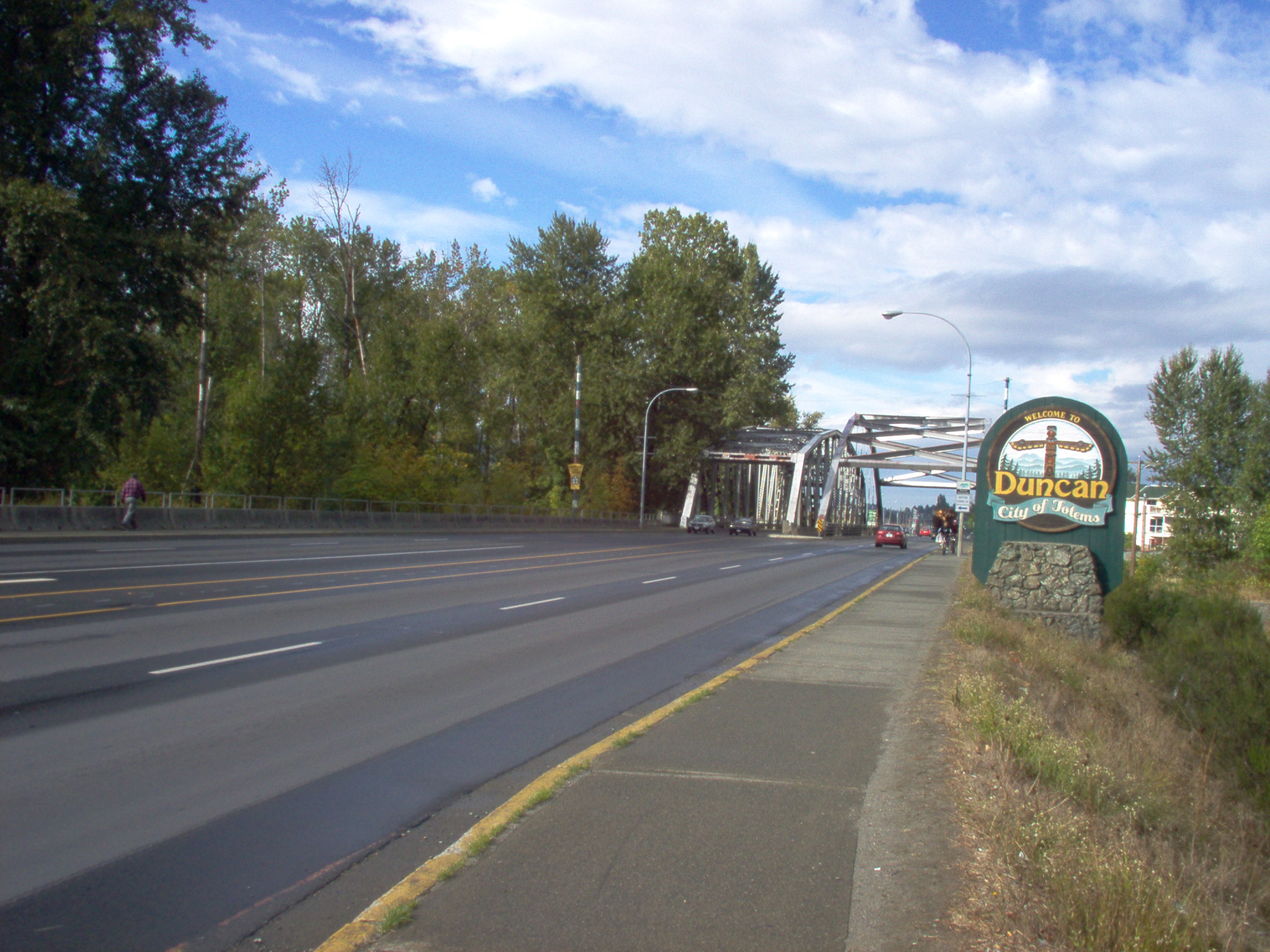
-

Silver Bridge
-
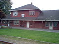
The Train Station
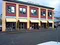
-

The Phoenix Motor Inn
-
Duncan Garage
-

Totem Pole
-
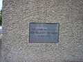
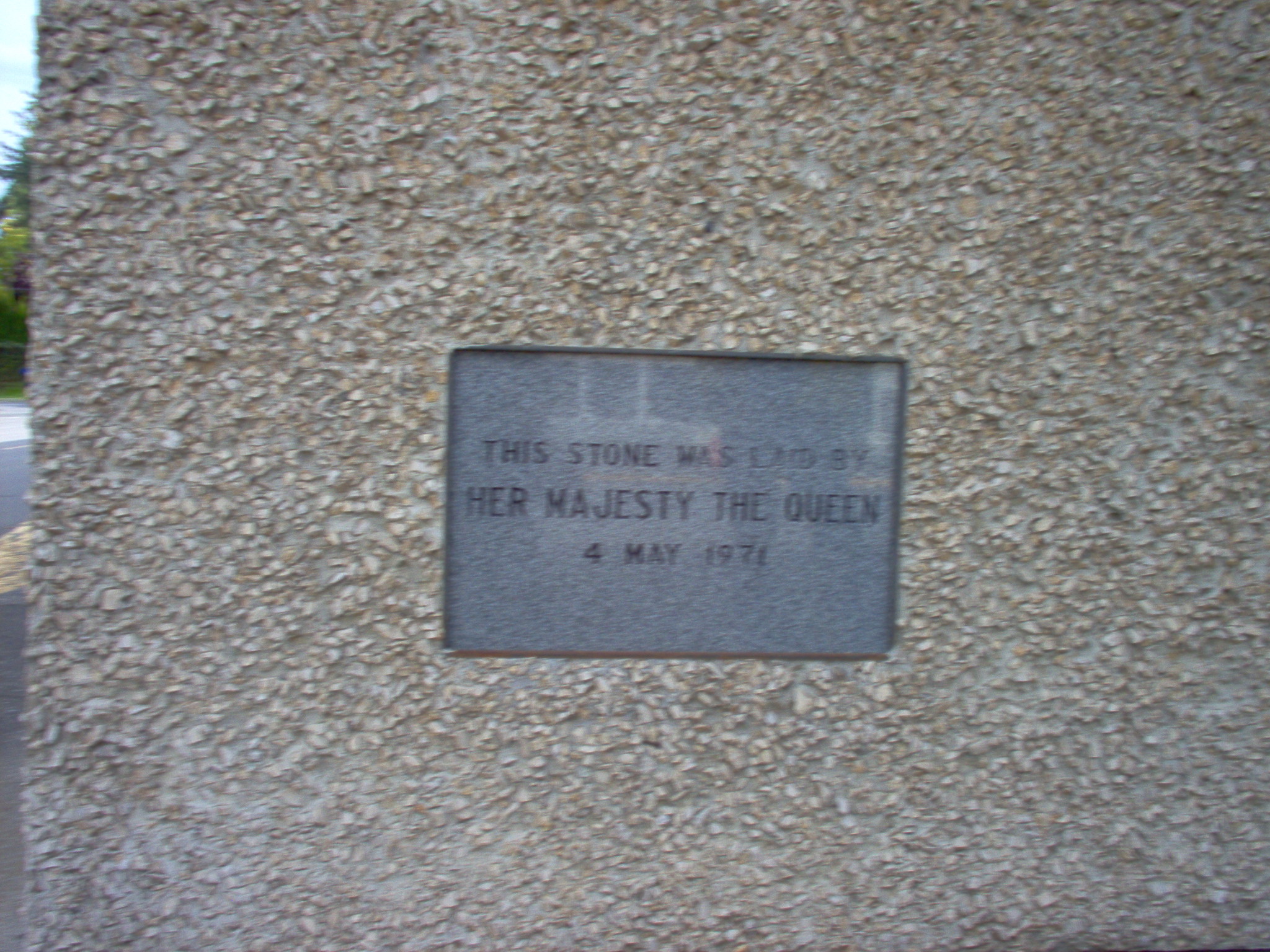
Special Stone...
-
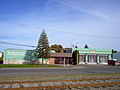
Fire Hall
References
- ^ "Duncan". BC Geographical Names. http://apps.gov.bc.ca/pub/bcgnws/names/15595.html.
- ^ From Camp to Community - Where They Came From - China
- ^ Sikh probe took wrong turn after Duncan blast: former CSIS agent, CBC News, May 24, 2007
- ^ World's Largest Hockey Stick & Puck, Duncan, British Columbia
- ^ World's Largest Hockey Stick & Puck, Tourism Vancouver, Retrieved July 3, 2007
- ^ Environment Canada—Canadian Climate Normals 1971–2000, accessed 10 July 2009
- ^ The Globe and Mail
External links

North Cowichan completely surrounds Halalt Cowichan Valley E 
Squaw-hay-one, Tsussie 6, Capital F  Duncan

Cowichan 1 Subdivisions of British ColumbiaSubdivisions Regions · Regional districts · Forest Regions and Forest Districts · School districts · Land DistrictsSettlements Urban centres Cities Abbotsford · Armstrong · Burnaby · Campbell River · Castlegar · Chilliwack · Colwood · Coquitlam · Courtenay · Cranbrook · Dawson Creek · Duncan · Enderby · Fernie · Fort St. John · Grand Forks · Greenwood · Kamloops · Kelowna · Kimberley · Kitimat · Langford · Langley · Merritt · Nanaimo · Nelson · New Westminster · North Vancouver · Parksville · Penticton · Pitt Meadows · Port Alberni · Port Coquitlam · Port Moody · Powell River · Prince George · Prince Rupert · Quesnel · Revelstoke · Richmond · Rossland · Salmon Arm · Surrey · Terrace · Trail · Vancouver · Vernon · Victoria · White Rock · Williams Lake Category:British Columbia ·
  Portal:British Columbia ·
  WikiProject:British Columbia
Coordinates: 48°46′43.3″N 123°42′28.3″W / 48.778694°N 123.707861°W
Categories:- Duncan, British Columbia
- Populated places on the British Columbia Coast
- Historical Chinatowns in British Columbia


Wikimedia Foundation. 2010.