- Cullman, Alabama
-
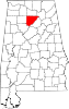
Cullman, Alabama — City — Location in Cullman County and the state of Alabama
Coordinates: 34°10′39″N 86°50′41″W / 34.1775°N 86.84472°W Country United States State Alabama County Cullman Settled 1873 Incorporated 1878 Founder Colonel Johann Gottfried Cullmann Named for Colonel Johann Gottfried Cullmann Government - Type Mayor-Council Area - Total 19.2 sq mi (49.6 km2) - Land 18.3 sq mi (47.4 km2) - Water 0.9 sq mi (2.2 km2) Elevation 898 ft (251 m) Population (2010) - Total 14,775 - Density 837.6/sq mi (282.2/km2) Time zone Central Standard Time (UTC-6) - Summer (DST) CDT (UTC-5) ZIP code 35055-35058 Area code(s) 256 Mayor Max Townson FIPS code 01-18976 GNIS feature ID 0116948 Website City of Cullman Official Website Cullman is a city in Cullman County, State of Alabama. Cullman is located along Interstate 65, about 50 miles (80 km) north of Birmingham, and about 55 miles (89 km) south of Huntsville. According to the U.S. Census Bureau's estimate in 2010 this city has a population of about 14,775 people[1] Cullman is the county seat of Cullman County, Alabama.
Contents
History
In the time before European settlement, the area that today includes Cullman was originally in the territory of the Cherokee Nation. The region was traversed by a trail known as the Black Warrior's Path, which led from the Tennessee River near the present location of Florence, Alabama, to a point on the Black Warrior River south of Cullman. This trail figured significantly in Cherokee history, and it featured prominently in the American Indian Wars prior to the establishment of the state of Alabama and the relocation of several American Indian tribes, including the Creek tribe westward along the Trail of Tears. During the Creek Indian War in 1813, General Andrew Jackson of the U.S. Army dispatched a contingent of troops down the trail, one of which included the famous frontiersman Davy Crockett.[2]
During the American Civil War, the future location of Cullman was the site of the minor Battle of Day's Gap. On 30 April 1863, Union forces under the command of Colonel Abel Streight won a victory over forces under Confederate General Nathan Bedford Forrest. This battle was part of a campaign and chase known collectively as Streight's Raid. Although Streight got the upper hand in this battle, Forrest would have the last laugh. In one of the more humorous moments of the war, Streight sought a truce and negotiations with Forrest in present-day Cherokee County near present-day Gaylesville. Although Streight's force was larger than Forrest's, while the two were negotiating, Forrest had his troops march repeatedly in a circuitous route past the site of the talks. Thinking himself to be badly outnumbered, Streight surrendered to Forrest on the spot.[3]
 Colonel John Cullmann, founder of Cullman (1823-1895)
Cullman itself was founded in 1873 by Colonel John G. Cullmann, a German refugee who had arrived in America in 1865. (The city's name was Americanized to "Cullman", although some sources state that Cullmann had earlier Americanized his name from "Kullmann". Stanley Johnson, his only surviving American descendant, told The Cullman Times in 1998 that there are no German records indicating the name "Kullmann", and that "Cullmann" had always been the correct spelling.)[4] Cullmann had been an advocate of democratic reforms in his native Bavaria, and he fled when the autocratic Prussian-dominated regime emerged ascendant after the Revolutions of 1848. In 1873, Cullmann negotiated an agreement to act as agent for a 349,000 acres (1,410 km2) tract of land owned by the Louisville and Nashville Railroad Company, on which he established a colony for German immigrants.[5][6]
Five German families moved to the area in March 1873; in 1878, the town was incorporated and named after Colonel Cullmann. Over the next twenty years, Cullmann encouraged around 10,000 Germans to immigrate to the United States, with many settling in the Cullman area. Cullmann drew on his military engineering training in laying out and planning the town. During this period, Cullman underwent considerable growth. German continued to be widely spoken, and Cullmann himself was the publisher of a German-language newspaper. When Cullmann died in 1895, at the age of 72, his funeral was marked by the attendance of Governor William C. Oates.[5] The site Cullmann selected for his headquarters is now his gravesite.
For many years Cullman was a college town, with Saint Bernard College serving as the home of several hundred students. In the mid-1970s, St. Bernard briefly merged with Sacred Heart College (a two-year Benedictine women’s college), to become Southern Benedictine College. That college closed in 1979, and it now operates as Saint Bernard Preparatory School. The former site of Sacred Heart College is now the Sacred Heart Monastery, which serves as a retreat center operated by the Benedictine Sisters of Sacred Heart Monastery.[7]
During the twentieth century, Cullman developed a more diverse economy, including several manufacturing and distribution facilities. However, its economy remains primarily based on agriculture and providing services to the agricultural workforce. Cullman County has the highest agricultural production in the state, and is one of the sixty largest agricultural-production counties in dollar terms in the United States.[8]
Cullman gained national attention in early 2008, when a special election was held to fill a vacancy in the Alabama House of Representatives. Although Cullman is known throughout the region as a former sundown town, the district that included Cullman elected James C. Fields, an African-American, in that special election.[9]
Cullman's German heritage was repressed during World War I and World War II, as the United States was fighting Germany. This was reversed in the 1970s, with renewed interest in the city's history and heritage. Today, Cullman holds an annual Oktoberfest.[10] An honorary "Bürgermeister" is elected for each Oktoberfest. Starting in 2011, the Oktoberfest can offer beer.[11]
Tornado
On April 27, 2011, a powerful tornado from the April 25–28, 2011 tornado outbreak struck downtown Cullman. Rated an EF4, it destroyed many buildings in downtown and residential area on the east side of Cullman, there were no deaths in the city limits, although there were 2 reported for the county, and moved northeast towards Arab and Guntersville, killing six or more all told.[12]
Geography
Cullman is located on top of Brindley Mountain plateau at 34°10′39″N 86°50′42″W / 34.1775°N 86.845°W (34.177508, -86.844996).[13] This is a close offshoot of the long geographic ridge called Sand Mountain, a southmost extension of the Appalachian Mountains. The elevation is 826 feet (252 m), close to the watershed between the Tennessee River and the Black Warrior River. Cullman provides its own town water supply from a city-owned lake within the city limits, Lake Catoma.[citation needed]
According to the U.S. Census Bureau, the city has a total area of 19.1 square miles (49 km2). 18.3 square miles (47 km2) of this is land, with water making up 4.5%, or 0.9 square miles (2.3 km2).[14]
Education
The Cullman City School System operates five schools: Cullman Primary School (Pre-K - First Grade),
East Elementary (Second Grade - Sixth Grade),
West Elementary (Second Grade - Sixth Grade),
John G. Cullman Middle School (Seventh and Eighth Grades),
and Cullman High School (Ninth Grade - Twelfth Grade).[15] Other schools in Cullman include the Saint Bernard Preparatory School, a Benedictine boarding school (Ninth Grade - Twelfth Grade),
Saint Bernard Middle School (Seventh and Eighth Grade),
Sacred Heart Elementary School (Pre-K - Sixth Grade),
Saint Paul's Lutheran School (Pre-K - Sixth Grade),
and Cullman Christian School (Pre-K - Twelfth Grade).Demographics
Historical populations Census Pop. %± 1880 426 — 1890 1,017 138.7% 1900 1,255 23.4% 1910 2,130 69.7% 1920 2,467 15.8% 1930 2,786 12.9% 1940 5,074 82.1% 1950 7,523 48.3% 1960 10,853 44.3% 1970 12,601 16.1% 1980 13,084 3.8% 1990 13,367 2.2% 2000 13,995 4.7% Est. 2010 14,775 5.6% As of the census[16] of 2010, there were 14,775 people and 6,957 households. ref name=2010census>"Fact Sheet- Cullman city, Alabama". American Fast Facts. United States Census Bureau. http://factfinder.census.gov/servlet/SAFFFacts?_event=Search&geo_id=04000US01&_geoContext=01000US%7C04000US01%7C05000US01043&_street=&_county=Cullman+city&_cityTown=Cullman+city&_state=04000US01&_zip=&_lang=en&_sse=on&ActiveGeoDiv=geoSelect&_useEV=&pctxt=fph&pgsl=040&_submenuId=factsheet_1&ds_name=DEC_2000_SAFF&_ci_nbr=null&qr_name=null®=null%3Anull&_keyword=&_industry=. Retrieved 27 January 2010.</ref> The population density was 765.0 inhabitants per square mile (295.4 /km2). There were 6,957 housing units at an average density of 365.1 per square mile (141.0 /km2).[17] The racial makeup of the city was 93.4% White, 0.9% Black or African American, 0.3% Native American, 0.9% Asian, 0.05% Pacific Islander, and 1.1% from two or more races. 8.2% of the population were Hispanic or Latino of any race.[18]
There were 6,957 households, out of which 22.5% had children under the age of 18 living with them, 48.3% were married couples living together, 10.7% had a female householder with no husband present, and 37.9% were non-families. 35.2% of all households were made up of individuals and 18.0% had someone living alone who was 65 years of age or older. The average household size was 2.22 and the average family size was 2.85.[18]
In the city the population was spread out with 21.8% under the age of 18, 8.2% from 18 to 24, 25.3% from 25 to 44, 22.6% from 45 to 64, and 22.1% who were 65 years of age or older. The median age was 41 years. For every 100 females there were 87.5 males. For every 100 females age 18 and over, there were 81.4 males.[19]
The median income for a household in the city was $29,164, and the median income for a family was $41,313. Males had a median income of $32,863 versus $21,647 for females. The per capita income for the city was $18,484. About 9.4% of families and 13.2% of the population were below the poverty line, including 12.3% of those under age 18 and 18.5% of those age 65 or over.[19]
Media
Radio stations
- WFMH 1340 AM (Sports/Talk)
- WKUL 92.1 FM (Country/Talk)
- WMCJ 1460 AM (Southern Gospel)
- WYDE-FM 101.1 FM (Talk Radio)
Newspaper
- The Cullman Times (daily)
- The Cullman Tribune (weekly)
Television
Cullman is in the TV broadcasting areas of both Birmingham, Alabama, and Huntsville, Alabama.
Also, there is one low-power broadcasting station in Cullman: WCQT-LP TV-27
Health care
- Cullman Regional Medical Center - a 115-bed hospital.
Transportation
 Interstate 65
 U.S. Highway 31
 U.S. Highway 278
 Alabama State Route 69
 Alabama State Route 157
- CSX Transportation Railroad
- Folsom Field municipal airport
Sister city
 - Frankweiler (Germany)
Notable persons from Cullman
- JoJo Billingsley, singer/songwriter
- Wesley Britt, National Football League player
- James E. "Big Jim" Folsom, Governor of Alabama 1947 - 51 and 1955 – 59
- James E. "Little Jim" Folsom, Jr., Governor of Alabama 1993 - 95, former and current Lieutenant Governor of Alabama
- Robert Hall, professional make-up artist
- Roger Hallmark, country musician
- Kurt Heinecke, composer and voice actor
- Charles Kleibacker, fashion designer
- Harold E. Martin, journalist and 1970 Pulitzer Prize winner
- Julian L. McPhillips candidate for Attorney General of Alabama in 1978.
- Channing Tatum, actor/model
- Holly Williams, country music singer (and daughter of Hank Williams, Jr.)
- Larry Willingham, professional football player
References
- ^ "Detailed Tables". American Fact Finder. United States Census Bureau. http://factfinder.census.gov/servlet/DTTable?_bm=y&-context=dt&-ds_name=PEP_2008_EST&-mt_name=PEP_2008_EST_G2008_T001&-CONTEXT=dt&-tree_id=808&-all_geo_types=N&-geo_id=16000US0118976&-search_results=16000US0118976&-format=&-_lang=en. Retrieved 27 January 2010.
- ^ Fulenwider, Dan. "Cullman County, Alabama History: The Black Warrior's Path". Cullman County, Alabama. http://www.co.cullman.al.us/history3.htm#blackwarrior. Retrieved 28 January 2010.
- ^ Partain, Rich. "Streight's Raid". co.cullman.al.us. http://www.co.cullman.al.us/history2.htm. Retrieved January 28, 2010.
- ^ "Cullman: Moving Forward while Treasuring the Past". the Cullman Times. 1998.
- ^ a b Johnson, Stanley. "Founding of Cullman". co.cullman.al.us. http://www.co.cullman.al.us/history1.htm. Retrieved January 28, 2010.
- ^ Northern Alabama: Historical and Biographical. Birmingham: Smith & Deland. 1888.
- ^ "History of St Bernard Prep". stbernardprep.com. http://www.stbernardprep.com/node/65. Retrieved January 28, 2010.
- ^ "The Cullman Area Chamber of Commerce- Business Climate". cullmanchamber.org. http://www.cullmanchamber.org/business_climate.htm. Retrieved January 28, 2010.
- ^ NOSSITER, Adam (February 21, 2008). "Race Matters Less in Politics of South". The New York Times. p. A1. http://www.nytimes.com/2008/02/21/us/politics/21race.html?_r=1&scp=1&sq=Cullman%20election&st=cse&oref=slogin. Retrieved 28 Januart 2010.
- ^ "Oktoberfest history Oktoberfest". Cullman, Alabama Oktoberfest. http://www.cullmanoktoberfest.com/history.cfm. Retrieved November 29, 2010.
- ^ "Cheers: Home of dry Oktoberfest goes wet". Montgomery Advertiser. Associated Press. November 4, 2010. http://www.montgomeryadvertiser.com/article/20101104/NEWS02/11040314/1009/rss04. Retrieved November 29, 2010.
- ^ [1]
- ^ "US Gazetteer files: 2010, 2000, and 1990". United States Census Bureau. 2011-02-12. http://www.census.gov/geo/www/gazetteer/gazette.html. Retrieved 2011-04-23.
- ^ "Geographic Comparison Table- Alabama". American Fast Facts. United States Census Bureau. http://factfinder.census.gov/servlet/GCTTable?_bm=y&-geo_id=04000US01&-_box_head_nbr=GCT-PH1&-ds_name=DEC_2000_SF1_U&-format=ST-7. Retrieved 27 January 2010.
- ^ "Cullman City Schools". cullmancats.net. http://www.cullmancats.net/schools.html. Retrieved January 28, 2010.
- ^ "American FactFinder". United States Census Bureau. http://factfinder.census.gov. Retrieved 2008-01-31.
- ^ Cite error: Invalid
<ref>tag; no text was provided for refs named2010censusarea; see Help:Cite errors/Cite error references no text - ^ Cite error: Invalid
<ref>tag; no text was provided for refs named2010census; see Help:Cite errors/Cite error references no text - ^ a b "Fact Sheet- Cullman city, Alabama". American Fast Facts. United States Census Bureau. http://factfinder.census.gov/servlet/SAFFFacts?_event=Search&geo_id=04000US01&_geoContext=01000US%7C04000US01%7C05000US01043&_street=&_county=Cullman+city&_cityTown=Cullman+city&_state=04000US01&_zip=&_lang=en&_sse=on&ActiveGeoDiv=geoSelect&_useEV=&pctxt=fph&pgsl=040&_submenuId=factsheet_1&ds_name=DEC_2000_SAFF&_ci_nbr=null&qr_name=null®=null%3Anull&_keyword=&_industry=. Retrieved 27 January 2010.
External links
- City of Cullman, Alabama web site
- History of Cullman, on the Cullman High School web site
- Cullman Schools web Site
Coordinates: 34°10′39″N 86°50′42″W / 34.177508°N 86.844996°W
Municipalities and communities of Cullman County, Alabama County seat: Cullman Cities Arab‡ | Cullman | Hanceville
Towns Baileyton | Colony | Dodge City | Fairview | Garden City‡ | Good Hope | Holly Pond | South Vinemont | West Point
Unincorporated
communitiesArkadelphia | Battleground | Berlin | Bremen | Bug Tussle | Crane Hill | Joppa | Wilburn
Footnotes ‡This populated place also has portions in an adjacent county or counties
Categories:- Cities in Alabama
- Populated places in Cullman County, Alabama
- Micropolitan areas of Alabama
- County seats in Alabama
- Populated places established in 1873


Wikimedia Foundation. 2010.