- Opovo
-
Opovo
Опово— Municipality and Town — A street in Opovo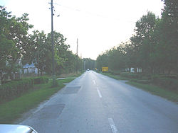 Location of the municipality of Opovo within Serbia
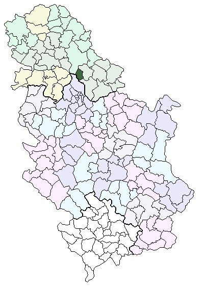
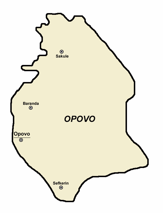
Coordinates: 11°11′N 11°11′E / 11.183°N 11.183°E Country Serbia District South Banat Settlements 111 Government - Mayor Milorad Soldatović Area[1] - Municipality 11 km2 (4.2 sq mi) Population (2011 census)[2] - Town 11 - Municipality 1 Time zone CET (UTC+1) - Summer (DST) CEST (UTC+2) Postal code 1 Area code +381 111 Car plates PA Website www.opovo.org.rs  Map of Opovo municipality
Opovo (Опово) is a town and municipality in South Banat, in the province of Vojvodina, Serbia. The town has a population of 4,664, while Opovo municipality has 10,938 inhabitants.
Contents
Name
In Serbian, the town is known as Opovo (Опово), in German as Opowa, in Hungarian as Ópáva, in Croatian as Opovo, in Romanian as Opovo, in Slovak as Opovo, and in Rusyn as Опово.
History
There are traces from Neolithic and Roman periods in this area. An older settlement named Želj existed at this locality during medieval Hungarian and later Ottoman administration. During Hungarian administration it was part of the Kovin county and during Ottoman administration part of the Temeşvar Eyalet. Southern part of modern Opovo is still called Želj by local inhabitants. According to historical sources, modern Opovo was mentioned first in 1672-1690 and it was populated by Serbs. They lived in the houses made from mud. During Ottoman administration, settlement had 27 houses and, after Habsburg conquest, in 1717, it had 64 houses.
During Habsburg administration, Opovo firstly was part of the Banat of Temeswar (until 1751) and then part of the Habsburg Military Frontier. In 1753, Opovo was recorded as ethnic Serb settlement. In the second half of the 18th century (in 1769), Germans and Hungarians settled in Opovo. Serb elementary school in Opovo was opened in 1768, while German school was opened around 1773-4. Construction plan from 1776 predicted that 225 Serb and 60 Catholic houses would be built in the settlement. In 1782, settlement had population of 1,497 people. In the first half of the 19th century (1829–1831), Serbian Orthodox church of Saint Nikolaj was built. In 1848-1849, Opovo was part of autonomous Serbian Vojvodina, but was returned under military administration in 1849. With the abolishment of Military Frontier in Banat (in 1873), Opovo was included into Torontál County, which was part of the Habsburg Kingdom of Hungary and Austria-Hungary. In 1885, new elementary school was elevated in the settlement.[3] In 1910, Serbs were in an absolute majority in Opovo, while other ethnic groups that lived in the settlement included Germans, Croats and Hungarians.[4]
In 1918, following the collapse of Austria-Hungary, Opovo firstly became part of the Kingdom of Serbia and then part of the newly formed Kingdom of Serbs, Croats and Slovenes (later renamed to Yugoslavia). In 1918-1919 it was part of the Banat, Bačka and Baranja region. From 1918 to 1922 Opovo was part of Veliki Bečkerek county, from 1922 to 1929 part of Belgrade oblast, and from 1929 to 1941 part of Danube Banovina. From 1941 to 1944, it was occupied by German Axis troops and was included into German-administered Banat region, which formally was part of the Nedić's Serbia. In 1944, Soviet Red Army and Yugoslav partisans expelled Axis troops from the region and Opovo was included into Autonomous Province of Vojvodina within new socialist Yugoslavia. Since 1945, Vojvodina is part of the People's Republic of Serbia. Before World War II, Opovo was part of Kovačica municipality and, after the war, part of Pančevo municipality. Later, separate municipality of Opovo was formed.
Inhabited places
Opovo municipality includes the town of Opovo and the following villages:
Opovo is the largest settlement in the municipality.
Historical population
Population of the town in different censuses:
- 1948: 4,396
- 1953: 4,415
- 1961: 4,254
- 1971: 4,482
- 1981: 4,796
- 1991: 4,777
- 2002: 4,693
Ethnic groups (2002 census)
The population of the Opovo municipality:
All settlements in the municipality have an ethnic Serb majority.
Cultural projects
Wifi network greenlinks is non-profit wireless network originated in Opovo, member of Srbija Wireless.
See also
- List of places in Serbia
- List of cities, towns and villages in Vojvodina
References
- Dr Slobodan Ćurčić, Naselja Banata - geografske karakteristike, Novi Sad, 2004.
- Istorijski atlas, Geokarta, Beograd, 1999.
- The Times History of Europe, Times Books, London, 2002.
Notes
- ^ "Municipalities of Serbia, 2006". Statistical Office of Serbia. http://webrzs.stat.gov.rs/axd/en/Zip/OG2006webE.zip. Retrieved 2010-11-28.
- ^ (in Serbian) Popis stanovništva, domaćinstava i Stanova 2002. Knjiga 1: Nacionalna ili etnička pripadnost po naseljima. Statistical Office of Serbia. 2003. ISBN 86-84443-00-09. May be downloaded from: [1]
- ^ Source: Stevan Kovačević, Gradovi Srbije u slici i reči, Beograd, 2010.
- ^ http://img190.imageshack.us/img190/3899/vojvodina1910.png
Municipalities and cities of Serbia Central Serbia Belgrade (Barajevo • Čukarica • Grocka • Lazarevac • Mladenovac • Novi Beograd • Obrenovac • Palilula • Rakovica • Savski Venac • Sopot • Stari Grad • Surčin • Voždovac • Vračar • Zemun • Zvezdara) • Čačak • Jagodina • Kragujevac (Aerodrom • Pivara • Stanovo • Stari Grad • Stragari) • Kraljevo • Kruševac • Leskovac • Loznica • Niš (Crveni Krst • Medijana • Niška Banja • Palilula • Pantelej) • Novi Pazar • Požarevac • Smederevo • Šabac • Užice • Valjevo • Vranje • Zaječar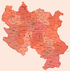 Aleksandrovac • Aleksinac • Aranđelovac • Arilje • Babušnica • Bajina Bašta • Batočina • Bela Palanka • Blace • Bogatić • Bojnik • Boljevac • Bor • Bosilegrad • Brus • Bujanovac • Crna Trava • Čajetina • Ćićevac • Ćuprija • Despotovac • Dimitrovgrad • Doljevac • Gadžin Han • Golubac • Gornji Milanovac • Ivanjica • Kladovo • Knić • Knjaževac • Koceljeva • Kosjerić • Krupanj • Kučevo • Kuršumlija • Lajkovac • Lapovo • Lebane • Lučani • Ljig • Ljubovija • Majdanpek • Mali Zvornik • Malo Crniće • Medveđa • Merošina • Mionica • Negotin • Nova Varoš • Osečina • Paraćin • Petrovac • Pirot • Požega • Preševo • Priboj • Prijepolje • Prokuplje • Rača • Raška • Ražanj • Rekovac • Sjenica • Smederevska Palanka • Sokobanja • Surdulica • Svilajnac • Svrljig • Topola • Trgovište • Trstenik • Tutin • Ub • Varvarin • Velika Plana • Veliko Gradište • Vladičin Han • Vladimirci • Vlasotince • Vrnjačka Banja • Žabari • Žagubica • Žitorađa
Vojvodina 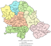 Ada • Alibunar • Apatin • Bač • Bačka Palanka • Bačka Topola • Bački Petrovac • Bečej • Bela Crkva • Beočin • Čoka • Inđija • Irig • Kanjiža • Kikinda • Kovačica • Kovin • Kula • Mali Iđoš • Nova Crnja • Novi Bečej • Novi Kneževac • Odžaci • Opovo • Pećinci • Plandište • Ruma • Sečanj • Senta • Šid • Srbobran • Sremski Karlovci • Stara Pazova • Temerin • Titel • Vrbas • Vršac • Žabalj • Žitište
Kosovo Dečani • Đakovica • Dragaš • Glogovac • Gnjilane • Istok • Kačanik • Klina • Kosovo Polje • Kosovska Kamenica • Kosovska Mitrovica • Leposavić • Lipljan • Mališevo • Novo Brdo • Obilić • Orahovac • Peć • Podujevo • Priština • Prizren • Štimlje • Srbica • Štrpce • Suva Reka • Uroševac • Vitina • Vučitrn • Zubin Potok • Zvečan New Municipalities: Đeneral Janković • Gračanica • Junik • Klokot-Vrbovac • Mamuša • Parteš • RanilugPlanned Municipality: North Kosovska MitrovicaCategories:
- Places in Serbian Banat
- Populated places in South Banat District
- Municipalities of Vojvodina


Wikimedia Foundation. 2010.