- Pančevo
-
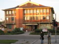
Pančevo
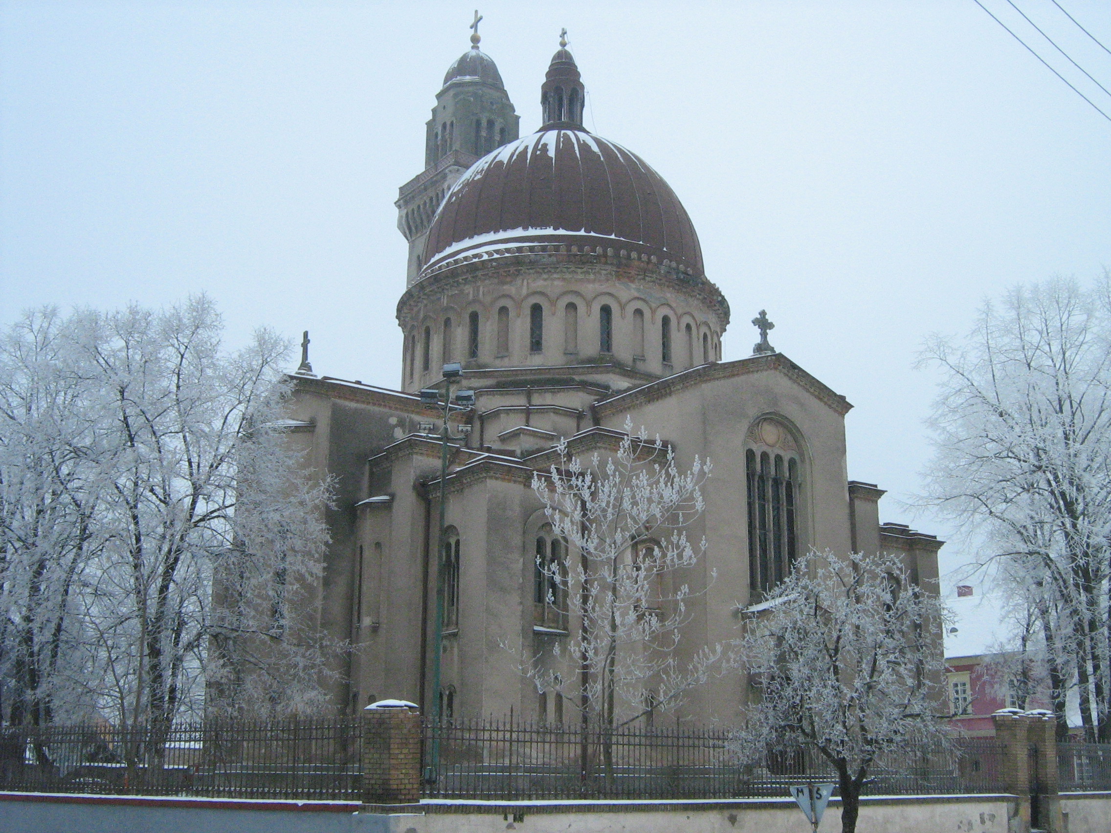
Панчево— City — Church of the Assumption

Coat of armsLocation of the municipality of Pančevo within Serbia
Coordinates: 44°52′N 20°38′E / 44.867°N 20.633°E Country Serbia District South Banat Settlements 10 Government – Mayor Vesna Martinović Area[1] – Municipality 759 km2 (293.1 sq mi) Population (2011 census)[2] – Town 77,087 – Municipality 127,162 Time zone CET (UTC+1) – Summer (DST) CEST (UTC+2) Postal code 26000 Area code +381 13 Car plates PA Website www.pancevo.rs  PančevoMunicipality
of Pančevo
●
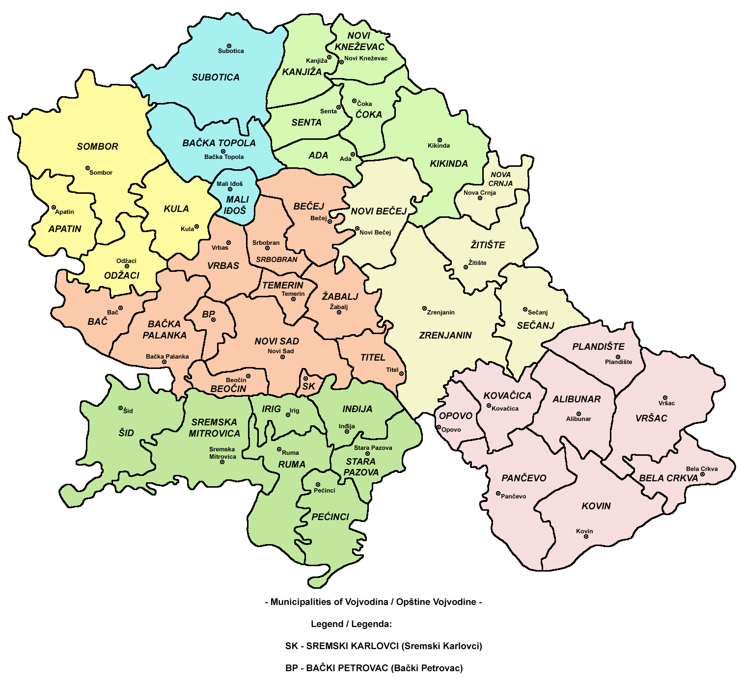
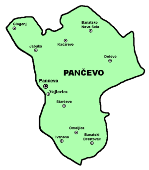 Map of Pančevo municipality
Pančevo (Serbian Cyrillic: Панчево, pronounced [pâːnt͡ʃe̞v̞ɔ̝]) is a city and municipality located in the southern part of Serbian province of Vojvodina, 15 km northeast from Belgrade. In 2002, the city had a total population of 77,087, while municipality of Pančevo had 127,162 inhabitants. It is the administrative center of the South Banat District of Serbia. Pančevo is also the most important port on the Tamiš river, which flows near the city.
Contents
Name
In Serbian, the town is known as Pančevo (Панчево), in Hungarian as Pancsova, in Turkish as Pançova, in German as Pantschowa, in Romanian as Panciova, in Slovak as Pánčevo, and in Rusyn as Панчево (Pančevo).
History
Early history
8th century BC ornitho-morphic fibulae was found in the town.[3]
The first historical record mentioning the town is from 1153 book of "Idrisia" when it was a mercantile harbour. The city was populated by Serbs and was administered by the Bulgarian Empire in the 9th and 11th century and later by the Kingdom of Hungary, until the 16th century, when it became part of the Ottoman Empire. During the Ottoman rule, the city was part of the Ottoman Province of Temeşvar and was a large settlement mostly populated by ethnic Serbs.
Habsburg Monarchy
After 1716, the city was under Habsburg rule, and was included into Habsburg military province named Banat of Temeswar. In 1751, the northern parts of the province were placed under civil administration, while the southern parts (including Pančevo) were included into Military Frontier (Banat Krajina). During this time the Habsburg administration encouraged massive immigration of German settlers to develop the land. Soon the town of Pančevo was divided into two municipalities: one Serb, one "German". According to the 1767 data, the population of the Serb municipality numbered 424 families, while the population of the German municipality numbered 132 families. According to the 1787 data, the population of the city was composed of 3,506 Orthodox Christians and 2,005 Roman Catholics. The city was briefly restored to Ottoman administration from 1787 to 1788. In 1794, Serb and German municipality were joined into one.
In 1848/1849, Pančevo was part of the Serbian Voivodship, a Serb autonomous region within Austrian Empire, but in 1849 it was returned under administration of the Military Frontier. In 1873, the Banatian Military Frontier was abolished and the city was included into Torontal county. According to the 1910 census, the population of the city was 20,808, of whom 8,714 spoke Serbian language, 7,467, German language, 3,364 Hungarian language, etc.
After 1918
In 1918, Pančevo (with the rest of western Banat) became part of the Kingdom of Serbs, Croats and Slovenes (later renamed to Yugoslavia). According to the 1921 data, the population of the city was 19,362, of whom 9,422 were Serbs, 7,237 Germans, 887 Hungarians, etc. Between 1918 and 1922, the city was part of the Banat county, between 1922 and 1929 it was part of the Belgrade oblast, and between 1929 and 1941 it was part of the Belgrade city administration.
Between 1941 and 1944, Pančevo was under Axis occupation and was part of the autonomous Banat within German-occupied Serbia. Many local Danube Swabians were enlisted in the Waffen-SS after failing to volunteer in sufficient numbers.[citation needed] During the war, between 1941 and 1944, fascists killed about 12,000 people at the Small Marsh locality near Pančevo, including 6-7,000 Jews from Vojvodina, Serbia and Hungary.[4] Following the war, most Danube Swabians left from the city, together with occupational German army. Minority of them who remained in the city were expropriated of their private property and expelled; some men were murdered.[citation needed]
During 1999 the city was heavily bombed by NATO forces. Targets included an oil refinery, the Utva aircraft factory and chemical plants.
Inhabited places
The Pančevo municipality includes the city of Pančevo and the following villages:
City quarters
- Centar, Pančevo
- Donji Grad, Pančevo
- Gornji Grad, Pančevo
- Karaula, Pančevo
- Kotež 1, Pančevo
- Kotež 2, Pančevo
- Kudeljarski Nasip, Pančevo
- Margita, Pančevo
- Misa Vinogradi, Pančevo
- Mladost, Pančevo
- Mali London, Pančevo
- Pepeljara, Pančevo
- Sodara, Pančevo
- Solara, Pančevo
- Strelište, Pančevo
- Utvina Kolonija, Pančevo
- Tesla, Pančevo
- Topola, Pančevo
- Vojlovica, Pančevo
Demographics
Population and major ethnic groups in the town
Year Total Serbs Germans Yugoslavs Hungarians Slovaks Macedonians Croats Romanians Rest 1910 20,808 41.88% 35.89% 0.0% 16.17% 1.17% 0.0% 0.65% - 4.24% 1921 - 48%(*) 37% - 8% - - (*) 7% - 1991 72,793 72.57% N.D 8.75% 5.56% 2.20% 2.40% 1.35% - 5.29% 2002 77,087 79.08% N.D 2.35% 4.25% 1.82% 1.55% 0.92% - 9.00% (*) In 1921, Serbs and Croats were counted together.
Population and major ethnic groups in the municipality
Year Population Serbs Germans Romanians Hungarians Slovaks Macedonians Yugoslavs Croats Roma Rest 1910. 62,491 31.0% 36.72% 15.77% 10.30% 2.05% 0.0% 0.0% 2.2% 0.53% 1.43% 1931. 63,158 36.15% 38.50% N.D 7.37% N.D 0.0% 0.0% N.D N.D 17.96% 1961. 93,744 64.40% N.D 7.71% 8.17% 2.30 N.D N.D 2.99% 0.22% 14.21% 1991. 125,261 68.92% 0.24% 4.03% 4.02% 1.39% N.D N.D 1.35% 0.79% 19.26% 2002. 127,162 76.38% 0.18% 3.19% 3.17% 1.24% 4.14% 2.35% 0.92% 1.09% 7.34% Most of the settlements in the municipality have an ethnic Serb majority. Ethnically mixed settlement with relative Hungarian majority is Ivanovo. There is also a growing Chinese community in northern parts of Pančevo.
Culture
Pančevo has one of the oldest monasteries in this region. Currently it is situated inside of Oil refinery (See Vojlovica monastery article).
City has many cultural events. One of them is ArtTech, international festival of digital arts.
Economy
Pančevo has a strong industrial background with the petrochemical, fertilizer, machinery, and aircraft industries (See: Lola Utva aircraft factory). It has a single oil refinery.
Gallery
-

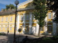
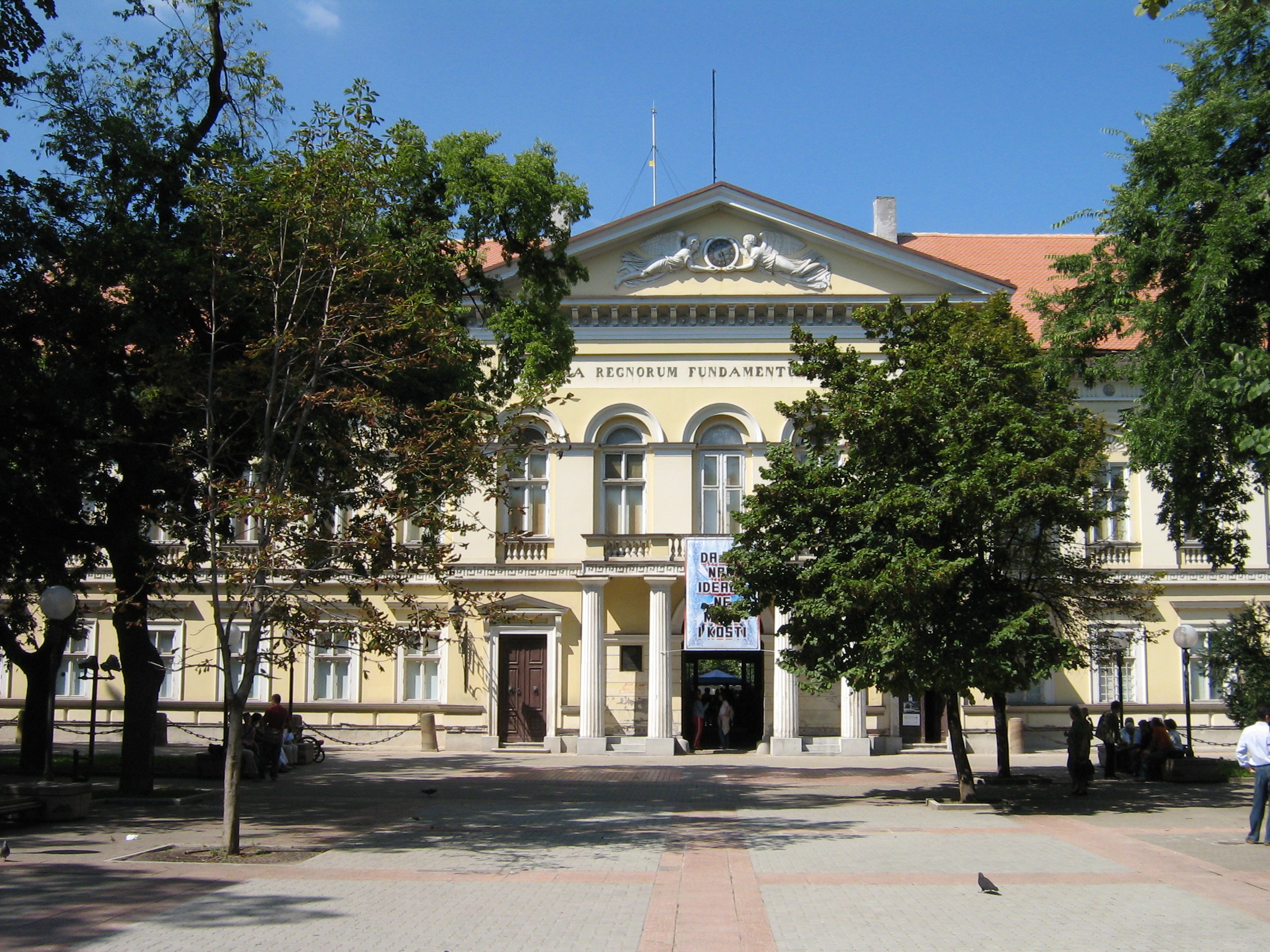
Pančevo National Museum, formerly the city's historical municipal building
-

Gymnasium "Uroš Predić" in Pančevo
-

Gymnasium "Uroš Predić" in Pančevo
-
Old hospital building
-

Municipal court in Pančevo
-

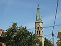
Roman catholic church in Pančevo
-

Suburban railway station, between Kotež 2 and Misa
-

Suburban railway station
-
Evangelist church near Old Town
-
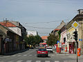
The Old Town
-
Central bus station
-

Main postal building
-

Old Uptown Church
Twin cities
 Boulogne-Billancourt, France
 Neapolis, Greece
 Prijedor, Bosnia and Herzegovina
 Reşiţa, Romania
 Zaanstad, Netherlands
Famous citizens
- Pančevo is the birth place of Georg Weifert (Đorđe Vajfert).
See also
References
- ^ "Municipalities of Serbia, 2006". Statistical Office of Serbia. http://webrzs.stat.gov.rs/axd/en/Zip/OG2006webE.zip. Retrieved 2010-11-28.
- ^ "2011 Census of Population, Households and Dwellings in the Republic of Serbia – FIRST RESULTS". Bulletin (Statistical Office of the Republic of Serbia) 540. 2011. ISSN 0354-3641. http://media.popis2011.stat.rs/2011/prvi_rezultati.pdf. Retrieved 2011-11-21.
- ^ http://sehumed.uv.es/revista/numero16/SEHUMED_colecc131.PDF
- ^ Soviet Jewish affairs, Volumes 11-12, Institute of Jewish Affairs, World Jewish Congress, 1981.
External links
- Official local government site
- South Banat district portal K-013 with all informations from Pancevo and region.(serbian,english...)
- Pančevo web portal - Provides all city information's
- Pancevo on the internet
- The unofficial pancevo site
- Genocide of The Ethnic Germans in Yugoslavia 1944-1948
- History of Pančevo
- The local newspaper "Pančevac"
- ArtTech, festival of digital arts
Administrative divisions of Serbia 
Districts of Serbia Vojvodina Central Serbia Kosovo and Metohija1 Kosovo • Kosovo-Pomoravlje • Kosovska Mitrovica • Peć • Prizren1 Sovereignty disputed with the Republic of Kosovo. These are the districts recognized by the Republic of Serbia. For the districts recognized by the Republic of Kosovo, see Districts of Kosovo.Municipalities and cities of Serbia Central Serbia Belgrade (Barajevo • Čukarica • Grocka • Lazarevac • Mladenovac • Novi Beograd • Obrenovac • Palilula • Rakovica • Savski Venac • Sopot • Stari Grad • Surčin • Voždovac • Vračar • Zemun • Zvezdara) • Čačak • Jagodina • Kragujevac (Aerodrom • Pivara • Stanovo • Stari Grad • Stragari) • Kraljevo • Kruševac • Leskovac • Loznica • Niš (Crveni Krst • Medijana • Niška Banja • Palilula • Pantelej) • Novi Pazar • Požarevac • Smederevo • Šabac • Užice • Valjevo • Vranje • Zaječar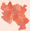 Aleksandrovac • Aleksinac • Aranđelovac • Arilje • Babušnica • Bajina Bašta • Batočina • Bela Palanka • Blace • Bogatić • Bojnik • Boljevac • Bor • Bosilegrad • Brus • Bujanovac • Crna Trava • Čajetina • Ćićevac • Ćuprija • Despotovac • Dimitrovgrad • Doljevac • Gadžin Han • Golubac • Gornji Milanovac • Ivanjica • Kladovo • Knić • Knjaževac • Koceljeva • Kosjerić • Krupanj • Kučevo • Kuršumlija • Lajkovac • Lapovo • Lebane • Lučani • Ljig • Ljubovija • Majdanpek • Mali Zvornik • Malo Crniće • Medveđa • Merošina • Mionica • Negotin • Nova Varoš • Osečina • Paraćin • Petrovac • Pirot • Požega • Preševo • Priboj • Prijepolje • Prokuplje • Rača • Raška • Ražanj • Rekovac • Sjenica • Smederevska Palanka • Sokobanja • Surdulica • Svilajnac • Svrljig • Topola • Trgovište • Trstenik • Tutin • Ub • Varvarin • Velika Plana • Veliko Gradište • Vladičin Han • Vladimirci • Vlasotince • Vrnjačka Banja • Žabari • Žagubica • Žitorađa
Vojvodina 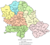 Ada • Alibunar • Apatin • Bač • Bačka Palanka • Bačka Topola • Bački Petrovac • Bečej • Bela Crkva • Beočin • Čoka • Inđija • Irig • Kanjiža • Kikinda • Kovačica • Kovin • Kula • Mali Iđoš • Nova Crnja • Novi Bečej • Novi Kneževac • Odžaci • Opovo • Pećinci • Plandište • Ruma • Sečanj • Senta • Šid • Srbobran • Sremski Karlovci • Stara Pazova • Temerin • Titel • Vrbas • Vršac • Žabalj • Žitište
Kosovo Dečani • Đakovica • Dragaš • Glogovac • Gnjilane • Istok • Kačanik • Klina • Kosovo Polje • Kosovska Kamenica • Kosovska Mitrovica • Leposavić • Lipljan • Mališevo • Novo Brdo • Obilić • Orahovac • Peć • Podujevo • Priština • Prizren • Štimlje • Srbica • Štrpce • Suva Reka • Uroševac • Vitina • Vučitrn • Zubin Potok • Zvečan New Municipalities: Đeneral Janković • Gračanica • Junik • Klokot-Vrbovac • Mamuša • Parteš • RanilugPlanned Municipality: North Kosovska MitrovicaCategories:
- Pančevo
- Places in Serbian Banat
- Populated places in Vojvodina
- Municipalities of Vojvodina


Wikimedia Foundation. 2010.