- Dalhart, Texas
-
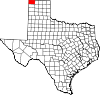
Dalhart, Texas — City — Dalhart Consumers Grain Elevator is the city's tallest structure. Location of Dalhart, Texas
Coordinates: 36°3′39″N 102°31′7″W / 36.06083°N 102.51861°WCoordinates: 36°3′39″N 102°31′7″W / 36.06083°N 102.51861°W Country United States State Texas Counties Dallam, Hartley Area – Total 4.3 sq mi (11.1 km2) – Land 4.3 sq mi (11.1 km2) – Water 0.0 sq mi (0.0 km2) Elevation 3,983 ft (1,214 m) Population (2000) – Total 7,237 – Density 1,686.1/sq mi (651.0/km2) Time zone Central (CST) (UTC-6) – Summer (DST) CDT (UTC-5) ZIP code 79022 Area code(s) 806 FIPS code 48-18524[1] GNIS feature ID 1355552[2] Dalhart is a city in Dallam and Hartley counties in the U.S. state of Texas, and the county seat of Dallam County.[3] The population was 7,237 at the 2000 census. Founded in 1901, Dalhart is named for its location on the border of Dallam and Hartley counties. Dalhart sits at the intersection of U.S. Highway 87, 385, and 54. Two miles south of Dalhart is Rita Blanca Canyon, site of Rita Blanca Lake State Park.
The city of Dalhart is known by many Texans as a gateway to the Colorado Rockies. The city's position in the northwestern corner of the Texas Panhandle -- only the town of Texline is further northwestward in Texas—makes it a pivotal stopover for travelers going to or returning from the mountains. The City was founded at the site of a Railroad junction, which heavily contributed to its early growth.
Past and present notable residents: None
Dalhart is also known as the "XIT City" because of its relationship with the historic XIT Ranch. The ranch was a 3,000,000-acre (12,000 km2) plot of land traded in exchange for the construction of the Texas State Capitol in Austin. The ranch was dissolved in 1912, but its history is celebrated with the city's XIT Museum and the XIT Rodeo and Reunion. Held annually on the first full Thursday through Sunday weekend of August, the event includes the world's largest free barbecue, junior rodeo as well as Professional Rodeo Cowboys Association events, three nights of live music, and a variety of other offering to celebrate the occasion. The Empty Saddle Monument, located at the crossroads of Dalhart, was constructed in 1940 at the request of Bobby Dycke, the wife of a ranch hand, to recognize the contribution of the XIT cowboys to the history of the region.
Dalhart was in the center of the Dust Bowl, an area adversely affected by a long period of drought and dust storms during the Great Depression of the 1930s. It was here that Tex Thornton operating on the now debunked concussion theory coaxed today's inflation adjusted equivalent of $1 million from the locals on claims he could fire rocket-powered explosives into the clouds and cause rain.[4]
At the Dallam County Courthouse, Dalhart honors the memory of James R. Fox, Jr. (March 16, 1919—March 11, 1943), who flew supplies to China for Pan American Airways, then a joint Chinese and American company, during World War II through the treacherous Hump Route. Fox and his two Chinese copilots were killed, when their Douglas C-52 cargo plane crashed. In 2002, the Peoples Republic of China made a bronze bust in Fox's honor and presented it to Dalhart.[5]
Contents
Geography
Dalhart is located at 36°3′39″N 102°31′7″W / 36.06083°N 102.51861°W (36.060856, -102.518656)[6].
According to the United States Census Bureau, the city has a total area of 4.3 square miles (11.1 km²). None of the area is covered with water.
Dalhart is located closer to six other state capitals than to Texas' capital of Austin. In surface mileage (over major highways), Dalhart is 579 miles (932 km) from Austin [1], but is 263 miles (423 km) from Santa Fe, New Mexico[2], 343 miles (552 km) from Oklahoma City, Oklahoma[3], 348 miles (560 km) from Denver, Colorado[4], 448 miles (721 km) from Cheyenne, Wyoming[5], 461 miles (742 km) from Topeka, Kansas[6], and 540 miles (870 km) from Lincoln, Nebraska[7].
As the "crow flies," Dalhart is 491 miles (790 km) from Austin, but 201 miles (323 km) from Santa Fe, New Mexico, 281 miles (452 km) from Oklahoma City, 289 miles (465 km) from Denver, Colorado, 375 miles (604 km) from Cheyenne, Wyoming, 434 miles (698 km) from Topeka, Kansas, and 458 miles (737 km) from Lincoln, Nebraska.[8]
The city also has an impressively prodigious cattle feed lot in its outskirts, which contains thousands upon thousands of cows.
Climate
Dalhart experiences a semi-arid climate (Köppen BSk) with cool, dry winters and hot, wetter summers.
Climate data for Dalhart Municipal Airport Month Jan Feb Mar Apr May Jun Jul Aug Sep Oct Nov Dec Year Average high °F (°C) 47.9
(8.8)52.7
(11.5)60.3
(15.7)68.1
(20.1)76.6
(24.8)86.3
(30.2)90.0
(32.2)87.7
(30.9)80.3
(26.8)70.4
(21.3)57.5
(14.2)48.6
(9.2)68.87
(20.48)Daily mean °F (°C) 33.5
(0.8)38.0
(3.3)45.0
(7.2)53.2
(11.8)62.6
(17.0)72.2
(22.3)76.4
(24.7)74.6
(23.7)66.7
(19.3)55.6
(13.1)42.9
(6.1)34.5
(1.4)54.60
(12.56)Average low °F (°C) 19.0
(−7.2)23.3
(−4.8)29.7
(−1.3)38.2
(3.4)48.6
(9.2)58.1
(14.5)62.8
(17.1)61.5
(16.4)53.1
(11.7)40.8
(4.9)28.2
(−2.1)20.4
(−6.4)40.31
(4.62)Precipitation inches (mm) 0.52
(13.2)0.40
(10.2)1.08
(27.4)1.35
(34.3)2.72
(69.1)2.27
(57.7)3.11
(79)2.99
(75.9)1.56
(39.6)1.32
(33.5)0.71
(18)0.54
(13.7)18.57
(471.7)Source: NOAA (normals, 1971-2000) [7] Demographics
As of the census[1] of 2000, there were 7,237 people, 2,779 households, and 1,939 families residing in the city. The population density was 1,686.1 people per square mile (651.3/km²). There were 3,101 housing units at an average density of 722.5 per square mile (279.1/km²). The racial makeup of the city was 85.44% White, 1.46% African American, 0.79% Native American, 0.32% Asian, 0.01% Pacific Islander, 9.96% from other races, and 2.02% from two or more races. Hispanic or Latino of any race were 22.80% of the population.
There were 2,779 households out of which 36.2% had children under the age of 18 living with them, 55.7% were married couples living together, 9.6% had a female householder with no husband present, and 30.2% were non-families. 26.8% of all households were made up of individuals and 12.3% had someone living alone who was 65 years of age or older. The average household size was 2.57 and the average family size was 3.12.
In the city the population was spread out with 29.7% under the age of 18, 7.7% from 18 to 24, 27.7% from 25 to 44, 21.7% from 45 to 64, and 13.2% who were 65 years of age or older. The median age was 34 years. For every 100 females there were 95.0 males. For every 100 females age 18 and over, there were 92.8 males.
The median income for a household in the city was $30,897, and the median income for a family was $39,193. Males had a median income of $29,521 versus $19,899 for females. The per capita income for the city was $16,530. About 8.5% of families and 11.8% of the population were below the poverty line, including 13.0% of those under age 18 and 19.5% of those age 65 or over.
Government and infrastructure
The Texas Department of Criminal Justice's Dalhart Unit prison is located in unincorporated Hartley County, near Dalhart.[8]
Economy
Dalhart's economy is centered around agribusiness, including farming, ranching, feedlot operations, large scale pig farms, and, more recently, relocated California dairies. The construction of a cheese processing plant near the city by California based Hilmar Cheese Company will add an estimated three hundred jobs to the local economy and require additional dairies to meet the daily needs of the plant. The Hilmar plant itself is employing 120 people, of which about 30 were relocated from their original facility. Dalhart is also home to a state prison.
During the heyday of the XIT Ranch, the land was in native grass. Some land was diverted into dry farmland, but there was insufficient rain to make it productive. Then a few irrigation wells were drilled in areas where the soil was not sandy and was level enough for row irrigation. Later center pivot irrigation entered and was perfect for the rolling sandy soils. About the same time frame, big feedlots were built due to the low-humidity climate. This created a good market for corn.
Education
The Dalhart Independent School District serves the city of Dalhart.
Gallery
-

Welcome sign at Dalhart, Texas -

Downtown streets are made of brick in Dalhart. -

Founded on December 11, 1902, the Dalhart Texan newspaper is published Monday, Wednesday, and Friday on Denrock Street in Dalhart. -

Closeup of Veterans Memorial in Dalhart -

Historical marker at Dallam County Courthouse honors James R. Fox, Jr. (1919–43), of Dalhart for his unique World War II service. -

The XIT Museum operates across the street from the Dallam County Courthouse in Dalhart.
References
- ^ a b "American FactFinder". United States Census Bureau. http://factfinder.census.gov. Retrieved 2008-01-31.
- ^ "US Board on Geographic Names". United States Geological Survey. 2007-10-25. http://geonames.usgs.gov. Retrieved 2008-01-31.
- ^ "Find a County". National Association of Counties. http://www.naco.org/Counties/Pages/FindACounty.aspx. Retrieved 2011-06-07.
- ^ "Black Blizzard" - History Channel
- ^ Historical marker at Dallam County Courthouse, Dalhart, Texas
- ^ "US Gazetteer files: 2010, 2000, and 1990". United States Census Bureau. 2011-02-12. http://www.census.gov/geo/www/gazetteer/gazette.html. Retrieved 2011-04-23.
- ^ "Climatography of the United States NO.81". National Oceanic and Atmospheric Administration. http://cdo.ncdc.noaa.gov/climatenormals/clim81/TXnorm.pdf. Retrieved January 6, 2011.
- ^ "Dalhart Unit." Texas Department of Criminal Justice. Retrieved on June 4, 2010.
Timothy Egan, The Worst Hard Time (Mariner Books, 2006). ISBN 0-618-34697-X
External links
- City of Dalhart
- Dalhart Chamber of Commerce
- XIT Rodeo & Reunion
- Dalhart Online Magazine: TexasViews.net
- The Dalhart Texan
- Dalhart Police Department
Municipalities and communities of Dallam County, Texas County seat: DalhartCity Dalhart‡
Town Unincorporated
communityGhost town Footnotes ‡This populated place also has portions in an adjacent county or counties
Municipalities and communities of Hartley County, Texas Cities Channing | Dalhart‡

CDP Footnotes ‡This populated place also has portions in an adjacent county or counties
County seats of Texas A B Baird · Ballinger · Bandera · Bastrop · Bay City · Beaumont · Beeville · Bellville · Belton · Benjamin · Big Lake · Big Spring · Boerne · Bonham · Boston · Brackettville · Brady · Breckenridge · Brenham · Brownfield · Brownsville · Brownwood · Bryan · BurnetC Caldwell · Cameron · Canadian · Canton · Canyon · Carrizo Springs · Carthage · Center · Centerville · Channing · Childress · Clarendon · Clarksville · Claude · Cleburne · Coldspring · Coleman · Colorado City · Columbus · Comanche · Conroe · Cooper · Corpus Christi · Corsicana · Cotulla · Crane · Crockett · Crosbyton · Crowell · Crystal City · CueroD E F Fairfield · Falfurrias · Farwell · Floresville · Floydada · Fort Davis · Fort Stockton · Fort Worth · Franklin · FredericksburgG Gail · Gainesville · Galveston · Garden City · Gatesville · George West · Georgetown · Giddings · Gilmer · Glen Rose · Goldthwaite · Goliad · Gonzales · Graham · Granbury · Greenville · Groesbeck · Groveton · GuthrieH Hallettsville · Hamilton · Haskell · Hebbronville · Hemphill · Hempstead · Henderson · Henrietta · Hereford · Hillsboro · Hondo · Houston · HuntsvilleJ K L M N O P Paducah · Paint Rock · Palestine · Palo Pinto · Panhandle · Paris · Pearsall · Pecos · Perryton · Pittsburg · Plains · Plainview · Port Lavaca · PostQ R Rankin · Raymondville · Refugio · Richmond · Rio Grande City · Robert Lee · Roby · Rockport · Rocksprings · Rockwall · RuskS San Angelo · San Antonio · San Augustine · San Diego · San Marcos · San Saba · Sanderson · Sarita · Seguin · Seminole · Seymour · Sherman · Sierra Blanca · Silverton · Sinton · Snyder · Sonora · Spearman · Stanton · Stephenville · Sterling City · Stinnett · Stratford · Sulphur Springs · SweetwaterT, U V, W, Z Van Horn · Vega · Vernon · Victoria · Waco · Waxahachie · Weatherford · Wellington · Wharton · Wheeler · Wichita Falls · Woodville · ZapataCategories:- Cities in Texas
- County seats in Texas
- Populated places in Dallam County, Texas
- Populated places in Hartley County, Texas
-


Wikimedia Foundation. 2010.