- National Register of Historic Places listings in Russell County, Alabama
-
 Location of Russell County in Alabama
This is a list of the National Register of Historic Places listings in Russell County, Alabama.
This is intended to be a complete list of the properties and districts on the National Register of Historic Places in Russell County, Alabama, United States. Latitude and longitude coordinates are provided for many National Register properties and districts; these locations may be seen together in a Google map.[1]
There are 24 properties and districts listed on the National Register in the county, including 3 National Historic Landmarks.
-
- This National Park Service list is complete through NPS recent listings posted November 10, 2011.[2]
Current listings
[3] Landmark name Image Date listed Location City or town Summary 1 Apalachicola Fort 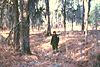
October 15, 1966 Address Restricted Holy Trinity 2 Bass-Perry House 
January 19, 1976 4 miles northeast of Seale on U.S. Route 431
32°20′46″N 85°07′57″W / 32.346111°N 85.1325°WSeale 3 Brooks-Hughes House 
November 3, 1983 1010 Sandfort Rd.
32°27′33″N 85°00′29″W / 32.459167°N 85.008056°WPhenix City 4 Brownville-Summerville Historic District November 3, 1983 Roughly bounded by 15th and 23rd Sts. and 6th and 11th Aves.
32°28′40″N 85°00′17″W / 32.477778°N 85.004722°WPhenix City 5 Floyd-Newsome House 
November 3, 1983 900 22nd St.
32°28′56″N 85°00′15″W / 32.482222°N 85.004167°WPhenix City 6 Fort Mitchell Historic Site 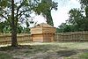
June 13, 1972 Address Restricted Fort Mitchell 7 Fort No. 5 
May 6, 1976 West of Phenix on the Opelika Highway
32°29′00″N 85°02′04″W / 32.483333°N 85.034444°WPhenix City 8 Girard High School November 3, 1983 Sandfort Rd.
32°27′38″N 85°00′14″W / 32.460556°N 85.003889°WPhenix City 9 Girard Historic District November 3, 1983 Roughly bounded by 8th Pl., 10th St., 5th and 8th Aves.
32°27′45″N 85°00′06″W / 32.4625°N 85.001667°WPhenix City 10 Glenn-Thompson Plantation 
April 9, 1980 South of Pittsview on U.S. Route 431
32°08′12″N 85°09′06″W / 32.136667°N 85.151667°WPittsview 11 Glennville Historic District 
August 7, 1979 South of Pittsview
32°06′38″N 85°10′09″W / 32.110556°N 85.169167°WPittsview 12 Joel Hurt House 
August 11, 2005 605 Church St.
32°14′25″N 85°24′38″W / 32.240278°N 85.410556°WHurtsboro 13 Hurtsboro Historic District 
October 19, 2009 308-905 Church St., 508 Daniel St., 303-407 Dickinson St., 302-802 Goolsby St., 402-502 Lloyd St., and 242-282 Long St.
32°14′40″N 85°24′47″W / 32.244475°N 85.413117°WHurtsboro 14 Kid Alley Residential Historic District November 3, 1983 11th Ave. at 9th Pl.
32°27′52″N 85°00′27″W / 32.464444°N 85.0075°WPhenix City 15 Lower Twentieth Street Residential Historic District November 3, 1983 20th St. from 2nd to 6th Aves.
32°28′47″N 84°59′55″W / 32.479722°N 84.998611°WPhenix City 16 Morgan-Curtis House 
November 3, 1983 1815 Abbott Dr.
32°28′05″N 85°01′08″W / 32.468056°N 85.018889°WPhenix City 17 Samuel R. Pitts Plantation 
June 25, 1992 East of U.S. Route 431, south of the Southern railroad tracks
32°10′43″N 85°09′28″W / 32.178611°N 85.157778°WPittsview 18 Russell County Courthouse at Seale 
May 23, 1974 Courthouse Sq.
32°17′54″N 85°10′03″W / 32.298333°N 85.1675°WSeale 19 Shapre-Monte House 
November 3, 1983 721 6th Ave.
32°27′32″N 85°00′07″W / 32.458889°N 85.001944°WPhenix City 20 Smith Residential Historic District November 3, 1983 20th St., 7th Ave., and 6th Court
32°28′47″N 85°00′04″W / 32.479722°N 85.001111°WPhenix City 21 Snow Valley Residential Historic District November 3, 1983 11th and 12th Sts. at 11th Ave.
32°28′04″N 85°00′29″W / 32.467778°N 85.008056°WPhenix City 22 Uchee Methodist Church 
July 3, 1997 County Road 22, 1.8 miles west of its junction with County Road 65
32°21′11″N 85°19′53″W / 32.353056°N 85.331389°WHatchechubbee 23 Upper Twentieth Street Residential Historic District November 3, 1983 1201-1217 W. 20th St.
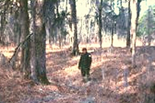
32°28′45″N 85°00′38″W / 32.479167°N 85.010556°WPhenix City 24 Yuchi Town 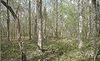
June 19, 1996 Address Restricted Fort Benning See also
- List of National Historic Landmarks in Alabama
- National Register of Historic Places listings in Alabama
References
- ^ The latitude and longitude information provided in this table was derived originally from the National Register Information System, which has been found to be fairly accurate for about 99% of listings. For about 1% of NRIS original coordinates, experience has shown that one or both coordinates are typos or otherwise extremely far off; some corrections may have been made. A more subtle problem causes many locations to be off by up to 150 yards, depending on location in the country: most NRIS coordinates were derived from tracing out latitude and longitudes off of USGS topographical quadrant maps created under the North American Datum of 1927, which differs from the current, highly accurate WGS84 GPS system used by Google maps. Chicago is about right, but NRIS longitudes in Washington are higher by about 4.5 seconds, and are lower by about 2.0 seconds in Maine. Latitudes differ by about 1.0 second in Florida. Some locations in this table may have been corrected to current GPS standards.
- ^ "National Register of Historic Places: Weekly List Actions". National Park Service, United States Department of the Interior. Retrieved on November 10, 2011.
- ^ Numbers represent an ordering by significant words. Various colorings, defined here, differentiate National Historic Landmark sites and National Register of Historic Places Districts from other NRHP buildings, structures, sites or objects.
U.S. National Register of Historic Places in Alabama Lists by county Autauga • Baldwin • Barbour • Bibb • Blount • Bullock • Butler • Calhoun • Chambers • Cherokee • Chilton • Choctaw • Clarke • Clay • Cleburne • Coffee • Colbert • Conecuh • Coosa • Covington • Crenshaw • Cullman • Dale • Dallas • DeKalb • Elmore • Escambia • Etowah • Fayette • Franklin • Geneva • Greene • Hale • Henry • Houston • Jackson • Jefferson • Lamar • Lauderdale • Lawrence • Lee • Limestone • Lowndes • Macon • Madison • Marengo • Marion • Marshall • Mobile • Monroe • Montgomery • Morgan • Perry • Pickens • Pike • Randolph • Russell • St. Clair • Shelby • Sumter • Talladega • Tallapoosa • Tuscaloosa • Walker • Washington • Wilcox • Winston

Lists by city Other lists Municipalities and communities of Russell County, Alabama City 
Town CDP Unincorporated
communitiesFort Mitchell | Glenville | Holy Trinity | Pittsview | Seale
Footnotes ‡This populated place also has portions in an adjacent county or counties
Categories:- National Register of Historic Places in Russell County, Alabama
-


Wikimedia Foundation. 2010.