- Chéticamp, Nova Scotia
-
Coordinates: 46°38′16.39″N 61°0′32.90″W / 46.6378861°N 61.009139°W Coordinates: 49°42′N 83°40′W / 49.7°N 83.667°W
Chéticamp — Village — 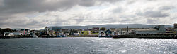

Flag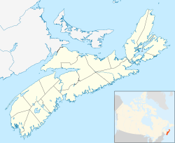
 Chéticamp
Coordinates: 46°38′16.39″N 61°0′32.9″W / 46.6378861°N 61.009139°W Country  Canada
Province  Nova Scotia
District Inverness County Established 1785 Government - Type Village - Counselor - Governing Body - MP Area[1] - Land 98.67 km2 (38.1 sq mi) Population (2006)[1] - Total 4,000 - Density 60.0/km2 (155.4/sq mi) Time zone EST (UTC-4) - Summer (DST) AST (UTC-4) Postal code span B0E Area code(s) 902 Website http://www.cheticamp.ca/fr/acceuil.php Chéticamp (locally [ʃatikɑ̃]) is a fishing community on the Cabot Trail on the west coast of Cape Breton Island, Nova Scotia at the western entrance to Cape Breton Highlands National Park. The downtown area overlooks a large bay, into which the Chéticamp River flows, that is protected from the Gulf of Saint Lawrence by Chéticamp Island. Having a number of public facilities it performs a service function for the northernmost part of Inverness County. The community has almost 4,000 residents, a large number of whom are Acadians and speak French natively, as well as English. Together with its smaller neighbour, Saint-Joseph-du-Moine, Chéticamp makes up the largest Francophone enclave on Cape Breton Island. The 2001 population was 3,145 people.[2]
Contents
Name
The name "Chéticamp" derives from the name given by the Micmac people, who still live on Cape Breton Island (but not in Chéticamp). The name is Awjátúj[3] (Francis-Smith orthography) in the Micmac language, meaning "rarely full", presumably making reference to the mouth of Chéticamp harbor that once had a large dune that grew during low tide.[4]
The French spelling of the town's name went through several variations including Ochatisia (1660), Ochatis (1689), Chétican, Chéticamps (1725) and Chétifcamp (1803).[4] The current spelling appeared for the first time on 3 May 1815, in the writings of the missionary Antoine Manseau.[4] In French, the name has been pronounced successively Le Chady, Le Grand Chady, Le Chady Grand, Île de Chedegan and finally, the current version, Chatican (IPA: [ʃatikɑ̃]).[4] Chéticamp is usually pronounced phonetically in French outside of the area.
The name does not always take the acute accent on the e in English (i.e., "Cheticamp").
A village in western Nova Scotia, Saint Alphonse de Clare, was originally called Chéticamp de Clare. Its name was changed to avoid confusion for postal delivery.
History
Chéticamp started as a fishing station used during the summer months by Charles Robin, a merchant from the island of Jersey, and is considered one of the Acadian capitals of the world. In the years following the Great Expulsion many Acadians came to this area. The first permanent settlers, the families of Pierre Bois and Joseph Richard, arrived in 1782. The settlement was established in 1785 by a grant of land to the 14 original settlers. Today Chéticamp, which is at the entrance of the Cape Breton Highlands National Park, is a popular tourist spot.
Economy
Apart from an important gypsum mine which operated off and on until the Second World War, the main industry in Chéticamp historically has been fishing. As fish stocks have declined, tourism has taken on more importance and is the largest industry at this time. Unfortunately the tourism industry has not been the success that many forecasted.
The tourism industry is based on the scenery found in the coastal village at the entrance of the Cape Breton Highlands National Park. Chéticamp has also attempted to cash in on its traditional rug hookers ("tapis hookers"), Acadian music and food, with mixed results, and nowhere near the success that was once envisioned. Activities for visitors include whale watching. They also host an International Dance Festival,[5] and La fête nationale de l'Acadie (August 15).
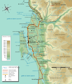 Topographic map of the Chéticamp area
Tourist attractions
The local beach named La Plage St. Pierre [6] gives the locals as well as tourists a place for swimming, camping, and other recreational activities.
The Northern Inverness Recreational Association also manages the local golf course.[7] is considered part of "Cape Breton's Fabulous Foursome"[8] and is renowned for the beautiful views and many rabbits.
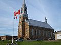
Chéticamp extends itself for four kilometres along the Cabot Trail. One kilometre northeast is Petit Étang, then further east is La Prairie. South of La Prairie is Le Platin and Belle-Marche. Even further south is Pointe-à-la-Croix (Point Cross). From Main street Chéticamp, you can view the typical Chéticamp houses. The church of Saint-Pierre is unique and rich in Acadian history.
The Université Sainte-Anne has a campus in Saint-Joseph-du-Moine. Many fisherman travel from Chéticamp to the Magdalen Islands, which are also Acadian, even though they are part of Quebec.
Gallery
-
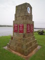
Acadian Monument to their Return (1790)
-

Main street in Chéticamp.
-

Houses in Chéticamp.
-
Church of Saint-Pierre.
-
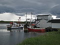
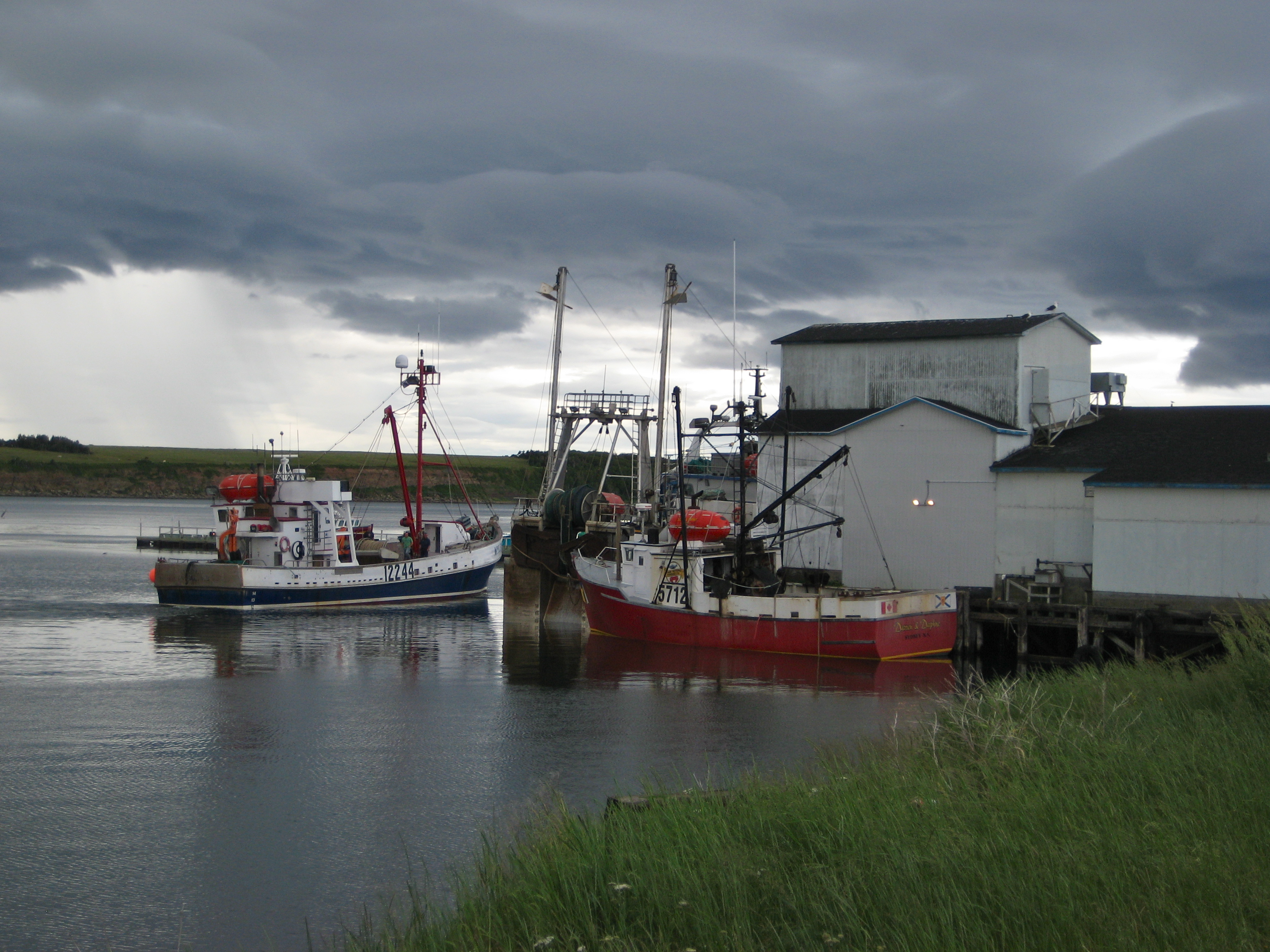
Fishing boats at Chéticamp.
Climate
Climate data for Chéticamp Month Jan Feb Mar Apr May Jun Jul Aug Sep Oct Nov Dec Year Record high °C (°F) 18
(64)16
(61)18.9
(66.0)23.5
(74.3)29.5
(85.1)31.5
(88.7)32
(90)31.5
(88.7)30
(86)25.5
(77.9)23
(73)18.3
(64.9)32
(90)Average high °C (°F) −0.9
(30.4)−2
(28)2
(36)7
(45)13.7
(56.7)18.9
(66.0)22.7
(72.9)22.2
(72.0)17.8
(64.0)12.3
(54.1)7.1
(44.8)2
(36)10.6 Average low °C (°F) −8.9
(16.0)−10.6
(12.9)−6.4
(20.5)−0.7
(30.7)4.4
(39.9)9.6
(49.3)14
(57)13.7
(56.7)9.8
(49.6)5.1
(41.2)0.8
(33.4)−4.6
(23.7)2.2 Record low °C (°F) −29.5
(−21.1)−29
(−20)−23.3
(−9.9)−14
(7)−6.1
(21.0)−1.7
(28.9)3.5
(38.3)4.4
(39.9)−1.1
(30.0)−6
(21)−16
(3)−19.5
(−3.1)−29.5
(−21.1)Precipitation mm (inches) 145.8
(5.74)108.8
(4.283)107.5
(4.232)86.1
(3.39)82.7
(3.256)92.4
(3.638)90.2
(3.551)104.7
(4.122)118.7
(4.673)141.7
(5.579)148
(5.83)164.1
(6.461)1,391.1
(54.768)Source: Environment Canada[9] References
- ^ a b Statistics Canada 2006 Census - Hearst community profile
- ^ NS Community counts
- ^ Silliboy, Helen (1998). "Mi'kmaw Place Names in Cape Breton". [Cape Breton University - Mi'kmaq Resource Centre]. http://www.cbu.ca/mrc/place-names. Retrieved 25 July 2011.
- ^ a b c d Anselme Chiasson. Chéticamp: History and Acadian Traditions. Translation of Chéticamp: histoire et traditions acadiennes by Jean Doris LeBlanc. Wreck Cove, NS: Breton Books, 1998. p. 6. ISBN 1-895415-29-2.
- ^ Festival de l'Escaouette
- ^ La Plage St. Pierre
- ^ Le Portage Golf Course
- ^ Cape Breton's Fabulous Foursome
- ^ Environment Canada Canadian Climate Normals 1971–2000, accessed 16 July 2009
External links
- The Official Chéticamp Website
- Photographs of Cheticamp war memorial
- Cheticamp and St. Joseph du Moine website
Acadia History 
People and culture Language and education Related  Category
  PortalCategories:
- Communities in Inverness County, Nova Scotia
- General Service Areas in Nova Scotia
-


Wikimedia Foundation. 2010.